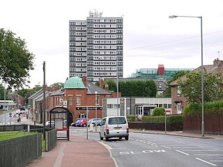
Wallsend is a town in North Tyneside, Tyne and Wear, England, at the eastern end of Hadrian's Wall. It has a population of 43,842 and lies 4 miles east of Newcastle upon Tyne.

Dinnington is a town in the civil parish of Dinnington St John's, in the Metropolitan Borough of Rotherham, in South Yorkshire, England. It is near to the towns of Worksop and Rotherham and cities of Sheffield and Doncaster.

Ellington is a small village in the civil parish of Ellington and Linton, on the coast of Northumberland, England. Ellington is 4 miles (6 km) from Ashington, 6 miles (10 km) from Morpeth and 20 miles (32 km) north of Newcastle upon Tyne.

Throckley is a village in the Newcastle upon Tyne district, in the county of Tyne and Wear, England, approximately 7 miles (11 km) west of Newcastle city centre. Hadrian's Wall passed through the village, its course traced by the village's main road, Hexham Road. Throckley lies within the historic county of Northumberland.

Medomsley is a village in County Durham, England. It is about 2 miles (3 km) northeast of the centre of Consett, 1+1⁄2 miles (2 km) south of Hamsterley and 1 mile (2 km) southeast of Ebchester along the B6309. Leadgate lies a further mile to the south east.

Felling is a town in the Metropolitan Borough of Gateshead in Tyne and Wear, England. Historically part of County Durham, the town became part of the metropolitan borough of Gateshead in 1974. It lies on the B1426 Sunderland Road and the A184 Felling bypass, than 1 mile (1.6 km) east of Gateshead, 1 mile (1.6 km) south east of Newcastle-upon-Tyne and 10 miles north west of the City of Sunderland. In 2011, Felling had a population of 8,908.

Wylam is a village and civil parish in the county of Northumberland, England. It is located about 10 miles (16 km) west of Newcastle upon Tyne.

Elswick is a district and electoral ward of the city and metropolitan borough of Newcastle upon Tyne, in the county of Tyne and Wear, England, 1.9 miles west of the city centre, bordering the River Tyne. Historically in Northumberland, Elswick became part of Newcastle upon Tyne in 1835. Elswick is home to the Newcastle Utilita Arena; and Newcastle College, with approximately 45,000 students.

Backworth is a village in the metropolitan borough of North Tyneside in the county of Tyne and Wear, England, about 3+1⁄2 miles (6 km) west of Whitley Bay on the north east coast. It lies 5 miles (8 km) northeast of Newcastle upon Tyne. Other nearby towns include North Shields to the southeast, Wallsend to the south, and Cramlington to the northwest.

Newburn is a village and district of Newcastle upon Tyne, in Tyne and Wear, England. Situated on the North bank of the River Tyne, it is built rising up the valley from the river. It is situated approximately 5 miles (8 km) from the city centre, 14 miles (23 km) east of Hexham and 13 miles (21 km) south south west of Morpeth. In the 2001 census, the population was given as 9,301, increasing to 9,536 at the 2011 Census. Newburn is in the Newcastle upon Tyne district of Tyne and Wear and is part of the parliamentary constituency of Newcastle upon Tyne North.
Hazlerigg is a village and civil parish north of the City of Newcastle upon Tyne in Tyne and Wear, England. It is about 5 miles (8.0 km) north of the city centre, on the A1. It is split between Newcastle upon Tyne and North Tyneside, each side of the A1 being a different district. The parish council administer the Newcastle side, whereas the area located in North Tyneside is unparished. Much of the Newcastle Great Park development is within the area administered by the Hazlerigg Parish Council. Located in the village is a post office, a fish & chip shop, a beauty salon, a hairdresser, a garage, a convenience store and a social club that is now open under new management. In spite of having a population of 1,053, and almost 800 homes, Hazlerigg has never had a pub. The population of the civil Parish taken at the 2011 Census was 980.

Gedling is a village and former civil parish which gives its name to the larger Borough of Gedling in Nottinghamshire, England. It lies 4 miles (6.4 km) north-east of Nottingham city centre. The parish was abolished in 1935 and absorbed into the urban district of Carlton, which in turn was abolished in 1974 on the creation of borough of Gedling. The population of the Gedling ward at the 2011 census was 6,817 and 111,787 for the district. Gedling was recorded in the Domesday Book and is still a distinct settlement, although residential, commercial and industrial growth in the wider borough of Gedling and the neighbouring city of Nottingham, boroughs of Broxtowe and Rushcliffe and district of Ashfield means it can be difficult to distinguish the village of Gedling from the nearby town of Carlton, with which it has become contiguous.

Seghill is a large village and former civil parish, now in the parish of Seaton Valley, located on the Northumberland border which is the county boundary between Northumberland and Tyne and Wear. Seghill is situated between the villages of Seaton Delaval and Annitsford, about 8 miles (13 km) north of Newcastle upon Tyne.

Kenton is a suburb and electoral ward in the north west of Newcastle upon Tyne, in the county of Tyne and Wear, England. It borders the Town Moor and Gosforth. Kenton also has close road links to Newcastle Airport. The ward population at the 2011 Census was 11,605.

Ashington is a town and civil parish in Northumberland, England, with a population of 27,864 at the 2011 Census. It was once a centre of the coal mining industry. The town is 15 miles (24 km) north of Newcastle upon Tyne, west of the A189 and bordered to the south by the River Wansbeck. Many inhabitants have a distinctive accent and dialect known as Pitmatic. This varies from the regional dialect known as Geordie.
Brunswick Village is a village split between North Tyneside and Newcastle upon Tyne, Tyne and Wear, England. It is situated approximately 6 miles north of Newcastle upon Tyne, and borders Hazlerigg, Dinnington and Wideopen. It was formerly known as Dinnington Colliery.

Coxlodge is an area situated between Fawdon, Gosforth and Kenton in Newcastle upon Tyne, in the county of Tyne and Wear, England. Until 1974 it was in Northumberland.

Burradon is a village in the North Tyneside district, in the county of Tyne and Wear, England, to the north of Newcastle upon Tyne. It is adjacent to Camperdown and the two villages are closely linked. Camperdown was once known as Hazlerigge. Until 1974 it was in Northumberland.

Harraton is a suburb of Washington, in the Sunderland metropolitan borough, in Tyne and Wear, England. Harraton is near the River Wear and is 3 miles north-east of Chester-le-Street, 2 miles south-west of Washington town centre and 9 miles south-southwest of Sunderland.

Brenkley is a hamlet and former civil parish about 6 miles from Newcastle upon Tyne, now in the parish of Dinnington, in the Newcastle upon Tyne district, in the county of Tyne and Wear, England. In 1951 the parish had a population of 28.


