
Loughton is a town and civil parish in the Epping Forest District of Essex. Part of the travel to work and urban area of London, the town borders Chingford, Waltham Abbey, Theydon Bois, Chigwell and Buckhurst Hill, and is 12 miles (19 km) northeast of Charing Cross.
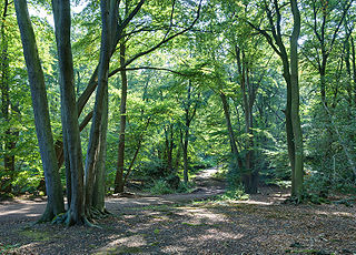
Epping Forest is a 2,400-hectare (5,900-acre) area of ancient woodland, and other established habitats, which straddles the border between Greater London and Essex. The main body of the forest stretches from Epping in the north, to Chingford on the edge of the London built-up area. South of Chingford the forest narrows, and forms a green corridor that extends deep into East London, as far as Forest Gate; the Forest's position gives rise to its nickname, the Cockney Paradise. It is the largest forest in London.
The A10 is a major road in England which runs between The City of London and King's Lynn in Norfolk.
The A11 is a major trunk road in England. It originally ran roughly north east from London to Norwich, Norfolk. It now consists of a short section in Inner London and a much longer section in Cambridgeshire, Suffolk and Norfolk. The lengthy section between these was renumbered as a result of the opening of the M11 in the 1970s and then the A12 extension in 1999.

Chigwell is a town and civil parish in the Epping Forest District of Essex, England. It is part of the urban and travel to work area of London, and is adjacent to the northern boundary of Greater London. It is on the Central line of the London Underground.
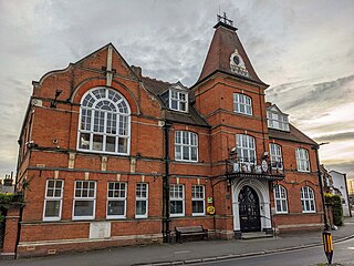
Epping Forest is a local government district in Essex, England. Situated in the west of the county, bordering northeastern Greater London, it is named after, and contains a large part of, Epping Forest.

Buckhurst Hill is a suburban town in the Epping Forest district of Essex, England. It is part of the Greater London Urban Area and adjacent to the northern boundary of the London Borough of Redbridge. The area developed following the opening of a railway line in 1856, originally part of the Eastern Counties Railway and now on the Central line of the London Underground.

Buckhurst Hill is a London Underground station, in the Epping Forest district of Essex. It is served by the Central line and is between Woodford and Loughton. It is the larger of the two Underground stations in the town of Buckhurst Hill, with Roding Valley station being the smaller. It is the only London Underground station located in Zone 5 but not in a London Borough.

The River Roding rises at Molehill Green, Essex, England, then flows south through Essex and London and forms Barking Creek as it reaches the River Thames.

Waltham Abbey is a town and civil parish in the Epping Forest District of Essex, within the travel to work and urban area of London, England, 14 miles (23 km) north-east of Charing Cross. It lies on the Greenwich Meridian, between the River Lea in the west and Epping Forest in the east, with large sections forming part of the Metropolitan Green Belt. The town borders Nazeing and Epping Upland to the north, Chingford to the south, Loughton, Theydon Bois and Buckhurst Hill to the east and south-east, and Waltham Cross, Cheshunt and Enfield to the west.

Epping Forest is a constituency represented in the House of Commons of the UK Parliament since 1997 by Eleanor Laing, a Conservative.
The district of Epping Forest is in the county of Essex in England. It was created on 1 April 1974, following the merger of Epping Urban District, Chigwell Urban District, Waltham Holy Cross Urban District, and part of Epping and Ongar Rural District.
Normanhurst School is a mixed private school in North Chingford in the London Borough of Waltham Forest. The school caters for around 285 boys and girls.

The A104 is an A road which runs from Islington Green in London to Epping in Essex, England.

London Buses route 167 is a Transport for London contracted bus route in London, England. Running between Ilford and Loughton station, it is operated by Stagecoach London.
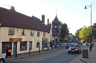
Loughton is a town in the county of Essex in England. The first settlement can be traced back to 2,500 years ago, but the earliest records of the modern-day site of Loughton are from the Anglo-Saxon era of English history, when it was known as Lukintone. After the Norman conquest it became part of the estate of Waltham Abbey and is mentioned in the Domesday Book as Lochintuna. It was during the 17th century, however, when Loughton began to grow significantly as a coaching stop on the newly created main route to Cambridge and East Anglia. With good transport links and proximity to both London and also Epping Forest and the countryside, it became a popular location for aristocratic and wealthy Londoners to have a home.

Epping is a market town and civil parish in the Epping Forest district of the county of Essex, England. The town is 17 miles (30 km) northeast from the centre of London, is surrounded by the northern end of Epping Forest, and on a ridge of land between the River Roding and River Lea valleys.

High Beach is a village inside Epping Forest in south-west Essex, England. Part of Waltham Abbey, the village is within the Epping Forest District and the ward of Waltham Abbey High Beach, and lies approximately 11 miles (18 km) north-east of Charing Cross.
Waltham Abbey is a civil parish in Epping Forest District in Essex, England. Located approximately 14 miles (23 km) north-northeast of central London and adjacent to the Greater London boundary, it is a partly urbanised parish with large sections of open land in the Metropolitan Green Belt. Waltham Abbey is a recent renaming of the ancient parish of Waltham Holy Cross. Aside from the town of Waltham Abbey, it includes the hamlets of Claverhambury, Fishers Green, Holyfield, Sewardstone and Upshire, and the village of High Beach. The local council is Waltham Abbey Town Council.
