
Fakenham is a market town and civil parish in Norfolk, England. It is situated on the River Wensum, about 25 miles north-west of Norwich. The town is at the junction of several local roads, including the A148 from King's Lynn to Cromer, the A1067 to Norwich and the A1065 to Swaffham.
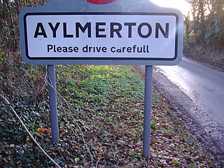
Aylmerton is a village in the county of Norfolk, England. It is in the area of North Norfolk and lies 2.2 miles (3.5 km) south of the North Sea, 3.2 miles (5.1 km) south-west of Cromer and 7.5 miles (12.1 km) east of Holt. The parish is bordered by the parishes of Beeston Regis and Runton to the north, West Beckham to the west, Felbrigg to the east and Gresham and Sustead to the south. The centre of the village is ¾ miles south of the A148 King’s Lynn to Cromer road with Sandy Lane and Beechwood Avenue north of it. The nearest railway stations are West Runton at the bottom of Sandy Lane, Cromer at 2.9 miles (4.7 km) and Roughton Road at 4.1 miles (6.6 km). The civil parish has an area of 6.86 square kilometres and in the 2001 census the population was 435 in 178 households, increasing to 458 at the 2011 Census. For the purposes of local government, the parish is in North Norfolk, whose headquarters are in Cromer.

Bodham is a civil parish in the English county of Norfolk. The village is 27.2 miles north north west of Norwich, 6.4 miles west of Cromer and 131 miles north north east of London. The village lies 3.1 miles south west of the nearest town of Sheringham.The nearest railway station is at Sheringham for the Bittern Line which runs between Cromer and Norwich. The nearest airport is Norwich International Airport. The village is situated on the A148 coast road which links the town of King’s Lynn to Cromer. The civil parish had in 2001 census, a population of 435, increasing to 484 at the 2011 Census. For the purposes of local government, the parish falls within the district of North Norfolk.

Gunthorpe is a village and a civil parish in the English county of Norfolk. The village is 8.6 miles east north east of the town of Fakenham, 14.9 miles west south west of Cromer and 122 miles north north east of London. The nearest railway station is at Sheringham for the Bittern Line which runs between Sheringham, Cromer and Norwich. The nearest airport is Norwich International Airport.

The fishing port and holiday resort of Cromer in the English county of Norfolk has had a rail service since 1877. It was served by three railway stations for many years, and is now served by two. Cromer Beach station, which opened in 1887, was renamed Cromer following the closure of the other early stations.

Letheringsett with Glandford is a civil parish in the English county of Norfolk. It includes the village of Letheringsett, along with the hamlet of Glandford. The village straddles the A148 King’s Lynn to Cromer road. Letheringsett is 1.2 miles west of Holt, 32.2 west north east of King’s Lynn and 126 miles north north east of London. The nearest railway station is at Sheringham for the Bittern Line which runs between Sheringham, Cromer and Norwich. The nearest airport is Norwich International Airport.

West Beckham is a village and a civil parish in the English county of Norfolk The village is 6.1 miles (9.8 km) west south west of Cromer, 25.3 miles (40.7 km) north north west of Norwich and 131 miles (211 km) north north east of London. The village lies 4.1 miles (6.6 km) east of the town of Holt. The village is 2.4 miles (3.9 km) inland from the North Norfolk Coast to the north. The village is 0.8 miles to the south of the A148 King’s Lynn to Cromer road. The nearest railway station is at Sheringham for the Bittern Line which runs between Sheringham, Cromer and Norwich. The nearest airport is Norwich International Airport.

The A149 is commonly known as "The Coast Road" to local residents and tourists, as this road runs along the North Norfolk coast from King's Lynn to Great Yarmouth, via coastal villages.

The A1065 is a main road in the English region of East Anglia. It provides the principal road connection to parts of the west and north of the county of Norfolk from Newmarket and points south of there, including London. It runs from a junction near Mildenhall, to a junction on the western outskirt of Fakenham.
West Rudham is a civil parish in the English county of Norfolk. The village straddles the A148 King's Lynn to Cromer road. It covers an area of 11.81 km2 (4.56 sq mi) and had a population of 213 in 97 households at the 2001 census, the population including Houghton and increasing to 288 at the 2011 census. For the purposes of local government, it falls within the district of King's Lynn and West Norfolk.
Upper Sheringham is a village and a civil parish in the English county of Norfolk. The village is 26.8 miles (43.1 km) north-north-west of Norwich, 6 miles (9.7 km) west of Cromer and 132 miles (212 km) north-north-east of London. The village is 1.2 miles (1.9 km) from the town of Sheringham. The nearest railway station is at Sheringham for the Bittern Line which runs between Sheringham, Cromer and Norwich. The nearest airport is Norwich International Airport. Nearby road connections are the A149 King's Lynn to Great Yarmouth road to the north of the village and the A148 King's Lynn to Cromer road just to the south. The parish of Upper Sheringham in the 2001 census, a population of 214, reducing slightly to 209 at the 2011 Census. For the purposes of local government, the parish falls within the district of North Norfolk.
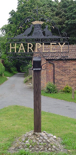
Harpley is a village and civil parish in the English county of Norfolk. It covers an area of 9.29 km2 (3.59 sq mi) and had a population of 353 in 157 households at the 2001 census, the population reducing to 338 at the 2011 Census. For the purposes of local government, it falls within the district of King's Lynn and West Norfolk.

Hillington is a village and civil parish in the English county of Norfolk. It covers an area of 10.27 km2 (3.97 sq mi) and had a population of 287 in 123 households as of the 2001 census, increasing to 400 at the 2011 Census. For the purposes of local government, it falls within the district of King's Lynn and West Norfolk.

Tattersett is a village and civil parish in the English county of Norfolk. It covers an area of 11.38 square kilometres, and had a population of 902 in 390 households at the 2001 census, the population increasing to 962 at the 2011 Census. For the purposes of local government, it falls within the district of North Norfolk.
High Kelling is a village and civil parish in the north of the English county of Norfolk. The village is located on the A148 road which links Cromer to King's Lynn. The village is 1.7 miles east of the town of Holt, and 7.8 miles west of Cromer. High Kelling is within the area covered by North Norfolk District Council. In the last Census, carried out in 2001, the population of High Kelling was counted as 515, increasing to 636 at the 2011 census.

The A1082 is an English A road entirely in the county of Norfolk. It runs from a junction with the A148 King's Lynn to Cromer Road to a roundabout on the A149 in the North Norfolk coastal town of Sheringham.

Melton Constable was a railway station on the Midland and Great Northern Railway which served the North Norfolk village of Melton Constable from 1882 to 1964. Notwithstanding its rural location, the station became an important railway centre with lines converging from all directions providing connections to key East Anglian towns such as King's Lynn, Norwich, Cromer, Fakenham, Yarmouth and Lowestoft. Although long since demolished, there is a possibility that the station may yet be resurrected as part of the proposed Norfolk Orbital Railway.
Holt railway station was a railway station that served the town of Holt in Norfolk, England. It was part of the Midland and Great Northern Joint Railway network, which spread over much of East Anglia, providing connections to Cromer, Norwich and Yarmouth. Closed in 1964. It has since been closed and occupied by a main road. There are proposals to rebuild the line through the town as part of an orbital railway scheme and possibly a new station to serve the town.

Barney is a village and former civil parish, now in the parish of Fulmodeston, in the North Norfolk district, in the county of Norfolk, England. Settled prior to the Norman Invasion of 1066, the village lies to the south of the A148 King's Lynn to Cromer road near Thursford.The village is 7.2 miles (11.6 km) east north east of the town of Fakenham, 17.1 miles (27.5 km) west south west of Cromer and 121 miles (195 km) north north east of London. The nearest railway station is at Sheringham for the Bittern Line which runs between Sheringham, Cromer and Norwich. The nearest airport is Norwich International Airport. In 1931 the parish had a population of 243.
The Cromer line was a railway branch in Norfolk, England that connected the railway junction of Melton Constable with Cromer on the sea.
