
South Yorkshire is a ceremonial county in the Yorkshire and the Humber region of England. It borders North Yorkshire and West Yorkshire to the north, the East Riding of Yorkshire to the north-east, Lincolnshire to the east, Nottinghamshire to the south-east, and Derbyshire to the south and west. The largest settlement is the city of Sheffield.

Doncaster is a city in South Yorkshire, England. Named after the River Don, it is the administrative centre of the larger City of Doncaster, and is the second largest settlement in South Yorkshire after Sheffield. Noted for its horse racing and railway history, it is situated in the Don Valley on the western edge of the Humberhead Levels and east of the Pennines. The urban subdivision had a population of 113,566 at the 2021 census, whilst the City of Doncaster metropolitan borough had a population of 308,106.

The City of Doncaster is a metropolitan borough with city status in South Yorkshire, England. It is named after its principal settlement, Doncaster, and includes the surrounding suburbs of Doncaster as well as numerous towns and villages. The district has large amounts of countryside; at 219 square miles (570 km2), it is the largest metropolitan borough in England by area.
The Wakefield line is a railway line and service in the West Yorkshire Metro and South Yorkshire Passenger Transport Executive areas of northern England. The Wakefield line is coloured yellow on maps and publications by West Yorkshire Metro. The line was electrified in 1989, between Leeds & Wakefield Westgate, as part of the programme to electrify the East Coast Main Line.

Balby is a suburb of Doncaster in South Yorkshire, England. Historically part of the West Riding of Yorkshire, Balby is within the Doncaster Central constituency and contains the electoral wards Balby South and Hexthorpe and Balby North.

Adwick le Street is a village in the City of Doncaster, South Yorkshire, England. The Adwick ward of Doncaster Metropolitan Borough Council had a population of 15,911 at the 2011 Census. It is situated north-west of Doncaster. Under the 2011 census, the settlement had a population of 10,507.
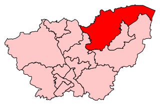
Doncaster North is a constituency in South Yorkshire, England, represented in the House of Commons of the UK Parliament since 2005 by Ed Miliband of the Labour Party. From 2010 until 2015, he was Leader of the Opposition before he lost the 2015 general election to David Cameron and the Conservatives. Part of the red wall, it was formerly a Labour stronghold, until the 2019 general election when it became a Labour-Conservative marginal.

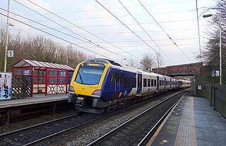
Bentley railway station is a railway station that serves Bentley, South Yorkshire, England. It lies on the Wakefield Line and is managed by Northern, who also provide all the passenger trains serving it. It was opened on 27 April 1992 by British Rail with financial assistance from the South Yorkshire Passenger Transport Executive. An earlier wooden halt, Bentley Crossing, built by the West Riding and Grimsby Railway, had previously existed at the same location but was closed by 1943.

Wilfred Paling was a British Labour Party politician.

Bentley Colliery F.C. was an English football club based in Bentley, Doncaster, South Yorkshire. Until December 2015 they played in the Central Midlands League North Division, at level 11 of the English football league system.

The West Riding and Grimsby Railway was a railway company that promoted a line between Wakefield and Doncaster, in Yorkshire, England. There was also a branch line connection from Adwick le Street to Stainforth, which gave access towards Grimsby. The company was promoted independently, but it was sponsored by the Manchester, Sheffield and Lincolnshire Railway and the Great Northern Railway, and became jointly owned by them.

Bentley is a suburb of Doncaster in South Yorkshire, England two miles north of the city centre. The population of the ward within the City of Doncaster at the 2011 Census was 14,191. The Bentley built-up area subdivision had a population of 27,145.
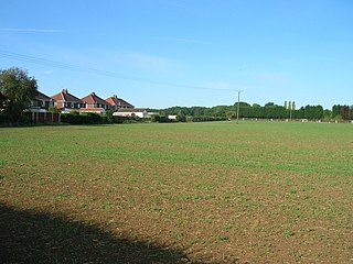
Little Canada is a hamlet in the City of Doncaster in South Yorkshire, England. It is situated on the B6422 road between Brodsworth and Scawthorpe, approximately 4 miles (6.4 km) north-west of Doncaster city centre.

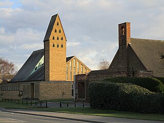
Don Valley Academy member of Delta Academies Trust is a mixed 11–18 Academy located in Scawthorpe, Doncaster, South Yorkshire, England. The school also has a Sixth Form centre.

Cusworth is a village and suburb of Doncaster in South Yorkshire, England, located 2 miles (3.2 km) to its north-west within the civil parish of Sprotbrough and Cusworth and the City of Doncaster, with a population of 4,728. It is home to Cusworth Hall, an 18th century country house, and its surrounding parkland. Some buildings in the old village can be dated back to the 16th century.
Scawsby is a suburb of Doncaster, South Yorkshire, England. It is situated approximately 2 miles north-west of the city centre on the A635 road to Barnsley close to its terminus with the A638.
Sunnyfields is a suburb of Doncaster, South Yorkshire, England. It lies to the east of Scawsby and to the west of Scawthorpe.

Bentley Colliery was a coal mine in Bentley, near Doncaster in South Yorkshire, England, that operated between 1906 and 1993. In common with many other mines, it suffered disasters and accidents. The worst Bentley disaster was in 1931 when 45 miners were killed after a gas explosion. The site of the mine has been converted into a woodland.

The Ea Beck, also spelled Eaubeck or Eau Beck, is a small river in South Yorkshire, England, that flows eastwards into the River Don at Thorpe-in-Balne. The Environment Agency lists the beck as starting at South Elmsall, but mapping lists the beck with several names along its course. The beck has twice flooded areas and villages that it passes through in the 21st century.
Roman Ridge—consisting of Cusworth, Scawsby and part of Scawthorpe—is one of 21 electoral wards in the Metropolitan Borough of Doncaster, South Yorkshire, England. It forms part of the Doncaster North parliamentary constituency. It elects 2 councillors to Doncaster Metropolitan Borough Council. The ward is named after the Roman Ridge, a bridleway that was an ancient Roman road. In 2011 it had a population of 11,229. The ward was formed in 2015.


