
Woodlands is a model village 4 miles (6 km) north-west of Doncaster in South Yorkshire, England. The village lies adjacent to Highfields and Adwick le Street within the City of Doncaster. The colliery village was designed and built in the early 20th century by the architect Percy Houfton as tied cottages for the miners of the neighbouring Brodsworth Colliery. In an era of model villages such as Saltaire, Port Sunlight and Bournville, Woodlands, with extensive open spaces, many different designs of houses, and overall living conditions excellent for their time, possibly represents the height of the model village movement. The village is a conservation area.

Bawtry is a market town and civil parish in the City of Doncaster in South Yorkshire, England. It lies 8 miles (13 km) south-east of Doncaster, 10 miles (16 km) west of Gainsborough and 8 miles (13 km) north-west of Retford, on the border with Nottinghamshire and close to Lincolnshire. The town was historically divided between the West Riding of Yorkshire and Nottinghamshire. Its population of 3,204 in the 2001 UK census increased to 3,573 in 2011, and was put at 3,519 in 2019. Nearby settlements include Austerfield, Everton, Scrooby, Blyth, Bircotes and Tickhill.

The City of Doncaster is a metropolitan borough with city status in South Yorkshire, England. It is named after its principal settlement, Doncaster, and includes the surrounding suburbs of Doncaster as well as numerous towns and villages. The district has large amounts of countryside; at 219 square miles (570 km2), it is the largest metropolitan borough in England by area.

Wombwell is a town in the Metropolitan Borough of Barnsley in South Yorkshire, England. In the 2011 census, data for the town was split between the ward of Wombwell and small sections that fell into the wards of Darfield and Stairfoot. Added together, these record the town's population at approximately 15,316.

David Pegg was an English footballer who played as an outside-left and one of the eight Manchester United players who died in the Munich air disaster on 6 February 1958.

Mexborough is a town in the City of Doncaster District, South Yorkshire, England, between Manvers and Denaby Main, on the River Don close to where it joins the River Dearne, and the A6023 road. It is contiguous with Swinton to the southwest and Conisbrough to the east.

Adwick le Street is a village in the City of Doncaster, South Yorkshire, England. It is situated north-west of Doncaster. It had a population of 2,815 as of 2014.

Skellow is a village in the Doncaster district, in the county of South Yorkshire, England. Historically part of the West Riding of Yorkshire, the village is roughly 5 miles (8 km) north-west of Doncaster. The village falls in the Askern Spa Ward of Doncaster MBC. To the north and south is mixed farmland, the A1 runs immediately along the western edge of the village, and to the east Skellow merges with the adjacent village of Carcroft along the B1220 road.

Barnsdale, or Barnsdale Forest, is an area of South and West Yorkshire, England. The area falls within the modern-day districts of Doncaster and Wakefield. Barnsdale was historically part of the West Riding of Yorkshire. Barnsdale is commonly associated with Robin Hood.
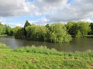
Highfields Lake is an ornamental lake in the Woodlands wildlife park at Highfields, north of Doncaster, South Yorkshire, England.
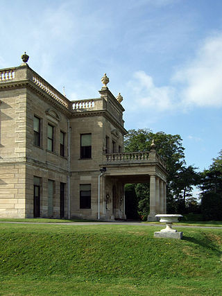
Brodsworth is a village and civil parish in the City of Doncaster district in South Yorkshire, England. Situated about five miles north-west of Doncaster city centre, the parish also includes Scawsby. According to the 2001 census, it had a population of 2,875, increasing to 2,936 at the 2011 Census.

The A638 is a major road in England. It runs between the A1 at Markham Moor, Nottinghamshire and Chain Bar Interchange – Junction 26 of the M62 motorway, south of Bradford in West Yorkshire.

The West Riding and Grimsby Railway was a railway company that promoted a line between Wakefield and Doncaster, in Yorkshire, England. There was also a branch line connection from Adwick le Street to Stainforth, which gave access towards Grimsby. The company was promoted independently, but it was sponsored by the Manchester, Sheffield and Lincolnshire Railway and the Great Northern Railway, and became jointly owned by them.

Carcroft is a rural village in the City of Doncaster, South Yorkshire, England. Historically part of the West Riding of Yorkshire, the village is roughly 6 miles (10 km) north-north west of Doncaster. At the time of the 2011 Census the village fell within the ward of Adwick le Street & Carcroft in the Doncaster MBC.
Roman Ridge is a bridleway that was part of the Roman road of Ermine Street, between Scawsby and Redhouse to the north of Doncaster, England.
Hangthwaite Castle was an earthwork motte and bailey castle founded by Nigel Fozzard. It stood in the 11th century and is situated just north of Scawthorpe, Doncaster, South Yorkshire, England. Originally, the site was known as Langthwaite, though it changed over the years to Hangthwaite. In the 13th century, a fortified house called Radcliffe Moat replaced Hangthwaite Castle as a local fortification. Nowadays, only the motte and the ditches remain. Encased by the wide wet ditch, the motte defends a bean-shaped eastern bailey and a small north-western mound, which is possibly a barbican.

While there are many castles in South Yorkshire, the majority are manor houses and motte-and-bailey which were commonly found in England after the Norman Conquest.
Adwick le Street and Carcroft is a ward in the metropolitan borough of Doncaster, South Yorkshire, England. The ward contains 33 listed buildings that are recorded in the National Heritage List for England. Of these, one is listed at Grade II*, the middle of the three grades, and the others are at Grade II, the lowest grade. The ward contains the villages of Adwick le Street and Carcroft, and the surrounding area. Most of the listed buildings are in the model village of Woodlands, and consist of houses built for the Brodsworth Colliery Company, and designed by Percy Houfton in Arts and Crafts style. Also in the model village are a church and two schools. Elsewhere, the listed buildings consist of an older church, the remains of a churchyard cross and a memorial in the churchyard, a former water mill, a large house later used as a club, a war memorial in the form of a clock tower, and a miners' welfare institute.
Adwick le Street and Carcroft—consisting of Adwick le Street, Carcroft, Highfields, Skellow and Woodlands—is one of 21 electoral wards in the Metropolitan Borough of Doncaster, South Yorkshire, England. It forms part of the Doncaster North parliamentary constituency. The ward is a stronghold for the Labour Party. In 2011 it had a population of 16,894. The ward was formed in 2015.

