Whitby

Last updated

Whitby
Town
View along the River Esk at Whitby (geograph 7257032).jpg
View of Whitby from the West Cliff
Coat of Arms of Whitby.svg
Arms of Whitby Town Council featuring three green serpents (prior to 1935 depicted as ammonites).
North Yorkshire UK location map (2023).svg
Red pog.svg
Whitby
Location within North Yorkshire
Population13,213 (2011 census) [1]
OS grid reference NZ893109
Civil parish
  • Whitby
Unitary authority
Ceremonial county
Region
Country England
Sovereign state United Kingdom
Post town WHITBY
Postcode district YO21, YO22
Dialling code 01947
Police North Yorkshire
Fire North Yorkshire
Ambulance Yorkshire
UK Parliament
List of places
UK
England
Yorkshire
54°29′09″N0°37′14″W / 54.4858°N 0.6206°W / 54.4858; -0.6206

Whitby is a seaside town, port and civil parish in North Yorkshire, England. It is on the Yorkshire Coast at the mouth of the River Esk. It has a maritime, mineral and tourist economy. The fishing port emerged during the Middle Ages, supporting important herring and whaling fleets, [2] [3] and was where Captain Cook learned seamanship and, coincidentally, where his first vessel to explore the southern ocean, HMS Endeavour, was built. [4] Jet and alum were mined locally, and Whitby jet, which was mined by the Romans and Victorians, became fashionable during the 19th century.

Contents

The earliest record of a permanent settlement is in 656 AD, when as Streanæshealh it was the place where Oswy, the Christian king of Northumbria, founded the first abbey, under the abbess Hilda. The Synod of Whitby was held there in 664 AD. In 867 AD, Viking raiders destroyed the monastery. The town's East Cliff is home to the ruins of Whitby Abbey, where Cædmon, the earliest recognised English poet, lived. Another monastery was founded in 1078 AD. It was in this period that it gained its current name, Whitby (from "white settlement" in Old Norse). In the following centuries Whitby functioned as a fishing settlement until, in the 18th century, it developed as a port and centre for shipbuilding and whaling, the trade in locally mined alum, and the manufacture of Whitby jet jewellery. Tourism started in Whitby during the Georgian period and developed with the arrival of the railway in 1839.

Whitby's attraction as a tourist destination is enhanced by the nearby high ground of the North York Moors national park and the heritage coastline and by association with the horror novel Dracula . The abbey ruin at the top of the East Cliff is the town's oldest and most prominent landmark. Other significant features include the swing bridge, which crosses the River Esk and the harbour, which is sheltered by the grade II listed East and West piers. Its maritime heritage is commemorated by statues of the explorer Captain Cook and the whaler and scientist William Scoresby, as well as the whalebone arch that sits at the top of the West Cliff. It also has a strong literary tradition and has featured in literary works, television and cinema, most famously in Bram Stoker's novel Dracula .

While Whitby's cultural and historical heritage contribute to the local economy, it is financially constrained by its remote location, ongoing changes in the fishing industry, relatively underdeveloped transport infrastructure and limitations on available land and property. As a result, tourism and some forms of fishing remain the mainstay of its economy. It is the closest port to a proposed wind farm development in the North Sea, 47 miles (76 km) from York and 22 miles (35 km) from Middlesbrough. There are transport links to the rest of North Yorkshire and North East England, primarily through national rail links to Middlesbrough and road links to Teesside, via both the A171 and A174, and Scarborough by the former. As at 2011, the town had a population of 13,213. [1]

History

Priests and harrying

Whitby was called Streanæshalc, Streneshalc, Streoneshalch, Streoneshalh, and Streunes-Alae in Lindissi in records of the 7th and 8th centuries. Prestebi, from Old Norse býr (village) and presta (of the priests), is an 11th-century name. Its name was recorded as Hwitebi and Witebi, from the Old Norse from hvítr (white) and býr (village), in the 12th century, Whitebi in the 13th century and Qwiteby in the 14th century. [5]

A monastery was founded at Streanæshealh in 657 AD by King Oswiu or Oswy of Northumbria, as an act of thanksgiving, after defeating Penda, the pagan king of Mercia. At its foundation, the abbey was an Anglo-Saxon 'double monastery' for men and women. Its first abbess, the royal princess Hild, was later venerated as a saint. [6] The abbey became a centre of learning, and here Cædmon the cowherd was "miraculously" transformed into an inspired poet whose poetry is an example of Anglo-Saxon literature. The abbey became the leading royal nunnery of the kingdom of Deira, and the burial-place of its royal family. The Synod of Whitby, in 664, established the Roman date of Easter in Northumbria at the expense of the Celtic one. [7]

The monastery was destroyed between 867 and 870 in a series of raids by Vikings from Denmark under their leaders Ingwar and Ubba. Its site remained desolate for more than 200 years until after the Norman Conquest of England in 1066. [5] After the Conquest, the area was granted to William de Percy who, in 1078 donated land to found a Benedictine monastery dedicated to St Peter and St Hilda. [8] William de Percy's gift included land for the monastery, the town and port of Whitby and St Mary's Church and dependent chapels at Fyling, Hawsker, Sneaton, Ugglebarnby, Dunsley, and Aislaby, five mills including Ruswarp, Hackness with two mills and two churches. [9]

When the Domesday Book was compiled in 1086, Whitby was recorded being partially waste and a small settlement lying within the Langbaurgh Wapentake of Yorkshire. [10] Further details reveal the state of Whitby's economic and agricultural decline (when compared with its pre-Conquest state under Earl Siward) which were due to the depredations of William the Conqueror's army during the Harrying of the North in 1069-70. [11]

In about 1128 Henry I granted the abbey burgage in Whitby and permission to hold a fair at the feast of St Hilda on 25 August. A second fair was held close to St Hilda's winter feast at Martinmas. Market rights were granted to the abbey and descended with the liberty.

Blubber, Cook and dissolution

The ruins of Whitby Abbey are reflected in the abbey pond Whitby Abbey 1.jpg
The ruins of Whitby Abbey are reflected in the abbey pond

Whitby Abbey surrendered in December 1539 when Henry VIII dissolved the monasteries. By 1540 the town had between 20 and 30 houses and a population of about 200. [12] The burgesses, who had little independence under the abbey, tried to obtain self-government after the dissolution of the monasteries. The king ordered Letters Patent to be drawn up granting their requests, but it was not implemented. In 1550 the Liberty of Whitby Strand, except for Hackness, was granted to the Earl of Warwick who in 1551 conveyed it to Sir John York and his wife Anne who sold the lease to the Cholmleys. [13] In the reign of Elizabeth I, Whitby was a small fishing port. In 1635 the owners of the liberty governed the port and town where 24 burgesses had the privilege of buying and selling goods brought in by sea. Burgage tenure continued until 1837, when by an Act of Parliament, government of the town was entrusted to a board of Improvement Commissioners, elected by the ratepayers. [5]

At the end of the 16th century Thomas Chaloner visited alum works in the Papal States [14] where he observed that the rock being processed was similar to that under his Guisborough estate. At that time alum was important for medicinal uses, in curing leather and for fixing dyed cloths and the Papal States and Spain maintained monopolies on its production and sale. Chaloner secretly brought workmen to develop the industry in Yorkshire, and alum was produced near Sandsend Ness 3 miles (5 km) from Whitby in the reign of James I. [15] Once the industry was established, imports were banned and although the methods in its production were laborious, England became self-sufficient. [16] [17] Whitby grew significantly as a port as a result of the alum trade and by importing coal from the Durham coalfield to process it. [18]

Whitby grew in size and wealth, extending its activities to include shipbuilding using local oak timber. In 1790–91 Whitby built 11,754 tons of shipping, making it the third largest shipbuilder in England, after London and Newcastle. [19] Taxes on imports entering the port raised money to improve and extend the town's twin piers, improving the harbour and permitting further increases in trade. In 1753 the first whaling ship set sail to Greenland and by 1795 Whitby had become a major whaling port. The most successful year was 1814 when eight ships caught 172 whales, and the whaler, the Resolution's catch produced 230 tons of oil. The carcases yielded 42 tons of whale bone used for 'stays' which were used in the corsetry trade until changes in fashion made them redundant. [20] Blubber was boiled to produce oil for use in lamps in four oil houses on the harbourside. Oil was used for street lighting until the spread of gas lighting reduced demand and the Whitby Whale Oil and Gas Company changed into the Whitby Coal and Gas Company. As the market for whale products fell, catches became too small to be economic and by 1831 only one whaling ship, the Phoenix, remained. [21]

Captain Cook's statue Captain James Cook Memorial Monument, Whitby (geograph 7256328).jpg
Captain Cook's statue

Whitby benefited from trade between the Newcastle coalfield and London, both by shipbuilding and supplying transport. In his youth the explorer James Cook learned his trade on colliers, shipping coal from the port. [22] HMS Endeavour, the ship commanded by Cook on his voyage to Australia and New Zealand, was built in Whitby in 1764 by Tomas Fishburn as a coal carrier named Earl of Pembroke. She was bought by the Royal Navy 1768, refitted and renamed. [23]

Whitby developed as a spa town in Georgian times when three chalybeate springs were in demand for their medicinal and tonic qualities. Visitors were attracted to the town leading to the building of "lodging-houses" and hotels, particularly on the West Cliff. [5]

Rail and jet

In 1839, the Whitby and Pickering Railway connecting Whitby to Pickering and eventually to York was built, and played a part in the town's development as a tourism destination. George Hudson, who promoted the link to York, was responsible for the development of the Royal Crescent which was partly completed. [24] For 12 years from 1847, Robert Stephenson, son of George Stephenson, engineer to the Whitby and Pickering Railway, was the Conservative MP for the town promoted by Hudson as a fellow protectionist. [25]

Whitby jet mourning jewellery became popular in late Victorian England Schwarzer Trauerschmuck2.jpg
Whitby jet mourning jewellery became popular in late Victorian England

The black mineraloid jet, the compressed remains of ancestors of the monkey-puzzle tree, is found in the cliffs and on the moors and has been used since the Bronze Age to make beads. The Romans are known to have mined it in the area. [26] [27] In Victorian times jet was brought to Whitby by pack pony to be made into decorative items. It was at the peak of its popularity in the mid-19th century when it was favoured for mourning jewellery by Queen Victoria after the death of Prince Albert. [28]

Whitby town from Abbey Terrace, sketched on 3 October 1861, looking across to Whitby Abbey DV307 no.138 Whitby from Abbey Terrace Oct 3 1861.png
Whitby town from Abbey Terrace, sketched on 3 October 1861, looking across to Whitby Abbey

The advent of iron ships in the late 19th century and the development of port facilities on the River Tees led to the decline of smaller Yorkshire harbours. The Monks-haven launched in 1871 was the last wooden ship built in Whitby, and a year later the harbour was silted up. [29] [30]

20th century

On 30 October 1914, the hospital ship Rohilla was sunk, hitting the rocks within sight of shore just off Whitby at Saltwick Bay. Of the 229 people on board, 85 died in the disaster; most are buried in the churchyard at Whitby. [31]

The Bombardment of Whitby, 16 December 1914, by William Scott Hodgson William Scott Hodgson - The Bombardment of Whitby, 16 December 1914 NY PPA 116.jpg
The Bombardment of Whitby, 16 December 1914, by William Scott Hodgson

In a raid on Scarborough, Hartlepool and Whitby in December 1914, the town was shelled by the German battlecruisers Von der Tann and Derfflinger. In the final assault on the Yorkshire coast, the ships aimed their guns at the signal post on the end of the headland. Whitby Abbey sustained considerable damage in the attack, which lasted ten minutes. The German squadron responsible for the strike escaped despite attempts made by the Royal Navy. [32]

During the early 20th century the fishing fleet kept the harbour busy, and few cargo boats used the port. It was revitalised as a result of a strike at Hull docks in 1955, when six ships were diverted and unloaded their cargoes on the fish quay. Endeavour Wharf, near the railway station, was opened in 1964 by the local council. The number of vessels using the port in 1972 was 291, increased from 64 in 1964. Timber, paper and chemicals are imported, while exports include steel, furnace-bricks and doors. [33] The port is owned and managed by Scarborough Borough Council since the Harbour Commissioners relinquished responsibility in 1905.

A marina was started in 1979 by dredging the upper harbour and laying pontoons. Light industry and car parks occupy the adjacent land. More pontoons were completed in 1991 and 1995. [34] The Whitby Marina Facilities Centre was opened in June 2010. [35]

Governance

Whitby Town Council
Type
Type
Leadership
Robert Dalrymple [36]
Michael King
Structure
Seats16 Councillors [37]
10 / 16
2 / 16
2 / 16
1 / 16
1 / 16
Elections
Last election
7 May 2019
Next election
2 May 2023
Meeting place
Whitby Museum Whitby museum.JPG
Whitby Museum
Website
www.whitbytowncouncil.gov.uk
Old Town Hall, a grade II* listed building no longer used for municipal use The Old Town Hall at Whitby (geograph 7266230).jpg
Old Town Hall, a grade II* listed building no longer used for municipal use

By an Act of 1837 government of the town was entrusted to a board of Improvement Commissioners, elected by the ratepayers. A Local Board was formed in 1872, and lasted until Whitby Urban District Council was formed under the Local Government Act 1894. [5] The townships of Whitby, Ruswarp and Hawsker-cum-Stainsacre were formed into a Parliamentary borough under the Reform Act of 1832 returning one member until the Redistribution of Seats Act 1885. [5]

From 1974 to 2023 Whitby was administered as part of a two tier council system by Scarborough Borough Council, one of the seven district councils in North Yorkshire. [38] For borough council purposes the town comprised three wards: Mayfield, Streonshalh and Whitby West Cliff. The borough council was a non-metropolitan district, responsible for housing, planning, leisure and recreation, waste collection, environmental health and revenue collection. [39] Above the Borough council was North Yorkshire County Council, which was a non-metropolitan county providing education, transport, highways, fire, waste disposal, social and library services. [40]

In April 2023 both councils were replaced by North Yorkshire Council along with all district councils in North Yorkshire. [41] The unitary authority now provides all the services previously provided separately by the two councils.

At the lowest level of governance Whitby has a town council which, for election and administrative purposes, is divided into six electoral wards represented by 19 councillors responsible for burial grounds, allotments, play areas and street lighting. Elections to the town council are held every four years. [42]

In the UK parliament the town is represented by a Conservative, Robert Goodwill, who was elected member for the Scarborough and Whitby constituency in 2010. [43] [44]

Religion

St Mary's Church St. Mary's Church. - geograph.org.uk - 159153.jpg
St Mary's Church

In the three wards that make up the Whitby district of North Yorkshire, out of a population of 13,596 there are 10,286 who stated that their religion was Christian in the 2001 UK census. There were 19 Muslims, 17 Buddhists, 12 Jews, 3 Sikhs and 499 people had no religious affiliations. [45] [46] [47]

St Mary’s Church is an ancient foundation, St Ninian's opened in Baxtergate in 1778 and St John's, also on Baxtergate, was consecrated in 1850. St Michael's was opened in 1856 and St Hilda's on the West Cliff was built in 1885. The Roman Catholic church dedicated to St Hilda was built in 1867 on Baxtergate. [5] There are places of worship for nonconformists including a United Reformed Church; two Methodist chapels are no longer used. [48] The Mission to Seafarers maintains a Christian ministry and has a chapel, reading room and recreational facilities. [49]

The Bishop of Whitby is a suffragan bishop of the Church of England Diocese of York, in the Province of York. [50] The town lies within the Central Vicariate of the Roman Catholic Diocese of Middlesbrough. [51]

Geography

Whitby is situated on the east coast of Yorkshire facing the North Sea in a deep valley at the mouth of the River Esk. It has been a bridging point since at least medieval times and several bridges have spanned the river. The current bridge, built in 1908, is a swing bridge with a 75-foot (23 m) span that separates the upper and lower harbours which have a total area of around 80.1 acres (32.40 ha). The houses are built of brick or stone, often with red pantiled roofs, in narrow, steep streets, on both sides of the river. [52]

The town is surrounded on its landward sides by the moorland of the North York Moors National Park and the North Sea abuts it on the seaward side. The coastal areas are designated part of the North Yorkshire and Cleveland Heritage Coast. [53] The harbour and the mouth of the River Esk are on a geological fault. On the east side the cliff is tall, 187 feet (57 m), and consists of alternating layers of shale, sandstone and clay. [54] On the west side the cliff is much lower and has a deep capping of boulder clay over a sandstone base making it less stable and liable to slippage. Both cliffs are being eroded quite rapidly. [55]

Fossils and snakestones

A snakestone from near Whitby, with head carved onto a specimen of Dactylioceras commune (Sowerby, 1815), Whitby Formation, Toarcian Stage, late Lower Jurassic. Specimen in the Natural History Museum, London. Snakestone Whitby.jpg
A snakestone from near Whitby, with head carved onto a specimen of Dactylioceras commune (Sowerby, 1815), Whitby Formation, Toarcian Stage, late Lower Jurassic. Specimen in the Natural History Museum, London.

The town is a coastal stretch known as the Dinosaur Coast or the Fossil Coast, the area is around 35 miles (56 km) long and stretches from Staithes in the north and south to Flamborough. At Whitby dinosaur footprints are visible on the beach. [56] [57] The rock strata contain fossils and organic remains including jet. Fossils include the petrified bones of an almost complete crocodile and a specimen of plesiosaurus measuring 15 feet 6 inches (4.72 m) in length, and 8 feet 5 inches (2.57 m) in breadth was discovered in 1841. The Rotunda Museum in Scarborough has a comprehensive collection of fossils from the area.

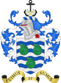
Smaller fossils include numerous species of ammonites, or "snake stones", from the Whitby Mudstone Formation (Alum Shale Member) and at Whitby Scar nautiloids in the lower beds of the lias strata. The town's folklore (similar to Keynsham's in Somerset) has it that fossils were once living serpents that were common in the area. This was until the 7th century AD when Anglo-Saxon Abbess St Hilda of Whitby (614–680), first had to rid the region of snakes. She did so by casting a spell that turned them to stone and then threw them from the cliff tops.

Local collectors and dealers in fossils often carved heads on ammonites to increase curiosity value and improve sales. Since 1935, the Whitby Coat of Arms incorporates three snakestones due to this folklore. The Hildoceras genus of ammonite is named in St Hilda's honour. [52] [58]

Economy

Shipbuilding in Whitby Parkol Marine Engineering, Whitby.jpg
Shipbuilding in Whitby

Tourism supported by fishing is the mainstay of Whitby's economy in an isolated community with poor transport infrastructure and restricted by building constraints in the surrounding North York Moors National Park. [59] [60] The economy is governed by the changing fortunes of fishing, tourism and to some extent, manufacturing. Structural changes have led to concentrations of deprivation, unemployment and benefit dependence. A narrowing employment base and dependence on low wage and low skill sectors has resulted in younger age groups leaving the area. There are few business start-ups and small and medium-sized enterprises. Older people who make increasing demands on the area's health and social care capacity have moved into the area. Demographic changes, Whitby's relative isolation from the region's main growth areas and decline in traditional employment sectors pose an economic challenge. [61]

The town has a variety of self-catering accommodation, holiday cottages, caravans and campsites, and guest houses, inns, bed & breakfast establishments and hotels. The jet industry declined at the end of the 19th century, but eight shops sell jet jewellery, mainly as souvenirs to tourists. [62] In 1996, Whitby West Cliff qualified for a 'Tidy Britain Group Seaside Award'. The town was awarded "Best Seaside Resort 2006", by Which? Holiday magazine. [63]

The harbour has a total area of about 80 acres (32 ha) and is used by commercial, fishing and pleasure craft. Inshore fishing, particularly for crustaceans and line fish, takes place along the coast. Lobsters, brown and velvet crabs are important to the local fishery. From May to August, salmon is found in the Esk, and small open boats are licensed to net these off the harbour entrance. There are around 40 licensed angling party boats. The commercial catch is no longer herring but has been replaced by cod, haddock, and other fish caught within 12 miles (19 km) of the coast. [64] A fish market on the quayside operates as need arises. [65] The ready supply of fresh fish has resulted in an abundance of "chippies" in the town, including the Magpie Cafe which Rick Stein has described as the best fish and chip shop in Britain. [66]

The Marina was built to develop and diversify the local economy. Harbour from Church steps.JPG
The Marina was built to develop and diversify the local economy.

The Whitby Marina project, jointly funded by Scarborough Borough Council, Yorkshire Forward and the European Regional Development Fund, was developed to diversify the local economy. [67] The remaining shipbuilding firm, Parkol Marine, is a family-run business on the east side of the river. [68] Founded in 1988, the boatyard has two berths for new build and a dry dock for repairs. [69] St Hilda's Business Centre provides office space for a range of businesses. Whitby Business Park is a 49-acre (20 ha) site located by the A171 road, 2 miles (3 km) from the harbour on the southern outskirts of the town. Companies on the park include Supreme Plastics, Whitby Seafoods Ltd and Botham's of Whitby alongside major retailers, Homebase and Sainsbury's. [70]

The east coast has limited conventional energy generation capacity, but Whitby is the closest port to a proposed development on Dogger Bank, ideally placed to provide the offshore wind power industry with support vessel operations and logistics. [71] [72] The Dogger Bank wind farm could include up to 2,600 giant 400-foot (120 m) turbines covering more than 3,300 square miles (850,000 ha). [73]

Transport

Water

Whitby and River Esk Whitby harbour from new Quay - geograph.org.uk - 47082.jpg
Whitby and River Esk

Whitby is on the River Esk and has a port used for shipping to Europe, especially Scandinavia, and it mainly handles grain, steel products, timber and potash cargo. Vessels limited to 3,000 tonnes deadweight tonnage can dock at the wharf, which is able to load or unload two ships simultaneously. As of 2004, 54,000 square feet (5,000 m2) of dock space is used to store all-weather cargo, with a 17,000-square-foot (1,600 m2) warehouse. [74] [75]

Land

Rail

From 2007, Whitby railway station has been used by steam and heritage diesel locomotives from the North Yorkshire Moors Railway Whitby railway station.jpg
From 2007, Whitby railway station has been used by steam and heritage diesel locomotives from the North Yorkshire Moors Railway

The town is served by Whitby railway station which is the terminus of the Esk Valley Line from Middlesbrough, operated by Northern. It was formerly the northern terminus of the Whitby, Pickering and York Line. In 2007, the North Yorkshire Moors Railway began a summer service between Pickering and Whitby operated by steam locomotives, as an extension of their long-standing Pickering-Grosmont service. The Scarborough and Whitby Railway, which follows a scenic route along the coast, was built in 1885; it required construction of the red brick Larpool Viaduct across the Esk Valley into Whitby. [76] The line closed as a result of the Beeching axe in 1965; the trackbed is now used as a footpath, bridleway and by cyclists. [77] The Whitby, Redcar and Middlesbrough Union Railway had a station at Whitby West Cliff and ran close to the cliffs to the north of the town. It opened in 1883 and closed in 1958. [78]

Road

Whitby is situated on the A171 road from Scarborough to Guisborough, which originally passed over the swing bridge. A high level bridge over the Esk Valley was built in 1980 to avoid the bridge and ease congestion in the town centre. The A174 accesses coastal towns to the north and the A169 crosses the moors to Pickering.

Whitby Bus Station Whitby03LB.jpg
Whitby Bus Station

Whitby is served by the Yorkshire Coastliner bus line, operating from Leeds, Tadcaster, York, Scarborough, Bridlington, Pickering and Malton, with connections beyond Yorkshire. [79] In 2018, this was voted Britain's most scenic bus route. [80] Arriva North East runs bus services connecting Whitby to Scarborough and Middlesbrough.

Walking

Beggars' Bridge, c. 1890-1900 (Whitby, Glaisdale, Beggars' Bridge, Yorkshire, England) (LOC) (16776947166).jpg
Beggars' Bridge, c.1890–1900

The coastal section of the 110-mile (180 km) Cleveland Way National Trail passes through Whitby. [81]

Air

The nearest airport, about 45 miles (72 km) from Whitby, is Teesside International Airport, which has a regular service from Amsterdam, Schiphol airport. [82]

Public services

Whitby Lifeboat Station before it was replaced in 2007 Whitby Lifeboat Station - geograph.org.uk - 76631.jpg
Whitby Lifeboat Station before it was replaced in 2007

A wide range of health care services is provided by Whitby Community Hospital, formerly run by the Scarborough and North East Yorkshire Health Care NHS Trust and now by the Humber NHS Foundation Trust. [83] In February 2018 it was agreed to redevelop the hospital site at a cost of £12 million into a "health and wellbeing hub" with an urgent care centre and 19 inpatient beds. [84]

There are five general practitioners and five dentists in the area. [85] [86] Yorkshire Ambulance Service provides hospital transport throughout Yorkshire. [87]

Whitby fire station, run by North Yorkshire Fire and Rescue Service, is crewed between 8 am and 6 pm. [88] The town's two police stations are provided by the North Yorkshire Police Authority. [89] The lifeboat station built in 2007, on the east bank, is operated by the Royal National Lifeboat Institution. The crew members are unpaid volunteers and the station has two lifeboats, an inshore D class lifeboat the Warter Priory which was donated to the station in 2017, [90] and an all-weather Shannon-class lifeboat, the Lois Ivan, launched in 2023. [91]

North Yorkshire County Council waste management services provide a household waste recycling centre at Whitby Industrial Estate, and operates an alternate weekly collection of household waste, whereby the type of waste collected alternates between recyclables and landfill waste. [92] [93] The water supply, predominantly from the River Esk, is treated at Ruswarp Water Treatment Works and distributed from there by Yorkshire Water who also deal with the town's sewerage. [94] CE Electric UK is responsible for delivering electricity and Northern Gas Networks supply piped gas. [95] [96]

Education

Whitby has a three-tier school system, primary, middle (11–14) and Caedmon College (11–19), which was formed in 2014 from the merger of Caedmon School (11–14) and Whitby Community College (14–19). [97] Eskdale School continues to operate as a middle school, but is currently consulting on raising its age range to 16. In February 2018 Caedmon College and Eskdale School agreed to federate and plan to provide a joint sixth form operation in the town. [98]

The primary schools are St Hilda's Roman Catholic Primary School, Stakesby Community Primary School, West Cliff Primary School, Airy Hill Community Primary School and East Whitby Community Primary School. North Yorkshire County Council provides education services. [99]

The Whitby and District Fishing Industry Training School offers training for new entrants to the fishing industry and experienced fishermen. [100]

Landmarks

Whitby Bridge, spanning the River Esk, opens to allow shipping access to the upper harbour. Swing bridge over the River Esk (geograph 7150984).jpg
Whitby Bridge, spanning the River Esk, opens to allow shipping access to the upper harbour.

The swing bridge spanning the Esk divides the upper and lower harbours and joins the east and west sides of the town. Whitby developed as an important bridging point of the River Esk and in 1351 permission was granted for tolls to be taken on the bridge for its maintenance. In 1609 a survey for a new bridge was commissioned while in 1628 it was described as a drawbridge where men raised planks to let vessels pass and tolls were collected. The bridge posts were rebuilt in stone at a cost of £3,000 in 1766. This structure was replaced by a four-arched bridge between 1833 and 1835, one arch made of cast iron swivelled to allow vessels to pass. [5] [52] This bridge was replaced between 1908 and 1909 by the current electric swing bridge. [101]

The bridge allowed the town to spread onto the west bank, whilst the east bank, the Haggerlythe, is dominated by St Mary's Church and the ruins of Whitby Abbey which is owned by English Heritage. St Mary's Church is a grade I listed building on the site of a Saxon church. The church's ancient foundation dates from the 12th century. Over time it has been extensively altered and enlarged but retains several features including box pews. The East Cliff is quite a distance by road from the church, the alternative is to climb the 199 steps of the "Church Stairs" or use the footpath called "Caedmon's Trod". [102] The stone stairs, which replaced the original wooden steps, were built about 200 years ago and renovated between 2005 and 2006. There are landings originally assisting coffin bearers on their journey to the graveyard on the cliff top. [103]

Whitby West Pier Lighthouse
Whitby lighthouse and West Pier. - geograph.org.uk - 1077167.jpg
LocationWhitby
North Yorkshire
England
OS grid NZ8994311722
Coordinates 54°29′34″N0°36′46″W / 54.49287°N 0.612916°W / 54.49287; -0.612916
Tower
Constructed1831  OOjs UI icon edit-ltr-progressive.svg
Constructionstone (tower)  OOjs UI icon edit-ltr-progressive.svg
Height25 m (82 ft)  OOjs UI icon edit-ltr-progressive.svg
Shapecylindrical tower with balcony and lantern [104]
Markingsblack (dome), white (lantern), unpainted (tower)  OOjs UI icon edit-ltr-progressive.svg
OperatorWhitby Harbour Board  OOjs UI icon edit-ltr-progressive.svg
Heritage Grade II listed [105]
Fog signal 1 blast every 30s
Light
Characteristic occasionally F G
Whitby West Pier beacon OOjs UI icon edit-ltr-progressive.svg
The end of the West Pier - geograph.org.uk - 1423449.jpg
Constructed1914  OOjs UI icon edit-ltr-progressive.svg
Constructionlumber  OOjs UI icon edit-ltr-progressive.svg
Height7 m (23 ft)  OOjs UI icon edit-ltr-progressive.svg
Shapecylindrical lantern on a four legs skeletal structure
Markingsunpainted (tower), green (lantern)  OOjs UI icon edit-ltr-progressive.svg
Operator North Yorkshire Council
Focal height12 m (39 ft)  OOjs UI icon edit-ltr-progressive.svg
Range5 nmi (9.3 km; 5.8 mi)  OOjs UI icon edit-ltr-progressive.svg
Characteristic Q G  OOjs UI icon edit-ltr-progressive.svg
Whitby East Pier Lighthouse
East Pier and Breakwater - geograph.org.uk - 1263533.jpg
LocationWhitby
North Yorkshire
England
OS grid NZ9001311721
Coordinates 54°29′34″N0°36′43″W / 54.492848°N 0.611836°W / 54.492848; -0.611836
Tower
Constructed1855  OOjs UI icon edit-ltr-progressive.svg
Constructionstone (tower)  OOjs UI icon edit-ltr-progressive.svg
Height17 m (56 ft)  OOjs UI icon edit-ltr-progressive.svg
Shapecylindrical tower with balcony and lantern
Markingsunpainted (tower), white (lantern), black (dome)  OOjs UI icon edit-ltr-progressive.svg
OperatorWhitby Harbour Board  OOjs UI icon edit-ltr-progressive.svg
Heritage Grade II listed [106]
Fog signal 1 blast every 30s
Light
Deactivated1914  OOjs UI icon edit-ltr-progressive.svg
Whitby East Pier beacon OOjs UI icon edit-ltr-progressive.svg
Light at the end of East Pier, from West Pier, Whitby - geograph.org.uk - 1426552.jpg
Constructed1914  OOjs UI icon edit-ltr-progressive.svg
Constructionlumber (tower)  OOjs UI icon edit-ltr-progressive.svg
Height7 m (23 ft)  OOjs UI icon edit-ltr-progressive.svg
Shapecylindrical lantern on a four legs skeletal structure
Markingsunpainted (tower), red (lantern)  OOjs UI icon edit-ltr-progressive.svg
Operator North Yorkshire Council
Focal height12 m (39 ft)  OOjs UI icon edit-ltr-progressive.svg
Range5 nmi (9.3 km; 5.8 mi)  OOjs UI icon edit-ltr-progressive.svg
Characteristic Q R  OOjs UI icon edit-ltr-progressive.svg

The harbour is sheltered by the grade II listed east and west piers each with a lighthouse and beacon. [105] [106] The west lighthouse, of 1831, is the taller at 84 feet (25.5 m) and the east lighthouse, built in 1855, is 54 feet (16.5 m) high. On the west pier extension is a foghorn that sounds a blast every 30 seconds during fog. [107] New lights were fitted to both the lighthouse towers and the beacons in 2011. [108] Whitby Lighthouse, operated by Trinity House, is south-east of the town on Ling Hill.

On the West Cliff is a statue of Captain James Cook who served his apprenticeship in the town, and a whalebone arch, commemorates the whaling industry. [109] It is the second such arch, the original is preserved in Whitby Archives Heritage Centre. By the inner harbour is a statue commemorating William Scoresby Sr. (father of William Scoresby Jr.), designer of the crow's nest. [110]

On the outskirts of town to the west is the 19th-century Sneaton Castle built by James Wilson who sold his sugar plantation where he had over 200 slaves and moved to Whitby. [111] Alongside it is St Hilda's Priory, [112] the mother house of the Order of the Holy Paraclete. The castle was used as a school and is now a conference centre and hotel in association with the priory.

Culture and media

Frank Meadow Sutcliffe left a photographic record of the town, harbour, fishing and residents in late-Victorian times. His most famous photograph entitled "Water Rats" was taken in 1886. He became famous internationally as a great exponent of pictorial photography. He exhibited his work in Tokyo, Vienna, France, the US and Great Britain winning over 60 gold, silver and bronze medals. He retired in 1922 and became curator of Whitby Museum. [113] The Royal Photographic Society made him an honorary member in 1935. A gallery of his work is located on Flowergate. [114]

Pannett Park The Lily Pond in Pannett Park (geograph 5446235).jpg
Pannett Park

Pannett Park was built on land purchased by a local philanthropist and politician Alderman Robert Pannett in 1902. After his death in 1928, the trust he set up created a public park and art gallery. [115] In 1931 Whitby Museum was built behind the gallery by the Whitby Literary and Philosophical Society. It holds a collection of the archaeological and social history of jet and has on display a "Hand of Glory". [116] The Friends of Pannett Park, formed in 2005, successfully bid for a Heritage Lottery Fund grant to refurbish the park. [117]

There has been a lifeboat in Whitby since 1802 and the old boathouse, built in 1895 and used until 1957, is a museum displaying the Robert and Ellen Robson lifeboat, built in 1919. [118]

The ancient Penny Hedge ceremony is performed on the eve of Ascension Day commemorating a penance imposed by the abbot on miscreant hunters in the Middle Ages. [119] The hunters using a knife costing a penny had to cut wood in Eskdaleside and take it to Whitby harbour where it was made into a hedge that would survive three tides. This tradition is carried out annually on the east side of the upper harbour. [120]

The Whitby Gazette was founded in 1854 by Ralph Horne, a local printer. The first issues were records of visitors and lodgings rather than a newspaper. [121] The publication became a weekly newspaper in 1858, with a short spell of being published twice weekly between 2000 and 2012. [122] The local radio stations are BBC Radio Tees, [123] This is The Coast and Coast & County Radio

The Pavilion Theatre built in the 1870s in West Cliff hosts a range of events during the summer months. [124] For over four decades the town has hosted the Whitby Folk Week, and since 1993 the bi-annual Whitby Goth Weekend for members of the Goth subculture. "Whitby Now" is an annual live music event featuring local bands in the Pavilion which has taken place since 1991. [125] Since 2008, the Bram Stoker Film Festival has taken place in October. [126]

Literature

The town has a strong literary tradition; it can even be said that the earliest English literature comes from Whitby as Cædmon, the first known Anglo Saxon poet [127] was a monk at the order that used Whitby Abbey during the abbacy of St Hilda (657–680). [128] Part of Bram Stoker's novel Dracula was set in Whitby, incorporating pieces of local folklore, including the beaching of the Russian ship Dmitri. Stoker discovered the name "Dracula" at the old public library. One scholar has suggested that Stoker chose Whitby as the site of Dracula's first appearance in England because of the Synod of Whitby, given the novel's preoccupation with timekeeping and calendar disputes. [129] [130] Elizabeth Gaskell set her novel Sylvia's Lovers partly in the town which she visited in 1859 [131] and Lewis Carroll stayed at 5, East Terrace between July and September 1854: his first publications may have been published in the Whitby Gazette. [132]

Charles Dickens is known to have visited Whitby, and in a letter of 1861 to his friend Wilkie Collins, who was at the time in Whitby, Dickens says:

In my time that curious railroad by the Whitby Moor was so much the more curious, that you were balanced against a counter-weight of water, and that you did it like Blondin. But in these remote days the one inn of Whitby was up a back-yard, and oyster-shell grottoes were the only view from the best private room. [133] [134]

Wilkie Collins stayed in Whitby to work on his novel, No Name. He was accompanied by Caroline Graves, the inspiration for The Woman in White . [135] Mary Linskill was born in a small house at Blackburn's Yard in 1840. She reached a wide readership when her second novel, Between the Heather and the Northern Sea, was published in 1884. Her last novel For Pity's Sake, was published posthumously in 1891. [136] James Russell Lowell, the American writer, visited Whitby while ambassador in London 1880–85, staying at 3 Wellington Terrace, West Cliff. [137] [138] On his last visit in 1889, he wrote:

This is my ninth year at Whitby and the place loses none of its charm for me. [139]

G. P. Taylor, a former Church of England curate in Whitby, is now a celebrated author. His best-selling book Shadowmancer was set in Whitby. Theresa Tomlinson, a writer of historical and other fiction for children and young adults, lives in the town. [140]

The novel Possession: A Romance by A. S. Byatt, set in the town, was adapted into a 2002 feature film called Possession starring Gwyneth Paltrow. [141]

A crime novel series by James Whitworth is set in Whitby. The first two novels are Death's Disciple and The Eve of Murder. These were followed by Bidding to Die, Better the Devil You Know and Murder on the Record.

A trilogy of young adult novels, The Whitby Witches , makes much of the town's setting and history, embellishing local traditions whilst incorporating them into the narrative. The author, Robin Jarvis, recalls "The first time I visited Whitby, I stepped off the train and knew I was somewhere very special. It was a grey, drizzling day but that only added to the haunting beauty and lonely atmosphere of the place. Listening to Carmina Burana on my headphones, I explored the ruined abbey on the clifftop. The place was a fantastic inspiration. In The Whitby Witches I have interwoven many of the existing local legends, such as the frightening Barguest, whilst inventing a few of my own, most notably the aufwaders." [142] Jarvis returned to Whitby for his 2016 novel, The Power of Dark , the first in The Witching Legacy series.

Other literary works making reference to Whitby include:

Sport

Wind surfing, sailing and surfing take place off the beaches between Whitby and Sandsend [148] and the area is visited by divers. Whitby has various sports facilities including the town cricket and football pitches and tennis courts.

The Whitby Regatta takes place annually over three days in August. [149] The competition between three rowing clubs – Whitby Friendship ARC, Whitby Fishermen's ARC and Scarborough ARC – forms the backbone of the weekend. [149] The event has expanded to include a fair on the pier, demonstrations, fireworks and military displays – including the spectacle of the Red Arrows aerobatics display team of the Royal Air Force. [150]

Whitby Golf Club View over golf links to Whitby - geograph.org.uk - 186814.jpg
Whitby Golf Club

Golfing facilities range from "pitch and putt" to Whitby Golf Club. The golf club formed in 1891 and has been at its current site, a 18-hole course situated on the cliff tops to the northwest of the town, since 1895. [151]

Whitby Town F.C., formed in 1892, is a semi-professional football club which plays in the Northern Premier League at the 3,200 capacity Turnbull Ground on Upgang Lane. [152] England international footballer Beth Mead was born in the town. [153]

Whitby Cricket Club has been in existence since the 1920s and is located on Whitby's West Cliff, on the Turnbull Ground. [154] Two senior Saturday teams compete in the North Yorkshire & South Durham Cricket League [155] and a junior section play in the Derwent Valley Junior Cricket League. [156]

Climate

The area generally has warm summers and relatively mild winters. Weather conditions vary from day to day as well as from season to season. Its latitude means that it is influenced by predominantly westerly winds with depressions and their associated fronts, bringing unsettled and windy weather particularly in winter. Between depressions there are often small mobile anticyclones that bring periods of fine weather. In winter anticyclones bring cold dry weather. In summer the anticyclones tend to bring dry settled conditions which can lead to drought. The two dominant influences on the climate of the Whitby area are shelter against the worst of the moist westerly winds provided by the North York Moors and the proximity of the North Sea. Late, chilly springs and warm summers are a feature of the area but there are often spells of fine autumn weather. Onshore winds in spring and early summer bring mists or low stratus clouds (known locally as sea frets) to the coast and moors. [157]

Climate data for Whitby, elevation: 41 m (135 ft), 1991–2020 normals, extremes 1961–present
MonthJanFebMarAprMayJunJulAugSepOctNovDecYear
Record high °C (°F)14.8
(58.6)
19.6
(67.3)
20.0
(68.0)
25.0
(77.0)
25.6
(78.1)
30.9
(87.6)
29.9
(85.8)
33.1
(91.6)
27.9
(82.2)
28.0
(82.4)
17.8
(64.0)
16.2
(61.2)
33.1
(91.6)
Mean daily maximum °C (°F)7.3
(45.1)
7.9
(46.2)
9.8
(49.6)
12.0
(53.6)
14.7
(58.5)
17.6
(63.7)
19.9
(67.8)
19.7
(67.5)
17.3
(63.1)
13.8
(56.8)
10.1
(50.2)
7.7
(45.9)
13.1
(55.6)
Daily mean °C (°F)4.7
(40.5)
5.1
(41.2)
6.5
(43.7)
8.4
(47.1)
11.0
(51.8)
13.8
(56.8)
16.1
(61.0)
16.0
(60.8)
13.8
(56.8)
10.7
(51.3)
7.4
(45.3)
5.1
(41.2)
9.9
(49.8)
Mean daily minimum °C (°F)2.2
(36.0)
2.3
(36.1)
3.2
(37.8)
4.8
(40.6)
7.3
(45.1)
10.1
(50.2)
12.2
(54.0)
12.2
(54.0)
10.3
(50.5)
7.7
(45.9)
4.7
(40.5)
2.4
(36.3)
6.6
(43.9)
Record low °C (°F)−11.8
(10.8)
−10.5
(13.1)
−12.5
(9.5)
−7.0
(19.4)
−2.3
(27.9)
0.3
(32.5)
1.9
(35.4)
3.0
(37.4)
0.5
(32.9)
−3.0
(26.6)
−8.7
(16.3)
−19.6
(−3.3)
−19.6
(−3.3)
Average precipitation mm (inches)57.5
(2.26)
46.4
(1.83)
39.2
(1.54)
44.4
(1.75)
38.8
(1.53)
57.6
(2.27)
49.1
(1.93)
61.3
(2.41)
53.3
(2.10)
58.9
(2.32)
71.0
(2.80)
66.7
(2.63)
644.1
(25.36)
Mean monthly sunshine hours 60.987.7129.8167.5211.4194.0202.5188.2145.7108.270.355.71,622
Source 1: Met Office [lower-alpha 1] [158]
Source 2: Starlings Roost Weather [159] [160]
Whitby seen from A171 Whitby and the River Esk (2011.10.19).jpg
Whitby seen from A171

On 5 January 2016 the town was seriously affected by flash floods. [161] North Yorkshire Police cautioned motorists to drive with "extreme caution" and advised that the area be avoided "unless absolutely necessary". [162]

Demography

According to the 2011 UK census, Whitby parish had a population of 13,213 living in 6,097 households. [1] In the 2001 UK census of the total number of 5,973 homes 2,034 were rented and 3,939 were owner occupied. [163] Of the 5,506 economically active persons aged between 16 and 74, 420 were unemployed. [164] The number of people working in the service industry was 4,113. [164] Approximately 2,500 people were aged under 16, 8,400 were aged 16–64, and 2,700 aged 65 and over. [165] The mean age of the population was 41.78 years. [165] The number of people who travel to work by motorised transport is 3,134 [164] but 2,190 households have no cars or vans. [166]

Population change

Population growth in Whitby from 1801 to 2021
Year180118111821183118411851186118711881189119011911192119311939 [lower-alpha 2] 19511961197119811991200120112021
Whitby CP8,1257,8868,8207,5016,3495,8795,811
Ruswarp CP3,1414,2364,8395,0975,0194,8316,195
Helredale CP387411504
Hawsker CP (part)590665741816797979
Population10,97410,27512,58411,72511,68212,87511,85612,78714,40013,41411,83411,21812,58911,45112,69811,67411,67512,32712,98013,63213,59413,21313,129

Whitby CP/AP [167]

Note: Between 1801 and 1925 Whitby comprised Whitby, Ruswarp and part of Hawsker civil parishes and (between 1894 and 1925) Helredale civil parish, all of which were merged on 1 April 1925 into the current Whitby area. [168]

Notable people

William Bateson (1861–1926), geneticist, was born in Whitby

Twin towns

Whitby is twinned with a number of towns across the globe. Most were either visited by Captain Cook in ships that were built in Whitby – and one was named after Whitby by settlers from England.

See also

Notes

  1. Data was calculated from Met Office raw monthly long term data from 1991–2020.
  2. There was no United Kingdom census in 1941.

Related Research Articles

<span class="mw-page-title-main">North Yorkshire</span> County of England

North Yorkshire is a ceremonial county in the Yorkshire and the Humber and North East regions of England. It borders County Durham to the north, the North Sea to the east, the East Riding of Yorkshire to the south-east, South Yorkshire to the south, West Yorkshire to the south-west, and Cumbria and Lancashire to the west. Northallerton is the county town.

<span class="mw-page-title-main">North York Moors</span> National park in North Yorkshire, England

The North York Moors is an upland area in north-eastern Yorkshire, England. It contains one of the largest expanses of heather moorland in the United Kingdom. The area was designated as a National Park in 1952, through the National Parks and Access to the Countryside Act 1949. Covering an area of 554 sq mi (1,430 km2), the National Park has a population of 23,380. It is administered by the North York Moors National Park Authority, whose head office is based in Helmsley.

<span class="mw-page-title-main">Scarborough, North Yorkshire</span> Town in North Yorkshire, England

Scarborough is a seaside town in the district and county of North Yorkshire, England. With a population of 61,749, Scarborough is the largest town on the Yorkshire Coast and the fourth-largest settlement in the county.

<span class="mw-page-title-main">Whitby Abbey</span> Abbey in Whitby, North Yorkshire, England

Whitby Abbey was a 7th-century Christian monastery that later became a Benedictine abbey. The abbey church was situated overlooking the North Sea on the East Cliff above Whitby in North Yorkshire, England, a centre of the medieval Northumbrian kingdom. The abbey and its possessions were confiscated by the crown under Henry VIII during the Dissolution of the Monasteries between 1536 and 1545.

<span class="mw-page-title-main">Borough of Scarborough</span> Former local government district in England

The Borough of Scarborough was a non-metropolitan district with borough status in North Yorkshire, England. In addition to the town of Scarborough, it covered a large stretch of the coast of Yorkshire, including Whitby and Filey. It bordered Redcar and Cleveland to the north, the Ryedale and Hambleton districts to the west and the East Riding of Yorkshire to the south.

<span class="mw-page-title-main">Filey</span> Seaside town and civil parish in North Yorkshire, England

Filey is a seaside town and civil parish in North Yorkshire, England. It is located between Scarborough and Bridlington on Filey Bay. Although it was a fishing village, it has a large beach and became a popular tourist resort. According to the 2011 UK census, Filey parish had a population of 6,981, in comparison to the 2001 UK census population figure of 6,819, and a population of 6,870 in 1991.

<span class="mw-page-title-main">River Esk, North Yorkshire</span> River in North Yorkshire, England

The River Esk is a river in North Yorkshire, England that empties into the North Sea at Whitby after a course of around 28 miles (45 km) through the valley of Eskdale, named after the river itself. The river's name is derived from the Brythonic word "isca" meaning "water". The Esk is the only major river in Yorkshire that flows directly into the North Sea; all other watercourses defined as being major rivers by the Environment Agency, either flow to the North Sea via the River Tees or the Humber Estuary.

<span class="mw-page-title-main">Robin Hood's Bay</span> Village in North Yorkshire, England

Robin Hood's Bay is a village in North Yorkshire, England. It is 6 miles (10 km) south of Whitby and 15 miles (24 km) north of Scarborough on the Yorkshire Coast.

<span class="mw-page-title-main">Scarborough and Whitby (UK Parliament constituency)</span> Parliamentary constituency in the United Kingdom

Scarborough and Whitby is a constituency in North Yorkshire represented in the House of Commons of the UK Parliament since 2005 by Robert Goodwill, a Conservative.

<span class="mw-page-title-main">Staithes</span> Village in North Yorkshire, England

Staithes is a village in North Yorkshire, England. Easington and Roxby Becks, which run into Staithes Beck, form the border between the unitary authorities of North Yorkshire and Redcar and Cleveland. The area located on the Redcar and Cleveland side is called Cowbar. Formerly a hub for fishing and mining, in Staithes is now a tourist destination within the North York Moors National Park.

<span class="mw-page-title-main">Aislaby, Scarborough</span> Village and civil parish in North Yorkshire, England

Aislaby is a village and civil parish in North Yorkshire, England. It is situated near the town of Whitby on the northern slopes of Eskdale just off the A171.

<span class="mw-page-title-main">Sleights</span> Village in North Yorkshire, England

Sleights is a village in North Yorkshire, England. Located in the Esk Valley in the postal region of Whitby, the village is part of the civil parish of Eskdaleside cum Ugglebarnby and the borough of Scarborough. Sleights lies along the steep main A169 road that runs north to south between Whitby and Malton via Pickering across the North York Moors.

<span class="mw-page-title-main">Scarborough and Whitby Railway</span> Disused railway line in Yorkshire, England

The Scarborough & Whitby Railway was a railway line from Scarborough to Whitby in North Yorkshire, England. The line followed a difficult but scenic route along the North Yorkshire coast.

<span class="mw-page-title-main">Glaisdale</span> Village and civil parish in North Yorkshire, England

Glaisdale is a village and civil parish in the Scarborough district of North Yorkshire, England, within the North York Moors National Park.

<span class="mw-page-title-main">Hinderwell</span> Village and civil parish in North Yorkshire, England

Hinderwell is a village and civil parish in the Scarborough district of North Yorkshire, England which lies within the North York Moors National Park, about a mile from the coast on the A174 road between the towns of Loftus and Whitby. The 2011 UK census states Hinderwell parish had a population of 1,875, a decrease on the 2001 UK census figure of 2,013. Hinderwell is the most northerly parish in the Scarborough Borough Council area. Hinderwell is mentioned in the Domesday Book of 1086 as Hildrewell, and is said to have got its name from Saint Hilda of Whitby, the Abbess of Whitby Abbey.

<span class="mw-page-title-main">Runswick Bay</span> Village in North Yorkshire, England

Runswick Bay is a bay in the Scarborough Borough of North Yorkshire, England. It is also the name of a village located on the western edge of the bay. It is 5 miles (8 km) north of Whitby, and close to the villages of Ellerby and Hinderwell. It is a popular tourist attraction due to its picturesque cliffside village, stunning coastal walks, fossil hunting and Runswick Sands, a white sand beach. It is on the Cleveland Way national trail. Runswick Bay was chosen as Beach of the Year 2020 by The Sunday Times.

<span class="mw-page-title-main">Yorkshire Coast</span> Coastline of Yorkshire, England

The Yorkshire Coast runs from the Tees estuary to the Humber estuary, on the east coast of England. The cliffs at Boulby are the highest on the east coast of England, rising to 660 feet (200 m) above the sea level.

<span class="mw-page-title-main">Yorkshire coast fishery</span> History of sea fishing in Yorkshire, England

The Yorkshire coast fishery has long been part of the Yorkshire economy for centuries. The 114-mile (183 km) Yorkshire Coast, from the River Tees to the Humber estuary, has many ports both small and large where the fishing trade thrives. The historic ports at Hull and Whitby are important locations for the landing and processing of fish and shellfish. Scarborough and Bridlington are also sites of commercial fishing.

<span class="mw-page-title-main">Ship and boat building in Whitby</span> Shipbuilders in Whitby, Yorkshire, England

Ship and boat building in Whitby was a staple part of the industry of Whitby, North Yorkshire, England between the 17th and 19th centuries. In 1792 and 1793, Whitby was the second largest ship-building port in England and Wales. Building continued throughout the 20th century but on a smaller scale both in terms of output and overall size of the vessels being built.

<span class="mw-page-title-main">Port of Whitby</span> Port in North Yorkshire, England

The Port of Whitby is an ancient and historic seaport on the North Yorkshire coast of England. The port lies at the mouth of the River Esk, where it enters into the North Sea. A port has been in existence at Whitby since at least the 7th century, when it was used to bring in supplies for Whitby Abbey. The port is famous for being the port of origin for the sailings of Captain Cook, and some of the ships that he sailed on were also built in the harbour.

References

  1. 1 2 3 UK Census (2011). "Local Area Report – Whitby Parish (1170217370)". Nomis. Office for National Statistics . Retrieved 21 March 2018.
  2. "BLESSING THE HERRING FLEET – British Pathe". britishpathe.com. 2011. Archived from the original on 29 July 2012. Retrieved 20 October 2011.
  3. "Whaling in Whitby – Whitby Online". whitbyonline.co.uk. 2011. Retrieved 20 October 2011.
  4. Hough 1994, p. 55
  5. 1 2 3 4 5 6 7 8 Page, William, ed. (1923). Parishes: Whitby. Victoria County History. British History Online. pp. 506–528. Retrieved 5 September 2010.{{cite book}}: |work= ignored (help)
  6. Bede (1994). McClure, J.; Collins, R. (eds.). The Ecclesiastical History of the English People. Oxford University Press. pp. 150–151.
  7. Lapidge, Michael; et al., eds. (1999). The Blackwell Encyclopaedia of Anglo-Saxon England. Blackwell. pp. 155, 472.
  8. Hinson, Colin. "GENUKI: Whitby History" . Retrieved 4 October 2011.
  9. Dugdale, William, Sir (1817–1830). "Dugdale's Monasticon Volume 1" (PDF). Monasticon Anglicanum: a History of the Abbies and other Monasteries, Hospitals, Frieries, and Cathedral and Collegiate Churches, with their Dependencies, in England and Wales. Archived from the original (PDF) on 11 September 2011. Retrieved 12 August 2011.{{cite web}}: CS1 maint: multiple names: authors list (link)
  10. Whitby in the Domesday Book
  11. White, Andrew (2019). A History of Whitby. Phillimore & Company Limited. ISBN   9780750990370.
  12. "A Brief History – Whitby". Whitby Sights. Archived from the original on 23 October 2009. Retrieved 2 August 2009.
  13. Page, William, ed. (1923). The liberty of Whitby Strand. Victoria County History. British History Online. pp. 502–505. Retrieved 5 September 2010.{{cite book}}: |work= ignored (help)
  14. Balston, John. "The Whatmans and Wove Paper – In Defence of Alum – 2. England". John Balston. Retrieved 2 August 2009.
  15. Wikisource:Chaloner, Thomas (1561-1615) (DNB00)
  16. "Coast – Point 7 – Alum". Where I Live – North Yorkshire. BBC. 21 July 2005. Retrieved 2 August 2009.
  17. Lloyd, Chris (26 July 2008). "Taking the waters". The Northern Echo. Archived from the original on 23 August 2009. Retrieved 30 July 2011.
  18. "Alum Quarrying, The effect of extractive industry on the Yorkshire Coastal Landscape". East Yorkshire Coast – Geology and Geomorphology. Archived from the original on 16 July 2011. Retrieved 30 July 2011.
  19. White, Andrew (1993). A History of Whitby. Chichester: Phillimore & co. p. 69. ISBN   0-85033-842-5.
  20. Young, George (1824). A picture of Whitby and its environs. Whitby: R. Rogers. p. 199.
  21. "Whitby Whalers". Whitby Sights. Archived from the original on 28 March 2012. Retrieved 22 July 2011.
  22. Simpson, David (2009). "Coal Mining in North East England". England's North East. Retrieved 20 July 2011.
  23. McLintock, A. H., ed. (1966). "Ships, Famous". An Encyclopedia of New Zealand. Ministry for Culture and Heritage/Te Manatū Taonga, Government of New Zealand. Retrieved 5 May 2009.
  24. "Coast – Point 9 – Royal Crescent". Where I Live – North Yorkshire. BBC. 29 September 2006. Retrieved 4 November 2008.
  25. Seatrobe, J. B. (29 October 2010). "They were also MPs: Robert Stephenson (1803–1859)". Total Politics. Archived from the original on 4 October 2011. Retrieved 20 July 2011.
  26. "Superstitions" . Retrieved 4 October 2011.
  27. "Durham Mining Museum – Mine & Quarry Engineering" . Retrieved 4 October 2011.
  28. "Jet Jewellery". Whitby Museum. 6 April 2011. Archived from the original on 22 July 2011. Retrieved 2 August 2011.
  29. "Records of the Smales Brothers, shipowners and shipbuilders". Access to Archives. The National Archives. 2011. Retrieved 4 October 2011.
  30. "Whitby Port – Whitby Sights". 2011. Archived from the original on 28 March 2012. Retrieved 13 August 2011.
  31. "The RNLI rescue of The Rohilla,1914 at saltwick bay – Whitby". 2011. Retrieved 13 August 2011.
  32. "Whitby WWI Raids". 2011. Retrieved 13 August 2011.
  33. "Whitby Port". Whitby Sights. Archived from the original on 28 March 2012. Retrieved 22 July 2011.
  34. "Whitby – History". Yorkshire Ports. Scarborough Borough Council. Archived from the original on 30 August 2011. Retrieved 19 July 2011.
  35. "Whitby Marina Facility". Yorkshire Forward. Archived from the original on 25 August 2010. Retrieved 22 July 2011.
  36. "Mayor of Whitby". Whitby Town Council. May 2023. Retrieved 10 June 2023.
  37. "Your Town Councillors". Whitby Town Council. 17 March 2020. Retrieved 2 October 2020.
  38. "Local Development Framework and Local Plan Proposals Map". Scarborough. Borough Council. Archived from the original on 28 July 2011. Retrieved 19 July 2011.
  39. "Scarborough Borough Council Homepage – Whitby | Scarborough | Filey". 2011. Archived from the original on 10 August 2011. Retrieved 13 August 2011.
  40. "Home : North Yorkshire County Council". 2011. Archived from the original on 7 August 2011. Retrieved 13 August 2011.
  41. "North Yorkshire Council: New local authority begins work". BBC News. 1 April 2023. Retrieved 7 May 2023.
  42. "Councillors and Clerks". Whitby Town Council. 2011. Archived from the original on 27 March 2012. Retrieved 19 July 2011.
  43. "Robert Goodwill MP, Scarborough and Whitby – TheyWorkForYou". theyworkforyou.com. 2011. Retrieved 19 July 2011.
  44. "Yorkshire Coast Election Results". Yorkshire Coast Radio. 9 June 2017. Retrieved 27 February 2018.
  45. "2001 Census: Topics – Religion (KS07): Area: Mayfield (Ward)". Neighbourhood Statistics. Office for National Statistics . Retrieved 6 August 2011.
  46. "2001 Census: Topics – Religion (KS07): Area: Whitby West Cliff (Ward)". Neighbourhood Statistics. Office for National Statistics. Archived from the original on 4 March 2016. Retrieved 6 August 2011.
  47. "2001 Census: Topics – Religion (KS07): Area: Streonshalh (Ward)". Neighbourhood Statistics. Office for National Statistics . Retrieved 6 August 2011.
  48. "The Ancient Parish of Whitby". GenUKI. Retrieved 20 July 2011.
  49. "Charity overview". charitycommission.gov.uk. 2011. Retrieved 21 July 2011.
  50. Crockford's Clerical Directory 2008/2009 (100th ed.). Church House Publishing. December 2007. ISBN   978-0-7151-1030-0.
  51. "Parishes". middlesbrough-diocese.org.uk. 2011. Retrieved 21 July 2011.
  52. 1 2 3 Lewis, Samuel, ed. (1848). Whitby. British History Online. pp. 543–551. Retrieved 5 September 2010.{{cite book}}: |work= ignored (help)
  53. "Natural England – North Yorkshire and Cleveland". naturalengland.org.uk. 2011. Archived from the original on 18 March 2012. Retrieved 19 July 2011.
  54. "Geology of Whitby, North Yorkshire". 2011. Retrieved 13 August 2011.
  55. White, Andrew (1993). A History of Whitby. Phillimore. p. 1. ISBN   0-85033-842-5.
  56. Kent, Sir Peter (1980). British Regional Geology. Eastern England from the Tees to the Wash. London: HMSO. pp.  52–60. ISBN   0-11-884121-1.
  57. Buhaenko, Helen (28 March 2009). "Coast watch: Tracing the footsteps of dinosaurs and Dracula in Whitby". The Independent . London: INM. ISSN   0951-9467. OCLC   185201487 . Retrieved 22 July 2011.
  58. "Hildoceras bifrons| Natural History Museum". 2011. Retrieved 14 August 2011.
  59. "Report on Whitby and the North York Moors National Park". Whitby Town Council. December 2010.
  60. "Whitby Marina, North Yorkshire". Yorkshire Forward. 2011. Archived from the original on 29 September 2011. Retrieved 13 August 2011.
  61. "The Yorkshire And Humber Plan – Draft For Public Consultation – December 2005" (PDF). 2005. Archived from the original (PDF) on 11 September 2011. Retrieved 19 July 2011.
  62. Campbell, Sophie (17 February 2010). "Whitby: The return of the jet age" . The Daily Telegraph . London. ISSN   0307-1235. OCLC   49632006. Archived from the original on 12 January 2022. Retrieved 13 August 2011.
  63. "Whitby voted best seaside resort in UK". Whitby Gazette. 12 May 2006. Retrieved 18 July 2011.
  64. "Shoreline Management Plan" (PDF). Mouchel Consulting Limited. September 1997. Archived from the original (PDF) on 11 September 2011. Retrieved 4 August 2011.
  65. "Whitby Harbour Fishing". Yorkshire Ports. Scarborough Borough Council. Archived from the original on 20 February 2012. Retrieved 3 August 2011.
  66. Richardson, Belinda (23 September 2006). "Are you ready to order? This week: The Magpie, Whitby, North Yorkshire". Daily Telegraph. Archived from the original on 28 October 2006. Retrieved 4 August 2011.
  67. "Whitby Marina : the business coast | Scarborough Whitby Filey business website". 2011. Archived from the original on 28 March 2012. Retrieved 13 August 2011.
  68. "Parkol planning to expand shipbuilders' site". Whitby Gazette. 27 March 2008. Retrieved 13 August 2011.
  69. "Whitby Harbour | Whitby UK |wonderfulwhitby.co.uk". 2011. Retrieved 13 August 2011.
  70. "Business Parks". The Business Coast. Scarborough Borough Council. Archived from the original on 27 November 2011. Retrieved 22 July 2011.
  71. "Offshore wind". Whitby and Scarborough Offshore Wind. Scarborough Borough Council. Archived from the original on 16 November 2010. Retrieved 19 July 2011.
  72. Hayes, Julie (21 July 2010). "Windfarm project presents "massive" business opportunities". York Press. Archived from the original on 23 July 2010. Retrieved 19 July 2011.
  73. Jeeves, Paul (26 May 2011). "UK firms becalmed in wind power race". Yorkshire Post. Retrieved 19 July 2011.
  74. "Whitby Harbour – Cargo – Berthing". Yorkshire Ports. Scarborough Borough Council. Archived from the original on 26 January 2007. Retrieved 22 July 2011.
  75. "About Whitby". Archived from the original on 30 March 2012. Retrieved 15 August 2011.
  76. "Hawsker". Disused Stations. Retrieved 19 July 2011.
  77. "The Cycle Route". Moor to Sea Cycle. Archived from the original on 23 July 2011. Retrieved 19 July 2011.
  78. "Whitby West Cliff". Disused Stations. Retrieved 19 July 2011.
  79. "Coastliner bus services – Summary". getdown.org.uk. 2011. Retrieved 20 July 2011.
  80. "Britain's most scenic bus routes". bbc.co.uk. 2018. Retrieved 27 August 2018.
  81. "Home – Cleveland Way". National Trails. Natural England. Retrieved 20 July 2011.
  82. "Whitby and North York Moors National Park Maps & Travel | Visit Whitby". 2011. Archived from the original on 4 August 2011. Retrieved 13 August 2011.
  83. "Overview – Whitby Community Hospital – NHS Choices". nhs.uk. 2011. Retrieved 20 July 2011.
  84. "Trust secures vital capital for hospital rebuild". Health Service Journal. 22 February 2018. Retrieved 2 April 2018.
  85. "GP practices/doctors surgeries in and around Whitby". nhs.uk. 2011. Retrieved 20 July 2011.
  86. "Dentists in and around Whitby". nhs.uk. 2011. Retrieved 20 July 2011.
  87. "About Us – Yorkshire Ambulance Service NHS Trust". yas.nhs.uk. 2011. Archived from the original on 18 May 2009. Retrieved 20 July 2011.
  88. "Station Contact Details : Contact Us : North Yorkshire Fire & Rescue Service". northyorksfire.gov.uk. 2011. Archived from the original on 17 July 2011. Retrieved 20 July 2011.
  89. "New police office for Whitby – North Yorkshire Police". northyorkshire.police.uk. 2011. Archived from the original on 28 September 2011. Retrieved 20 July 2011.
  90. "Naming Ceremony for New Whitby Lifeboat". Yorkshire Coast Radio. 8 July 2017. Retrieved 27 February 2018.
  91. "Whitby's Shannon Class Lifeboat Enters Service". This is the Coast. 11 September 2023. Retrieved 22 October 2023.
  92. "Whitby household waste recycling centre". Scarborough Borough Council. Archived from the original on 10 December 2010. Retrieved 20 July 2011.
  93. "Household waste – rubbish collections". Scarborough Borough Council. Archived from the original on 28 September 2011. Retrieved 20 July 2011.
  94. "Message board". Yorkshire Water. 2011. Archived from the original on 14 August 2011. Retrieved 20 July 2011.
  95. "Homepage". ce-electricuk.com. 2011. Archived from the original on 8 July 2011. Retrieved 20 July 2011.
  96. "£125k gas upgrade for Whitby". northerngasnetworks.co.uk. 2011. Archived from the original on 23 March 2011. Retrieved 20 July 2011.
  97. "UPDATE: Whitby School Merger to Go Ahead". Yorkshire Coast Radio. 27 May 2014. Retrieved 27 February 2018.
  98. "Whitby Secondary Schools Agree to Federate". Yorkshire Coast Radio. 8 February 2019. Retrieved 11 February 2019.
  99. "North Yorkshire County Council : Online mapping". maps.northyorks.gov.uk. 2011. Retrieved 20 July 2011.
  100. "Whitby & District Fishing Industry Training School – Apprenticeships in North Yorkshire UK". whitbyfishingschool.co.uk. 2007. Retrieved 19 July 2011.
  101. "Whitby Bridge". Yorkshire Ports. Scarborough Borough Council. Archived from the original on 24 January 2007. Retrieved 19 July 2011.
  102. "Background Information: Whitby Abbey". English Heritage. Retrieved 1 December 2009.
  103. "199 Steps Church Stairs". Whitby Sights. Archived from the original on 17 January 2012. Retrieved 22 July 2011.
  104. Rowlett, Russ. "Lighthouses of Northeastern England". The Lighthouse Directory. University of North Carolina at Chapel Hill . Retrieved 7 May 2016.
  105. 1 2 Historic England. "West Pier Lighthouse (1253731)". National Heritage List for England . Retrieved 21 May 2021.
  106. 1 2 Historic England. "East Pier Lighthouse (1261631)". National Heritage List for England . Retrieved 21 May 2021.
  107. "Whitby – History". 2011. Archived from the original on 30 August 2011. Retrieved 21 August 2011.
  108. "Whitby harbour operations and performance report Oct 2011" . Retrieved 20 January 2015.
  109. "Whitby's West Cliff" . Retrieved 21 August 2011.
  110. "Whitby Harbour" . Retrieved 7 June 2020.
  111. "James Wilson – Whitby and Sneaton Castle". Open2. Retrieved 19 July 2011.
  112. "Sneaton Castle". British Listed Buildings Online. Retrieved 9 August 2011.
  113. Hiley, Michael (2004). "Sutcliffe, Francis Meadow [Frank] (1853–1941), photographer" . Oxford Dictionary of National Biography (online ed.). Oxford University Press. doi:10.1093/ref:odnb/38440 . Retrieved 19 July 2011.(Subscription or UK public library membership required.)(subscription required)
  114. "The Sutcliffe Gallery – Photographs of Whitby". Frank Sutcliffe-Photographs of Whitby. Retrieved 30 July 2011.
  115. "Pannett Park, Whitby – Conservation Management Plan" (PDF). Friends of Pannett Park, Whitby Town Council, Scarborough Borough Council. Archived from the original (PDF) on 28 September 2011. Retrieved 28 July 2011.
  116. "Hand of Glory". Whitby Museum. Retrieved 22 June 2022.
  117. "History of Pannett Park". Pannett Park. Archived from the original on 22 March 2012. Retrieved 19 July 2011.
  118. "The RNLI Whitby Museum". Royal National Lifeboat Institution. Archived from the original on 26 August 2011. Retrieved 20 July 2011.
  119. "Crowd gathers for ancient Whitby custom of Penny Hedge". Whitby Gazette. 30 April 2008. Retrieved 23 July 2011.
  120. "The Penny Hedge". North York Moors National Park Authority. Archived from the original on 7 October 2011. Retrieved 31 July 2011.
  121. "Whitby Gazette – First Issue". The Whitby Seagull. Retrieved 31 July 2011.
  122. "Whitby Gazette". British Newspapers. Retrieved 19 July 2011.
  123. "BBC Tees was BBC Radio Cleveland!". BBC Tees. BBC. 11 August 2007. Retrieved 20 July 2011.
  124. "Whitby Pavilion Theatre – Whitby Pavilion Complex". Discover Yorkshire Coast. Scarborough Borough Council. Archived from the original on 28 March 2012. Retrieved 22 July 2011.
  125. Scales, Jean (28 April 2008). "Organisers invite to town musical talent". Whitby Gazette. Retrieved 4 August 2011.
  126. "Bram Stoker Film Festival – Official Site" . Retrieved 31 July 2011.
  127. The twelve named Anglo-Saxon poets are Æduwen, Aldhelm, Alfred the Great, Anlaf, Baldulf, Bede, Cædmon, Cnut, Cynewulf, Dunstan, Hereward, and Wulfstan (or perhaps Wulfsige). Most of these are considered by modern scholars to be spurious—see O'Donnell 2005, Introduction 1.22. The three for whom biographical information and documented texts survive are Alfred, Bede, and Cædmon. Cædmon is the only Anglo-Saxon poet known primarily for his ability to compose vernacular verse, and no vernacular verse survives that is known to have been written by either Bede or Alfred. There are a number of verse texts known to have been composed by Cynewulf, but we know nothing of his biography. (No study appears to exist of the "named" Anglo-Saxon poets—the list here has been compiled from Frank 1993 Roberta Frank, Opland 1980, Sisam 1953 and Robinson 1990).
  128. Rabin, Andrew (February 2009). "Bede, Dryhthelm, and the Witness to the Other World: Testimony and Conversion in the Historia ecclesiastica". Modern Philology. 106 (3): 392. doi:10.1086/605070. S2CID   162345723.
  129. "Killing Time: Dracula and Social Discoordination" in Economics of the Undead Eds. Glen Whitman and James Dow (Rowman & Littlefield, 2014), chapter 23
  130. Bram Stoker's Notes for Dracula: A Facsimile Edition by Robert Eighteen-Bisang & Elizabeth Miller (McFarland, 2008), pp. 244–46.
  131. "Sylvia's Lovers, unpopular with Whitby folk – but a very good read". Darlington and Stockton Times. 7 December 2007. Archived from the original on 1 October 2011. Retrieved 30 July 2011.
  132. "Lewis Carroll plaque set to be unveiled in terrace". Whitby Gazette. 25 November 2008. Retrieved 30 July 2011.
  133. "The Black Horse Inn: Black Horse People". the-black-horse.com. 2009. Archived from the original on 28 March 2012. Retrieved 30 July 2011.
  134. Dickens, Charles (1880). Hogarth, Georgina; Dickens, Mamie (eds.). The letters of Charles Dickens volume II. London: Chapman & Hall. p. 84. OCLC   258782.
  135. "The Public Face of Wilkie Collins: The Collected Letters | The Wilkie Collins Journal". acc.wilkiecollinssociety.org. 2011. Archived from the original on 28 March 2012. Retrieved 31 July 2011.
  136. "Mary Linskill Orlando Project". orlando.cambridge.org. 2011. Retrieved 22 July 2011.
  137. "Henry James, James Russell Lowell, and George Du Maurier in Whitby". nq.oxfordjournals.org. 2011. Archived from the original on 16 October 2015. Retrieved 30 July 2011.
  138. "James Russell Lowell". xroads.virginia.edu. 2001. Retrieved 31 July 2011. Whitby
  139. Russell Lowell, James (2011). Letters of James Russell Lowell Part Two – Google Books. Kessinger. p. 376. ISBN   9781419175114 . Retrieved 14 August 2011.
  140. Armstrong, Julia (7 April 2020). "Sheffield's women of steel star in new children's book by Theresa Tomlinson". Sheffield Star. Retrieved 30 March 2023.
  141. "Possession: A Romance by A. S. Byatt – Whitby Online". whitbyonline.co.uk. 1889. Retrieved 22 July 2011.
  142. "Robin Jarvis website". 2010. Retrieved 9 November 2014.
  143. Robinson, Peter (1990). Caedmon's Song. Viking Press. ISBN   0-670-83304-5.
  144. Faber, Michael (2001). The Hundred and Ninety-nine Steps. Canongate Books Ltd. ISBN   1-84195-199-4.
  145. Meredith (2007). "Kim Wilkins: The Resurrectionists – an infinity plus review" . Retrieved 21 August 2011.
  146. "Painting the town red (From The Northern Echo)". 2010. Retrieved 21 August 2011.
  147. "Death at the Seaside: the eighth Kate Shackleton mystery by Frances Brody". frances-brody.com. Retrieved 8 August 2020.
  148. "FT.com / Pursuits – Off the beaten coast". ft.com. 2011. Archived from the original on 10 December 2022. Retrieved 20 July 2011.
  149. 1 2 "History of the Regatta". Whitby Regatta 2011. Retrieved 20 July 2011.
  150. "Whitby Regatta 2012". Yorkshire Coast Radio. Retrieved 20 March 2018.
  151. "Whitby Golf Club". Whitby Golf Club. Retrieved 22 July 2011.
  152. "Whitby Town FC". napit.co. Retrieved 19 July 2011.
  153. "Women's World Cup 2019: Mapping England's Lionesses squad". BBC Sport. 2 July 2019. Retrieved 6 September 2019.
  154. "Active Yorkshire Coast: Whitby CC". activeyorkshirecoast.co.uk. Active Yorkshire Coast. Retrieved 2 June 2021.
  155. "North Yorkshire & South Durham Cricket League". nysdl.play-cricket.com. NYSDCL. Retrieved 2 June 2021.
  156. "Derwent Valley Junior Cricket League". derwentvalleyjcl.play-cricket.com. DVJCL. Retrieved 2 June 2021.
  157. "Regional Climates: North East England". The Met Office. Archived from the original on 5 November 2013. Retrieved 20 July 2011.
  158. "Whitby 1991–2020 averages". Met Office. Retrieved 10 November 2016.
  159. "Monthly Extreme Maximum Temperature". Starlings Roost Weather. Retrieved 7 March 2023.
  160. "Monthly Extreme Minimum Temperature". Starlings Roost Weather. Retrieved 7 March 2023.
  161. "UPDATE: Whitby Recovers From Flooding". Yorkshire Coast Radio. 5 January 2016. Retrieved 11 September 2018.
  162. "UK weather Whitby North Yorkshire cut off by flash floods" . The Telegraph. 5 January 2015. Archived from the original on 12 January 2022. Retrieved 6 January 2016.
  163. "2001 Census: Parish Profile – Accommodation and Tenure: Area: Whitby CP (Parish)". Neighbourhood Statistics. Office for National Statistics . Retrieved 3 August 2011.
  164. 1 2 3 "2001 Census: Parish Profile – Work and Qualifications: Area: Whitby CP (Parish)". Neighbourhood Statistics. Office for National Statistics . Retrieved 3 August 2011.
  165. 1 2 "2001 Census: Parish Profile – People: Area: Whitby CP (Parish)". Neighbourhood Statistics. Office for National Statistics. Archived from the original on 12 September 2012. Retrieved 3 August 2011.
  166. "2001 Census: Parish Profile – Households: Area: Whitby CP (Parish)". Neighbourhood Statistics. Office for National Statistics . Retrieved 3 August 2011.
  167. "Whitby CP/AP Population Change". Vision of Britain. 2011. Retrieved 20 July 2011.
  168. "MDFS::Docs.Whitby.Census". mdfs.net. Retrieved 8 August 2020.
  169. "Mayor Maurice heading down under". Whitby Gazette. 17 December 2001. Archived from the original on 4 January 2016. Retrieved 20 July 2011.
  170. "Twin City Whitby, England". Porirua City Council. Archived from the original on 2 August 2011. Retrieved 21 July 2011.
  171. "Council hosts international visitor". Scarborough Borough Council. 6 February 2009. Archived from the original on 28 September 2011. Retrieved 20 July 2011.
  172. "Twinning can boost economy". This is Nottingham. 2011. Archived from the original on 13 September 2012. Retrieved 13 August 2011.
  173. "10 Things you need to know about The Volcano Lesley Vainikolo". Daily Mirror . London: Trinity Mirror. ISSN   9975-9950. OCLC   223228477 . Retrieved 13 August 2011.
  174. "Things to Do in Whitby". thingstodowhitby.com. 2016. Archived from the original on 25 August 2016. Retrieved 22 August 2016.
  175. "Visit marks 20th anniversary". Whitby Gazette. 4 June 2008. Archived from the original on 4 March 2016. Retrieved 13 August 2011.

Further reading