
The Corporation of Trinity House of Deptford Strond, also known as Trinity House, is the official authority for lighthouses in England, Wales, the Channel Islands and Gibraltar. Trinity House is also responsible for the provision and maintenance of other navigational aids, such as lightvessels, buoys, and maritime radio/satellite communication systems. It is also an official deep sea pilotage authority, providing expert navigators for ships trading in Northern European waters.

Southwold Lighthouse is a lighthouse operated by Trinity House in the centre of Southwold in Suffolk, England. It stands on the North Sea coast, acting as a warning light for shipping passing along the east coast and as a guide for vessels navigating to Southwold harbour.

The River Avon is a river in the southwest of England. To distinguish it from a number of other rivers of the same name, it is often called the Bristol Avon. The name 'Avon' is loaned from an ancestor of the Welsh word afon, meaning 'river'.
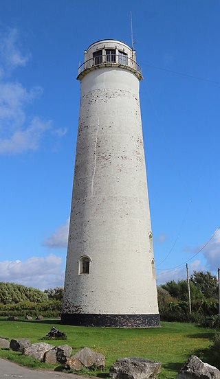
Leasowe Lighthouse is a historic lighthouse in Moreton on the Wirral Peninsula in Merseyside, England. The lighthouse was built in 1763 by The Mersey Docks and Harbour Company to guide shipping safely to the Port of Liverpool and is the oldest lighthouse built from bricks in the United Kingdom. The lighthouse became obsolete and was closed in 1908. The last lighthouse keeper was a Mrs. Williams, the only known female lighthouse keeper of the period.

Hoylake is a seaside town in the Metropolitan Borough of Wirral, Merseyside, England. It is at the north west of the Wirral Peninsula, near West Kirby and where the River Dee meets the Irish Sea. Historically part of Cheshire, the Domesday Book of 1086 recorded it within the Hundred of Wilaveston.

The Hilbre Islands are an archipelago consisting of three islands at the mouth of the estuary of the River Dee, the border between England and Wales at this point. The islands are administratively part of the Metropolitan Borough of Wirral. They are a Local Nature Reserve and are within the estuary Site of Special Scientific Interest. As of 2012, the islands have no permanent residents. The name is thought to derive from a chapel built on the Island and dedicated to St. Hildeburgh. Visitors typically travel by foot to the Islands from West Kirby.

The Wirral Peninsula, known locally as the Wirral, is a peninsula in North West England. The roughly rectangular peninsula is about 15 miles (24 km) long and 7 miles (11 km) wide, and is bounded by the Dee Estuary to the west, the Mersey Estuary to the east, and Liverpool Bay to the north.
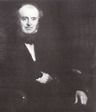
James Walker was an influential British civil engineer and contractor.

St Mary's Lighthouse is on the tiny St Mary's Island, just north of Whitley Bay on the coast of North East England. The small rocky tidal island is linked to the mainland by a short concrete causeway which is submerged at high tide.

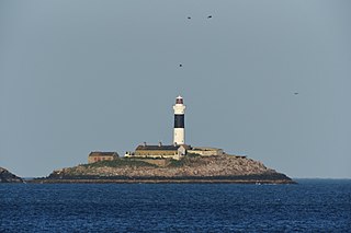
Round Island Lighthouse, in the Isles of Scilly was designed by William Tregarthen Douglass for Trinity House and completed in 1887. At the time of building it was one of three lights in the Isles of Scilly, the others being the Bishop Rock and St Agnes lighthouse. The light was modernised in 1966, automated in 1987 and the island designated as a Site of Special Scientific Interest (SSSI) in 1995. It is now managed by the Isles of Scilly Wildlife Trust, and except for the maintenance of the Grade II listed lighthouse, landing is not allowed.

Point Lynas Lighthouse is located on a headland in Llaneilian Community, on the north-east corner of Anglesey in North Wales. A pilot station was established on the point in 1766, to guide ships entering and leaving Liverpool, with an associated lighthouse added in 1779. The present building was built on the hilltop in 1835, so does not need a tower. Built and managed by the Mersey Docks and Harbour Board, it did not come under the care of Trinity House until 1973. By 2001 the lights were fully automated, so no resident staff were needed. Whilst the light is retained in operational use, the building and associated lighthouse keepers cottages were returned to the Mersey Docks and Harbour Board who sold them to be a private home and holiday accommodation.
Maryport Lighthouse is a small lighthouse located in Maryport, Cumbria, England, formerly run by England's general lighthouse authority, Trinity House. It is a Grade II listed building.

Hartland Point Lighthouse is a Grade II listed building at Hartland Point, Devon, England. The point marks the western limit of the Bristol Channel with the Atlantic Ocean continuing to the west. Trinity House, the lighthouse authority for England and Wales, have a lighthouse on the tip of the peninsula.

Llaneilian is a village and community in Anglesey, Wales. It is located in the north east of the island, 2.2 miles (3.5 km) east of Amlwch, 16.5 miles (26.6 km) north west of Menai Bridge and 12.5 miles (20.1 km) north of Llangefni. The community includes the villages and hamlets of Dulas, Llaneilian, Pengorffwysfa, Cerrig Man and Penysarn, Gadfa and Nebo, and at the 2001 census had a population of 1,192, decreasing slightly to 1,186 at the 2011 Census. The parish is crowned by its hill, Mynydd Eilian, a HuMP, popular with walkers and ramblers, and its beach, Traeth Eilian, which is popular with holidaymakers and for watersport activities. At the north easternmost point is Point Lynas,, while Ynys Dulas lies off the North East coast of the island, east of Dulas Bay.

The Europa Point Lighthouse, also referred to as the Trinity Lighthouse at Europa Point and the Victoria Tower or La Farola in Llanito, is a lighthouse at Europa Point, on the southeastern tip of the British Overseas Territory of Gibraltar, on the southern end of the Iberian Peninsula, at the entrance to the Mediterranean Sea.
Rockabill Lighthouse is an active 19th century lighthouse, on the larger of the two islands that form Rockabill. The islands lie some 5 kilometres (3.1 mi) off the east coast of Ireland, north-east of Skerries, in County Dublin. It is operated and maintained by the Commissioners of Irish Lights.

Casquets Lighthouse is an active lighthouse located on the rocky Les Casquets, Alderney, Channel Islands.
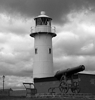
The Heugh Lighthouse is a navigation light on The Headland in Hartlepool, in north-east England. The current lighthouse dates from 1927; it is owned and operated by PD Ports. It is claimed that its early-Victorian predecessor was the first lighthouse in the world reliably lit by gas.

Hoylake Lifeboat Station is located on the North Parade promenade in the town of Hoylake on the Wirral Peninsula in Merseyside. A lifeboat was first stationed at Hoylake by the Liverpool Dock Trustees in 1803. The station was transferred to the Royal National Lifeboat Institution (RNLI) in 1894.

