
Longships Lighthouse is an active 19th-century lighthouse about 1.25 mi (2.0 km) off the coast of Land's End in Cornwall, England. It is the second lighthouse to be built on Carn Bras, the highest of the Longships islets which rises 39 feet (12 m) above high water level. In 1988 the lighthouse was automated, and the keepers withdrawn. It is now remotely monitored from the Trinity House Operations & Planning Centre in Harwich, Essex.

Southwold Lighthouse is a lighthouse operated by Trinity House in the centre of Southwold in Suffolk, England. It stands on the North Sea coast, acting as a warning light for shipping passing along the east coast and as a guide for vessels navigating to Southwold harbour.
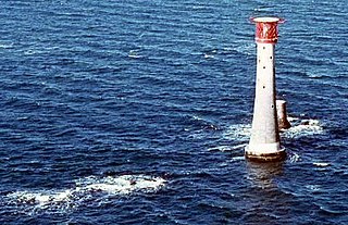
The Eddystone Lighthouse is a lighthouse on the Eddystone Rocks, 9 statute miles (14 km) south of Rame Head in Cornwall, England. The rocks are submerged below the surface of the sea and are composed of Precambrian gneiss.

Maryport is a town and civil parish in Cumbria, England.
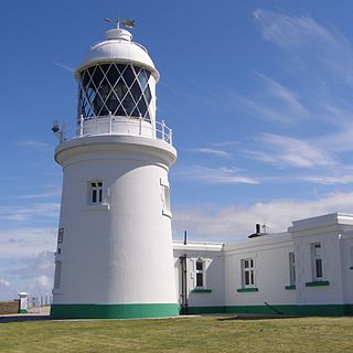
Pendeen Lighthouse, also known as Pendeen Watch is an active aid to navigation located 2 kilometres (1.2 mi) to the north of Pendeen in west Cornwall, England. It is located within the Aire Point to Carrick Du SSSI, the Cornwall Area of Outstanding Natural Beauty and the Penwith Heritage Coast. The South West Coast Path passes to the south.

Point Lynas Lighthouse is located on a headland in Llaneilian Community, on the north-east corner of Anglesey in North Wales. A pilot station was established on the point in 1766, to guide ships entering and leaving Liverpool, with an associated lighthouse added in 1779. The present building was built on the hilltop in 1835, so does not need a tower. Built and managed by the Mersey Docks and Harbour Board, it did not come under the care of Trinity House until 1973. By 2001 the lights were fully automated, so no resident staff were needed. Whilst the light is retained in operational use, the building and associated lighthouse keepers cottages were returned to the Mersey Docks and Harbour Board who sold them to be a private home and holiday accommodation.

St Bees Lighthouse is a lighthouse located on St Bees Head near the village of St Bees in Cumbria, England. The cliff-top light is the highest in England at 102 m (335 ft) above sea level.

Winterton Lighthouse is located in Winterton-on-Sea in the English county of Norfolk. In 1845 Winterton Ness was described as being 'well known to the mariner as the most fatal headland between Scotland and London'. As well as marking the headland, the lighthouse was intended to help guide vessels into the Cockle Gat, which provided the northern entry into the safe water of Yarmouth Roads. The lighthouse was known to Daniel Defoe and is mentioned in his novel Robinson Crusoe.

Wolf Rock Lighthouse is on the Wolf Rock, a single rock located 18 nautical miles east of St Mary's, Isles of Scilly and 8 nautical miles southwest of Land's End, in Cornwall, England, United Kingdom. The fissures in the rock are said to produce a howling sound in gales, hence the name.

Hartland Point Lighthouse is a Grade II listed building at Hartland Point, Devon, England. The point marks the western limit of the Bristol Channel with the Atlantic Ocean continuing to the west. Trinity House, the lighthouse authority for England and Wales, have a lighthouse on the tip of the peninsula.

Heligoland Lighthouse is located on Germany's only offshore island, Heligoland. Constructed during World War II as an anti-aircraft tower, it was turned into a lighthouse in 1952. It features the strongest light on the German North Sea coast with a range of 28 nautical miles (52 km) so that it can be seen as far as on the East Frisian or the North Frisian islands and Halligen. The lighthouse is operated by the Tönning water and shipping authority.
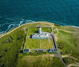
The Anvil Point Lighthouse is a fully-automated lighthouse located at Durlston Country Park near Swanage in Dorset, England. It is owned by Trinity House and currently operated as two holiday cottages.

Lowestoft Lighthouse is a lighthouse operated by Trinity House located to the north of the centre of Lowestoft in the English county of Suffolk. It stands on the North Sea coast close to Ness Point, the most easterly point in the United Kingdom. It acts as a warning light for shipping passing along the east coast and is the most easterly lighthouse in the UK.

Peninnis Lighthouse is situated on Peninnis Head, St Mary's, Isles of Scilly.

Dungeness Lighthouse on the Dungeness Headland started operation on 20 November 1961. Its construction was prompted by the building of Dungeness nuclear power station, which obscured the light of its predecessor which, though decommissioned, remains standing. The new lighthouse is constructed of precast concrete rings; its pattern of black and white bands is impregnated into the concrete. It remains in use today, monitored and controlled from the Trinity House Operations and Planning Centre at Harwich, Essex.

Casquets Lighthouse is an active lighthouse located on the rocky Les Casquets, Alderney, Channel Islands.
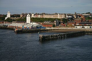
The High and Low Lights of North Shields are decommissioned leading lights in North Shields, Tyne and Wear in the United Kingdom. Two pairs of lights survive: the older pair date from 1727 and were operational until 1810; the newer pair then took over, remaining in use until 1999. All four are listed buildings. They were sometimes known as the Fish Quay High and Low Lights, or as 'Fish Quay ' and 'Dockwray Square '.
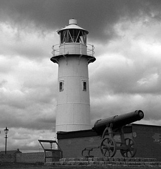
The Heugh Lighthouse is a navigation light on The Headland in Hartlepool, in north-east England. The current lighthouse dates from 1927; it is owned and operated by PD Ports. It is claimed that its early-Victorian predecessor was the first lighthouse in the world reliably lit by gas.

Scarborough Pier Lighthouse is an active aid to navigation on Vincent Pier in Scarborough, North Yorkshire, owned and operated by Scarborough Borough Council. The lighthouse dates from 1806, but it had to be rebuilt following damage sustained in the German bombardment of 1914.

The isle of Lundy has three lighthouses: a pair of active lights built in 1897 and a preserved older lighthouse dating from 1819.


