
Longships Lighthouse is an active 19th-century lighthouse about 1.25 mi (2.0 km) off the coast of Land's End in Cornwall, England. It is the second lighthouse to be built on Carn Bras, the highest of the Longships islets which rises 39 feet (12 m) above high water level. In 1988 the lighthouse was automated, and the keepers withdrawn. It is now remotely monitored from the Trinity House Operations & Planning Centre in Harwich, Essex.
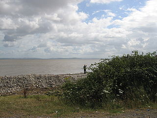
Bridgwater Bay is on the Bristol Channel, 5 kilometres (3.1 mi) north of Bridgwater in Somerset, England at the mouth of the River Parrett and the end of the River Parrett Trail. It stretches from Minehead at the southwestern end of the bay to Brean Down in the north. The area consists of large areas of mudflats, saltmarsh, sandflats and shingle ridges, some of which are vegetated. It has been designated as a Site of Special Scientific Interest (SSSI) covering an area of 3,574.1 hectares since 1989, and is designated as a wetland of international importance under the Ramsar Convention. The risks to wildlife are highlighted in the local Oil Spill Contingency Plan.

The Bristol Channel is a major inlet in the island of Great Britain, separating South Wales and South West England. It extends from the smaller Severn Estuary of the River Severn to the North Atlantic Ocean. It takes its name from the English city and port of Bristol

Burnham-on-Sea is a seaside town in Somerset, England, at the mouth of the River Parrett, upon Bridgwater Bay. Burnham was a small fishing village until the late 18th century when it began to grow because of its popularity as a seaside resort.
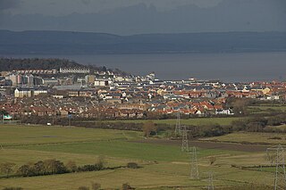
Portishead is a town and civil parish in the North Somerset unitary authority area, in the county of Somerset, England. The town had a population of 25,000 and is located next to the Severn Estuary opposite Cardiff and Newport in Wales. The town is 8 miles (13 km) to the west of Bristol and 18 miles northeast of Weston-super-Mare.

Lavernock is a hamlet in the Vale of Glamorgan in Wales, lying on the coast 7 miles (11 km) south of Cardiff between Penarth and Sully, and overlooking the Bristol Channel.
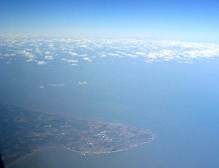
North Foreland is a chalk headland on the Kent coast of southeast England, specifically in Broadstairs.

The Bristol Channel floods of 30 January 1607 drowned many people and destroyed a large amount of farmland and livestock during a flood in the Bristol Channel area of the UK. The known tide heights, probable weather, extent and depth of flooding, and coastal flooding elsewhere in the UK on the same day all point to the cause being a storm surge rather than a tsunami.
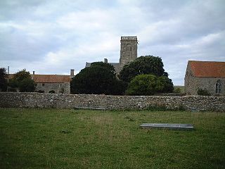
Kewstoke is a civil parish and village in Somerset, England, within the unitary authority of North Somerset, located next to the strip of coast called Sand Bay. Its population in the 2011 census was 1,690.

Braunton Burrows is a sand dune system on the North Devon coast. It is privately owned and forms part of the Christie Devon Estates Trust. Braunton Burrows is a prime British sand dune site, the largest sand dune system (psammosere) in England. It is particularly important ecologically because it includes the complete successional range of dune plant communities, with over 470 vascular plant species. The short turf communities are very rich in lichens and herbs, and the dune slacks are also rich. The many rare plants and animals include 14 with UK Biodiversity Action Plans. For example, this is one of only two sites in the UK for the Amber Sandbowl Snail Catinella arenaria, which is found on the wet dune slacks.

St Andrew's Church is the Church of England parish church of Burnham-on-Sea in the English county of Somerset. Of medieval origins, the church is a grade I listed building, well known for its leaning tower.
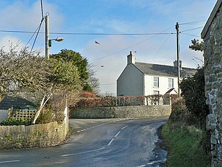
Marcross is a small village in the rural community of St Donats in the Vale of Glamorgan, south Wales. It consists of a public house and a few scattered houses, farms, and a small medieval church in the centre of the village.

Cromer Lighthouse is situated in the coastal town of Cromer, in the English county of Norfolk.
The High lighthouse or pillar lighthouse is one of three lighthouses in Burnham-on-Sea, Somerset, England. A Grade II listed building, it is no longer functional as a lighthouse and has been converted for use as a private dwelling.

The Low Lighthouse is one of three historic lighthouses in Burnham-on-Sea, Somerset, England, and the only one of the three which is still active. It is a Grade II listed building and stands on the foreshore. First lit in 1832, the Low Lighthouse operated in conjunction with the (onshore) High Lighthouse for 137 years. Then, in 1969 the Low Lighthouse was deactivated; but later, in 1993, the Low Lighthouse was re-established and the High Lighthouse was instead decommissioned).

Black Nore Lighthouse at Portishead, Somerset, England, was built in 1894. It is a Grade II listed building.

Casquets Lighthouse is an active lighthouse located on the rocky Les Casquets, Alderney, Channel Islands.
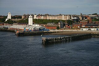
The High and Low Lights of North Shields are decommissioned leading lights in North Shields, Tyne and Wear in the United Kingdom. Two pairs of lights survive: the older pair date from 1727 and were operational until 1810; the newer pair then took over, remaining in use until 1999. All four are listed buildings. They were sometimes known as the Fish Quay High and Low Lights, or as 'Fish Quay ' and 'Dockwray Square '.
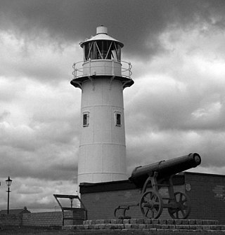
The Heugh Lighthouse is a navigation light on The Headland in Hartlepool, in north-east England. The current lighthouse dates from 1927; it is owned and operated by PD Ports. It is claimed that its early-Victorian predecessor was the first lighthouse in the world reliably lit by gas.

Plover Scar Lighthouse, also known as the Abbey Lighthouse, is an active 19th century lighthouse sited at the entrance of the Lune estuary, near Cockersand Abbey in Lancashire, England. The lighthouse is maintained by the Lancaster Port Commission. It is registered under the international Admiralty number A4876 and has the NGA identifier of 114-5144.


