The name Ribble may be a Brittonic compound-formation.[1] The second element is the noun *pol, with connotations including "puddle, pond, upland-stream" (Welshpwll).[1] The first is rö-, an intensive prefix, with nouns meaning "great" (Welsh rhy-, Cornish re-).[1]
Ribble may once have been known as *Bremetonā-, underlying the name Bremetenacum, the Roman fort at Ribchester.[1] Involved here is the Brittonic root *breμ–, meaning "roaring" (cf. Welsh brefu),[1] as observed at the river-names Breamish in Northumberland,[1]Braan in Scotland and Brefi in Wales.[1]
History
Neolithic to Saxon finds from along the River Ribble during the creation of the Preston Docks and others revealed man has been in the area for a long time. The River Ribble looked completely different then and the coastline is likely to have been much further inland than it is at present where land has been reclaimed and the marsh extended out into the River Ribble due to sedimentation.
The Ribble would appear to have been known in Roman times as the Belisama,[2] possibly giving its name to Samlesbury. Ptolemy's "Belisama aest." seems to represent the estuary of the Ribble. Bremetennacum was a Roman fort that guarded a crossing-point of the river at Ribchester. Remains of another Roman site were discovered at Walton-le-Dale in the mid-19th century.
The Cuerdale Hoard, the largest Viking silver hoard ever found outside Russia was discovered in 1840 on the southern bank of a bend of the river, at Cuerdale near Preston.[3] Whilst the medieval silver Mitton Hoard was found near where this river joins the River Hodder in 2009.[4]
At one time the Ribble marked the northernmost extent of the ancient kingdom of Mercia.[5] At the time of the Domesday Book, the river formed the northern boundary of an area of land (known as Inter Ripam et Mersam) that was included in the Domesday information for Cheshire,[6] though it was probably not formally part of the county of Cheshire.[7][8][9]
After his defeat in the Battle of Hexham in 1464 (during the Wars of the Roses), King Henry VI went into hiding at a number of houses belonging to his supporters. A little over a year later he was at Waddington Hall in Waddington. On 13 July 1465, a group of Yorkists, including the property-owner's brother, arrived at the hall to arrest him. Escaping into nearby woods, Henry was captured soon after crossing the river at the old stepping stones at Brungerley.[11]
Around 1785, a large weir was constructed across the river, slightly downstream at Waddow Hall, to supply water to a cotton mill at Low Moor. The site relied on water power right up to closure around 1930, although the water wheels gradually gave way to water turbines and were augmented by steam engines.[12]
During 2009, an Archimedean screw type hydropower station was constructed at Settle weir near Bridge End Mill. Built for a community-owned company, Settle Hydro, the site became operational by the end of the year. As of February 2024, the generator has produced 1.2 million kWh of electricity.[13]
Samlesbury Weir was constructed in the 1970s as a hydrometric gauging station by the local water authority for the purpose of measuring low flows on the River Ribble. The structure subsequently became redundant. In 2020 it was removed as part of a river restoration scheme intended to increase biodiversity and to facilitate the free passage of migratory fish species, including salmon, smelt and eels.
The Ribble Way is a long-distance footpath which follows the river for much of its course. The river is connected to both the Leeds and Liverpool Canal and the Lancaster Canal (via the Ribble Link). The river downstream of Preston was actively dredged when Preston was an active port; this is no longer done and silt from the river is now spreading more widely over the (sand) beaches around Fairhaven and St. Annes.
Its 10-mile-wide (16km) estuary forms part of the Ribble and Alt EstuariesSpecial Protection Area for wildlife. An average of 340,000 water birds over-winter in the estuary making it the most important wetland site in Britain. The Ribble is also a key breeding ground for the endangered Atlantic salmon.[5]
1.25 million people live in the Ribble's catchment area.[5]
Tidal regime and estuarine processes
The Normal Tidal Limit (NTL) of the river is at Fishwick Bottoms, between Preston and Walton-le-Dale, 11 miles (18km) from the sea.[5]
The River Ribble has the third-largest tides in England, with tides that run at 4 knots (5mph; 7km/h) and a tidal range at the mouth of the river of 30 feet (9m) during spring tides.
Tidal bore on the Ribble, between the River Douglas and Preston
The estuary is strongly flood-dominant. At Preston the flood tide lasts approximately 2.5 hours compared with an ebb duration of around 10 hours, and peak flood velocities exceed those of the ebb.
On spring tides, a tidal bore can travel upstream as far as Preston Dock at speeds of approximately 4 knots. The bore's wave height at Hutton Sands can be 3ft and decreases as it travels further up-river
Since River Ribble dredging ceased, the estuary is filling with sand and is developing a meandering path, depending on the tides and river runoff. In addition, many tributaries flow into the main channel including the Savick Brook/Ribble Link, while the River Douglas, has a significant influence both on sediment transport and hydrodynamics of the estuary.[16]
There was a bridge at Edisford, Clitheroe in 1339. The age of the present sandstone bridge is not known, but parts contain features indicating they may date to the late medieval period.[17] The current Ribchester Bridge dates from 1774. It replaced one built in 1669, which also had a predecessor of unknown age.[18]
Evidence of a bridge between Preston and Walton-le-Dale occurs in a deed in the early 13th century. A stone bridge was built in the early 1400s, possibly just west of the present Walton Bridge which was completed in 1781. Until 1755 this was the only bridge over the Ribble at Preston.[19] The original attempt to build a bridge directly to Penwortham was completed in 1755, only to collapse the following year. The Penwortham Old Bridge opened in 1759 to replace it.[20] In 1802 the Lancaster Canal Company completed a timber trestle bridge to facilitate a temporary tramroad to connect the two isolated sections of the canal. The missing section was never completed and, although heavily modified, the disused Old Tramroad Bridge still stands today.[21]
Ferries (historic)
Several ferry crossings were marked along the lower part of the river, on the first Ordnance Survey map of Lancashire, published in the 1840s. The Hacking Ferry near Hacking Hall and Trowers Ferry near Dinckley Hall. Another, downstream of Osbaldeston Hall and the Balderstone Hall Ferry. Also at Samlesbury Church as well as an old boat house, upstream of Penwortham Old Bridge.[22]
It is uncertain when these services began. A 1354 charter assigned some land for the use of the ferryman near Ribchester, possibly referring to the crossing near Osbaldeston Hall.[23] The Hacking Ferry seems to have been funded by the Shireburn family of Stonyhurst, and established during the 1600s. It continued operating as a regular toll service until 1938, but continued occasionally afterward until it finally ceased operation in 1955. In later years it operated two johnboat-type rowing boats. The older boat could carry twelve passengers and a newer boat had a capacity of 19. The former is now in the collection at Clitheroe Castle Museum.[24]
Estuary crossing proposals
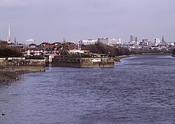
Ribble estuary
A Ribble estuary fixed crossing has been proposed on several occasions, to provide a quicker route between the seaside resorts of Southport and Blackpool. Two routes for a tramroad were proposed; the first in 1899 outlined a route between Crossens and Lytham, then between 1900 and 1906 as a route from Crossens to Warton via Hesketh Bank.[25] A railway tunnel was proposed in 1907, between Hesketh Bank and Warton.[26] A bridge was proposed between 1938 and 1947.[27] A road link was campaigned for in 2007, envisaging a development similar to the Rance Tidal Power Station in Brittany.[28] In 2011, an April fools' joke suggested a 9-mile-long (14km) road tunnel from Marshside to Lytham St Annes.[29]
Preston City Council published plans to build a barrage across the River Ribble, in their 'Riverworks' proposals (2006).[38] The aim of these proposals was to build a barrage and a water sports park on a section of the Ribble, coupled with over 4,000 units of housing and businesses in the river's flood plain. Some local residents opposed these plans, arguing that they endanger wildlife, increase flood risk to local housing and damage greenbelt areas. These residents set up the Save The Ribble campaign, and their two-year information campaign successfully overturned Preston City Council's proposals, and South Ribble Borough Council announced the alternative creation of a Country Park. Parts of the river are a County Biological Heritage Site.
Human-Origin Discharges and Remedies
Industrial Effluent via the "Rainbow River" (River Darwen)
The River Darwen is a major tributary that meets the River Ribble at Walton-le-Dale. For much of the 19th and 20th centuries, this waterway was known locally as the "Rainbow River." [39] This name originated from the discharge of industrial effluent by businesses in Blackburn and Darwen.These included major paint works, such as the Walpamur Company, and various wallpaper and paper mills. [40] The water changed colour daily based on the specific pigments used in production.
Visible dyes were accompanied by other chemical pollutants including heavy metals, bleaching agents, and ammonia. These substances travelled through the Darwen directly into the wider Ribble system. Such practices caused significant chemical pollution and damaged the local ecology. Strict environmental regulations introduced in the 1970s ended these discharges. [41]
Courtaulds Red Scar Works
Courtaulds operated the Red Scar Works in Preston from 1939 to the late 1970s, producing viscose rayon. Viscose manufacture typically generated wastewater containing sulphuric acid, zinc compounds and organic residues from cellulose processing.[42] The plant was a major industrial facility within the Ribble catchment.
Late 20th Century Sewage and Urban Runoff Discharges (Preston)
During the late twentieth century, the Preston area experienced intermittent discharges of wastewater and urban runoff into the River Ribble and its estuary. A 2013 engineering assessment identified 32 unsatisfactory intermittent discharges across the Preston, Penwortham, Watery Lane, Lea Gate and Ribbleton catchments. Several of these outfalls affected the tidal section of the river. The discharges occurred when the combined sewer system reached capacity during periods of heavy rainfall. They consisted of foul sewage mixed with urban surface water, including rainwater and street runoff carrying general pollutants. The Environment Agency identified these discharges as affecting bathing water quality and designated shellfish areas.[43]
Early 21st Century Sewage and Urban Runoff Remedies (Preston)
Between 2010 and 2013, a programme of works was carried out to reduce the frequency of intermittent discharges of wastewater and urban runoff. The scheme included a 3.5km interceptor tunnel with large storm-storage capacity to replace older overflow points that had previously discharged to the Ribble and Savick Brook. It also introduced a series of detention shafts, tunnel sections, pumping improvements and raised weirs designed to intercept stormwater, sewage and urban runoff before these flows reached the river. These measures created additional storage within the combined sewer network and redirected flows for full treatment at Clifton Marsh Wastewater Treatment Works.. [43][44]
Uranium and Radionuclide Discharges from Springfields
Established in 1946, the Springfields facility at Salwick was the first plant in the world to manufacture commercial nuclear fuel. Throughout its history under UKAEA, BNFL, and currently Westinghouse, the site has processed uranium ore concentrate to produce fuel for nuclear fission reactors.
1991 Uranium Investigation and Remediation
In 1991, an investigation by the ITV series World in Action[45] and a report by environmentalist Nick Cassidy for Friends of the Earth (Profits Before Safety) [46][47] highlighted high levels of uranium and thorium-234 in the Ribble's silt. The report alleged that the BNFL Springfields plant was discharging untreated waste into Savick Brook to avoid filtration costs, specifically impacting houseboat residents at Hesketh Bank. Following a 1991 Early Day Motion in Parliament, BNFL implemented decanter centrifuge technology to "scrub" the effluent[48], significantly reducing discharges by the mid-1990s. [49][50]
Current situation
The Springfields nuclear fuel facility near Preston operates under a permit allowing regulated releases of uranium-bearing effluent, which enters the Ribble system via Savick Brook (the Ribble Link). These discharges are monitored by the Environment Agency and reported as remaining within authorised limits.
Certainly there were links between Cheshire and south Lancashire before 1000, when Wulfric Spot held lands in both territories. Wulfric's estates remained grouped together after his death, when they were left to his brother Aelfhelm, and indeed there still seems to have been some kind of connexion in 1086, when south Lancashire was surveyed together with Cheshire by the Domesday commissioners. Nevertheless, the two territories do seem to have been distinguished from one another in some way and it is not certain that the shire-moot and the reeves referred to in the south Lancashire section of Domesday were the Cheshire ones.
The Domesday Survey (1086) included south Lancashire with Cheshire for convenience, but the Mersey, the name of which means 'boundary river' is known to have divided the kingdoms of Northumbria and Mercia and there is no doubt that this was the real boundary.
↑Rowland, P.; Neal, C.; Sleep, D.; Vincent, C.; Scholefield, P. (2011). "Chemical Quality Status of Rivers for the Water Framework Directive: A Case Study of Toxic Metals in North West England". Water. 3 (2): 649–666. doi:10.3390/w3020650.{{cite journal}}: CS1 maint: unflagged free DOI (link)
↑Wheeler, Edward. (1928). The Manufacture of Artificial Silk with Special Reference to the Viscose Process. Chapman & Hall.{{cite book}}: CS1 maint: date and year (link)
Crosby, A. (1996). A History of Cheshire. (The Darwen County History Series.) Chichester, West Sussex, UK: Phillimore & Co. Ltd. ISBN0-85033-932-4.
Greenhalgh, M. (2009). Ribble: river and valley, a local and natural history. Lancaster, Carnegie Publishing. ISBN978-1-85936-135-1.
Harris, B. E., and Thacker, A. T. (1987). The Victoria History of the County of Chester. (Volume 1: Physique, Prehistory, Roman, Anglo-Saxon, and Domesday). Oxford: Oxford University Press. ISBN0-19-722761-9.
Morgan, P. (1978). Domesday Book Cheshire: Including Lancashire, Cumbria, and North Wales. Chichester, Sussex: Phillimore & Co. Ltd. ISBN0-85033-140-4.
Phillips A. D. M., and Phillips, C. B. (2002), A New Historical Atlas of Cheshire. Chester, UK: Cheshire County Council and Cheshire Community Council Publications Trust. ISBN0-904532-46-1.
Further reading
Assinder, D.J.; Mudge, S.M. & Bourne, G.S. (1997). "Radiological assessment of the Ribble estuary—I. Distribution of radionuclides in surface sediments". Journal of Environmental Radioactivity. 36 (1). Published by Elsevier Science Ltd.: 1–19. doi:10.1016/S0265-931X(96)00073-2.
Mudge, S.M.; Bourne, G.S. & Assinder, D.J. (1997). "Radiological assessment of the Ribble estuary—II. Beta and gamma dose rates and doses to critical groups". Journal of Environmental Radioactivity. 36 (1). Published by Elsevier Science Ltd.: 21–41. doi:10.1016/S0265-931X(96)00074-4.
Mudge, S.M.; Assinder, D.J. & Bourne, G.S. (1997). "Radiological assessment of the Ribble estuary—III. Redistribution of radionuclides". Journal of Environmental Radioactivity. 36 (1). Published by Elsevier Science Ltd.: 43–67. doi:10.1016/S0265-931X(96)00075-6.
External links
Wikimedia Commons has media related to River Ribble.
This page is based on this Wikipedia article Text is available under the CC BY-SA 4.0 license; additional terms may apply. Images, videos and audio are available under their respective licenses.