 River Twiss, Raven Ray footbridge. To the north the limestone slopes of Keld Head Scars rise to the summit of Gragareth
 Manor Bridge over River Twiss
 Cuckoo Island in the River Twiss
 River Twiss seen from the road bridge in Ingleton
 Pecca Falls, River Twiss, near Ingleton
 Thornton Force, River Twiss, Ingleton
| River Twiss | |
|---|---|
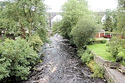 River Twiss and Ingleton Viaduct | |
 | |
| Location | |
| Country | England |
| Physical characteristics | |
| Source | |
| • location | Kingsdale Beck, Keld Head |
| • coordinates | 54°11′3″N2°28′4″W / 54.18417°N 2.46778°W |
| • elevation | 264 metres (866 ft) |
| Mouth | |
• location | River Doe |
• coordinates | 54°9′11″N2°28′15″W / 54.15306°N 2.47083°W |
• elevation | 118 metres (387 ft) |
| Length | 4.17 km (2.59 mi) |
The River Twiss is a river in the county of Yorkshire, England. The source of the river is Kingsdale Beck, which rises at Kingsdale Head at the confluence of Back Gill and Long Gill in the Yorkshire Dales. Beneath Keld Head, the river changes its name to the River Twiss. It has two notable waterfalls, Thornton Force and Pecca Falls, and its course follows part of the Ingleton Waterfalls Walk, [1] then through Swilla Glen to Thornton in Lonsdale and down to Ingleton, where it meets the River Doe to form the River Greta.
Contents
The English landscape artist J. M. W. Turner was a frequent visitor to the area, and his sketch of Thornton Force in 1816 is currently part of the Tate collection. [2]


