
Doncaster is a city in South Yorkshire, England. Named after the River Don, it is the administrative centre of the City of Doncaster metropolitan borough, and is the second largest settlement in South Yorkshire after Sheffield. Noted for its racing and railway history, it is situated in the Don Valley on the western edge of the Humberhead Levels and east of the Pennines. It had a population of 87,455 at the 2021 census, whilst the wider metropolitan borough had a population of 308,100.

The River Don is a river in South Yorkshire and the East Riding of Yorkshire, England. It rises in the Pennines, west of Dunford Bridge, and flows for 69 miles (111 km) eastwards, through the Don Valley, via Penistone, Sheffield, Rotherham, Mexborough, Conisbrough, Doncaster and Stainforth. It originally joined the Trent, but was re-engineered by Cornelius Vermuyden as the Dutch River in the 1620s, and now joins the River Ouse at Goole. Don Valley is a UK parliamentary constituency near the Doncaster stretch of the river.

The River Rother, a waterway in the northern midlands of England, gives its name to the town of Rotherham and to the Rother Valley parliamentary constituency. It rises in Pilsley in Derbyshire and flows in a generally northwards direction through the centre of Chesterfield, where it feeds the Chesterfield Canal, and on through the Rother Valley Country Park and several districts of Sheffield before joining the River Don at Rotherham in Yorkshire. Historically, it powered mills, mainly corn or flour mills, but most had ceased to operate by the early 20th century, and few of the mill buildings survive.

Mexborough is a town in the City of Doncaster in South Yorkshire, England. Situated between Manvers and Denaby Main, it lies on the River Don close to where it joins the River Dearne, and the A6023 road runs through the town. It is contiguous with the town of Swinton which is directly to the southwest immediately across the railway and Conisbrough to the east.

The Little Don River also known as the Porter, is a tributary of the River Don in South Yorkshire, England. Arising on the Langsett Moors in the northern Peak District, the Little Don River feeds the Langsett and Underbank Reservoirs. It runs through the town of Stocksbridge before joining the River Don.

Doncaster railway station is on the East Coast Main Line serving the city of Doncaster, South Yorkshire, England. It is 155 miles 77 chains (251 km) down the line from London King's Cross and is situated between Retford and York on the main line. It is managed by London North Eastern Railway. It is the second busiest station in South Yorkshire, and the fourth busiest station in Yorkshire & the Humber.

Swinton is a town in the Metropolitan Borough of Rotherham, in South Yorkshire, England on the west bank of the River Don. It has a population of 15,559 (2011). The town is five miles north-northeast of the larger town of Rotherham and south-west of Mexborough. The original junior and infant school building built in 1852 on Church Street still exists, and is being converted into residential apartments called Fitzwilliam Lodge.

Selby railway station is a Grade II listed station which serves the market town of Selby in North Yorkshire, England. The original terminus station was opened in 1834 for the Leeds and Selby Railway. The Hull and Selby Railway extended the line in 1840 and a new station was built, with the old station becoming a goods shed. The station was rebuilt in 1873 and 1891; the 1891 rebuilding was required due to the replacement of the swing bridge over the River Ouse at the same time.

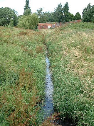
The Meers Brook is a stream in Sheffield, England and one of the main tributaries of the River Sheaf. The Meers Brook originates in Gleadless and flows downhill through Gleadless Valley and Meersbrook then, culverted, continues underneath Heeley to pour into the River Sheaf near Saxon Road and Clyde Road in Lowfield.

The Blackburn Brook is a stream in Sheffield, South Yorkshire, England which flows through the Blackburn Valley along the M1 and Ecclesfield Road and joins the River Don near the Meadowhall shopping centre. Downstream from the A61 road at Chapeltown the Blackburn Brook is defined as a main river by the Environment Agency, which requires new building development to be at least 26 feet (8 m) from the bank side as a flood defence measure and to allow access to the watercourse for maintenance.

The Stainforth and Keadby Canal is a navigable canal in South Yorkshire and Lincolnshire, England. It connects the River Don Navigation at Bramwith to the River Trent at Keadby, by way of Stainforth, Thorne and Ealand, near Crowle. It opened in 1802, passed into the control of the River Don Navigation in 1849, and within a year was controlled by the first of several railway companies. It became part of the Sheffield and South Yorkshire Navigation, an attempt to remove several canals from railway control, in 1895. There were plans to upgrade it to take larger barges and to improve the port facilities at Keadby, but the completion of the New Junction Canal in 1905 made this unnecessary, as Goole could easily be reached and was already a thriving port.
The South Yorkshire Railway was a railway company with lines in the West Riding of Yorkshire, England.

The River Don Navigation was the result of early efforts to make the River Don in South Yorkshire, England, navigable between Fishlake and Sheffield. The Dutch engineer Cornelius Vermuyden had re-routed the mouth of the river in 1626, to improve drainage, and the new works included provision for navigation, but the scheme did not solve the problem of flooding, and the Dutch River was cut in 1635 to link the new channel to Goole. The first Act of Parliament to improve navigation on the river was obtained in 1726, by a group of Cutlers based in Sheffield; the Corporation of Doncaster obtained an Act in the following year for improvements to the lower river. Locks and lock cuts were built and by 1751 the river was navigable to Tinsley.

Hexthorpe is a suburb of Doncaster, South Yorkshire, England. Historically part of the West Riding of Yorkshire, the area's shape resembles a rhombus, with borders with Balby and Doncaster town centre, separated by railway lines and the river separating the area from the villages of Sprotbrough and Newton. The Hexthorpe House was a well known pub in the area. Following a fire, the pub remained derelict for a few months and the remains were demolished in 2009. The old pub sign was saved and has now been erected in Hexthorpe Flatts Park.
The Hull and Doncaster Branch is a secondary main railway line in England, connecting Kingston upon Hull to South Yorkshire and beyond via a branch from the Selby Line near Gilberdyke to a connection to the Doncaster–Barnetby line at a junction near Thorne 8 miles north-east of Doncaster.

Knaresborough Viaduct is a viaduct in the North Yorkshire town of Knaresborough, England. The viaduct carries the Harrogate line over the River Nidd in the town. The viaduct was supposed to have opened in 1848, but the first construction collapsed into the river very near to completion, which necessitated a new viaduct and delayed the opening of the line through Knaresborough by three years.

The York and Doncaster branch was a railway line that opened in 1871 connecting Doncaster with York via Selby in Yorkshire, England. This line later became part of the East Coast Main Line (ECML) and was the route that express trains took between London King's Cross, the north of England and Scotland. It was opened by the North Eastern Railway (NER) between York and Shaftholme Junction, some 4.5 miles (7.2 km) north of Doncaster railway station. Between its opening in 1871 and the grouping in 1923, the line was used by both the NER, and the Great Northern Railway (GNR). All of the intermediate local stations that had opened with the line in 1871 closed down in the 1950s and 1960s leaving just Selby open between the town of Doncaster and the city of York.

The River Tutt is a 8.7-mile (14 km) long tributary of the River Ure in North Yorkshire, England. The river rises near to the villages of Nidd and Scotton draining mainly arable land north eastwards before emptying into the Ure at Boroughbridge. Where the river joins the Ure in Boroughbridge, has been the site of significant historic flooding. An Environment Agency project to alleviate flooding on the river has seen diversion schemes and pumps added to prevent this.
Holgate Beck is a small watercourse that flows north-eastwards through Holgate across the west side of the City of York, England. Primarily flowing through Holgate, from which it derives its name, the beck drains a large part of Askham Bog and Hob Moor, then running underneath the various lines near York railway station. It empties into the River Ouse at Water End, being one of five main tributaries for the River Ouse in York, and consequently added to the flooding in the river and immediate environs. To counter this, some flood diversionary schemes have been implemented near to Askham Bog and Hob Moor.

Beckhole Incline was a steep, rope-worked gradient on the railway line between Whitby and Pickering, in the North Riding of Yorkshire, England. Opened in May 1836 as part of the horse-worked Whitby & Pickering Railway, the line was operated by three railway companies before becoming redundant on the opening of a diversionary line to the east that allowed through working by steam engines on the entire line. Although the incline was closed to regular traffic in 1865, it was used for a very brief period in 1872, to test a special locomotive intended for railways with steep gradients.

