Holgate Beck

Last updated

Holgate Beck
Holgate Beck - geograph.org.uk - 278495.jpg
Holgate Beck flowing through Millennium Green
North Yorkshire UK relief location map.jpg
Red pog.svg
Location within York
EtymologyNamed after Holgate, the suburb it flows through
Location
CountryEngland
City York
Physical characteristics
Source 
  location Askham Bog
  coordinates 53°55′30″N1°07′30″W / 53.925°N 1.125°W / 53.925; -1.125
  elevation39 feet (12 m)
Mouth  
  location
Water End
  coordinates
53°57′54″N1°06′36″W / 53.965°N 1.110°W / 53.965; -1.110
  elevation
33 feet (10 m)
Length4.28 miles (6.88 km)
Basin size2,650 acres (1,072 ha)
Discharge 
  locationWater End
Basin features
Progression River OuseHumber EstuaryNorth Sea.

Holgate Beck is a small watercourse that flows north-eastwards through Holgate across the west side of the City of York, England. Primarily flowing through Holgate, from which it derives its name, the beck drains a large part of Askham Bog and Hob Moor, then running underneath the various lines near York railway station. It empties into the River Ouse at Water End, being one of five main tributaries for the River Ouse in York, and consequently added to the flooding in the river and immediate environs. To counter this, some flood diversionary schemes have been implemented near to Askham Bog and Hob Moor.

Contents

The Environment Agency list Holgate Beck as a Critical Ordinary Watercourse (COW) due to the potential for flooding from the beck.

History

Holgate Beck flows for 4.28 miles (6.88 km) [note 1] from a small pond on the east side of the A1237 at Askham Bryan, to the River Ouse at Water End in York. [3] Ordnance Survey mapping shows Holgate Beck starting near to Hob Moor School, but the Environment Agency show the beck starting further south west and draining Askham Bog. [4] Similarly, the internal drainage board map shows the confluence of two becks at Askham Bog to be the start of the named watercourse. [5] Askham Bog is drained by two streams on either side; Askham Bog Drain and Pike Hill Drain, which join at the north-eastern end of the bog and are pumped onwards by an Internal Drainage Board flood station. [6] This consists of two weirs than can rise up to prevent water flowing into Holgate Beck, allowing it to be diverted through the Knavesmire Culvert. The water from Knavesmire Culvert reaches the Ouse near to Bishopthorpe Palace. [7] [8] From Askham Bog it drains north-eastwards past Dringhouses and through Holgate, where it enters a culvert by The Fox public house, then travelling some 16 feet (5 m) under the railway lines before re-appearing at Millennium Green for a short distance above ground until it is pumped into the River Ouse at Water End. [9] [10]

A pumping station at the outfall of the beck at Water End was installed to prevent the River Ouse back-flooding the beck. [11] At Askham Bog, the height above sea level is 39 feet (12 m), and in the first 2.2 miles (3.5 km), the beck only falls by 4.7 inches (12 cm). [12] At the outfall, the beck is at 33 feet (10 m) above sea level. [9]

In Medieval times, a corn mill was located on the beck on Hob Moor. The mill was mentioned as far back as 1563, but was destroyed by fire in 1600. [13] It was rebuilt in 1601, and was used as a place to house plague victims, which "discouraged people from taking corn to the mill". [14] In 1868, works to install a gas plant for the North Eastern Railway led to the discovery of the York Hoard at the outfall of Holgate Beck into the River Ouse. [15] [16] As the outfall area of Holgate Beck is known to have been on a trade route that crossed the Ouse in that location, there is the belief that more archaeological remains lay there waiting to be discovered. [17] In 1884, when Holgate Ward was incorporated into the City of York, the beck became the natural border. [18]

The beck drains an area of 2,650 acres (1,072 ha), [3] and flows across peat bogs, lacustrine sands, glacial till and York Moraines. [19] Its catchment area includes Askham Bog, Hob Moor, Woodthorpe, Acomb and Holgate. [20] The Environment Agency classify the watercourse as being 'heavily modified', [3] and at the northern end it is enclosed under the railway yards and the proposed York Central Development. [21] At the northern end of the watercourse, the beck formed the eastern edge of Millennium Green open space and is central to helping with flood alleviation of the York Central Development scheme. [22]

Holgate Beck derives its name from the suburb that it flows through. Holgate is an Anglo-Saxon word meaning Hollow Street. [23]

Flooding

Historic flooding of York has been recorded often. Currently, Holgate Beck does not have any active flood defences (such as a barrier), however, some schemes have been implemented such as diversionary pipes to take water away to the south of the city rather the flowing northwards towards the Ouse. In 1980 and 1982, earthen banks were built at the unculverted lower reaches after flooding of Leeman Road properties in 1978. This area had also been affected by flooding in 1947. [24] The historical flooding of 1947, 1978 and the early 1980s, has been attributed to backflow from the River Ouse when that watercourse has been in extreme flood situations. This led to the construction of the pumping station at Water End. [25]

In 2014, the Water End Flood Alleviation Scheme created a height differential between the Ouse and Holgate Beck so that back-flooding from the Ouse was prevented. In doing so, estimates state that at least 400 homes and businesses in the area are protected from flooding. [26] However, in times of extreme rainfall, the beck can still flood the surrounding area. [27] [28]

Besides the two main rivers in York (Ouse and Foss), Holgate Beck is one of five 'Critical Ordinary Watercourses' (COWs) in York which are maintained by the Environment Agency. [29] The beck was transferred from the Marston Moor Internal Drainage Board to the Environment Agency in 2006, due to its COW designation. The EA define a COW as "..watercourses that are not classified as “main river” but which the Environment Agency and other operating authorities agree are critical because they have the potential to put at risk from flooding large numbers of people and property." [30]

Wildlife

Water vole are believed to be inhabiting the area of the beck in and around Millennium Green. This habitat is potentially at risk from the York Central Development. [31]

Notes

  1. Some Environment Agency documents list the beck as being 4.4 miles (7.1 km) long. [1] [2]

Related Research Articles

<span class="mw-page-title-main">River Ouse, Yorkshire</span> River in North Yorkshire, England

The River Ouse is a river in North Yorkshire, England. Hydrologically, the river is a continuation of the River Ure, and the combined length of the River Ure and River Ouse makes it, at 129 miles (208 km), the sixth-longest river of the United Kingdom and the longest to flow entirely in one county. The length of the Ouse alone is about 52 miles (84 km) but the total length of the river is disputed.

<span class="mw-page-title-main">River Ouse, Sussex</span> River in Sussex, England

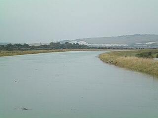
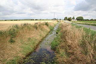
The Ouse is a 35 miles long river in the English counties of West and East Sussex. It rises near Lower Beeding in West Sussex, and flows eastwards and then southwards to reach the sea at Newhaven. It skirts Haywards Heath and passes through Lewes. It forms the main spine of an extensive network of smaller streams, of which the River Uck is the main tributary. As it nears the coast it passes through the Lewes and Laughton Levels, an area of flat, low-lying land that borders the river and another tributary, the Glynde Reach. It was a large tidal inlet at the time of the Domesday book in 1086, but over the following centuries, some attempts were made to reclaim some of the valley floor for agriculture, by building embankments, but the drainage was hampered by the buildup of a large shingle bar which formed across the mouth of the river by longshore drift.

<span class="mw-page-title-main">River Derwent, Yorkshire</span> River in Yorkshire, England

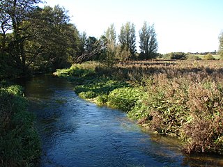
The Derwent is a river in Yorkshire in the north of England. It flows from Fylingdales Moor in the North York Moors National Park, east then southwards as far as its confluence with the River Hertford then westwards through the Vale of Pickering, south through Kirkham Gorge and the Vale of York, joining the River Ouse at Barmby on the Marsh. The confluence is unusual in that the Derwent converges on the Ouse at a shallow angle in an upstream direction.

<span class="mw-page-title-main">River Nar</span> River in England

The River Nar is a river in England, a tributary of the River Great Ouse. It rises at Mileham near Litcham in Norfolk and flows 15 miles west through Castle Acre and Narborough, joining the Ouse at King's Lynn. It has had a variety of alternative names, such as the Setch, the Sandringham, and Lynn Flu, though these are rarely, if ever, used today. In 2011 the Nar was recognised by the Environment Agency as one of the top ten most improved rivers in England and Wales.

The Ainsty or the Ainsty of York was a historic district of Yorkshire, England, west of the city of York. Originally a wapentake or subdivision of the West Riding of Yorkshire it later had a unique status as a rural area controlled by the corporation of the city.

<span class="mw-page-title-main">Hatfield Chase</span> Human settlement in England

Hatfield Chase is a low-lying area in South Yorkshire and North Lincolnshire, England, which was often flooded. It was a royal hunting ground until Charles I appointed the Dutch engineer Cornelius Vermuyden to drain it in 1626. The work involved the re-routing of the Rivers Don, Idle, and Torne, and the construction of drainage channels. It was not wholly successful, but changed the whole nature of a wide swathe of land including the Isle of Axholme, and caused legal disputes for the rest of the century. The civil engineer John Smeaton looked at the problem of wintertime flooding in the 1760s, and some remedial work was carried out.

<span class="mw-page-title-main">Internal drainage board</span>

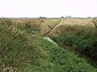
An internal drainage board (IDB) is a type of operating authority which is established in areas of special drainage need in England and Wales with permissive powers to undertake work to secure clean water drainage and water level management within drainage districts. The area of an IDB is not determined by county or metropolitan council boundaries, but by water catchment areas within a given region. IDBs are geographically concentrated in the Broads, Fens in East Anglia and Lincolnshire, Somerset Levels and Yorkshire.

<span class="mw-page-title-main">Sowy River</span> Artificial drainage channel in Somerset, England

The Sowy River is an artificial drainage channel in Somerset, England, designed to act as a flood relief channel for the River Parrett. Water from the Parrett can be diverted into it just below Langport, and is conveyed to the King's Sedgemoor Drain, which discharges back into the Parrett much nearer to its outfall into the Bristol Channel. Following extensive flooding of the surrounding land in 2014, new culverts to carry the river under the A372 road at Beer Wall were constructed, and a three-year project to raise the banks and widen the channel to increase its capacity was undertaken.

<span class="mw-page-title-main">River Foulness</span> River in the East Riding of Yorkshire, England

The River Foulness is a river in the East Riding of Yorkshire, England. Its name is derived from Old English fūle[n] ēa, meaning “dirty water”. Maintenance responsibilities for the river transferred from the Environment Agency to the Market Weighton Drainage Board on 1 October 2011. Market Weighton Drainage Board subsequently amalgamated with the Lower Ouse Internal Drainage Board on 1 April 2012 to create the Ouse and Humber Drainage Board. The river discharges into the Humber Estuary via Market Weighton Canal. Water levels within the river, its tributaries and the canal are managed and controlled by the Environment Agency. The river lies in an area known as the Humberhead Levels.

<span class="mw-page-title-main">River Eau</span> River in Lincolnshire, England

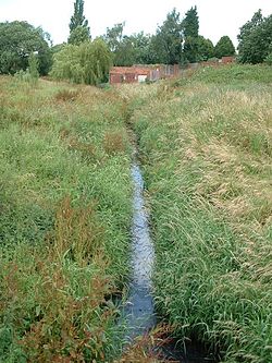
The River Eau is a 15-mile-long (24 km) tributary of the River Trent that flows through Lincolnshire, England.

<span class="mw-page-title-main">Winter flooding of 2013–14 on the Somerset Levels</span> Flooding in Somerset, England

From December 2013 onwards the Somerset Levels suffered severe flooding as part of the wider 2013–2014 Atlantic winter storms in Europe and subsequent 2013–2014 United Kingdom winter floods. The Somerset Levels, or the Somerset Levels and Moors as they are less commonly but more correctly known, is a coastal plain and wetland area of central Somerset, in South West England, running south from the Mendip Hills to the Blackdown Hills.

<span class="mw-page-title-main">Holderness Drain</span> English water project

Holderness Drain is the main feature of a Land Drainage scheme for the area of Holderness to the east of the River Hull in the East Riding of Yorkshire, England. Construction began in 1764, and several notable civil engineers were involved with the scheme over the years. Despite the high costs of the initial scheme, it was not particularly successful, because of the refusal of the ship owners of Hull to allow an outlet at Marfleet. They insisted that the water be discharged into the River Hull to keep the channel free of silt. Following a period of agricultural depression and the building of new docks in the early 1800s, an outlet at Marfleet was finally authorised in 1832. A high level system still fed upland water to the Hull, but the low level system discharged into the Humber, where levels were considerably lower. Following the success of steam pumping on the Beverley and Barmston Drain, the trustees looked at such a possibility for the Holderness Drain, but the development of the Alexandra Dock in the 1880s and then the King George V Dock in 1913 provided a solution, as the docks were topped up with water pumped from the drain, to lessen the ingress of silt-laden water.

<span class="mw-page-title-main">Beverley and Barmston Drain</span> Drainage canal in East Riding of Yorkshire, England

The Beverley and Barmston Drain is the main feature of a land drainage scheme authorised in 1798 to the west of the River Hull in the East Riding of Yorkshire, England. The area consisted of salt marshes to the south and carrs to the north, fed with water from the higher wolds which lay to the north, and from inundation by tidal water passing up the river from the Humber. Some attempts to reduce the flooding by building embankments had been made by the fourteenth century, and windpumps appeared in the seventeenth century. The Holderness Drainage scheme, which protected the area to the east of the river, was completed in 1772, and attention was then given to resolving flooding of the carrs.

<span class="mw-page-title-main">Sea Cut (Scalby Beck)</span> River in North Yorkshire, England

The Sea Cut (Scalby Beck) is a small river that enters the North Sea at Scalby Mills, Scarborough, North Yorkshire, England. The beck is fed from local streams in Scalby, Newby and Burniston and other watercourses draining off the nearby hills. It is also a bypass channel for the upper reaches of the River Derwent when it is under flood conditions.

<span class="mw-page-title-main">Pickering Beck</span> River in North Yorkshire, England

Pickering Beck is a river that runs for over 18 miles (29 km) from its source in the North York Moors National Park through the town of Pickering and on to its confluence with Costa Beck at Kirby Misperton. It is a meandering river that is fed by numerous named and unnamed becks and streams which flow over sandstone and limestone beds and an alluvia of sand, clay silt and gravel. The beck is known for flooding and in recent times has been a beneficiary of funding and experimental flood protection schemes.

<span class="mw-page-title-main">Lewes and Laughton Levels</span>

The Lewes and Laughton Levels are an area of low-lying land bordering the River Ouse near Lewes and the Glynde Reach near Laughton in East Sussex, England. The area was probably a tidal inlet in Norman times, but by the early 14th century, some meadows had been created by building embankments. Conditions deteriorated later that century, and by 1537, most of the meadows were permanently flooded. Part of the problem was the buildup of shingle across the mouth of the Ouse, but in 1537 a scot tax was raised, and a new channel cut through the shingle. By the mid 17th century, shingle was again preventing the region from draining properly, until the new channel was reinstated around 1731. In 1758 John Smeaton surveyed the area with a view to improving it for agriculture. He suggested straightening and widening the river channel, raising the banks around meadows, and building a large sluice near Piddinghoe, to keep the tides out. Some dredging and widening were carried out, but the straightending and sluice were discarded.

<span class="mw-page-title-main">River Tutt</span> River in North Yorkshire, England

The River Tutt is a 8.7-mile (14 km) long tributary of the River Ure in North Yorkshire, England. The river rises near to the villages of Nidd and Scotton draining mainly arable land north eastwards before emptying into the Ure at Boroughbridge. Where the river joins the Ure in Boroughbridge, has been the site of significant historic flooding. An Environment Agency project to alleviate flooding on the river has seen diversion schemes and pumps added to prevent this.

<span class="mw-page-title-main">Swinefleet Warping Drain</span> Artificial waterway in the East Riding of Yorkshire, England

Swinefleet Warping Drain is an artificial waterway in the English county of the East Riding of Yorkshire, which was built to allow silt to be deposited on the peat moors, but now functions as a land drainage channel. It was constructed by Ralph Creyke, and the first section was completed in 1821.

<span class="mw-page-title-main">Wyke Beck</span> Stream in West Yorkshire, England

Wyke Beck is a stream that runs from Roundhay Park to the River Aire in east Leeds, West Yorkshire, England. Described as an Urban Beck, the stream flows through housing estates and then an industrial landscape in its lower reaches. Wyke Beck has been prone to flooding so often, that remediation of its course and flood storage schemes have been initiated by Leeds City Council.

<span class="mw-page-title-main">Ea Beck</span> River in South Yorkshire, England

The Ea Beck, also spelled Eaubeck or Eau Beck, is a small river in South Yorkshire, England, that flows eastwards into the River Don at Thorpe-in-Balne. The Environment Agency lists the beck as starting at South Elmsall, but mapping lists the beck with several names along its course. The beck has twice flooded areas and villages that it passes through in the 21st century.

References

  1. "River Quality Survey 1998" (PDF). ea-lit.freshwaterlife.org. Environment Agency. 1998. p. 30. Retrieved 14 July 2021.
  2. "River Quality Survey 1994" (PDF). environment data.org. Environment Agency. 1994. p. 26. Retrieved 14 July 2021.
  3. 1 2 3 "Holgate Beck to Ouse". environment.data.gov.uk. Retrieved 13 July 2021.
  4. Lewis, Stephen (11 January 2019). "ANALYSIS: The battle to protect 'irreplaceable' Askham Bog". York Press. Retrieved 14 July 2021.
  5. "York Consortium of Drainage Boards Watercourses Ainsty 2008 IDB" (PDF). yorkconsort.gov.uk. Retrieved 13 July 2021.
  6. Jones 2019, p. 6–7.
  7. "Becks". fohm.org.uk. 2 March 2015. Retrieved 13 July 2021.
  8. "Flood Heights on the Ouse – York Civic Trust". yorkcivictrust.co.uk. Retrieved 13 July 2021.
  9. 1 2 "290" (Map). York. 1:25,000. Explorer. Ordnance Survey. 2015. ISBN   978-0-319-24487-6.
  10. "York Central Phase 1 Infrastructure RMA Design Statement" (PDF). hwa.uk.com. p. 24. Retrieved 14 July 2021.
  11. "Slowing the Flow in the Rivers Ouse & Foss" (PDF). consult.environment-agency.gov.uk/. July 2017. p. 13. Retrieved 13 July 2021.
  12. Fitter, Alistair; Smith, Clifford (1979). A wood in Ascam : a study in wetland conservation : Askham Bog 1879-1979. York: Ebor. p. 101. ISBN   0900657472.
  13. "Heritage Gateway - Results". www.heritagegateway.org.uk. Retrieved 13 July 2021.
  14. "Mills and fishponds | British History Online". www.british-history.ac.uk. Retrieved 13 July 2021.
  15. Knight, Charles Brunton (1944). A history of the city of York from the foundation of the Roman fortress of Eboracum A.D. 71 to the close of the reign of Queen Victoria A.D. 1901 ; with brief summeries of the contemporary English history of each successive period. York: York Herald. p. 1. OCLC   1073945555.
  16. Radley, J (1974). "The Prehistory of the Vale of York". Yorkshire Archaeological Journal. 46. Leeds: Yorkshire Archaeological Society: 12. ISSN   0084-4276.
  17. "York Central Access Options Review" (PDF). yorkcentral.info. August 2017. p. 22. Retrieved 13 July 2021.
  18. "Let's have a drink to that" . infoweb.newsbank.com. 28 September 2007. Retrieved 13 July 2021.
  19. Jones 2019, p. 8.
  20. Grainger 2007, p. 17.
  21. Krawiec, Kristina (2018). "York Central Redevelopment: A Preliminary Geoarchaeological Deposit Mode" (PDF). york.gov.uk. p. 1. Retrieved 14 July 2021.
  22. "Landscape York Central Emerging Masterplan Exhibition & environment" (PDF). s3-eu-west-1.amazonaws.com. Retrieved 13 July 2021.
  23. Lewis, Stephen (28 May 2018). "Holgate through history: 7 old photos". York Press. Retrieved 13 July 2021.
  24. Tapsell, S M; Tunstall, S M; Fordham, M (1993). "Public Perception of Rivers and Flood Defence: Flooding and Flood Defences in York" (PDF). environmentdata.org. National Rivers Authority. p. 8. Retrieved 13 July 2021.
  25. Grainger 2007, p. 41.
  26. "Community Profile: Holgate Beck" (PDF). assets.publishing.service.gov.uk. Retrieved 13 July 2021.
  27. "Flood warnings in place after Easter rain and snow". BBC News. 3 April 2018. Retrieved 13 July 2021.
  28. "Yorkshire flood warnings remain as river levels set to 'peak'". The Yorkshire Post. 3 April 2018. Retrieved 13 July 2021.
  29. "Water and drainage problems". york.gov.uk. Retrieved 13 July 2021.
  30. Grainger 2007, p. 31.
  31. "York Central Access Options Review" (PDF). yorkcentral.info. August 2017. p. 43. Retrieved 13 July 2021.

Sources