Wyke Beck

Last updated

Wyke Beck
Footbridge over the Wyke Beck (geograph 5834167).jpg
Footbridge over the Wyke Beck
West Yorkshire UK relief location map.jpg
Red pog.svg
Location
CountryEngland
County West Yorkshire
City Leeds
Physical characteristics
SourceWaterloo Lake
  location Roundhay Park, Leeds
  coordinates 53°49′52″N1°29′35″W / 53.831°N 1.493°W / 53.831; -1.493
  elevation490 feet (150 m)
Mouth River Aire
  location
Skelton Lake
  coordinates
53°45′58″N1°28′30″W / 53.766°N 1.475°W / 53.766; -1.475
  elevation
66 feet (20 m)
Length6.2 miles (10 km)

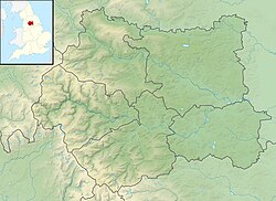
Wyke Beck is a stream that runs from Roundhay Park to the River Aire in east Leeds, West Yorkshire, England. Described as an Urban Beck, the stream flows through housing estates and then an industrial landscape in its lower reaches. Wyke Beck has been prone to flooding so often, that remediation of its course and flood storage schemes have been initiated by Leeds City Council.

Contents

The Wyke Beck is a green corridor through east Leeds and flows through, or near, five local nature reserves. Industrial development in its lower reaches has had an impact on the beck and future developments may also mean a reduction in sites for wildlife. A proposal to site a railway depot in the Temple Green/Knostrop area, has been identified as potentially damaging to a colony of white-clawed crayfish.

Description

The stream starts as an outflow of Waterloo Lake in Roundhay Park, Leeds. [1] The lake, which covers 33 acres (13 ha) and is 60 feet (18 m) deep, was previously a quarry which was adapted into a feature of the park by unemployed soldiers who had returned from the Napoleonic Wars, hence the name of the lake. [2] The beck heads in a southerly direction under the A58 road and through Gipton, under the A64 road and the Leeds to York Railway Line before circumnavigating the park at Primrose Valley by passing to the west. [3]

Below the B6159 (and latterly, the A63 road), the beck flows through an industrial landscape, which historically polluted the beck. The site of Meadowfield Primary School was in use as Wyke Beck Colliery until 1951. [4]

The watercourse was diverted in 1914 in conjunction with the opening of the sewage works at Knostrop. [5] The proposals to build the depot for HS2 trains at Knostrop (part of the Gateway 45 project) would see the beck diverted again with work expected to take six months. [6] Wyke Beck originally flowed through what is the site of Skelton Lake; at some point the River Aire was straightened, and the beck diverted to enter the river a little further south. [7]

As the beck flows through the populated areas in east Leeds, it is described as an urban beck. [8] [9]

Flooding

The beck has been described as a main tributary of the River Aire, [10] and has flooded many times in the 21st century, most notably in 2004, 2005, and 2007. [11] [12] The flooding is a combination of several factors; usually intense rainfall is the cause, but secondary effects are the amount of litter dumped into the stream and the developments built near to, or over, the beck. [8] Yorkshire Water have installed storm tanks in Wykebeck Valley Road, and Gipton, which are designed to prevent flash flood water and sanitary waste entering Wyke Beck. [13]

In August 2008, the level of the beck rose by 3-foot-3-inch (1 m) in 15 minutes, requiring the fire brigade to be called in to pump water away from the A64 road. [9] Peak flooding reached a level of 5 feet 7 inches (1.7 m) on the Dunhills Estate in 2017, after sirens were sounded to warn of flooding to properties. [14] A gauging weir at Gipton recorded the highest level ever in June 2007 as being 6 feet 6 inches (1.99 m). [15]

Recreation and LNRs

The course of the beck is shadowed by the Wykebeck Way, which follows the beck south as far as Temple Newsam. [16] The beck flows either through, or alongside, five Local Nature Reserves; Wykebeck Woods and Asket Hill, Arthur’s Rein, Killingbeck Fields, Primrose Valley, and Halton Moor. [17] A proposal to link the Wyke Beck Way with Rothwell Country Park by putting bridges across the River Aire and the Aire and Calder Navigation came to fruition in 2017 with the installation of the Skelton Bridge. [18] [19]

Flooding on the Wyke Beck has been problematic for properties below Killingbeck Meadows LNR, so in 2019, a programme was undertaken to provide flooding control and storage at Killingbeck Meadows. The programme was part of a £4.75 million scheme to help the local environment. [20] Further applications to create dams and wetlands in the Killingbeck LNR were made in May 2020. [21] The flood area at Killingbeck fields can hold 880,000 cubic feet (25,000 m3), which combined with the 2020 impounding application, can be increased to 1,600,000 cubic feet (45,000 m3). [22]

Hydrology and wildlife

The water quality of the beck has been recorded as Moderate for ecological status and Good for its chemical composition. In the early 2010s, the Wyke Beck was failing on its chemical status. [23] The Environment Agency has set a target of 2027 for the beck to be registered as having an overall quality of Good. [24] The adjacent Knostrop Sewage Works near to the beck's mouth, has historically discharged treated wastewater into the beck. [25] Diesel spills have been reported on the beck; one was in October 1991, with another in April 2018 that also polluted a 6 miles (9.7 km) stretch of the River Aire. [26] [27] A company from Surrey was fined £15,000 for allowing raw sewage to enter the beck in 2003 and kill crayfish. They had been installing a new sewer for Yorkshire Water. [28] The beck was also polluted with an insecticide in 2017, which was rated as "exceed[ing] chronic pollution levels for neonicotinoids". [29]

Water voles, European bullhead, trout and white-clawed crayfish are known to have been present on the beck. [30] The population of native crayfish in the beck (and also at nearby Meanwood Beck) has been described as strong, so much so that some were removed to Pudsey Beck to form an ark. [31] The habitat for all of these is under threat from the proposed development of the rolling stock depot (RSD) at Gateway 45 for the HS2 line into Leeds. The proposals include more culverting and drainage, which would result in "...permanent adverse effects... on the watercourse". [32]

Related Research Articles

<span class="mw-page-title-main">River Aire</span> River in Yorkshire, England

The River Aire is a major river in Yorkshire, England, 92 miles (148 km) in length. Part of the river below Leeds is canalised, and is known as the Aire and Calder Navigation.

<span class="mw-page-title-main">River Ouse, Yorkshire</span> River in North Yorkshire, England

The River Ouse is a river in North Yorkshire, England. Hydrologically, the river is a continuation of the River Ure, and the combined length of the River Ure and River Ouse makes it, at 129 miles (208 km), the sixth-longest river of the United Kingdom and the longest to flow entirely in one county. The length of the Ouse alone is about 52 miles (84 km) but the total length of the river is disputed.

<span class="mw-page-title-main">Meanwood Beck</span> Stream in West Yorkshire, England

The Meanwood Beck is a stream in West Yorkshire, England, which flows southwards through Adel, Meanwood and Sheepscar into the River Aire in central Leeds. Different portions of the same watercourse have been referred to as Adel Beck, Carr Beck, Lady Beck, Mabgate Beck, Sheepscar Beck, Timble Beck or Wortley Beck. The Meanwood Valley Trail footpath follows the line of the beck for much of its course.

<span class="mw-page-title-main">Appersett</span> Hamlet in Wensleydale, North Yorkshire, England

Appersett is a hamlet in the Yorkshire Dales in the Richmondshire district of North Yorkshire, England one mile (1.6 km) west of Hawes. It lies on the A684 road and an unclassified road runs alongside Widdale Beck to connect with the B6255 road between Hawes and Ingleton.

<span class="mw-page-title-main">Killingbeck</span> District of Leeds, West Yorkshire, England

Killingbeck is a district of east Leeds, West Yorkshire, England named after the Killingbeck family, historic local landowners, and is situated between Seacroft to the north, Cross Gates and Whitkirk to the east, Gipton to the west, Halton Moor to the south, Halton to the south-east and Osmondthorpe to the south-west.

<span class="mw-page-title-main">River Skirfare</span> River in North Yorkshire, England

River Skirfare is a small river in North Yorkshire, England, that flows through Littondale and ends where it joins the larger River Wharfe. The source is the confluence of Foxup Beck and Cosh Beck at the hamlet of Foxup.

<span class="mw-page-title-main">River Allen, Northumberland</span> River in Northumberland, England

The River Allen is a river in the English county of Northumberland. The river has its sources in the hills of the Northern Pennines, and is formed by the confluence of the East and West Allen rivers. The Allen is itself, a tributary of the River Tyne. The Allen was formerly very polluted from mining activity upstream, but remediation schemes have been implemented to allow the water quality to improve.

<span class="mw-page-title-main">Knowsthorpe</span>

Knowsthorpe, Knostrop or Knostropp is an area of Leeds, West Yorkshire, England, on the River Aire. The spelling "Knostrop" is predominantly used for the large water treatment works in the area. Atkinson Grimshaw painted Knostrop Cut, Leeds, Sunday Night, 1893. The area falls within Temple Newsam ward of Leeds City Council.

<span class="mw-page-title-main">Wykebeck</span> Suburb of Leeds, West Yorkshire, England

Wykebeck is an area of east Leeds, West Yorkshire, England named after the Wyke Beck and situated between Gipton and Seacroft along Wykebeck Road. The area falls within the Gipton and Harehills ward of the Leeds City Council. The area is seldom referred to, instead people usually perceive Gipton to be West of the beck and Seacroft to be East of it. The area consists of several blocks of highrise council flats to the south.

<span class="mw-page-title-main">Skelton Grange power station</span>

Skelton Grange Power Station refers to two now-demolished coal fired power stations that served the city of Leeds and surrounding areas. They were located in the Stourton area of the city. The power stations were built in the early 1950s and early 1960s, taken out of use in 1983 and 1994 and subsequently dismantled but the associated 275 kV switching substation was retained and remains in use.

<span class="mw-page-title-main">Eller Beck</span> River in North Yorkshire, England

The Eller Beck is a small river in North Yorkshire, England, that flows through the town of Skipton and is a tributary of the River Aire. Its channel was heavily modified to supply water to mills in the 18th and 19th centuries, and although all the mills have closed, the water now supplies power to the National Grid, generated by a turbine at High Corn Mill. The beck flows through several underground culverts in Skipton that contribute to the flood risk. To alleviate flooding in Skipton town centre, a scheme involving two flood water storage reservoirs was designed and eventually completed in 2017.

<span class="mw-page-title-main">Bradford Beck</span> River in Bradford, West Yorkshire, England

Bradford Beck is a river that flows through Bradford, West Yorkshire, England, and on to the River Aire at Shipley. As it reaches Bradford city centre it runs underground after being built over in the 19th century. It is culverted as it runs from Bradford city centre to Queen's Road after which it runs mostly in an open channel to Shipley. The beck used to be known as the filthiest river in England.

<span class="mw-page-title-main">River Tutt</span> River in North Yorkshire, England

The River Tutt is a 8.7-mile (14 km) long tributary of the River Ure in North Yorkshire, England. The river rises near to the villages of Nidd and Scotton draining mainly arable land north eastwards before emptying into the Ure at Boroughbridge. Where the river joins the Ure in Boroughbridge, has been the site of significant historic flooding. An Environment Agency project to alleviate flooding on the river has seen diversion schemes and pumps added to prevent this.

<span class="mw-page-title-main">Ponden Reservoir</span> Reservoir in West Yorkshire, England

Ponden Reservoir is an artificial upland lake in the Worth Valley, near Stanbury, West Yorkshire, England. Ponden was built as a compensation reservoir after the nearby Watersheddles Reservoir (upstream) was used to divert water away from the River Worth. Ponden was needed to regulate the flow of water down the river into the downstream mills in the valley.

<span class="mw-page-title-main">Skelton Lake services</span> Motorway service station in West Yorkshire, England

Skelton Lake services is a motorway service area operated by Extra, on the M1 motorway near Leeds, West Yorkshire, England. It is located on Junction 45 of the Motorway which also links into the A63. It lies on the south side of the motorway; however, the junction affords access to, and from, all directions.

<span class="mw-page-title-main">Holgate Beck</span> River in York, England

Holgate Beck is a small watercourse that flows north-eastwards through Holgate across the west side of the City of York, England. Primarily flowing through Holgate, from which it derives its name, the beck drains a large part of Askham Bog and Hob Moor, then running underneath the various lines near York railway station. It empties into the River Ouse at Water End, being one of five main tributaries for the River Ouse in York, and consequently added to the flooding in the river and immediate environs. To counter this, some flood diversionary schemes have been implemented near to Askham Bog and Hob Moor.

<span class="mw-page-title-main">Kex Gill Bypass</span> Future road in North Yorkshire, England

The Kex Gill Bypass is a future stretch of A-road across Kex Gill Moor to Blubberhouses in North Yorkshire, England. The route is part of the A59 road across the Pennines between Preston and York, with the Kex Gill Bypass being located within the Nidderdale Area of Outstanding Natural Beauty. The bypass is required as the 1820s built bypass is prone to landslips and road cracking, which accounted for eight weeks of closure in 2016. The bypass is expected to be 2.5 miles (4 km) long and to be opened in 2025.

<span class="mw-page-title-main">Newlay</span> Suburb of Horsforth, West Yorkshire, England

Newlay is a suburb of Horsforth, in West Yorkshire, England. Originally a hamlet, it is now part of Horsforth parish in the City of Leeds District, and has its own conservation area. Newlay is situated on the Leeds and Liverpool Canal and the River Aire, some 5 miles (8 km) north west of Leeds city centre.

<span class="mw-page-title-main">Oak Beck</span> River in North Yorkshire, England

Oak Beck is a watercourse that flows eastwards across the northern part of Harrogate in North Yorkshire, England. The beck flows through a broad V-shaped valley, before emptying into the River Nidd at Bilton, just upstream from the Nidd Gorge Viaduct. Water from Oak Beck has been used as a water supply for Harrogate and also for industrial purposes further downstream.

<span class="mw-page-title-main">Skelton Beck</span> River in North Yorkshire, England

Skelton Beck is a small river in North Yorkshire, England. The beck only runs for 23 kilometres (14 mi) and feeds directly into the North Sea on the south side of Saltburn beach. The beck is noted for occasionally being polluted with wastewater from the abandoned ironstone workings in its headwaters.

References

  1. Beecham, Richard (4 August 2020). "East Leeds set for multi-million pound flooding work". Yorkshire Evening Post. Retrieved 7 September 2020.
  2. "Waterloo Lake: The secrets lurking in its murky depths". The Yorkshire Post. 15 June 2017. Retrieved 7 September 2020.
  3. Smith, Gary (5 September 2020). "The 'bits in between' can provide so much beauty". The Yorkshire Post. Country Week. p. 22. ISSN   0963-1496.
  4. Lake, R. D.; Northmore, K. J.; Dean, M. T.; Tragheim, D. G. (1992). "Leeds : a geological background for planning and development". Onshore geology series (WA/92/1). Keyworth: British Geological Survey: 57. OCLC   59886018.
  5. "Sewage Disposal Works at Leeds". The Engineer. 118 (July – December 1914). London: Morgan-Grampian: 502. December 1914. ISSN   0013-7758. OCLC   859584571.
  6. HS2 2018, p. 39.
  7. "Explore georeferenced maps – Map images – National Library of Scotland". maps.nls.uk. Retrieved 7 September 2020. [Use the Change transparency of overlay function to show the difference between the late 19th century and modern day]
  8. 1 2 "Work on urban beck may finally end fears of flooding on estate". The Yorkshire Post. 7 July 2020. Retrieved 6 August 2020.
  9. 1 2 "Flood all-clear as beck retreats". BBC News. 21 August 2008. Retrieved 8 September 2020.
  10. "River Aire Fact File" (PDF). environment data.org. Environment Agency. p. 2. Retrieved 7 September 2020.
  11. "Battered county counts costs of downpour" . infoweb.newsbank.com. 26 June 2007. Retrieved 7 September 2020.
  12. "£500k flood defence scheme stands up to test". Water Briefing. 9 August 2012. Retrieved 8 September 2020.
  13. Edwards, Richard (23 October 2006). "How much water can our drains cope with?". infoweb.newsbank.com. Retrieved 7 September 2020.
  14. "Leeds flood sirens: The storm as it happened" . infoweb.newsbank.com. 23 August 2017. Retrieved 7 September 2020.
  15. "River level information for Wyke Beck at Gipton South Parkway – GOV.UK". flood-warning-information.service.gov.uk. Retrieved 7 September 2020.
  16. "Wykebeck Way". sustrans.org.uk. Retrieved 7 September 2020.
  17. "Wyke Beck Valley | Yorkshire Wildlife Trust". www.ywt.org.uk. Retrieved 7 September 2020.
  18. "Fresh Aire Draft Delivery Plan" (PDF). leeds.gov.uk. LDA design. 4 April 2014. p. 82. Retrieved 8 September 2020.
  19. "New bridge puts cyclists on the right path | Yorkshire Sport". Yorkshire Sport. 28 April 2017. Retrieved 8 September 2020.
  20. Mitchinson, James, ed. (5 August 2020). "Tree planting to cut flooding". The Yorkshire Post. p. 2. ISSN   0963-1496.
  21. "Leeds City Council: application made to abstract water and impound water". GOV.UK. 8 May 2020. Retrieved 8 September 2020.
  22. "Wykebeck Flood Alleviation" (PDF). westyorkshire.moderngov.co.uk/. p. 3. Retrieved 8 September 2020.
  23. "Wyke Beck from Source to River Aire". environment.data.gov.uk. Retrieved 7 September 2020.
  24. HS2 2018, p. 121.
  25. "SKELTON GRANGE ENERGY FROM WASTE FACILITY ENVIRONMENTAL PERMIT APPLICATION" (PDF). consult.environment-agency.gov.uk. SKELTON GRANGE EFW Submission to Discharge Pre-Commencement Conditions. June 2018. p. 7. Retrieved 7 September 2020.
  26. "Land at Triangle 45, Cross Green, Leeds For Halifax Estates Management" (PDF). sw.co.uk. May 2020. p. 4. Retrieved 7 September 2020.
  27. "Oil spill pollutes stretch of River Aire". BBC News. 6 April 2018. Retrieved 7 September 2020.
  28. "Raw sewage dump firm lucky to escape crown court appearance". Surrey Comet. 18 August 2005. Retrieved 8 September 2020.
  29. "Leeds watercourse '˜heavily contaminated' with harmful pesticides". The Yorkshire Post. 13 December 2017. Retrieved 7 September 2020.
  30. Sunderland, Kevin (December 2013). "River Aire Fish Populations 2012". The Naturalist. 138 (1,084). York: Yorkshire Naturalists' Union: 178. ISSN   0028-0771.
  31. "Lower Aire Key Project Details" (PDF). aireandcalderpartnership.org. p. 2. Retrieved 8 September 2020.
  32. HS2 2018, p. 92.

Sources