
North Yorkshire is a ceremonial county in the Yorkshire and the Humber and North East regions of England. It borders County Durham to the north, the North Sea to the east, the East Riding of Yorkshire to the south-east, South Yorkshire to the south, West Yorkshire to the south-west, and Cumbria and Lancashire to the west.

The River Ouse is a river in North Yorkshire, England. Hydrologically, the river is a continuation of the River Ure, and the combined length of the River Ure and River Ouse makes it, at 129 miles (208 km), the sixth-longest river of the United Kingdom and the longest to flow entirely in one county. The length of the Ouse alone is about 52 miles (84 km) but the total length of the river is disputed.

Wensleydale is a valley in North Yorkshire, England. It is one of the Yorkshire Dales, which are part of the Pennines. The dale is named after the village of Wensley, formerly the valley's market town. The principal river of the valley is the Ure, which is the source of the alternative name Yoredale. The majority of the dale is within the Yorkshire Dales National Park; the part below East Witton is within the national landscape of Nidderdale.

The River Cover is a river in the Yorkshire Dales in North Yorkshire, England. The Yorkshire Dales Rivers Trust has a remit to conserve the ecological condition of the River Cover. The river forms a limestone dale with ancient woodlands.

The River Ure in North Yorkshire, England, is about 74 miles (119 km) long from its source to the point where it becomes the River Ouse. It is the principal river of Wensleydale, which is the only major dale now named after a village rather than its river. The old name for the valley was Yoredale after the river that runs through it.

Aysgarth is a village and civil parish in Wensleydale, in North Yorkshire, England. The village is in the Yorkshire Dales National Park, about 16 miles (26 km) south-west of Richmond and 22.6 miles (36.4 km) west of the county town of Northallerton.

Bainbridge is a village and civil parish in North Yorkshire, England. The population of the civil parish at the 2011 census was 480. The village is situated in the Yorkshire Dales National Park, near the confluence of the River Bain with the River Ure. It is 27+1⁄2 miles west of Northallerton, the county town.

The River Kyle is a small river in North Yorkshire, England. At just under 6 miles (9.7 km) long, it is one of the shortest classified main rivers in the country.

Worton is a hamlet in Wensleydale in the Yorkshire Dales in the Richmondshire district of North Yorkshire, England. It lies 1-mile (1.6 km) east of Bainbridge on the A684 road, 4 miles (6.4 km) west of Aysgarth and 1-mile (1.6 km) south east of Askrigg. The hamlet is just south of the River Ure, the biggest river in Wensleydale. The hamlet is named in the Domesday Book and its name derives from the Old English wyrt-tūn and means the garden.

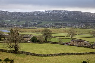
Thornton Rust is a village and civil parish in North Yorkshire, England. It lies in the Yorkshire Dales about 2 miles (3.2 km) west of Aysgarth, high on the south bank of the River Ure in Wensleydale.

Countersett is the largest of the three settlements in Raydale, around Semerwater in the Richmondshire district of North Yorkshire, England. It is in the Yorkshire Dales to the north of the lake. The Boar East and West were once one farm, and before that a pub called The Boar Inn. The date 1667 was above the door, along with a Latin inscription which translated as "Now mine, once thine, but whose afterwards I do not know"

The A6108 road is an A road in North Yorkshire, England. It runs from the south of Scotch Corner to Ripon going via Richmond and Leyburn across the moors and the valleys of Swaledale and Wensleydale. The road is 37 miles (60 km) long, but through traffic between the two destinations will find a shorter route of 26 miles (42 km) by going south on the A1. The route is single carriageway for its entire length.

High Abbotside is a civil parish in the Richmondshire district of North Yorkshire, England. It is a rural parish on the north side of upper Wensleydale, and includes the settlements of Hardraw, Sedbusk and several hamlets.

Raydale is a dale on the south side of Wensleydale in North Yorkshire, England. The northern part of the dale is the valley of the River Bain, which flows out of Semerwater, one of very few lakes in the Yorkshire Dales. Above the lake the dale is drained by smaller becks, and is joined by two smaller dales, Cragdale on the east and Bardale on the west.

The River Bain Hydro is a hydroelectric generator on the River Bain in the village of Bainbridge, North Yorkshire, England. Its screw turbine powers most of the properties in the village, with excess electricity being sold off to the National Grid. It was opened in 2011 with an installed capacity of 45 kW, and is expected to last 40 years. It is a low-demand ecofriendly scheme.

The River Burn is a river that flows wholly within North Yorkshire, England. The river starts as several small streams on Masham Moor and drains Colsterdale flowing eastwards before emptying into the River Ure just south of Masham. Conservation work on removing a weir, and introducing fish to the river in 2016, has meant that salmon have been recorded spawning in the river for the first time in over 100 years.

Virosidum was a Roman fort and settlement situated near to the modern town of Bainbridge, North Yorkshire, England. The site is a Scheduled monument.

Fleet Moss is an upland area separating Wharfedale from Wensleydale in North Yorkshire, England. The area is 1,850 ft (560 m) above sea level. Fleet Moss is noted for its peat blanket bog, which has been dated to the Neolithic period. The area is ombrotrophic; this means it needs rain, hail snow and fog for its nutrients. Fleet Moss is known as the most eroded blanket bog in all of Yorkshire; because of its observable damage, it is known colloquially as The Somme, and as such, is visible from space.
Wether Fell, also known as Drumaldrace, is a mountain in the Yorkshire Dales National Park, in North Yorkshire, England. Wether Fell is mountain that divides Wensleydale in the north and Upper Wharfedale in the south. Its summit is 614 metres (2,014 ft). A Roman Road, the Cam High Road, passes along the southern edge of the summit reaching 1,900 feet (580 m).


