River Wenning

Last updated

River Wenning
River Wenning - geograph.org.uk - 116841.jpg
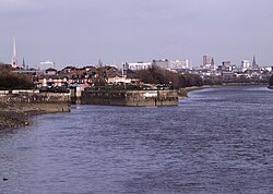
The Wenning passing The Punch Bowl in Low Bentham
Etymology Old English: The dark river
Physical characteristics
Length14.09 miles (22.67 km)
Basin features
River system Lune
Tributaries 
  leftKeasden Beck, River Hindburn

The River Wenning is a tributary of the River Lune, flowing through North Yorkshire and Lancashire. The name derives from the Old English Wann, meaning dark river. [1]

The Wenning is formed from the confluence of Clapham Beck, which rises above Clapham, and Austwick Beck, which rises in Crummackdale above Austwick. It then flows westwards through High Bentham, Low Bentham and Wennington. [2]

The river flows for 14.09 miles (22.67 km) and drains an area of 24.9 square miles (64.6 km2). [3] [4] It joins the River Lune approximately 1 mile (1.5 km) west of Hornby.

This river's valley, together with Airedale, Wharfedale and upper Ribblesdale, make up the district of Craven.

Related Research Articles

<span class="mw-page-title-main">River Lune</span> River in Cumbria and Lancashire, England

The River Lune is a river 53 miles (85 km) in length in Cumbria and Lancashire, England.

<span class="mw-page-title-main">West Beck</span> River in the East Riding of Yorkshire, England

West Beck is the common name given to the upper section of the old River Hull, as it rises in the foothills of the Yorkshire Wolds. After reaching Frodingham Beck at Emmotland, it becomes called the River Hull. It is noteworthy for being the most northerly chalk stream in England. It provides fly fishing for wild brown trout and grayling.

<span class="mw-page-title-main">Wharfe, North Yorkshire</span> Hamlet in North Yorkshire, England

Wharfe is a hamlet about a mile north east of the village of Austwick, North Yorkshire, England. Its postcode is LA2 8DQ. The name means 'The bend', The hamlet is the only settlement in Crummackdale, the upper valley of Austwick Beck. Austwick Beck, which runs through Wharfe, flows into the River Wenning which in turn flows into the River Lune. Moughton Fell rises immediately behind the hamlet to a height of 1,400 ft (430 m). The upper plateau of Moughton is contained within 856 acres (3.46 km2) of common land with grazing rights. The hamlet is within the boundary of the Yorkshire Dales National Park and is close to the Norber erratics, a group of boulders moved by glaciers during the last ice age.

<span class="mw-page-title-main">River Skirfare</span> River in North Yorkshire, England

River Skirfare is a small river in North Yorkshire, England, that flows through Littondale and ends where it joins the larger River Wharfe. The source is the confluence of Foxup Beck and Cosh Beck at the hamlet of Foxup.

<span class="mw-page-title-main">Skirden Beck</span> Minor river in Lancashire, England

Skirden Beck is a minor river in Lancashire, England. It is approximately 4.3 miles (6.85 km) long and has a catchment area of 18.87 square miles (48.882 km2).

<span class="mw-page-title-main">Risedale Beck</span> River in North Yorkshire, England

Risedale Beck is a small river that rises on Hipswell Moor, near Catterick Garrison in North Yorkshire, England. The name derives from Old Norse as meaning either Risi's Valley or translated as a valley overgrown with brushwood. Risedale Beck flows eastwards into Catterick Garrison as Leadmill Gill, which in turn flows into Colburn Beck, a tributary of the River Swale. The length of the beck from source to the River Swale is 6.5 miles (10.4 km).

<span class="mw-page-title-main">Barlings Eau</span> River in Lincolnshire, England

Barlings Eau is a small river near Barlings, Lincolnshire, England. It is a tributary of the River Witham, joining it near Short Ferry. It acts as the central spine for a number of other small rivers, which drain the low-lying land to either side. Most of its course is within the area managed by the Witham Third District IDB, an Internal Drainage Board responsible for land drainage. One of their pumping stations is on the banks of the river.

<span class="mw-page-title-main">Birkdale, North Yorkshire</span> Dale in North Yorkshire, England

Birkdale is a dale in the Yorkshire Dales National Park, in North Yorkshire, England. It lies at the far western end of Swaledale, close to the border with Cumbria. The dale is one of the smallest of the Yorkshire Dales. The hamlet of Birkdale is in the lower part of the dale, 2 miles (3.2 km) west of Keld. The area forms part of the civil parish of Muker.

<span class="mw-page-title-main">River Foulness</span> River in the East Riding of Yorkshire, England

The River Foulness is a river in the East Riding of Yorkshire, England. Its name is derived from Old English fūle[n] ēa, meaning “dirty water”. Maintenance responsibilities for the river transferred from the Environment Agency to the Market Weighton Drainage Board on 1 October 2011. Market Weighton Drainage Board subsequently amalgamated with the Lower Ouse Internal Drainage Board on 1 April 2012 to create the Ouse and Humber Drainage Board. The river discharges into the Humber Estuary via Market Weighton Canal. Water levels within the river, its tributaries and the canal are managed and controlled by the Environment Agency. The river lies in an area known as the Humberhead Levels.

<span class="mw-page-title-main">Fell Beck</span> Stream in North Yorkshire, England

Fell Beck is a stream near the foot of Ingleborough, in the Yorkshire Dales National Park. It is notable for running into Gaping Gill, the second-largest natural cave shaft in the UK. As it falls down the shaft for 110 metres it is the tallest unbroken waterfall in the UK. At times it is blocked off by a temporary dam to allow members of the public to descend the Gaping Gill shaft on a winch.

<span class="mw-page-title-main">Sea Cut (Scalby Beck)</span> River in North Yorkshire, England

The Sea Cut (Scalby Beck) is a small river that enters the North Sea at Scalby Mills, Scarborough, North Yorkshire, England. The beck is fed from local streams in Scalby, Newby and Burniston and other watercourses draining off the nearby hills. It is also a bypass channel for the upper reaches of the River Derwent when it is under flood conditions.

<span class="mw-page-title-main">Pickering Beck</span> River in North Yorkshire, England

Pickering Beck is a river that runs for over 18 miles (29 km) from its source in the North York Moors National Park through the town of Pickering and on to its confluence with Costa Beck at Kirby Misperton. It is a meandering river that is fed by numerous named and unnamed becks and streams which flow over sandstone and limestone beds and an alluvia of sand, clay silt and gravel. The beck is known for flooding and in recent times has been a beneficiary of funding and experimental flood protection schemes.

<span class="mw-page-title-main">Crimple Beck</span> River in North Yorkshire, England

Crimple Beck or the River Crimple is a beck which flows through North Yorkshire, England. It is a tributary of the River Nidd which it joins between Little Ribston and Walshford north of Wetherby. The beck is 15.5 miles (24.9 km) long, and has a total catchment area of 80 square kilometres (31 sq mi), which drains the area around Harrogate. Its tributaries include the Park Beck.

<span class="mw-page-title-main">River Burn, North Yorkshire</span> River in North Yorkshire, England

The River Burn is a river that flows wholly within North Yorkshire, England. The river starts as several small streams on Masham Moor and drains Colsterdale flowing eastwards before emptying into the River Ure just south of Masham. Conservation work on removing a weir, and introducing fish to the river in 2016, has meant that salmon have been recorded spawning in the river for the first time in over 100 years.

<span class="mw-page-title-main">River Tutt</span> River in North Yorkshire, England

The River Tutt is a 8.7-mile (14 km) long tributary of the River Ure in North Yorkshire, England. The river rises near to the villages of Nidd and Scotton draining mainly arable land north eastwards before emptying into the Ure at Boroughbridge. Where the river joins the Ure in Boroughbridge, has been the site of significant historic flooding. An Environment Agency project to alleviate flooding on the river has seen diversion schemes and pumps added to prevent this.

<span class="mw-page-title-main">Crummackdale</span> A valley in North Yorkshire, England

Crummackdale,, is a small valley north of the village of Austwick in the Craven District of North Yorkshire, England. The Valley is drained by Austwick Beck, which flows into the River Wenning, which in turn heads westwards to empty into the Irish Sea. Crummackdale is a narrow south west facing dale, at the south west corner of the Yorkshire Dales National Park.

<span class="mw-page-title-main">Holgate Beck</span> River in York, England

Holgate Beck is a small watercourse that flows north-eastwards through Holgate across the west side of the City of York, England. Primarily flowing through Holgate, from which it derives its name, the beck drains a large part of Askham Bog and Hob Moor, then running underneath the various lines near York railway station. It empties into the River Ouse at Water End, being one of five main tributaries for the River Ouse in York, and consequently added to the flooding in the river and immediate environs. To counter this, some flood diversionary schemes have been implemented near to Askham Bog and Hob Moor.

<span class="mw-page-title-main">Ea Beck</span> River in South Yorkshire, England

The Ea Beck, also spelled Eaubeck or Eau Beck, is a small river in South Yorkshire, England, that flows eastwards into the River Don at Thorpe-in-Balne. The Environment Agency lists the beck as starting at South Elmsall, but mapping lists the beck with several names along its course. The beck has twice flooded areas and villages that it passes through in the 21st century.

<span class="mw-page-title-main">Oak Beck</span> River in North Yorkshire, England

Oak Beck is a watercourse that flows eastwards across the northern part of Harrogate in North Yorkshire, England. The beck flows through a broad V-shaped valley, before emptying into the River Nidd at Bilton, just upstream from the Nidd Gorge Viaduct. Water from Oak Beck has been used as a water supply for Harrogate and also for industrial purposes further downstream.

<span class="mw-page-title-main">Eldroth</span> Village in North Yorkshire, England

Eldroth is a village in North Yorkshire, England. It is in the civil parish of Lawkland, part of the former Craven District, some 3.25 miles (5.23 km) west of Settle, on a stream which is one of the tributaries of the River Wenning. The main part of Eldroth only consists of twelve buildings, but the presence of the church, marks the settlement out as a village, rather than a hamlet. Eldroth lies just within the Forest of Bowland Area of Outstanding Natural Beauty.

References

  1. Metcalfe, Peter; Gower, Ted (1992). Place-names of the Yorkshire Dales: origins and meanings. Harrogate: North Yorkshire Marketing. p. 79. ISBN   1-873214-03-0.
  2. Dixon, Thomas (1994) [1781]. Moody, Len (ed.). Description of the environs of Ingleborough, and principal places on the banks of the river Wenning. Bentham: Mewith Publications. p. 10. ISBN   0-9513284-2-5.
  3. "Wenning - Upper | Catchment Data Explorer | Catchment Data Explorer". environment.data.gov.uk. Retrieved 1 April 2023.
  4. "Wenning – Lower | Catchment Data Explorer | Catchment Data Explorer". environment.data.gov.uk. Retrieved 1 April 2023.

54°06′N2°39′W / 54.100°N 2.650°W / 54.100; -2.650