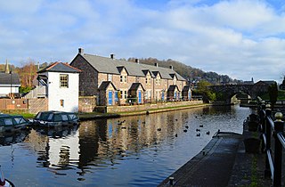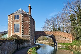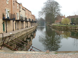
The Lancaster Canal is a canal in North West England, originally planned to run from Westhoughton in Lancashire to Kendal in south Cumbria. The section around the crossing of the River Ribble was never completed, and much of the southern end leased to the Leeds and Liverpool Canal, of which it is now generally considered part.

Waterway restoration is the activity of restoring a canal or river, including special features such as warehouse buildings, locks, boat lifts, and boats.

The Kennet and Avon Canal is a waterway in southern England with an overall length of 87 miles (140 km), made up of two lengths of navigable river linked by a canal. The name is used to refer to the entire length of the navigation rather than solely to the central canal section. From Bristol to Bath the waterway follows the natural course of the River Avon before the canal links it to the River Kennet at Newbury, and from there to Reading on the River Thames. In all, the waterway incorporates 105 locks.

The Thames and Severn Canal is a canal in Gloucestershire in the south-west of England, which was completed in 1789. It was conceived as part of a cargo route from Bristol and the Midlands to London, linking England's two largest rivers for better trade. The route climbs the steep Cotswold escarpment through the Golden Valley, tunnels underneath the summit of the Cotswold Edge, and emerges near the source of the Thames.

The Grantham Canal ran 33 miles (53 km) from Grantham through 18 locks to West Bridgford, where it joined the River Trent. It was built primarily for the transportation of coal to Grantham. It opened in 1797 and its profitability steadily increased until 1841. It was then sold to a railway company, declined, and was finally closed in 1936. It was used as a water supply for agriculture, and so most of it remained in water after closure, although bridges were lowered. Since the 1970s, the Grantham Canal Society have been working to restore parts of it. Two stretches are now navigable to small vessels. A new route will be required where the canal joins the Trent, as road building has severed the original one.

The Wey and Arun Canal is a partially open, 23-mile-long (37 km) canal in the southeast of England. It runs southwards from the River Wey at Gunsmouth in Shalford, Surrey to the River Arun at Pallingham, in West Sussex. The canal comprises parts of two separate undertakings – the northern part of the Arun Navigation, opened in 1787 between Pallingham and Newbridge Wharf, and the Wey and Arun Junction Canal, opened in 1816, which connected the Arun at Newbridge to the Godalming Navigation near Shalford, south of Guildford. The Arun Navigation was built with three locks and one turf-sided flood lock. The Junction Canal was built with 23 locks

The canals of the United Kingdom are a major part of the network of inland waterways in the United Kingdom. They have a varied history, from use for irrigation and transport, through becoming the focus of the Industrial Revolution, to today's role of recreational boating. Despite a period of abandonment, today the canal system in the United Kingdom is again increasing in use, with abandoned and derelict canals being reopened, and the construction of some new routes. Canals in England and Wales are maintained by navigation authorities. The biggest navigation authorities are the Canal & River Trust and the Environment Agency, but other canals are managed by companies, local authorities or charitable trusts.

The Montgomery Canal, known colloquially as "The Monty", is a partially restored canal in eastern Powys and northwest Shropshire. The canal runs 33 miles (53 km) from the Llangollen Canal at Frankton Junction to Newtown via Llanymynech and Welshpool and crosses the England–Wales border.

The Hatherton Canal is a derelict branch of the Staffordshire and Worcestershire Canal in south Staffordshire, England. It was constructed in two phases, the first section opening in 1841 and connecting the main line to Churchbridge, from where a tramway connected to the Great Wyrley coal mines. The second section was a joint venture with the Birmingham Canal Navigations, and linked Churchbridge to the Cannock Extension Canal by a flight of 13 locks, which were opened with the Extension Canal in 1863. The coal traffic was very profitable, and the canal remained in use until 1949. It was formally abandoned in 1955, after which the Churchbridge flight and much of the Extension Canal were destroyed by open cast mining.

The Inland Waterways Association (IWA) is a registered charity in the United Kingdom which was formed in 1946 to campaign for the conservation, use, maintenance, restoration and sensitive development of British canals and river navigations.

The Monmouthshire and Brecon Canal is a small network of canals in South Wales. For most of its currently (2018) navigable 35-mile (56 km) length it runs through the Brecon Beacons National Park, and its present rural character and tranquillity belies its original purpose as an industrial corridor for coal and iron, which were brought to the canal by a network of tramways and/or railroads, many of which were built and owned by the canal company.

The Driffield Navigation is an 11-mile (18-kilometre) waterway, through the heart of the Holderness Plain to the market town of Driffield, East Riding of Yorkshire, England. The northern section of it is a canal, and the southern section is part of the River Hull. Construction was authorised in 1767, and it was fully open in 1770. Early use of the navigation was hampered by a small bridge at Hull Bridge, which was maintained by Beverley Corporation. After protracted negotiation, it was finally replaced in 1804, and a new lock was built to improve water levels at the same time. One curious feature of the new works were that they were managed quite separately for many years, with the original navigation called the Old Navigation, and the new works called the New Navigation. They were not fully amalgamated until 1888.

The Waterway Recovery Group (WRG) is the national co-ordinating body for voluntary labour on the inland waterways of England and Wales. Founded in 1970 as an independent body, it became a division of the Inland Waterway Association in 2002.

The Stroudwater Navigation is a canal in Gloucestershire, England which linked Stroud to the River Severn. It was authorised in 1776, although part had already been built, as the proprietors believed that an Act of Parliament obtained in 1730 gave them the necessary powers. Opened in 1779, it was a commercial success, its main cargo being coal. It was 8 miles (13 km) in length and had a rise of 102 ft 5 in (31.22 m) through 12 locks. Following the opening of the Thames and Severn Canal in 1789, it formed part of a through route from Bristol to London, although much of its trade vanished when the Kennet and Avon Canal provided a more direct route in 1810. Despite competition from the railways, the canal continued to pay dividends to shareholders until 1922, and was not finally abandoned until 1954.

The Ripon Canal is located in North Yorkshire, England. It was built by the canal engineer William Jessop to link the city of Ripon with the navigable section of the River Ure at Oxclose Lock, from where boats could reach York and Hull. It opened in 1773 and was a moderate success. It was sold to the Leeds and Thirsk Railway in 1847 and was effectively closed by 1906 owing to neglect. It was not nationalised with most canals and railways in 1948 and was abandoned in 1956.

The Sleaford Navigation was a 12.5-mile (20.1 km) canalisation of the River Slea in Lincolnshire, England, which opened in 1794. It ran from a junction with the River Witham, near Chapel Hill to the town of Sleaford through seven locks, most of which were adjacent to mills. Lack of finance meant that it stopped short of its intended terminus, but it gradually grew to be successful financially. The coming of the railways in 1857 led to a rapid decline, and it was officially abandoned by an act of Parliament in 1878, but remained open for a further three years. The lower part of it remained navigable until the 1940s, when it was blocked by a sluice.

The Lancaster Canal Trust is a waterway society and a registered charity on the Lancaster Canal in Lancashire and Cumbria, England.

The Northern Reaches Restoration Group is a waterway society in Lancashire and Cumbria, England, UK. The purpose of the NRRG is to campaign for the re-opening of the final 14-mile stretch of the Lancaster Canal between Tewitfield Locks and Kendal. The Northern Reaches, as they are so named, became isolated from the rest of the canal following the construction of the M6 motorway in the 1960s. The navigation authority for the waterway is the Canal & River Trust, formerly British Waterways.

Priest Hutton is a village and civil parish in Lancashire, England. It is located 5 kilometres (3 mi) north east of Carnforth, in the City of Lancaster, close to the boundary with Cumbria. In the 2001 census Priest Hutton had a population of 177, increasing to 185 at the 2011 Census.
The Seven Wonders of the Waterways is a list of landmarks on the navigable waterways of the United Kingdom. The list was originally compiled in 1946 by Robert Aickman, co-founder of the Inland Waterways Association (IWA), at a time when the waterways network was largely derelict. Today, the Canal & River Trust—formerly British Waterways—has jurisdiction over all of the sites except for the Barton Swing Aqueduct, which is owned and operated by the Bridgewater Canal Company.


