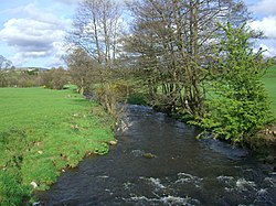
The River Conder is a river in the English county of Lancashire.
The source of the River Conder is a spring at Conder Head on Black Fell near Littledale, from where the stream briefly runs north, then west through Cragg Wood. The river then skirts around Quernmore in a southwesterly direction through a disproportionately wide valley, created by glacial action.[1]
Lancaster is a city and the county town of Lancashire, England, standing on the River Lune. Its population of 52,234 compares with one of 138,375 in the wider City of Lancaster local government district.
The Lancaster Canal is a canal in North West England, originally planned to run from Westhoughton in Lancashire to Kendal in south Cumbria. The section around the crossing of the River Ribble was never completed, and much of the southern end leased to the Leeds and Liverpool Canal, of which it is now generally considered part.
Galgate is a village in the City of Lancaster, just south of Lancaster University, and about 3 miles (4.8 km) south of Lancaster itself in the English county of Lancashire.
The River Lune is a river 53 miles (85 km) in length in Cumbria and Lancashire, England.
The Lune Millennium Bridge is a cable-stayed footbridge which spans the River Lune in Lancaster, England.
The Lonsdale Hundred is an historic hundred of Lancashire, England. Although named after the dale or valley of the River Lune, which runs through the city of Lancaster, for centuries it covered most of the north-western part of Lancashire around Morecambe Bay, including the detached parts of Furness and the Cartmel Peninsula. Ironically, only some of the detached part of North Lonsdale still remains partly within a British parliamentary constituency under the name of Lonsdale, being part of the Westmorland and Lonsdale constituency.
Tebay is a village and civil parish in Cumbria, England, within the historic borders of Westmorland. It lies in the upper Lune Valley, at the head of the Lune Gorge. The parish had a population of 728 in the 2001 census, increasing to 776 at the Census 2011.
Overton is a village and civil parish in Lancashire, England, south west of Lancaster and south of Morecambe between Heysham and the estuary of the River Lune. Neighbouring villages include Middleton and Sunderland Point; Glasson is on the opposite side of the river. The parish had a population of 1,069 at the 2011 Census.
Sunderland, commonly known as Sunderland Point, is a small village among the marshes, on a windswept peninsula between the mouth of the River Lune and Morecambe Bay, in the City of Lancaster district of Lancashire, England. It was used as a port for slave ships and cotton ships but its importance declined as other ports such as Lancaster were opened up.
The River Cocker is a river in Lancashire, England.
Thurnham is a civil parish in Lancashire, England. It is situated on the south side of the River Lune estuary in the City of Lancaster, and contains the villages of Conder Green, Glasson Dock, Lower Thurnham and Upper Thurnham. The parish has a population of 595, increasing to 651 at the 2011 Census.
Glasson Dock, also known as Glasson, is a village in Lancashire, England, south of Lancaster at the mouth of the River Lune. In 2011, it had a population of around 600.
Thurnham is a civil parish in Lancaster, Lancashire, England. It contains 37 listed buildings that are recorded in the National Heritage List for England. Of these, three are listed at Grade I, the highest of the three grades, three are at Grade II*, the middle grade, and the others are at Grade II, the lowest grade.
Ashton with Stodday is a former township and civil parish near Lancaster, Lancashire, England.
The Glasson Dock Branch Line was a railway line in Lancashire, England. Opened in 1883, this 5-mile branch line connected Glasson Dock to the UK rail network at Lancaster, with stations at Glasson Dock, Conder Green and at a private halt, Ashton Hall railway station. Passenger and freight services were provided, and its success came from transporting goods from the dock at Glasson and from St Georges Quay in Lancaster.
The Bay Cycle Way is an 80-mile (130 km) cycling route around Morecambe Bay in Lancashire and Cumbria in north west England. Most of it forms National Cycle Route 700, while other sections are waymarked as NCN 6, NCN 69 and NCN 70.
Glasson Dock railway station served the town of Glasson Dock, in Thurnham, Lancashire, England, with trains to nearby Conder Green and Lancaster along the Glasson Dock branch line.
Conder Green railway station served the hamlet of Conder Green, in Thurnham, Lancashire, England, with trains to nearby Glasson Dock and Lancaster along the Glasson Dock branch line.
The Crook o' Lune or Crook of Lune, about three miles north-east of Lancaster, Lancashire, is a horseshoe bend of the River Lune, which here meanders through meadows and low hills into a wooded gorge. It has long been noted for its views eastward up the Lune valley to Hornby Castle and, in the far distance, Ingleborough and other Pennine fells. It was painted by J. M. W. Turner and its scenic attractions were celebrated by such writers as Thomas Gray and William Wordsworth. In recent years the Sunday Times has claimed that it "rivals the beauty of the Lake District". It lies within the Forest of Bowland Area of Outstanding Natural Beauty and the Lune Millennium Park. The river is crossed here by two former railway viaducts and one road bridge, all being Grade II listed buildings.
The Port of Lancaster was located at the lowest crossing point on the River Lune and constitutes the central element of maritime Lancaster in north-west England. It dates back to Roman times, but is now based at Glasson Dock.
This page is based on this Wikipedia article Text is available under the CC BY-SA 4.0 license; additional terms may apply. Images, videos and audio are available under their respective licenses.