
The Forest of Bowland, also known as the Bowland Fells and formerly the Chase of Bowland, is an area of gritstone fells, deep valleys and peat moorland, mostly in north-east Lancashire, England, with a small part in North Yorkshire. It is a western outlier of the Pennines.

The River Ribble runs through North Yorkshire and Lancashire in Northern England. It starts close to the Ribblehead Viaduct in North Yorkshire, and is one of the few that start in the Yorkshire Dales and flow westwards towards the Irish Sea.

The Amounderness Hundred is one of the six subdivisions of the historic county of Lancashire in North West England, but the name is older than the system of hundreds first recorded in the 13th century and might best be described as the name of a Norse wapentake. In the Domesday Book, it was used for some territories north of the River Ribble included together with parts of Yorkshire. The area eventually became part of Lancashire, sitting geographically between the Rivers Lune and Ribble, in the strip of coast between the Irish Sea and Bowland Forest.
The River Wyre is a river in Lancashire, England, United Kingdom, which flows into the Irish Sea at Fleetwood. It is approximately 28 miles (45 km) in length. The river is a County Biological Heritage Site and has a sheltered estuary which, from its northwest corner, penetrates deep into the almost square peninsula of the Fylde.

The River Blakewater is a river running through Lancashire, giving its name to the town of Blackburn.

The River Hyndburn is a minor river in Lancashire, England. Beginning as Woodnook Water on the slopes of Goodshaw Hill, it passes through Stone Fold, Rising Bridge and Baxenden where it is augmented by streams from Thirteen Stone Hill and continues to the Woodnook area of Accrington. Near St James Church, it collects Broad Oak Water becoming the River Hyndburn.
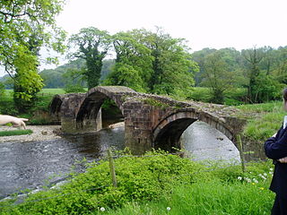
The River Hodder is in Lancashire, England. It is a County Biological Heritage Site.

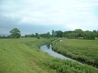
The River Calder is a major tributary of the River Ribble in Lancashire, England and is around 20 miles (32 km) in length.
The River Croco is a small river in Cheshire in England. It starts as lowland field drainage west of Congleton, flows along the south edge of Holmes Chapel, and joins the River Dane at Middlewich. It is about 8 miles (13 km) long.

The River Roddlesworth is a river in Lancashire, England, a tributary of the River Darwen.

Hyndburn Brook is a minor river in eastern Lancashire. It is approximately 4.5 miles (7.3 km) long, and has the catchment area of 13.61 square miles (35.243 km2).

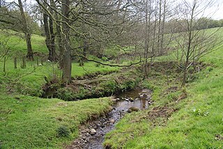
Sabden Brook is a small river running through Lancashire in England. It is 7.59 miles (12.21 km) long and has a catchment area of 6.84 square miles (17.723 km2). Rising just to the west of Newchurch-in-Pendle, Sabden Brook moves westward through its well-defined valley past Sabden Hall to the village of Sabden east of the town of Whalley.
Stydd Brook is a watercourse in Lancashire, England.

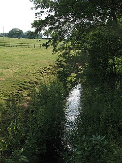
Pendleton Brook is a small river in Lancashire. The brook rises on Pendleton Moor and flows through the village of Pendleton, travelling north west to Higher Standen, then west past Standen Hall. From there, Pendleton Brook flows south of Clitheroe before meeting the River Ribble near Siddows.

The A556 is a road in England which extends from the village of Delamere in Cheshire West and Chester to the Bowdon Interchange in Cheshire East, bordering Greater Manchester. The road contains a mixture of single and dual carriageway sections and forms a large part of the route between Manchester and Chester. It also acts as a major access route to Chester/North Wales to the west and to Manchester to the east for the conurbation of towns and villages around the Dane Valley centering on Winsford and Northwich. The central part, which forms the Northwich Bypass between Davenham and Lostock Gralam, suffers because of the amount of commuter traffic from this area. The part of the route between the M6 motorway Junction 19 and the M56 motorway Junction 7 is a major route into Manchester and has been recently upgraded to a four-lane dual carriageway.
The Preston and Longridge Railway (P&LR) was a branch line in Lancashire, England. Originally designed to carry quarried stone in horse-drawn wagons, it became part of an ambitious plan to link the Lancashire coast to the heart of Yorkshire. The ambition was never achieved, but the line continued to carry passengers until 1930 and goods until 1967.

Skirden Beck is a minor river in Lancashire, England. It is approximately 4.3 miles (6.85 km) long and has a catchment area of 18.87 square miles (48.882 km2).
Longridge Fell is the most southerly fell in England, near the town of Longridge, Lancashire. It lies at the southern end of the Forest of Bowland Area of Outstanding Natural Beauty. As its name suggests, it takes the form of a long ridge which rises in a north-easterly direction from within the town of Longridge to its summit 4.5 miles distant. As the ridge curves towards the east, it comes to a sudden end and drops into the Hodder Valley. The fell is a good example of a cuesta; the ridge has a sharp drop or escarpment on its northern side, and a gentler, more varying slope on its southern side. These features make it a popular takeoff for hang-gliders and paragliders on the relatively infrequent occurrences of a northerly wind.
Savick Brook is a watercourse in Lancashire, England, which runs from the outskirts of Longridge westward north of Preston to the River Ribble.

Mearley Brook is a minor river in Lancashire, England. It is approximately 4.5 miles (7.2 km) long and has a catchment area of 8.79 square miles (22.77 km2).

