
Ribble Valley is a local government district with borough status within the non-metropolitan county of Lancashire, England. The total population of the non-metropolitan district at the 2011 Census was 57,132. Its council is based in Clitheroe. Other places include Whalley, Longridge and Ribchester. The area is so called due to the River Ribble which flows in its final stages towards its estuary near Preston. The area is popular with tourists who enjoy the area's natural unspoilt beauty, much of which lies within the Forest of Bowland.

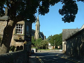
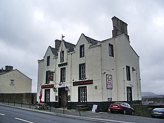
Whalley is a large village and civil parish in the Ribble Valley on the banks of the River Calder in Lancashire, England. It is overlooked by Whalley Nab, a large wooded hill over the river from the village. The population of the civil parish was 2,645 at the census of 2001, and increased to 3,629 at the census of 2011.
Bolton-le-Sands is a large village and civil parish of the City of Lancaster in Lancashire, England. The parish had a population of 4,098 recorded in the 2001 census, increasing to 4,127 at the 2011 Census.

Silverdale is a village and civil parish within the City of Lancaster district of Lancashire, England. The village stands on Morecambe Bay, near the border with Cumbria, 4.5 miles (7 km) north west of Carnforth and 8.5 miles (14 km) of Lancaster. The parish had a population of 1,519 recorded in the 2011 census.
Tarleton is a village and civil parish in the borough of South Ribble, Lancashire, England. It situated in the Lancashire mosslands approximately 10 miles north east of Southport, approximately 10 miles south west of Preston, approximately 10 miles west of the town of Chorley, and approximately 10 miles north of Ormskirk. The village is known for farming due to its rich soil quality. The River Douglas runs northwards to the east of the village, which is locally thought to be where the Vikings camped on the river banks of what is now Tarleton. The parish also includes the village of Mere Brow and the hamlets of Sollom and Holmes.

Wennington is a civil parish in the City of Lancaster district in Lancashire, England. The 2001 Census recorded the parish's population as 102, and the 2011 Census recorded it as 178.
Balderstone is a village and civil parish in the Ribble Valley district of Lancashire, England. The population of the Civil Parish taken at the 2011 census was 410.

Chipping is a village and civil parish of the borough of Ribble Valley, Lancashire, England, within the Forest of Bowland Area of Outstanding Natural Beauty. In the 2001 census, the parish had a population of 1,046, falling slightly to 1,043 at the 2011 Census. This Lancashire village has won several best-kept village competitions over the years. The village also won the village section of the Royal Horticultural Society Britain in Bloom competition in 2009 picking up RHS Tourism and Gold achievement awards in the process.
Feniton is a village and civil parish in East Devon in the English county of Devon. The village lies about 4 miles (6.4 km) west of Honiton, 3 miles (4.8 km) north of Ottery St Mary, and 2 miles (3.2 km) east of Talaton.
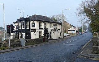
Billington is a village in the Ribble Valley district of Lancashire, England. It lies between the villages of Whalley and Langho. It forms part of the Billington and Langho civil parish and contains the schools St Augustine's RC High School, St Leonard's Primary and St Mary's Primary. The village population at the 2011 census was 1,409.

Pilling is a village and civil parish within the Wyre borough of Lancashire, England. It is 6.5 miles (10.5 km) north-northeast of Poulton-le-Fylde, 9.4 miles (15.1 km) south-southwest of Lancaster and 14.5 miles (23.3 km) northwest of Preston, in a part of the Fylde known as Over Wyre.

Sabden is a village and civil parish in the Ribble Valley, Lancashire, England. Sabden is located south of Pendle Hill, in a valley about three miles north west of Padiham. The parish covers 2,450.9 acres (991.85 ha), of which 103.2 acres (41.75 ha) is occupied by the village. It lies in the Forest of Pendle section of the Forest of Bowland Area of Outstanding Natural Beauty.

Ribbleton is a suburb and ward of the city of Preston, Lancashire, England. It is located to the east of the city centre, between the A59 New Hall Lane and the B6243 Longridge Road. The M6 motorway also runs through the area. The ward had a population of 7,351 recorded in the 2001 census increasing to 8,548 at the 2011 Census.
Dinckley is a small village and civil parish located in the Ribble Valley, in Lancashire, England. Owing to the limited extent of the population details from the Census 2011 are maintained within the civil parish of Billington and Langho. The parish is situated on the south side of the River Ribble, 6 miles (9.7 km) north of Blackburn. The northern boundary of the parish is formed by the River Ribble, and the eastern boundary by Park Brook and Dinckley Brook. The parish is part of the Langho ward, which is represented on Ribble Valley Borough Council by two councillors, both from the Conservative Party.

Downham is a village and civil parish in Lancashire, England. It is in the Ribble Valley district and at the United Kingdom 2001 census had a population of 156. The 2011 Census includes neighbouring Twiston giving a total for both parishes of 214. The village is on the north side of Pendle Hill off the A59 road about 3 miles (4.8 km) from Clitheroe. Much of the parish, including the village is part of the Forest of Bowland Area of Outstanding Natural Beauty (AONB). It adjoins the Ribble Valley parishes of Rimington, Twiston, Worston, Chatburn and Sawley, and the Pendle parish of Barley-with-Wheatley Booth.
Wilpshire is a village and civil parish in the county of Lancashire, England. It is 2.5 miles (4.0 km) north of Blackburn, and forms part of the town's urban area, although it is in the Ribble Valley local government district. In the 2001 United Kingdom census, the parish had a population of 2,569, increasing to 2,582 at the 2011 Census.

Sawley is a village and civil parish in the Borough of Ribble Valley in Lancashire, England. The population of the civil parish was 305 at the 2001 Census, rising to 345 at the 2011 census. It is situated north-east of Clitheroe, on the River Ribble. It was historically part of the West Riding of Yorkshire.

Hornby-with-Farleton is a civil parish in the City of Lancaster in Lancashire, England. It had a population of 729 recorded in the 2001 census, increasing marginally to 730 at the 2011 Census. The parish is about 8.5 miles (13.7 km) north-east of Lancaster and consists of two villages: Hornby and Farleton, both on the A683 road. The parish was formed 24 March 1887 from the parishes of "Hornby" and "Farleton".
Sir Harcourt Everard Clare was born in 1854, Market Bosworth, Leicestershire, England. He was well known in Lancashire where, in 1896, when he took up a post as Clerk at Lancashire County Council, which he kept until his death, at Bank Hall, in 1922.

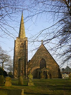
Old St Leonard's Church is a redundant Anglican church 1 mile (1.6 km) northwest of the village of Langho, Lancashire, England. It is recorded in the National Heritage List for England as a designated Grade I listed building, and is under the care of the Churches Conservation Trust.


