Thornley-with-Wheatley

Last updated

Thornley-with-Wheatley
St William of York Ch - geograph.org.uk - 74706.jpg
Lee House chapel
Location map United Kingdom Borough of Ribble Valley.svg
Red pog.svg
Thornley-with-Wheatley
Location in Ribble Valley Borough
Location map United Kingdom Forest of Bowland.svg
Red pog.svg
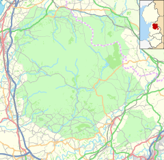
Thornley-with-Wheatley
Location in the Forest of Bowland
Lancashire UK location map.svg
Red pog.svg
Thornley-with-Wheatley
Location within Lancashire
Population320 (2011 Census) [1]
Civil parish
  • Thornley-with-Wheatley
District
Shire county
Region
Country England
Sovereign state United Kingdom
Post town PRESTON
Postcode district PR3
Dialling code 01772
Police Lancashire
Fire Lancashire
Ambulance North West
UK Parliament
List of places
UK
England
Lancashire
53°51′32″N2°33′50″W / 53.859°N 2.564°W / 53.859; -2.564

Thornley-with-Wheatley is a civil parish in the Borough of Ribble Valley, Lancashire, England. It is entirely rural, with no villages or other substantial settlements. Its population was 320 in 2011, [1] a figure that has not changed much for over a century. [2]

Contents

The parish includes most of the western half of Longridge Fell, including the part known as Jeffrey Hill, and, apart from half a mile (1 km) at its western end, lies within the Forest of Bowland Area of Outstanding Natural Beauty. The River Loud forms its northwestern border. It includes Longridge Golf Club and the isolated Catholic chapel of St William at Lee House, a Grade II listed building, [3] whose parish closed in 1991 but is still occasionally used. [4]

Ann Cutler, the weaver and Methodist evangelist, was born here in 1759. [5]

See also

Related Research Articles

<span class="mw-page-title-main">Donisthorpe</span> Human settlement in England

Donisthorpe is a village in the North West Leicestershire district of Leicestershire, England, historically an exclave of Derbyshire.

<span class="mw-page-title-main">Kirkham, Lancashire</span> Human settlement in England

Kirkham aka Kirkam-in-Amounderness is a market town and civil parish in the Borough of Fylde in Lancashire, England, midway between Blackpool and Preston and adjacent to the town of Wesham. It owes its existence to Carr Hill upon which it was built and which was the location of a Roman fort. At the census of 2011, it had a population 3,304 plus 3,890, giving a total of 7,194. By the census of 2021 the total had risen to 3,217 plus 4,666, giving a total of 7,883.

<span class="mw-page-title-main">Longridge</span> Town in Lancashire, England

Longridge is a market town and civil parish in the borough of Ribble Valley in Lancashire, England. It is situated 8 miles (13 km) north-east of the city of Preston, at the western end of Longridge Fell, a long ridge above the River Ribble. The nearest villages are Grimsargh, 2 miles (3 km) to the southeast, and Ribchester 4 miles (6 km) to the southeast. The parish of Longridge had a population of 7,546 recorded in the 2001 census, increasing to 7,724 at the 2011 Census.

<span class="mw-page-title-main">Ribble Valley</span> Borough and non-metropolitan district in England

Ribble Valley is a local government district with borough status in Lancashire, England. Its council is based in Clitheroe, the largest town. The borough also includes the town of Longridge and numerous villages and surrounding rural areas. It is named after the River Ribble. Much of the district lies within the Forest of Bowland, a designated Area of Outstanding Natural Beauty.

<span class="mw-page-title-main">Westhoughton</span> Town in Greater Manchester, England

Westhoughton is a town and civil parish in the Metropolitan Borough of Bolton, Greater Manchester, England, 4 miles (6 km) southwest of Bolton, 5 miles (8 km) east of Wigan and 13 miles (21 km) northwest of Manchester.

<span class="mw-page-title-main">Goosnargh</span> Village and parish in Lancashire, England

Goosnargh is a village and civil parish in the City of Preston district of Lancashire, England.

<span class="mw-page-title-main">Grimsargh</span> Human settlement in England

Grimsargh is a village and civil parish in the City of Preston, Lancashire, England. located 6 miles (10 km) east of Preston.

Barnacre-with-Bonds is a civil parish in the Wyre district of Lancashire, England. According to the 2001 census it had a population of 1,751 increasing to 2,148 at the 2011 census. The parish covers an area to the south and east of Garstang, including the settlements of Bonds, Calder Vale and Bowgreave. It is mostly rural and hilly with a small population.

<span class="mw-page-title-main">Plumpton, Cumbria</span> Human settlement in England

Plumpton or Plumpton Wall is a small village and former civil parish, in the parish of Hesket, in the Westmorland and Furness district, in the traditional and historic county of Cumberland but now in the ceremonial county of Cumbria, England. It is about 4 miles (6 km) north of Penrith. In 1931 the parish had a population of 320.

<span class="mw-page-title-main">Chipping, Lancashire</span> Human settlement in England

Chipping is a village and civil parish in the borough of Ribble Valley, Lancashire, England, within the Forest of Bowland Area of Outstanding Natural Beauty. Its grid reference is SD6243, and the nearest substantial settlement is Longridge, nearly 4 mi (6.4 km) to the south. In the 2001 census, the parish had a population of 1,046, falling slightly to 1,043 at the 2011 census. The village has won several best-kept village competitions over the years. The village also won the village section of the Royal Horticultural Society Britain in Bloom competition in 2009, picking up RHS Tourism and Gold achievement awards in the process.

<span class="mw-page-title-main">Hurst Green, Lancashire</span> Human settlement in England

Hurst Green is a small village in the Ribble Valley district of Lancashire, England, connected in its history to the Jesuit school, Stonyhurst College. The village is 5 miles (8 km) from Longridge and 4 miles (6 km) from Clitheroe, and is close to the River Ribble, near its junction with the River Hodder.

<span class="mw-page-title-main">Little Hulton</span> Area of Greater Manchester, England

Little Hulton is an area in the City of Salford, Greater Manchester, England, 3.4 miles (5.5 km) south of Bolton, 7 miles (11.3 km) northwest of Salford, and 9 miles (14.5 km) northwest of Manchester. Within the boundaries of the historic county of Lancashire, Little Hulton is bordered by Farnworth to the north, Walkden to the east and Tyldesley to the south.

<span class="mw-page-title-main">Wrightington</span> Human settlement in England

Wrightington is a civil parish in West Lancashire, England, with an area of 3,915½ acres. The surface is hilly, rising to over 400 ft. at Harrock on the border of Parbold, and then falling to the north, northeast and southeast. On the southern border, the boundary at Appley Bridge touches the River Douglas. Wrightington Hall is to the north of this point. Tunley and Broadhurst lie to the north of the park, and Fairhurst, to the west of Harrock, reaches down to the River Douglas. At the 2001 census, Wrightington had a population of 4,055, falling to 2,886 at the 2011 Census.

<span class="mw-page-title-main">St Wilfrid's Church, Ribchester</span> Church in Lancashire, England

St Wilfrid's Church is an Anglican church in the village of Ribchester in Lancashire, England that is situated close to the site of a Roman fort. It is an active parish church in the Diocese of Blackburn. It is recorded in the National Heritage List for England as a designated Grade I listed building.

<span class="mw-page-title-main">Places of worship in Burnley</span> List of places of worship

Burnley, in Lancashire, England, has a long history of religious worship, dating from at least before 1122 in the case of the Church of England. The chapel at Towneley Hall was the centre for Roman Catholic worship in Burnley until modern times. Well before the Industrial Revolution, the town saw the emergence of many non-conformist churches and chapels. In 1891 the town was the location of the meeting which saw the creation of the Baptist Union of Great Britain and Ireland. In the late 19th century a Jewish synagogue was established, and in recent times evangelical and free churches have appeared, as well as a large purpose-built mosque.

<span class="mw-page-title-main">St John the Evangelist's Church, Kirkham</span> Church in Lancashire, England

St John the Evangelist's Church is in Ribby Road, Kirkham, Lancashire, England. It is an active Roman Catholic parish church in the diocese of Lancaster. The church was designed by A. W. N. Pugin, and is recorded in the National Heritage List for England as a designated Grade II listed building.

<span class="mw-page-title-main">St Paul's Church, Longridge</span> Church in Lancashire, England

St Paul's Church stands off Berry Lane, Longridge, Lancashire, England. It is an active Anglican parish church in the diocese of Blackburn. The church was built in 1886–1888, and the tower was added in 1936–37. The church is recorded in the National Heritage List for England as a designated Grade II listed building.

Thornley-with-Wheatley is a civil parish in Ribble Valley, Lancashire, England. It contains nine listed buildings that are recorded in the National Heritage List for England. All of the listed buildings are designated at Grade II, the lowest of the three grades, which is applied to "buildings of national importance and special interest". The parish is entirely rural, and most of the listed buildings are farmhouses and farm buildings. The other listed buildings are a house, a church and presbytery, and a mounting block.

Ann Cutler was a British hand-loom weaver and Methodist evangelist.

References

  1. 1 2 UK Census (2011). "Local Area Report – Thornley-with-Wheatley Parish (1170215133)". Nomis. Office for National Statistics . Retrieved 2 February 2018.
  2. Thornley With Wheatley Tn/CP: Population, A vision of Britain through time, retrieved 17 February 2013
  3. Lee House. Church of St William of York and Adjoining Presbytery, Thornley-with-Wheatley, British Listed Buildings, retrieved 17 February 2013
  4. Closed churches & chapels, Diocese of Salford, retrieved 17 February 2013
  5. "Cutler, Ann (1759–1794), hand-loom weaver and Methodist evangelist | Oxford Dictionary of National Biography". www.oxforddnb.com. doi:10.1093/ref:odnb/67658 . Retrieved 13 February 2019.