Newton-in-Bowland

Last updated

Newton
Newton Hall - geograph.org.uk - 426394.jpg
Newton Hall
Location map United Kingdom Borough of Ribble Valley.svg
Red pog.svg
Newton
Location in Ribble Valley Borough
Location map United Kingdom Forest of Bowland.svg
Red pog.svg
Newton
Location in the Forest of Bowland
Lancashire UK location map.svg
Red pog.svg
Newton
Location within Lancashire
Population315  (2011 Census)
OS grid reference SD697505
Civil parish
  • Newton
District
Shire county
Region
Country England
Sovereign state United Kingdom
Post town Clitheroe
Postcode district BB7
Dialling code 01200
Police Lancashire
Fire Lancashire
Ambulance North West
UK Parliament
List of places
UK
England
Lancashire
53°56′49″N2°27′40″W / 53.947°N 2.461°W / 53.947; -2.461

Newton or Newton-in-Bowland is a village and civil parish in the Ribble Valley district, in the county of Lancashire, England, formerly known as Newton-on-Hodder. The civil parish had a population of 237 in 2001, according to the United Kingdom Census, [1] increasing to 315 at the 2011 Census. [2] The township covers almost 6,000 acres of the Forest of Bowland. Historically, the village is part of the West Riding of Yorkshire, but was transferred to Lancashire for administrative purposes on 1 April 1974, under the provisions of the Local Government Act 1972.

Contents

The village pub – The Parkers Arms – takes its name from the neighbouring Parker family of Browsholme Hall. For many generations, the Parkers have served the Lords of Bowland [3] as Bowbearers of the Forest of Bowland. The Parkers Arms is popular with tourists and locals alike. It serves modern British food and local ales and is renowned for sourcing much of its food from within the Bowland area. [4]

History

Recorded in Domesday as Neutone and part of the ancient parish of Slaidburn since Saxon times, [5] Newton has been a constituent part of the demesne of the Manor of Slaidburn since the second half of the fourteenth century. [6] A fall in the population resulting from the Black Death (1348–50) as well as the absorption of Bowland into the Duchy of Lancaster had led to wholesale manorial reorganisation during the 1360s. As a result, the Domesday manors of West Bradford and Grindleton - being part of the parish of Mitton - were also annexed into a new Liberty of Slaidburn, with the caput moving from Grindleton to Slaidburn. [7]

From the late eleventh century, the Manor of Slaidburn had formed part of the ancient Lordship of Bowland. That Lordship in turn comprised a Royal Forest and a Liberty of ten mesne manors spanning eight townships within four ancient parishes and covered an area of almost 300 square miles (800 km2) on the historic borders of Lancashire and Yorkshire. The manors within the Liberty of Bowland were Slaidburn (including Newton, West Bradford and Grindleton), Knowlmere, Waddington, Easington, Bashall, Mitton, Withgill (Crook), Leagram, Hammerton and Dunnow (Battersby). [7]

Two of the mesne manors of the Lords of Bowland remained within the bounds of the township of Newton after the fourteenth century but did not fall within the demesne of Slaidburn: Battersby was held by the eponymous Battersby family until the late sixteenth century. It was acquired and renamed Dunnow by a branch of the Shireburnes of Stonyhurst who held the manor until the time of the English Civil Wars. Much land being sold during this period, the Slinger family acquired the remnant which they held until 1728. Thereafter, the manor passed to Robert Parker, a relative of the Slingers, who sold it to the Wilkinsons in the early 1800s. The current Dunnow Hall dates from the nineteenth century. The last so-called Squire of Dunnow, John King-Wilkinson, died in May 2011.

Knowlmere was a mesne manor of the Lords of Bowland originally subinfeudated to the Savile family but held by the Hammertons from 1382. From at least the mid-thirteenth century, some thirty acres, the core of the estate, had been tenanted by the De Knoll family from which the manor takes its name. The Hammertons suffered severe penalties for Sir Stephen Hammerton's involvement in the Pilgrimage of Grace and their lands, including Knowlmere, were confiscated in 1537. [8] By this time, the manor of Knowlmere comprised "some eighteen farms and lesser holdings which included Birkett, Foulscales, Thorneyholme, Mossthwaite and other properties on the south side of the Hodder between Newton and Dunsop Bridge". [9] A portion of the original Knoll family holding, close to Burholme, appears to have been retained by the family until 1503 when it came into the possession of the Earls of Derby. [10] There has been some speculation that the mysterious Bogeuurde in Domesday - identified by Ekwall with Barge Ford, near Foulscales - may in fact be the manor of Knowlmere in its earliest manifestation. [11]

Title to the Manor and Liberty of Slaidburn, West Bradford and Grindleton, including the township of Newton, was bought by Tory MP, Ralph Assheton, later first Baron Clitheroe, in 1950. [12] In 1977, his second son, the Hon Nicholas Assheton, was granted title. [13] Since 2003, the Lord of the Manor and Liberty of Slaidburn has been Thomas Assheton, son of the Hon Nicholas Assheton and nephew of the second Baron Clitheroe. [7] [14]

Newton was an early centre of Nonconformist religion. Richard Leigh of Birkett, the founder of Newton's first independent chapel in 1696, was closely associated with the great Congregationalist preacher Thomas Jollie. [15] [16] Thomas Jollie's grandson, also Thomas, married Leigh's daughter while his nephew, John Jollie, served as Newton's first Congregationalist minister from 1696 to 1702. The original chapel was replaced in 1887 and was finally closed to services in June 2012. [17] Newton also boasts an historic Quaker burial ground. [18]

Geography

The Roman road known as Watling Street, that runs from Manchester via Ribchester to Carlisle, passes in a NNE direction to the west of the village.

The River Hodder flows through Newton, joined by Easington Brook on the eastern edge of the village, and Foulscales Brook a little further south. The confluence of Foulscales Brook and the Hodder is the location of Barge Ford, considered to be the mysterious Bogeuurde mentioned in Domesday [11] and by some, linked to the early origins of the manor of Knowlmere. Close by sits Foulscales Farm, a fourteenth-century hall, the oldest dwelling in Bowland, tenanted by the Eastwood family, descendants of Richard Eastwood (d. 1871), Bowbearer of the Forest of Bowland and founder of St Hubert's Catholic Chapel, Dunsop Bridge.

Governance

The civil parish of Newton was created from the township of the same name in 1866. In 1938, the geographically non-contiguous division of Lower Easington was transferred to Newton. [19]

Along with Bowland Forest Low, Slaidburn, Bolton-by-Bowland, and Easington, the parish forms the Bowland, Newton and Slaidburn ward of Ribble Valley Borough Council. [20] [21]

See also

Related Research Articles

<span class="mw-page-title-main">Forest of Bowland</span> Upland conservation area in Lancashire, England

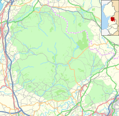
The Forest of Bowland, also known as the Bowland Fells and formerly the Chase of Bowland, is an area of gritstone fells, deep valleys and peat moorland, mostly in north-east Lancashire, England, with a small part in North Yorkshire. It is a western outlier of the Pennines.

<span class="mw-page-title-main">Ribble Valley</span> Borough and non-metropolitan district in England

Ribble Valley is a local government district with borough status in Lancashire, England. Its council is based in Clitheroe, the largest town. The borough also includes the town of Longridge and numerous villages and surrounding rural areas. It is named after the River Ribble. Much of the district lies within the Forest of Bowland, a designated Area of Outstanding Natural Beauty.

<span class="mw-page-title-main">Dunsop Bridge</span> Human settlement in England

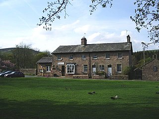
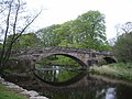
Dunsop Bridge is a village in the Borough of Ribble Valley, Lancashire, England, 9 miles (14 km) north-west of Clitheroe, 15 miles (24 km) south-east of Lancaster and 24.5 miles (39 km) west of Skipton. It is in the civil parish of Bowland Forest High. Historically, the village is part of the West Riding of Yorkshire, but was placed under the administration of Lancashire County Council on 1 April 1974.

<span class="mw-page-title-main">Bashall Eaves</span> Village and civil parish in the Ribble Valley district of Lancashire, England

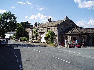
Bashall Eaves is a village and civil parish in the Ribble Valley district of Lancashire, England, about four miles (6 km) west of Clitheroe. The placename element eaves is Old English and refers to Bashall's location on the borders of the Forest of Bowland. Historically, the village is part of the West Riding of Yorkshire, but was transferred to Lancashire for administrative purposes on 1 April 1974, under the provisions of the Local Government Act 1972.

<span class="mw-page-title-main">Slaidburn</span> Human settlement in England

Slaidburn is a village and civil parish within the Ribble Valley district of Lancashire, England. The parish covers just over 5,000 acres of the Forest of Bowland.

<span class="mw-page-title-main">Bolton-by-Bowland</span> Human settlement in England

Bolton-by-Bowland is a village and civil parish in the Ribble Valley district of Lancashire, England. Before 1974, the village was part of Bowland Rural District in the West Riding of Yorkshire. According to the census of 2001, the parish had a population of just 498, rising marginally to 499 at the census of 2011.

<span class="mw-page-title-main">Bowland Forest Low</span> Human settlement in England

Bowland Forest Low is a civil parish in the Ribble Valley district of Lancashire, England, covering some 5,500 acres (22 km2) of the Forest of Bowland. According to the 2001 census, the parish had a population of 168, falling to 160 at the 2011 Census. The parish includes the hamlets of Whitewell and Cow Ark. From northwards clockwise, it borders the civil parishes of Newton, Bashall Eaves, Aighton, Bailey and Chaigley, Bowland-with-Leagram and Bowland Forest High. Before 1974, it formed part of Bowland Rural District in the West Riding of Yorkshire.

<span class="mw-page-title-main">Bowland Forest High</span> Human settlement in England

Bowland Forest High is a civil parish in the Ribble Valley district of Lancashire, England, covering some 20,000 acres (80 km2) of the Forest of Bowland. It fell within the ancient boundaries of the West Riding of Yorkshire. According to the 2001 census, the parish had a population of 163, falling to 144 at the 2011 Census. The parish includes the settlements of Hareden, Sykes, and Dunsop Bridge. It covers Sykes Fell, Whins Brow, Croasdale Fell and Wolfhole Crag. Before 1974, it formed part of Bowland Rural District in the West Riding of Yorkshire.

<span class="mw-page-title-main">Bowland-with-Leagram</span> Human settlement in England

Bowland-with-Leagram is a civil parish in the Ribble Valley district of Lancashire, England, covering part of the Forest of Bowland. According to the census, the parish had a population of 181 in 1951, 128 in 2001 and 169 at the Census 2011.

<span class="mw-page-title-main">Waddington, Lancashire</span> Human settlement in England

Waddington is a small village, 2 miles (3 km) north-west of Clitheroe in the Ribble Valley, Lancashire, England. The population of the civil parish at the 2011 census was 1,028. Before the 1974 county boundary changes, Waddington fell just within the Bowland Rural District of the West Riding of Yorkshire. It covers approximately 2000 acres of the Forest of Bowland.

<span class="mw-page-title-main">West Bradford, Lancashire</span> Human settlement in England

West Bradford is a village and civil parish in Lancashire, England, 27 miles (43 km) west of the larger city of Bradford, West Yorkshire and 2.5 miles (4 km) north of Clitheroe. The population of the civil parish taken at the 2011 census was 788. It covers some 2000 acres of the Forest of Bowland. In Domesday, it is recorded as Bradeford and in the thirteenth century, Braford in Bouland. It was part of the West Riding of Yorkshire until 1974. "West Bradford" was introduced in the nineteenth century at the time of the introduction of postal services to help distinguish the village from its larger eastern neighbour of the same name.

<span class="mw-page-title-main">Pendleton, Lancashire</span> Human settlement in England

Pendleton is a small village and civil parish in Ribble Valley, within the county of Lancashire, England. It is close to the towns of Whalley and Clitheroe. The parish lies on the north west side of Pendle Hill below the Nick o' Pendle. The village is just off the A59, Liverpool to York main road, since the construction of the Clitheroe By-Pass. Older roads through the parish include one from Clitheroe to Whalley which passes through the Standen area and another to Burnley which passes Pendleton Hall.

<span class="mw-page-title-main">Grindleton</span> Human settlement in England

Grindleton is a village and civil parish in the Ribble Valley district of the English county of Lancashire, formerly in the West Riding of Yorkshire. Its 3,700 acres sit within the Forest of Bowland. The population of the civil ward taken at the 2011 census was 772.

<span class="mw-page-title-main">Downham, Lancashire</span> Human settlement in England

Downham is a village and civil parish in Lancashire, England. It is in the Ribble Valley district and at the United Kingdom 2001 census had a population of 156. The 2011 Census includes neighbouring Twiston giving a total for both parishes of 214. The village is on the north side of Pendle Hill off the A59 road about 3 miles (4.8 km) from Clitheroe. Much of the parish, including the village is part of the Forest of Bowland Area of Outstanding Natural Beauty (AONB). It adjoins the Ribble Valley parishes of Rimington, Twiston, Worston, Chatburn and Sawley, and the Pendle parish of Barley-with-Wheatley Booth.

<span class="mw-page-title-main">Sawley, Lancashire</span> Human settlement in England

Sawley is a village and civil parish in the Borough of Ribble Valley in Lancashire, England. The population of the civil parish was 305 at the 2001 Census, rising to 345 at the 2011 census. It is situated north-east of Clitheroe, on the River Ribble. It was historically part of the West Riding of Yorkshire.

The Lordship of Bowland is a feudal barony associated with the Forest of Bowland in Lancashire, England. The lordship fell into disuse between 1885 and 2008, during which time it was widely believed to have lapsed; it was revived in 2008.

<span class="mw-page-title-main">Honour of Clitheroe</span>

The Honour of Clitheroe is an ancient grouping of manors and royal forests centred on Clitheroe Castle in Lancashire, England; an honour traditionally being the grant of a large landholding complex, not all of whose parts are contiguous. In the case of Clitheroe, this complex was loosely clustered around the ancient wapentake of Blackburnshire.

<span class="mw-page-title-main">Great Mitton</span> Human settlement in England

Great Mitton is a village and a civil parish in the Ribble Valley, Lancashire, England. It is separated from the civil parish of Little Mitton by the River Ribble, both lie about three miles from the town of Clitheroe. The combined population of both civil parishes at the 2011 census was 266. In total, Great and Little Mitton cover less than 2000 acres of the Forest of Bowland, making it the smallest township in the Forest. Historically, the village is part of the West Riding of Yorkshire, but was transferred to Lancashire for administrative purposes on 1 April 1974, under the provisions of the Local Government Act 1972.

<span class="mw-page-title-main">Easington, Lancashire</span> Human settlement in England

Easington is a civil parish within the Ribble Valley district of Lancashire, England, with a population in 2001 of 52. The Census 2011 population details have been grouped with the parish of Slaidburn. Before 1974, it formed part of Bowland Rural District in the West Riding of Yorkshire. It covers just over 9000 acres.

References

C J Spencer; S W Jolly. "Bowland: the rise and decline, abandonment and revival of a medieval lordship" (PDF). The Escutcheon: Journal of the Cambridge University Heraldic & Genealogical Society. Archived from the original (PDF) on 11 July 2011.

  1. "Census 2001 : Parish Headcounts : Ribble Valley". Office for National Statistics . Retrieved 24 April 2011.
  2. UK Census (2011). "Local Area Report – Newton Parish (1170215120)". Nomis. Office for National Statistics . Retrieved 24 February 2018.
  3. "Lord of the Fells, Guardian of History" (PDF). Rural Life. November 2014.
  4. "The Parkers Arms | www.parkersarms.co.uk".
  5. Jenny Bradley, Slaidburn: A Walk through the Village (Slaidburn Village Archive 2011), p. 6
  6. Slaidburn Court Rolls, 16th year of reign of Richard II, 1392/3, No 1: 8 membranes, 1 wrapper, Lancashire Record Office, DDHC1; William Farrer, Latin transcription (1900), Manchester City Archive
  7. 1 2 3 Spencer and Jolly: Escutcheon Vol 15
  8. RW Hoyle, The Pilgrimage of Grace and the Politics of the 1530s(Oxford University Press 2001)
  9. J Porter, The Forest of Bowland: Its Landscape and History (Farnborough 1994), p. 37
  10. Alice Peel, The Manor of Knowlmere (Privately published: Knowlmere 1913)
  11. 1 2 Eilert Ekwall, The Place-names of Lancashire (Manchester University Press: Manchester 1922)
  12. HM Land Registry, 22 June 1950
  13. HM Land Registry, 26 August 1977
  14. HM Land Registry, LA937696, 1 June 2003; ownership of common land is registered under LA955806, LA955807, LA955808, LA955809
  15. Henry Fishwick, ed., The Notebook of the Rev Thomas Jollie, AD 1671-1693 (Chetham Society: Manchester 1894)
  16. William Bowland, The Lord and the Preacher http://www.forestofbowland.com/files/uploads/THE_LORD_AND_THE_PREACHER%20minus%20picture%20Nov%202010.pdf Archived 11 September 2011 at the Wayback Machine
  17. Final Service at 125-year-old Chapel,Clitheroe Advertiser,17 June 2012
  18. Brian Dale, Bicentenary of Nonconformity in the Village of Newton in Bowland (William Byles: Bradford 1897)
  19. "History of NEWTON". visionofbritain.org.uk. Archived from the original on 24 December 2012. Retrieved 30 April 2011.
  20. "Bowland, Newton and Slaidburn". MARIO. Lancashire County Council. Retrieved 25 March 2016.
  21. "Bowland, Newton and Slaidburn". Ordnance Survey Linked Data Platform. Ordnance Survey. Retrieved 25 March 2016.