Mellor Brook

Last updated

Mellor Brook
The Feilden's Arms, Mellor Brook - geograph.org.uk - 404152.jpg
The Feilden's Arms public house, Mellor Brook
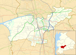
Location map United Kingdom Borough of South Ribble.svg
Red pog.svg
Mellor Brook
Shown within South Ribble
Location map United Kingdom Borough of Ribble Valley.svg
Red pog.svg
Mellor Brook
Shown within Ribble Valley
Lancashire UK location map.svg
Red pog.svg
Mellor Brook
Location within Lancashire
OS grid reference SD640311
Civil parish
District
Shire county
Region
Country England
Sovereign state United Kingdom
Post town BLACKBURN
Postcode district BB2
Dialling code 01254
Police Lancashire
Fire Lancashire
Ambulance North West
EU Parliament North West England
UK Parliament
List of places
UK
England
Lancashire
53°46′30″N2°32′49″W / 53.775°N 2.547°W / 53.775; -2.547 Coordinates: 53°46′30″N2°32′49″W / 53.775°N 2.547°W / 53.775; -2.547

Mellor Brook is a village which straddles the borders of the Boroughs of Ribble Valley and South Ribble in Lancashire, England. The village population at the 2011 census was 2,467. [1]

Ribble Valley Borough in England

Ribble Valley is a local government district with borough status within the non-metropolitan county of Lancashire, England. The total population of the non-metropolitan district at the 2011 Census was 57,132. Its council is based in Clitheroe. Other places include Whalley, Longridge and Ribchester. The area is so called due to the River Ribble which flows in its final stages towards its estuary near Preston. The area is popular with tourists who enjoy the area's natural unspoilt beauty, much of which lies within the Forest of Bowland.

South Ribble Borough in England

South Ribble is a non-metropolitan district and borough of Lancashire, England. Its council is based in Leyland. The population, at the 2011 Census, was 109,057. In May 2007, the council was officially declared "Excellent" by the Audit Commission, of the best five district councils in the country. The council is the only district council not to be part of the District Councils' Network.

Lancashire County of England

Lancashire is a ceremonial county in North West England. The administrative centre is Preston. The county has a population of 1,449,300 and an area of 1,189 square miles (3,080 km2). People from Lancashire are known as Lancastrians.

The village of Mellor Brook is approximately 4 miles (6 km) north west of Blackburn. The geographical area of Mellor Brook is quite small, covering an area of approximately 4 square miles (10 km2).

Blackburn town in Lancashire, England

Blackburn is a town in Lancashire, England, north of the West Pennine Moors on the southern edge of the Ribble Valley, 9 miles (14 km) east of Preston and 20.9 miles (34 km) NNW of Manchester. Blackburn is bounded to the south by Darwen, with which it forms the unitary authority of Blackburn with Darwen; Blackburn is its administrative centre.

There is a bakery located in the heart of Mellor Brook. The bakery is well known and successful and started in the village, eventually moving its main operation to nearby Ramsgreave, but still retaining its original village shop. The shop's pies are a favourite of the English fashion designer, Wayne Hemingway. In recent years, both the village's newsagent and post office have closed.

Ramsgreave

Ramsgreave is a civil parish in the Ribble Valley district of Lancashire, England. The parish is located on the northern edge of Blackburn although it is just outside the Blackburn with Darwen unitary district, and although the south and east of the parish is suburban, the parish also includes a rural area. The population of the civil parish taken at the 2011 census was 817. It is served by Ramsgreave and Wilpshire railway station.

Wayne Hemingway British fashion designer

Wayne Andrew Hemingway is an English designer and co-founder of Red or Dead. He is also on the Design Council Trustee Board and having been with the Commission for Architecture and the Built Environment (CABE) for a decade since its inception is now on the Design Council CABE Committee. Hemingway is a Professor in The Built Environment Department of Northumbria University, a Doctor of Design at Wolverhampton, Lancaster and Stafford, a Fellow of Blackburn College and a Senior Fellow of Regent's University London.

In 1808/9, the road (A59) from Mellor Brook to Clitheroe was opened as a toll road hence the position of the toll house at the top of Higher Commons Lane. Preston New Road (A677) between Blackburn and Preston, followed in 1824 and hence Branch Road, getting its name because it joined the two turnpike roads, opened at the same time.

A59 road road in England

The A59 is a major road in England which is around 109 miles (175 km) long and runs from Wallasey, Merseyside to York, North Yorkshire. The alignment formed part of the Trunk Roads Act 1936, being then designated as the A59. It is a key route connecting Merseyside at the M53 motorway to Yorkshire, passing through three counties and connecting to various major motorways. The road is a combination of historical routes combined with contemporary roads and a mixture of dual and single carriageway. Sections of the A59 in Yorkshire closely follow the routes of Roman roads, some dating back to the Middle Ages as salt roads, whilst much of the A59 in Merseyside follows Victorian routes which are largely unchanged to the present day.

The village also has a thriving community centre; it is thought the building came into existence in June 1823, when a plot of land was assigned to a group of gentlemen on which they could build an independent place of worship. The building was purchased by the Church of England in 1833 and it was proposed that it be used during the week as a schoolhouse.

The premises became known as St Saviours Chapel, Mellor Brook. The building was used as a primary school right until 1962, after which time the Church allowed it to be sold to the parish councils of the area. In 1966, Mellor Brook Community Centre came into existence, and has been such ever since.

The village is adjacent to the former Samlesbury Aerodrome, now under the tenure of BAe. BAe have successfully developed commercial units on the site close the village. A village meeting was held in 2008, with over one hundred attendees, including the sitting MP for the Ribble Valley, Nigel Evans.

Samlesbury Aerodrome airport in the United Kingdom

Samlesbury Aerodrome is a disused airfield at Balderstone near Samlesbury and blackburn in Ribble Valley district of Lancashire. The aerodrome is owned by defence company BAE Systems which uses the site for manufacturing of several aircraft types. Currently BAE employ approximately 3,000 people at the site. The aerodrome is part of Lancashire Enterprise Zone.

Nigel Evans British Conservative Party politician. Member of Parliament for the Ribble Valley constituency since 1992

Nigel Martin Evans is a British Conservative Party politician serving as Joint Executive Secretary of the 1922 Committee since 2017, and has served as Member of Parliament for the Ribble Valley in Lancashire since 1992. He served as First Deputy Chairman of Ways and Means, one of the Speaker's three deputies, from 2010 to 2013.

Evans agreed to return to further address the concerns of the villagers raised following his subsequent meetings with BAe. As of May2019, Evans has failed to return.

Related Research Articles

Preston, Lancashire city and the administrative centre of Lancashire, England

Preston is a city and the administrative centre of Lancashire, England, on the north bank of the River Ribble.

Whalley, Lancashire village in Lancashire, England

Whalley is a large village and civil parish in the Ribble Valley on the banks of the River Calder in Lancashire, England. It is overlooked by Whalley Nab, a large wooded hill over the river from the village. The population of the civil parish was 2,645 at the census of 2001, and increased to 3,629 at the census of 2011. Watercolour artist Thomas Frederick Worrall painted two scenes entitled Whalley from the Nab and Whalley Nab from Stoneyhurst, c. 1900, which are available on the Watercolour World web site.

River Blakewater, Lancashire river in Lancashire, United Kingdom

The River Blakewater is a river running through Lancashire, giving its name to the town of Blackburn.

Ribchester farm village in the United Kingdom

Ribchester is a village and civil parish within the Ribble Valley district of Lancashire, England. It lies on the banks of the River Ribble, six miles (10 km) northwest of Blackburn and twelve miles (19 km) east of Preston.

Langho village in the United Kingdom

Langho is a small rural village 5 miles (8 km) north of Blackburn in the Ribble Valley, Lancashire, England. It is part of the parish of Billington and Langho. The village is linked with Blackburn and Clitheroe by the A666 road and is served by Langho railway station on the Ribble Valley Line. The population at the 2011 census was 2,015.

Walton-le-Dale village in the United Kingdom

Walton-le-Dale is a large village in the Borough of South Ribble, in Lancashire, England. It lies on the south bank of the River Ribble, opposite the city of Preston, adjacent to Bamber Bridge. The population of the South Ribble Ward at the 2011 census was 3,792.

Longton, Lancashire village in Lancashire

Longton is a village and civil parish in the west of the borough of South Ribble, Lancashire, England. It is about 4 miles to the south west of Preston. The population of the civil parish, which also includes the village of New Longton, was 5,500 at the 2001 Census increasing to 7,652 at the 2011 Census.

Bamber Bridge village in United Kingdom

Bamber Bridge is an urban village in Lancashire, England, 3 miles (5 km) south-east of the city of Preston, in the borough of South Ribble. The name derives from the Old English "bēam" and "brycg", which probably means "tree-trunk bridge". It is mentioned in an undated medieval document. Bamber Bridge is often referred to as "Brig" by residents. People born in Bamber Bridge are known as "Briggers". The total population for the three active Bamber Bridge Wards was 12,126 at the 2001 census, increasing to a total of 13,945 at the 2011 Census.

Balderstone, Lancashire village and civil parish in the Ribble Valley district of Lancashire, England

Balderstone is a village and civil parish in the Ribble Valley district of Lancashire, England. The population of the Civil Parish taken at the 2011 census was 410.

Church, Lancashire village in United Kingdom

Church is a village in Hyndburn, Lancashire, England; situated a mile west of Accrington. The local travel links are located less than a mile from the village centre to Church and Oswaldtwistle railway station and 27 miles (43 km) to Blackpool Airport. Also, the main road running through the village is the A679. The village has a population of 3,990 according to the 2001 census, increasing to 5,186 at the 2011 Census.

Banks, Lancashire coastal village in Lancashire, England

Banks is a large coastal village in Lancashire, England, south of the Ribble estuary four miles (6 km) north-east of Southport. The village is administered by West Lancashire Borough and North Meols Parish Council. It is in the South Ribble parliamentary constituency. At the 2001 census, the population was 3,792.

Mellor, Lancashire a village located in Ribble Valley, United Kingdom

Mellor is a village situated in the Borough of Ribble Valley in Lancashire, England. The population of the civil parish at the census of 2011 was 2,262.

Chipping, Lancashire village and civil parish in Lancashire, UK

Chipping is a village and civil parish of the borough of Ribble Valley, Lancashire, England, within the Forest of Bowland Area of Outstanding Natural Beauty. In the 2001 census, the parish had a population of 1,046, falling slightly to 1,043 at the 2011 Census. This Lancashire village has won a number of best kept village competitions over the years. The village also won the village section of the Royal Horticultural Society Britain in Bloom competition in 2009 picking up RHS Tourism and Gold achievement awards in the process.

Much Hoole village in the United Kingdom

Much Hoole is a village and civil parish in the borough of South Ribble, Lancashire, England. The parish of Much Hoole had a population of 1,851 at the time of the 2001 census, increasing to 1,997 at the 2011 Census.

Chatburn a village located in Ribble Valley, United Kingdom

Chatburn is a village, civil parish and electoral ward in the Ribble Valley, East Lancashire, England. The population of the civil parish at the 2011 census was 1,102. It is situated in a hollow between two ridges north-east of Clitheroe, just off the A59 road. It lies near Pendle Hill, which is to the east of the village. The River Ribble flows to the west of the town. The town is approximately 400 feet above sea level.

Higher Walton, Lancashire village in the United Kingdom

Higher Walton is a village in South Ribble, Lancashire, England. It is on the old road between Blackburn and Preston where it crosses the River Darwen. The road, at this point, is now part of the A675. Nearby places include Walton-le-Dale, Coupe Green, and Bamber Bridge.

Salesbury human settlement in United Kingdom

Salesbury is a village and civil parish in Ribble Valley, located centrally in the county of Lancashire, England. The B6245 road runs straight through the village providing transport links to towns such as Blackburn, Preston and Burnley. Salesbury lies less than 5 miles north of Blackburn and approximately 2 miles south of the River Ribble.

Pendleton, Lancashire village in Lancashire, United Kingdom

Pendleton is a small village and civil parish in Ribble Valley, within the county of Lancashire, England. It is close to the towns of Whalley and Clitheroe. The parish lies on the north west side of Pendle Hill below the Nick o' Pendle. The village is just off the A59, Liverpool to York main road, since the construction of the Clitheroe By-Pass. Older roads through the parish include one from Clitheroe to Whalley which passes through the Standen area and another to Burnley which passes Pendleton Hall.

City of Preston, Lancashire City & Non-metropolitan district in England

The City of Preston is a city and non-metropolitan district in Lancashire, England. On the north bank of the River Ribble, it was granted city status in 2002, becoming England's 50th city in the 50th year of Queen Elizabeth II's reign. The City of Preston district has a population of 141,300 (mid-2017 est.), and lies at the centre of the Central Lancashire sub-region, with a population of 335,000.

References

  1. UK Census (2011). "Local Area Report – Mellor Brook Built-up area (E34000812)". Nomis. Office for National Statistics . Retrieved 27 May 2019.