Longton, Lancashire

Last updated

Longton
Longton, St. Andrew - geograph.org.uk - 158056.jpg
St Andrew's Church
Location map United Kingdom Borough of South Ribble 2020.svg
Red pog.svg
Longton
Shown within South Ribble
Lancashire UK location map.svg
Red pog.svg
Longton
Location within Lancashire
Population7,652  [1] (2011)
OS grid reference SD475262
Civil parish
  • Longton
District
Shire county
Region
Country England
Sovereign state United Kingdom
Post town PRESTON
Postcode district PR4
Dialling code 01772
Police Lancashire
Fire Lancashire
Ambulance North West
UK Parliament
List of places
UK
England
Lancashire
53°43′44″N2°47′49″W / 53.729°N 2.797°W / 53.729; -2.797

Longton is a village and civil parish in the west of the borough of South Ribble, Lancashire, England. It is about 4 miles to the south west of Preston. The population of the civil parish, which also includes the village of New Longton, was 5,500 at the 2001 Census increasing to 7,652 at the 2011 Census. [1]

Contents

History

Longton is a village of ancient origin. The parish church, St. Andrew's was completed in 1887 when the previous chapel of 1772 which stood nearer the main road was demolished. This stood on the site of an earlier chapel, the records of which are lost.

Although a document refers to "Eafward Priest of Longton" as early as 1153, and there is evidence of a chapel in Longton just before the reformation in 1517, when William Walton endowed a chantry at the chapel, there is no evidence that it stood on or near the site of the present parish church. No archaeological evidence has ever been found on the current site, and the dedication of the early chapel is unknown. [2]

During the Middle Ages, Longton was known as "a sort of Holy Land" because the monks of Penwortham Priory tended their lands here. It was no doubt the monks who established the first chapel here. Many mediaeval documents survive which are mostly concerning rents paid to the Shireburn Family of Stonyhurst. An old source mentions a meadow called "Tirolkar" which bears a remarkable resemblance to the "Hallcar" of today. [3]

The parish was part of Preston Rural District throughout its existence from 1894 to 1974. [4] In 1974 the parish became part of South Ribble.

Religion

Apart from St. Andrew's Church, the Anglican church on Liverpool Road, there is a Methodist Chapel called Longton Methodist Church [5] and the Catholic church of St. Oswald on Chapel Lane. [6]

A small, plain Wesleyan chapel was built in Marsh Lane in 1807 and enlarged in 1833. In 1872 a new chapel was built in the Early English style.

By 1837 the primitive Methodists had become so numerous that they opened a chapel down Chapel Lane, but as time went on they declined and the Chapel was converted into a small housing estate.

Despite the successful application for a licence to build a Congregational Chapel in 1821, it never got built.

St. Oswald's Catholic Church was established in 1893 and on 16 October 1894 a chapel and school was opened, entirely funded by the wealthy Liverpool priest, Canon Lennon. By 1965, the congregation had vastly increased and a new church was built on an adjacent site.


Places of interest

Longton Brickcroft is a former brickworks which has been transformed into a nature reserve and public open space. It was declared a Local Nature Reserve by South Ribble Borough Council in 1998. [7] The environment has been made extremely attractive, dominated by water which has filled the former clay pits. One of the water areas is available for fishing. The areas surrounding the water have been allowed to develop naturally with trees, shrubbery and wild plants.

The Brickcroft is of particular interest to birdwatchers and botanists with seating and footpaths making it accessible for most visitors. A purpose built visitor centre contains informative displays on the site's history, local wildlife and the environment. Facilities include toilets with disabled and baby changing provision, car parking and a picnic area. [8]

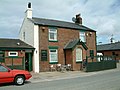
The long distance footpath the Ribble Way starts by The Dolphin Inn in Longton.

Fallout shelter

A small UKWMO nuclear observation bunker can be found to the north-west of the village on Back Lane. Its position is concealed as it is located on a private field, and as such it is relatively unknown among villagers.

Architecture

Most houses in Longton are semi-detached, detached, bungalows or homes that are part of modern housing estates. About 70% of accommodation in Longton was built in the 1960s and 1970s, but more modern developments have been constructed.

There is only one area of council housing in the village; it is in West and East Square and it is well maintained.

Education

Primary schools

Longton is home to two primary schools. There is a Catholic school on Chapel Lane called St. Oswald's. The majority of children in the village go to Longton Primary School in School Lane.

High schools

Most students from the village, after primary school go to the surrounding high schools. These include Hutton Grammar School, Penwortham Girls' High School, All Hallows Catholic High School and Penwortham Priory Academy. Bishop Rawstorne Church of England Academy and,Tarleton High School also takes in a few people each term also, as does Bolton School and Kirkham Grammar School.

Scouts and Girlguiding

Longton has a Scouts division, a small building across from Booths on Liverpool Road, next to St. Andrew's Church Hall. It has all 3 major stages, from Beavers to Cubs to Scouts. The neckerchief colours are blue and white. Longton also has a Girlguiding division. Based in the Church Hall, it has 2 of the major stages: Brownies and Guides.

Longton Marsh

Longton Marshes are a large area of marshland to the west of Longton lying at the confluence of the Rivers Douglas and Ribble which is now part of the Ribble Link. It is the natural home for a large variety of visiting and indigenous wildfowl. The 70 mile Ribble Way footpath starts at the Dolphin Inn, once owned by the Holmes family, on the edge of the marsh and follows its edge before joining the Ribble.

Transport

Railway

In 1882 the West Lancashire Railway came to the village. Longton Bridge railway station was aimed at opening the village up to the local economic hubs of Preston and Southport, but the placement of the station in relation to the village was too far. The line closed in 1964. While some of the line's earth bankings and bridge foundations are still visible on Liverpool Road, much of the track has been built over. [9]

Road

The A59 road passes to the east of the village and is known as "Longton Bypass". On the A59 there is a bridge over a road that connects Longton to New Longton. This bridge was originally constructed to take the Longton Bypass over the railway line between Preston and Southport, and was adapted to road use after the line's closure. The central reservation on the A59 dual carriageway was then made continuous to prevent traffic from crossing four lanes of fast-moving traffic. The poor visibility to the south, because of the alignment necessary to take the highway over the railway bridge, had made crossing the A59 very dangerous at this location.

Bus services in Longton are provided by Stagecoach North West, with regular services operating to Preston City Centre and Southport or Ormskirk. Preston Bus also operates a half hourly service linking the village with New Longton, Lower Penwortham and Preston City Centre.

People

The following is a list of notable people from Longton:

Geography

See also

Related Research Articles

<span class="mw-page-title-main">South Ribble</span> Borough and non-metropolitan district in England

South Ribble is a local government district with borough status in Lancashire, England. Its council is based in Leyland. The borough also includes the towns and villages of Penwortham, Leyland, Lostock Hall, Walton le Dale and Bamber Bridge. Many of the built-up areas in the borough form part of the wider Preston built-up area.

<span class="mw-page-title-main">A59 road</span> Road in Northern England

The A59 is a major road in England which is around 109 miles (175 km) long and runs from Wallasey, Merseyside to York, North Yorkshire. The alignment formed part of the Trunk Roads Act 1936, being then designated as the A59. It is a key route connecting Merseyside at the M53 motorway to Yorkshire, passing through three counties and connecting to various major motorways. The road is a combination of historical routes combined with contemporary roads and a mixture of dual and single carriageway. Some sections of the A59 in Yorkshire closely follow the routes of Roman roads, some dating back to the Middle Ages as salt roads, whilst much of the A59 in Merseyside follows Victorian routes which are largely unchanged to the present day.

<span class="mw-page-title-main">River Ribble</span> River in North Yorkshire and Lancashire, England

The River Ribble runs through North Yorkshire and Lancashire in Northern England. It starts close to the Ribblehead Viaduct in North Yorkshire, and is one of the few that start in the Yorkshire Dales and flow westwards towards the Irish Sea.

<span class="mw-page-title-main">Aintree</span> Village in England

Aintree is a village and civil parish in the Metropolitan Borough of Sefton, Merseyside, England. Historically in Lancashire, it lies between Walton and Maghull on the A59 road, 5+12 miles northeast of Liverpool city centre, in North West England.

<span class="mw-page-title-main">Lydiate</span> Village in England

Lydiate is a village and civil parish in the Metropolitan Borough of Sefton on Merseyside, England but historically in Lancashire. It is located 1.5 miles (2 km) north of Maghull, with which it has a common history. At the 2001 Census the civil parish of Lydiate had a population of 6,672, reducing to 6,308 at the 2011 Census.

<span class="mw-page-title-main">Burscough</span> Town in West Lancashire, England

Burscough is a town and civil parish in the district of West Lancashire, Lancashire, England. The town is located approximately 13.5 miles (21.7 km) north-northeast of Liverpool and 13 miles (21 km) southwest of Preston. Its northern part is called Burscough Bridge, and was originally a separate settlement.

<span class="mw-page-title-main">Tarleton</span> Human settlement in England

Tarleton is a village and civil parish in the West Lancashire district of Lancashire, England. It is situated approximately 19 miles (31 km) north-east of Liverpool and 9 miles (14 km) south-west of Preston. The parish includes the village of Mere Brow and the hamlets of Sollom and Holmes, and is an agricultural area. It had a population of 5,959 at the 2021 Census. Tarleton village, Holmes, and the villages of Hesketh Bank and Becconsall to the north form a single built-up area with a population of 8,755.

<span class="mw-page-title-main">Rufford, Lancashire</span> Village in West Lancashire, England

Rufford is a village in West Lancashire, England, where the Leeds and Liverpool Canal, Liverpool, Ormskirk and Preston Railway, the A59 and the River Douglas meet.

<span class="mw-page-title-main">Bamber Bridge</span> Human settlement in England

Bamber Bridge is a large village in Lancashire, England, 3 miles (5 km) south-east of Preston, in the borough of South Ribble. The name derives from the Old English "bēam" and "brycg", which probably means "tree-trunk bridge". People who live in Bamber Bridge like to be known as Briggers.

<span class="mw-page-title-main">Penwortham</span> Human settlement in England

Penwortham is a town and civil parish in South Ribble, Lancashire, England, on the south bank of the River Ribble facing the city of Preston. The town is at the most westerly crossing point of the river, with major road and rail links crossing it here. The population of the town at the 2011 census was 23,047.

<span class="mw-page-title-main">Bretherton</span> Human settlement in England

Bretherton is a small village and civil parish in the Borough of Chorley, Lancashire, England, situated to the south west of Leyland and east of Tarleton. The population of the civil parish at the 2011 census was 669. Its name suggests pre-conquest origins and its early history was closely involved with the manor house Bank Hall and the families who lived there. Bretherton remained a rural community and today is largely residential with residents commuting to nearby towns.

<span class="mw-page-title-main">Hesketh Bank</span> Human settlement in England

Hesketh Bank is a village in the West Lancashire district of Lancashire, England. It is situated approximately 7 miles (11 km) north-east of Southport and 7 miles (11 km) south-west of Preston. The village is within the civil parish of Hesketh-with-Becconsall, which includes the village of Becconsall immediately to the south and which borders the Ribble Estuary to the north. The parish had a population of 4,187 at the 2021 Census. Hesketh Bank, Becconsall, and the village of Tarleton to the south form a single built-up area with a population of 8,755.

<span class="mw-page-title-main">Banks, Lancashire</span> Human settlement in England

Banks is a large coastal village in Lancashire, England, south of the Ribble estuary four miles (6 km) north-east of Southport. The village is administered by West Lancashire Borough and North Meols Parish Council. It is in the South Ribble parliamentary constituency. At the 2001 census the population of the North Meols civil parish was 3,792, rising to 4,146 by the 2011 census.

<span class="mw-page-title-main">Much Hoole</span> Human settlement in England

Much Hoole is a village and civil parish in the borough of South Ribble, Lancashire, England. The parish of Much Hoole had a population of 1,851 at the time of the 2001 census, increasing to 1,997 at the 2011 Census.

<span class="mw-page-title-main">New Longton</span> Human settlement in England

New Longton is a village located 4 miles (6 km) south west of Preston, in the district of South Ribble, in the county of Lancashire, North West England. It is in the parish of Longton, which is the name of the older village located 2 miles (3 km) to the west of New Longton.

Hutton is a village and civil parish in Lancashire, England. It is located 3 miles (4.8 km) south west of Preston, in the South Ribble borough and parliamentary constituency. The population of the civil parish at the 2011 census was 2,277.

<span class="mw-page-title-main">Hundred End</span> Human settlement in England

Hundred End is a coastal hamlet in West Lancashire, England. It is 2 miles east of the larger village of Banks and 2 miles west of the larger village of Hesketh Bank.

<span class="mw-page-title-main">Transport in Preston</span>

Preston is a city in Lancashire, around 50 kilometres (31 mi) north-west of Manchester.

<span class="mw-page-title-main">Howick Cross</span> Human settlement in England

Howick Cross is a landmark and small hamlet in Penwortham, South Ribble, Lancashire, England. It is located just over 2 miles south west of the city of Preston. The hamlet is predominantly made up of a small community, a primary school, various farms and an electrical substation. The community had a population of 354 people in 2001.

References

  1. 1 2 UK Census (2011). "Local Area Report – Longton Parish (E04005296)". Nomis. Office for National Statistics . Retrieved 26 March 2021.
  2. "Archived copy". Archived from the original on 29 October 2010. Retrieved 23 October 2010.{{cite web}}: CS1 maint: archived copy as title (link)
  3. "Townships: Longton | British History Online". www.british-history.ac.uk.
  4. Preston RD, Vision of Britain, accessed 9 June 2014
  5. "Lonton Methodist Church". Archived from the original on 26 April 2012. Retrieved 3 December 2017.
  6. "The Archdiocese of Liverpool". Archived from the original on 5 September 2012. Retrieved 24 November 2011.
  7. "Special Sites: Local Nature Reserves: Longton Brickcroft". Natural England . Retrieved 18 July 2008.[ permanent dead link ]
  8. "Walking from Longton to Brickcroft". Lancashire Evening Post.
  9. "Spare| Spare | Spare | Spare". Archived from the original on 30 January 2010. Retrieved 23 October 2010.