Much Hoole

Last updated

Much Hoole
Hoole Parish Church - geograph.org.uk - 153573.jpg
St Michael's Parish Church
Location map United Kingdom Borough of South Ribble 2020.svg
Red pog.svg
Much Hoole
Shown within South Ribble
Lancashire UK location map.svg
Red pog.svg
Much Hoole
Location within Lancashire
Population1,997  [1]
OS grid reference SD471232
Civil parish
  • Much Hoole
District
Shire county
Region
Country England
Sovereign state United Kingdom
Post town PRESTON
Postcode district PR4
Dialling code 01772
Police Lancashire
Fire Lancashire
Ambulance North West
UK Parliament
List of places
UK
England
Lancashire
53°42′11″N2°48′04″W / 53.703°N 2.801°W / 53.703; -2.801 Coordinates: 53°42′11″N2°48′04″W / 53.703°N 2.801°W / 53.703; -2.801

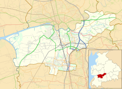
Much Hoole is a village and civil parish in the borough of South Ribble, Lancashire, England. The parish of Much Hoole had a population of 1,851 at the time of the 2001 census, increasing to 1,997 at the 2011 Census. [1]

Contents

History

Hoole derives from the Old English hulu, a shed or hovel. It was recorded as Hull in 1204, Hole in 1212 and Hoole in 1508. Magna Hole was recorded in 1235, Much Hole in 1260 [2] and Grett Wholle in 1551. [3]

At Much Hoole there are the remains of a medieval settlement and moat adjacent to Town Lane. Hoole gave its name to a family in the reign of King John and the parish has been held by the Montebegon family and by others, including those of Sir Thomas Hesketh and George Anthony Legh Keck.

Governance

The township was separated from Croston in 1642, and made into a parish in the Leyland hundred of Lancashire. [4] It became part of the Preston Poor Law Union, formed in 1837, which took responsibility for the administration and funding of the Poor Law and built a workhouse in the area. [5]

The parish was part of Preston Rural District throughout its existence from 1894 to 1974. [6] In 1974 the parish became part of South Ribble.

Religion

A chapel is mentioned in a grant of about 1280 by Amery de Hoole but it is not known what happened to it. [3] St Michael's Church was built of brick in 1628 and a stone tower was added when it was rebuilt in 1720. [4] The church was funded by the Stone family who lived at Carr House. Jeremiah Horrocks, who predicted the transit of Venus in 1639, was a curate at St Michael's. He is commemorated in some of the church's windows. [7]

Geography

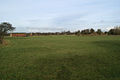
Much Hoole lies eight miles south west of Preston on the A59 from Preston to Ormskirk and Liverpool. It covers 1,701 acres (688 ha) of flat low-lying land. The soil is loam, peat moss and marsh. [4] [8] The River Douglas, which leads to the Ribble Estuary, forms Much Hoole's western boundary. Carr Brook forms its southern boundary. The highest land reaches 70 feet (21 m) above sea level in the east along the boundary with Leyland. The Preston to Southport line (closed in 1964), built by the Lancashire and Yorkshire Railway, crosses the north-west corner of the township. [3]

Population

Population growth in Much Hoole from 1881–1961
Year18811891190119111921193119511961
Population581567624627613621716745

Much Hoole CP/Tn [9]

Transport

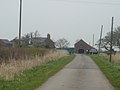
The A59 (Liverpool Road) runs through part of Much Hoole but mainly by-passes the village to the west. The village has regular bus services linking it with Preston, Southport and other local villages. Main roads in the village include the former main road, Liverpool Old Road, which passes through the centre of the village and Town Lane, which merges into Smithy Lane.

Much Hoole and Little Hoole were served by Hoole railway station on the West Lancashire Railway until the line closed in 1964.

In December 2005, plans for a 'microlight farm airstrip' between Bretherton and Much Hoole were rejected by Chorley and South Ribble councillors due to the fear of sound pollution and damage to the surrounding environment.

Facilities

There are two public houses, the Smithy Inn and the Fox Cub. The Rose and Crown, once owned by Albert Pierrepoint the Chief Executioner [10] and the Black Horse pub have been converted to restaurants.

The village primary school is Hoole St. Michael's. The village has a village hall, a park, tennis courts, and a bowling green. In 2006 the Little Chef was converted into an ice cream parlour and tapas bar. Nearby property has been redeveloped into a small shopping and business park. There are new housing developments in the village.

See also

Related Research Articles

South Ribble Borough in England

South Ribble is a borough in the county of Lancashire, England. Its council is based in Leyland. The population, at the 2011 Census, was 109,057. Notable towns and villages include Walton le Dale, Bamber Bridge, Leyland and Penwortham. It is wedged geographically between the towns of Blackburn, Lytham St Annes and Chorley and the city of Preston.

Euxton Human settlement in England

Euxton is a village and civil parish of the Borough of Chorley, in Lancashire, England. The population of the civil parish as taken at the 2011 census was 9,993, however, the population is now significantly higher due to the increase in housing developments in the village, including the Buckshaw development. The village is situated just to the west of Chorley, and to the south of Clayton-le-Woods.

South Ribble (UK Parliament constituency) Parliamentary constituency in the United Kingdom, 1983 onwards

South Ribble is a constituency represented in the House of Commons of the UK Parliament since 2019 by Katherine Fletcher, a Conservative.

Longton, Lancashire Human settlement in England

Longton is a village and civil parish in the west of the borough of South Ribble, Lancashire, England. It is about 4 miles to the south west of Preston. The population of the civil parish, which also includes the village of New Longton, was 5,500 at the 2001 Census increasing to 7,652 at the 2011 Census.

Shevington Village and civil parish within the Metropolitan Borough of Wigan

Shevington is a village and civil parish within the Metropolitan Borough of Wigan, England. The population of the Wigan ward called Shevington and Lower Ground had increased to 11,482 at the 2011 Census.

Tarleton Human settlement in England

Tarleton is a village and civil parish in the borough of South Ribble, Lancashire, England. It situated in the Lancashire mosslands approximately 10 miles north east of Southport, approximately 10 miles south west of Preston, approximately 10 miles west of the town of Chorley, and approximately 10 miles north of Ormskirk. The village is known for farming due to its rich soil quality. The River Douglas runs northwards to the east of the village, which is locally thought to be where the Vikings camped on the river banks of what is now Tarleton. The parish also includes the village of Mere Brow and the hamlets of Sollom and Holmes.

Farington Human settlement in England

Farington is a village and civil parish in the South Ribble local government district of Lancashire, England. The population of the civil parish at the 2011 census was 6,674.

Lostock Hall Human settlement in England

Lostock Hall is a suburban village within the South Ribble borough of Lancashire, England. It is located on the south side of the River Ribble, some 3 miles (4.8 km) south of Preston and 2.5 miles (4 km) north of Leyland. It is bordered on its southeastern side by the interchange for the M6, M61 and M65 motorways. At the time of the United Kingdom Census 2001, the central Lostock Hall area had a population of 3,948, falling to 3,762 at the 2011 Census.

Rufford, Lancashire Human settlement in England

Rufford is a village in West Lancashire, England, where the Leeds and Liverpool Canal, Liverpool, Ormskirk and Preston Railway, the A59 and the River Douglas meet.

Bamber Bridge Human settlement in England

Bamber Bridge is an urban village in Lancashire, England, 3 miles (5 km) south-east of Preston, in the borough of South Ribble. The name derives from the Old English "bēam" and "brycg", which probably means "tree-trunk bridge". The population was 13,945 at the 2011 Census.

Penwortham Human settlement in England

Penwortham is a town in South Ribble, Lancashire, England, on the south bank of the River Ribble facing the city of Preston. The town is at the most westerly crossing point of the river, with major road and rail links crossing it here. The population of the town at the 2011 census was 23,047.

Croston Human settlement in England

Croston is a village and civil parish in Lancashire, England near Chorley. The River Yarrow flows through the village. The population of the civil parish taken at the 2011 census was 1,280.

Bretherton Human settlement in England

Bretherton is a small village and civil parish in the Borough of Chorley, Lancashire, England, situated to the south west of Leyland and east of Tarleton. The population of the civil parish at the 2011 census was 669. Its name suggests pre-conquest origins and its early history was closely involved with the manor house Bank Hall and the families who lived there. Bretherton remained a rural community and today is largely residential with residents commuting to nearby towns.

Hesketh Bank Human settlement in England

Hesketh Bank is a small agricultural village in Lancashire, England. It lies to the north-east of the town of Southport on the Irish Sea estuary of the River Ribble. The area falls under West Lancashire Borough Council for administrative purposes, and Hesketh-with-Becconsall Parish Council for parochial matters. The population of the civil parish at the 2011 census was 4,041. It is in the South Ribble parliamentary constituency.

Banks, Lancashire Human settlement in England

Banks is a large coastal village in Lancashire, England, south of the Ribble estuary four miles (6 km) north-east of Southport. The village is administered by West Lancashire Borough and North Meols Parish Council. It is in the South Ribble parliamentary constituency. At the 2001 census the population of the North Meols civil parish was 3,792, rising to 4,146 by the 2011 census.

Ulnes Walton Human settlement in England

Ulnes Walton is a village and civil parish of the Borough of Chorley in Lancashire, England. According to the United Kingdom Census 2011 it had a population of 2,672.

Hutton is a village and civil parish in Lancashire, England. It is located 3 miles (4.8 km) south west of Preston, in the South Ribble borough and parliamentary constituency. The population of the civil parish at the 2011 census was 2,277.

Ribble Motor Services

Ribble Motor Services was a large regional bus operator in the North West England based in Preston.

The Bank Hall Estate is the demesne of the Jacobean mansion house of Bank Hall, including much of land around the village of Bretherton, which is owned by the Lilford Trust.

Little Hoole Human settlement in England

Little Hoole is a civil parish in Lancashire, England, It contains the village of Walmer Bridge, and the remaining part is predominantly a farming community. Other nearby villages include Much Hoole and Longton. The parish had a population of 1,815 people in 2001, increasing to 2,070 at the 2011 Census.

References

  1. 1 2 UK Census (2011). "Local Area Report – Much Hoole Parish (E04005297)". Nomis. Office for National Statistics . Retrieved 26 March 2021.
  2. Mills 1976 , p. 97
  3. 1 2 3 Farrer, William; Brownbill, J, eds. (1911), "Townships:Much Hoole", A History of the County of Lancaster: Volume 6, British History Online, pp. 149–153, retrieved 1 October 2011
  4. 1 2 3 Lewis, Samuel (1848), "Hoole(Holy Trinity)", A Topographical Dictionary of England, British History Online, pp. 542–545, retrieved 4 June 2010
  5. Workhouse, Workhouses.org, retrieved 1 October 2011
  6. Preston RD, Vision of Britain, accessed 9 June 2014
  7. "Archived copy". Archived from the original on 26 August 2002. Retrieved 28 February 2010.{{cite web}}: CS1 maint: archived copy as title (link)
  8. Much Hoole Township Boundaries, GenUKI, retrieved 1 December 2010
  9. Much Hoole Ch/CP : Total Population, Vision of Britain, retrieved 1 December 2010
  10. "Albert Pierrepoint, 87, Hangman In Hundreds of British Executions". The New York Times . 13 July 1992. Retrieved 26 August 2008.

Bibliography