| Moss Side | |
|---|---|
 A picture of the Black Bull pub, now demolished and replaced with the 'Old Orchard Place' housing estate | |
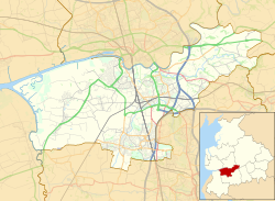 Moss Side Shown within South Ribble  Moss Side Location within Lancashire | |
| Area | 4.482 km2 (1.731 sq mi) |
| Population | 3,894 (2021 census) |
| • Density | 869/km2 (2,250/sq mi) |
| District | |
| Shire county | |
| Region | |
| Country | England |
| Sovereign state | United Kingdom |
| Police | Lancashire |
| Fire | Lancashire |
| Ambulance | North West |
Moss Side is a suburban, semi-rural community on the western side of Leyland and ward in the South Ribble district, in the county of Lancashire, England. [1] The growing suburb is adjacent to Bretherton, Ulnes Walton and Midge Hall. In 2021 the ward had a population of 3894. [2]
Contents
- Features of the area
- Public houses
- Schools
- Churches
- Moss Side Community Centre
- Industrial estate
- References
There is a Scouts group in the area and a concert party who perform for senior citizens. There are bowling and running groups in the community as well.
There were plans to build a new Redrow apartment development, but local residents fought a determined campaign to oppose this and planning permission was ultimately refused in December 2005.
A new ball court and a children's playground were completed in 2005 and a better community is coming together overall.
Moss Side has seen an increase in community involvement in recent years. This has delivered benefits such as the Moss Side Community Newsletter, a Moss Side football team and the new 'Your Moss Side' website.