This article needs additional citations for verification .(June 2025) |
| Midge Hall | |
|---|---|
 Midge Hall Methodist Church | |
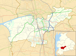 Midge Hall Shown within South Ribble  Midge Hall Location within Lancashire | |
| OS grid reference | SD514232 |
| District | |
| Shire county | |
| Region | |
| Country | England |
| Sovereign state | United Kingdom |
| Post town | LEYLAND |
| Postcode district | PR26 |
| Dialling code | 01772 |
| Police | Lancashire |
| Fire | Lancashire |
| Ambulance | North West |
| UK Parliament | |
Midge Hall is a small village on the outskirts of Leyland in the borough of South Ribble, Lancashire, England.
Contents
Notable features include the Midge Hall pub (formerly The Railway, and adjacent to the level crossing), [1] a mill which produces animal feed and a test track for cars and wagons from the Leyland Trucks factory.
There is a disused railway station which is on the Ormskirk Branch Line.