Farington

Last updated

Farington
Farington Lodge Hotel - geograph.org.uk - 1389740.jpg
Farington Lodge Hotel
Location map United Kingdom Borough of South Ribble 2020.svg
Red pog.svg
Farington
Shown within South Ribble
Lancashire UK location map.svg
Red pog.svg
Farington
Location within Lancashire
Population6,674  (2011 census) [1]
OS grid reference SD548232
Civil parish
  • Farington
District
Shire county
Region
Country England
Sovereign state United Kingdom
Post town LEYLAND
Postcode district PR25, PR26
Dialling code 01772
Police Lancashire
Fire Lancashire
Ambulance North West
UK Parliament
List of places
UK
England
Lancashire
53°42′11″N2°41′06″W / 53.703°N 2.685°W / 53.703; -2.685

Farington is a village and civil parish in the South Ribble local government district of Lancashire, England. The population of the civil parish at the 2011 census was 6,674. [2]

Contents

History

The parish was part of Preston Rural District throughout its existence from 1894 to 1974. [3] In 1974 the parish became part of South Ribble.

Farington railway station served the area from 1838 to 1960. [4]

Governance

Farington is a civil parish in South Ribble district; with Lostock Hall and Tardy Gate and Farington Moss it forms the district's Central Villages area chaired by Cllr Paul Wharton-Hardman BEM (July 2023). [5] It was also within the Parliamentary Constituency of South Ribble until the 2010 general election. However, at the recommendation of the Boundary Commission, the area was moved into the Ribble Valley constituency, but will be returning to South Ribble under new boundary changes in 2023. The parish includes the villages of Farington and Farington Moss, and parts of Lostock Hall and Whitestake.

Farington Parish has four South Ribble Councillors; Cllr George Rear and Cllr Karen Walton representing Farington West ward both elected as Conservative members, and Cllr Paul Wharton-Hardman BEM and Cllr Jacky Alty representing Farington East ward elected Labour members.

Lancashire County Council's Farington electoral division is represented by Michael Green, a Conservative Councillor. It comprises both Farington wards and Moss Side. [6]

Geography

Situated to the immediate north of Leyland, Farington consists of villages, farms and mossland, modern residential development and an industrial area around the Leyland Trucks headquarters and assembly plant. [7] [8]

The relationship between Farington and Leyland has always been strong but Farington is not part of Leyland. Stanifield Lane which runs through the village and into Leyland is the main thoroughfare for shoppers and commuters alike. There is a Catholic convent in Farington, serving a moderately large Catholic population.[ citation needed ] Farington has a park that has been referred to as the home of football in South Ribble.[ citation needed ]

It is home to the main tip site for South Ribble, the Farington Household Waste Recycling Centre.

Economy

Leyland Trucks, with HQ and assembly plant in Farington, is a major employer in the area. The Central Lancashire Primary Care Trust has its head office in the area. [5] Enterprise plc, a provider of support services to the public sector and utility companies, was based in Farington but has been integrated into Amey plc, which moved from its offices there when the lease expired in 2014 [9] There are few retail facilities in the centre of Farington, [10] but retail parks and Leyland town centre are nearby.

See also

Related Research Articles

<span class="mw-page-title-main">South Ribble</span> Borough and non-metropolitan district in England

South Ribble is a local government district with borough status in Lancashire, England. Its council is based in Leyland. The borough also includes the towns and villages of Penwortham, Leyland, Farington, Hutton, Longton, Walmer Bridge, Salmesbury, Lostock Hall, Walton le Dale and Bamber Bridge. Many of the built-up areas in the borough form part of the wider Preston built-up area.

<span class="mw-page-title-main">Ribble Valley</span> Borough and non-metropolitan district in England

Ribble Valley is a local government district with borough status in Lancashire, England. Its council is based in Clitheroe, the largest town. The borough also includes the town of Longridge and numerous villages and surrounding rural areas. It is named after the River Ribble. Much of the district lies within the Forest of Bowland, a designated Area of Outstanding Natural Beauty.

<span class="mw-page-title-main">Civil parishes in Lancashire</span>

A civil parish is a subnational entity, forming the lowest unit of local government in England. There are 219 civil parishes in the ceremonial county of Lancashire; Blackpool is completely unparished; Pendle and Ribble Valley are entirely parished. At the 2001 census, there were 587,074 people living in the 219 parishes, accounting for 41.5 per cent of the county's population.

<span class="mw-page-title-main">Ribble Valley (UK Parliament constituency)</span> Parliamentary constituency in the United Kingdom, 1983 onwards

Ribble Valley is a constituency in Lancashire represented in the House of Commons of the UK Parliament since 1992 by Nigel Evans, a Conservative. Evans has served as a Deputy Speaker of the House of Commons and Second Deputy Chairman of Ways and Means since January 2020; he previously served as First Deputy Chairman of Ways and Means from 2010 to 2013.

<span class="mw-page-title-main">South Ribble (UK Parliament constituency)</span> Parliamentary constituency in the United Kingdom, 1983 onwards

South Ribble is a constituency represented in the House of Commons of the UK Parliament since 2019 by Katherine Fletcher, a Conservative.

<span class="mw-page-title-main">Tarleton</span> Human settlement in England

Tarleton is a village and civil parish in the West Lancashire district of Lancashire, England. It is situated approximately 19 miles (31 km) north-east of Liverpool and 9 miles (14 km) south-west of Preston. The parish includes the village of Mere Brow and the hamlets of Sollom and Holmes, and is an agricultural area. It had a population of 5,959 at the 2021 Census. Tarleton village, Holmes, and the villages of Hesketh Bank and Becconsall to the north form a single built-up area with a population of 8,755.

<span class="mw-page-title-main">Lostock Hall</span> Human settlement in England

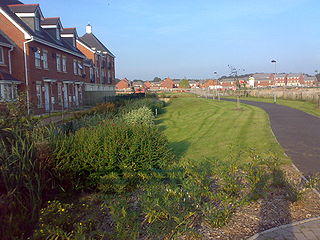
Lostock Hall is a suburban village within the South Ribble borough of Lancashire, England. It is located on the south side of the River Ribble, some 3 miles (4.8 km) south of Preston and 3 miles (5 km) north of Leyland. It is bordered on its southeastern side by the interchange for the M6, M61 and M65 motorways.

<span class="mw-page-title-main">Lostock Hall railway station</span>

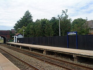
Lostock Hall railway station is a railway station serving the village of Lostock Hall in the South Ribble borough of Lancashire, England. It is on the East Lancashire Line and is managed by Northern, who also provide all passenger trains serving it.

<span class="mw-page-title-main">Bamber Bridge</span> Human settlement in England

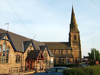
Bamber Bridge is a large village in Lancashire, England, 3 miles (5 km) south-east of Preston, in the borough of South Ribble. The name derives from the Old English "bēam" and "brycg", which probably means "tree-trunk bridge". People who live in Bamber Bridge like to be known as Briggers.

<span class="mw-page-title-main">Penwortham</span> Human settlement in England

Penwortham is a town and civil parish in South Ribble, Lancashire, England, on the south bank of the River Ribble facing the city of Preston. The town is at the most westerly crossing point of the river, with major road and rail links crossing it here. The population of the town at the 2011 census was 23,047.

<span class="mw-page-title-main">Buckshaw Village</span> Residential and industrial area in Lancashire, England

Buckshaw Village is a 21st-century residential and industrial area between the towns of Chorley and Leyland in Lancashire, England, developed on the site of the former Royal Ordnance Factory (ROF) Chorley. It had a population of 4,000. It is divided between the civil parishes of Euxton (south) and Whittle-le-Woods in Chorley, with the north western part being in Leyland unparished area in South Ribble district.

<span class="mw-page-title-main">Bretherton</span> Human settlement in England

Bretherton is a small village and civil parish in the Borough of Chorley, Lancashire, England, situated to the south west of Leyland and east of Tarleton. The population of the civil parish at the 2011 census was 669. Its name suggests pre-conquest origins and its early history was closely involved with the manor house Bank Hall and the families who lived there. Bretherton remained a rural community and today is largely residential with residents commuting to nearby towns.

<span class="mw-page-title-main">Much Hoole</span> Human settlement in England

Much Hoole is a village and civil parish in the borough of South Ribble, Lancashire, England. The parish of Much Hoole had a population of 1,851 at the time of the 2001 census, increasing to 1,997 at the 2011 Census.

<span class="mw-page-title-main">Leyland, Lancashire</span> Town in Lancashire, England

Leyland is a town in South Ribble, Lancashire, England, 6 miles (10 km) south of Preston. The population was 35,578 at the 2011 Census.

Chorley Interchange is a bus station in Chorley, England.

<span class="mw-page-title-main">Gregson Lane</span> Human settlement in England

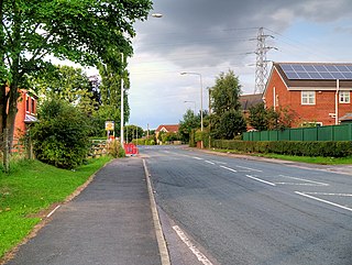
Gregson Lane is a village in Lancashire, England. It is situated between Bamber Bridge, Higher Walton, Coupe Green and Brindle, and is within four miles of the city of Preston.

<span class="mw-page-title-main">Farington Moss</span> Human settlement in England

Farington Moss is a village approximately two miles to the north of Leyland, Lancashire, England. It is a typical English village with one school and one church. To the northeast of the village runs the main west coast railway line.

<span class="mw-page-title-main">St Paul's Church, Farington</span> Church in Lancashire, England

St Paul's Church is in the village of Farington Moss, Lancashire, England. It is an active Anglican parish church in the deanery of Leyland, the archdeaconry of Blackburn and the diocese of Blackburn. Its benefice is united with that of St James, Lostock Hall. The church is recorded in the National Heritage List for England as a designated Grade II listed building. It was a Commissioners' church, having received a grant towards its construction from the Church Building Commission.

<span class="mw-page-title-main">City of Preston, Lancashire</span> City and non-metropolitan district in Lancashire, England

The City of Preston, or simply Preston, is a local government district with city status in Lancashire, England. It lies on the north bank of the River Ribble and has a population of 147,617 (2021). The neighbouring districts are Ribble Valley, South Ribble, Fylde and Wyre.

References

  1. "Archived copy" (PDF). Archived from the original (PDF) on 10 December 2006. Retrieved 2008-04-13.{{cite web}}: CS1 maint: archived copy as title (link)
  2. UK Census (2011). "Local Area Report – Farington Parish (E04005293)". Nomis. Office for National Statistics . Retrieved 26 March 2021.
  3. Preston RD, Vision of Britain, accessed 9 June 2014
  4. Butt, R. V. J. (October 1995). The Directory of Railway Stations: details every public and private passenger station, halt, platform and stopping place, past and present (1st ed.). Sparkford: Patrick Stephens Ltd. pp. 94–95. ISBN   978-1-85260-508-7. OCLC   60251199. OL   11956311M.
  5. 1 2 "Central Area Factfile" (PDF). South Ribble Borough Council. 20 October 2009. Retrieved 3 May 2013.[ permanent dead link ]
  6. "The County of Lancashire (Electoral Changes) Order 2005 No. 170". The National Archives. Retrieved 3 May 2013.
  7. "MARIO: Maps & Related Information Online". Lancashire County Council. Retrieved 11 August 2009.
  8. "A Landscape Strategy for Lancashire - Landscape Character Assessment: Mosslands". Lancashire County Council. Archived from the original on 17 February 2010. Retrieved 11 August 2009.
  9. Coates, David (16 April 2013). "Enterprise quitting county head office". Lancashire Evening Post. Johnston Publishing. Archived from the original on 7 May 2013. Retrieved 3 May 2013.
  10. "'Too many takeaways', say planners". Lancashire Evening Post. Johnston Publishing. 2 December 2011. Retrieved 3 May 2013.