Coupe Green

Last updated

Coupe Green
Old Oak Inn, Coupe Green - geograph.org.uk - 166201.jpg
The Old Oak Inn public house, Coupe Green
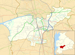
Location map United Kingdom Borough of South Ribble 2020.svg
Red pog.svg
Coupe Green
Shown within South Ribble
Lancashire UK location map.svg
Red pog.svg
Coupe Green
Location within Lancashire
OS grid reference SD592275
District
Shire county
Region
Country England
Sovereign state United Kingdom
Post town PRESTON
Postcode district PR5
Dialling code 01254
Police Lancashire
Fire Lancashire
Ambulance North West
UK Parliament
List of places
UK
England
Lancashire
53°44′31″N2°37′01″W / 53.742°N 2.617°W / 53.742; -2.617

Coupe Green or Coup Green is a village in Lancashire, England. It is located on the A675 between Higher Walton and Hoghton. The village is in the borough of South Ribble and the Ribble Valley parliamentary constituency. The village has a primary school which opened in 1975, [1] one pub ( [2] ) and a few shops including a hairdresser and a Texaco petrol station.

The village is situated in the Hoghton postal district as Royal Mail does not recognise it as a separate village, this postal district also includes Gregson Lane and Hoghton is often called the village of two halves by residents. Despite this, it is administratively and geographically separate. The village is in the Coupe Green & Gregson Lane ward which elects two councillors, At the May 2023 election, two councillors were elected, one from the Labour party, James Gleeson and one Independant, Matthew Forshaw. [3]

Related Research Articles

<span class="mw-page-title-main">South Ribble</span> Borough and non-metropolitan district in England

South Ribble is a local government district with borough status in Lancashire, England. Its council is based in Leyland. The borough also includes the towns and villages of Penwortham, Leyland, Farington, Hutton, Longton, Walmer Bridge, Salmesbury, Lostock Hall, Walton le Dale and Bamber Bridge. Many of the built-up areas in the borough form part of the wider Preston built-up area.

<span class="mw-page-title-main">Ribble Valley</span> Borough and non-metropolitan district in England

Ribble Valley is a local government district with borough status in Lancashire, England. Its council is based in Clitheroe, the largest town. The borough also includes the town of Longridge and numerous villages and surrounding rural areas. It is named after the River Ribble. Much of the district lies within the Forest of Bowland, a designated Area of Outstanding Natural Beauty.

<span class="mw-page-title-main">Borough of Chorley</span> Borough and non-metropolitan district in England

The Borough of Chorley is a local government district with borough status in Lancashire, England. It is named after the town of Chorley, which is an unparished area. The borough extends to several villages and hamlets including Adlington, Buckshaw Village, Croston, Eccleston, Euxton and Whittle-le-Woods.

<span class="mw-page-title-main">Ribble Valley (UK Parliament constituency)</span> Parliamentary constituency in the United Kingdom, 1983 onwards

Ribble Valley is a constituency in Lancashire represented in the House of Commons of the UK Parliament since 1992 by Nigel Evans, a Conservative. Evans has served as a Deputy Speaker of the House of Commons and Second Deputy Chairman of Ways and Means since January 2020; he previously served as First Deputy Chairman of Ways and Means from 2010 to 2013.

<span class="mw-page-title-main">South Ribble (UK Parliament constituency)</span> Parliamentary constituency in the United Kingdom, 1983 onwards

South Ribble is a constituency represented in the House of Commons of the UK Parliament since 2019 by Katherine Fletcher, a Conservative.

<span class="mw-page-title-main">Farington</span> Human settlement in England

Farington is a village and civil parish in the South Ribble local government district of Lancashire, England. The population of the civil parish at the 2011 census was 6,674.

<span class="mw-page-title-main">Grimsargh</span> Human settlement in England

Grimsargh is a village and civil parish in the City of Preston, Lancashire, England. located 6 miles (10 km) east of Preston.

<span class="mw-page-title-main">Lostock Hall</span> Human settlement in England

Lostock Hall is a suburban village within the South Ribble borough of Lancashire, England. It is located on the south side of the River Ribble, some 3 miles (4.8 km) south of Preston and 3 miles (5 km) north of Leyland. It is bordered on its southeastern side by the interchange for the M6, M61 and M65 motorways.

<span class="mw-page-title-main">Idle Toad</span> Political party in the United Kingdom

The Idle Toad was a registered English political party which fought elections in the South Ribble district of Lancashire, England.

<span class="mw-page-title-main">South Ribble Borough Council elections</span> Class of election in the United Kingdom

South Ribble Borough Council elections are held every four years. South Ribble Borough Council is the local authority for the non-metropolitan district of South Ribble in Lancashire, England. Since the last boundary changes in 2015, 50 councillors have been elected from 23 wards. The next borough council elections are due to take place in 2027 as part of the wider 2027 United Kingdom local elections.

<span class="mw-page-title-main">Chipping, Lancashire</span> Human settlement in England

Chipping is a village and civil parish in the borough of Ribble Valley, Lancashire, England, within the Forest of Bowland Area of Outstanding Natural Beauty. Its grid reference is SD6243, and the nearest substantial settlement is Longridge, nearly 4 mi (6.4 km) to the south. In the 2001 census, the parish had a population of 1,046, falling slightly to 1,043 at the 2011 census. The village has won several best-kept village competitions over the years. The village also won the village section of the Royal Horticultural Society Britain in Bloom competition in 2009, picking up RHS Tourism and Gold achievement awards in the process.

<span class="mw-page-title-main">Much Hoole</span> Human settlement in England

Much Hoole is a village and civil parish in the borough of South Ribble, Lancashire, England. The parish of Much Hoole had a population of 1,851 at the time of the 2001 census, increasing to 1,997 at the 2011 Census.

Ash Green is a village in the Nuneaton and Bedworth borough of Warwickshire, England. It forms part of the Coventry and Bedworth urban area.

<span class="mw-page-title-main">Leyland, Lancashire</span> Town in Lancashire, England

Leyland is a town in South Ribble, Lancashire, England, 6 miles (10 km) south of Preston. The population was 35,578 at the 2011 Census.

<span class="mw-page-title-main">Chatburn</span> Village in Lancashire, England

Chatburn is a village, civil parish and electoral ward in the Ribble Valley, East Lancashire, England. The population of the civil parish at the 2011 census was 1,102. Situated in a hollow between two ridges north-east of Clitheroe, just off the A59 road, relatively near Pendle Hill south-east of the village. Lanehead quarry is situated to the West at the termination of Chatburn Old Road. Ribble lane at 240 above sea level leads down to the River Ribble North of the village, the top of Downham road being 150 feet higher.

<span class="mw-page-title-main">Hoghton</span> Human settlement in England

Hoghton is a small village and civil parish in the Borough of Chorley, Lancashire, England. At the 2011 Census, it had a population of 802. Brindle and Hoghton ward also includes the parish of Brindle.

<span class="mw-page-title-main">Higher Walton, Lancashire</span> Human settlement in England

Higher Walton is a village in South Ribble, Lancashire, England. It is on the old road between Blackburn and Preston where it crosses the River Darwen. The road, at this point, is now part of the A675. Nearby places include Walton-le-Dale, Coupe Green, and Bamber Bridge.

<span class="mw-page-title-main">Gregson Lane</span> Human settlement in England

Gregson Lane is a village in Lancashire, England. It is situated between Bamber Bridge, Higher Walton, Coupe Green and Brindle, and is within four miles of the city of Preston.

<span class="mw-page-title-main">Goldington</span> Human settlement in England

Goldington is part of Bedford, Bedfordshire, England. It encompasses much of the historic village and parish of Goldington that was merged with Bedford in 1934, although some parts of the old village are within the neighbouring Newnham ward. It also includes two modern estates that are part of Renhold parish.

References

https://www.southribble.gov.uk/article/1173/Councillors