Higher Walton, Lancashire

Last updated

Higher Walton
Parish Church of All Saints - geograph.org.uk - 2088024.jpg
All Saints Church, Higher Walton
Location map United Kingdom Borough of South Ribble 2020.svg
Red pog.svg
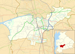
Higher Walton
Shown within South Ribble
Lancashire UK location map.svg
Red pog.svg
Higher Walton
Location within Lancashire
OS grid reference SD575275
District
Shire county
Region
Country England
Sovereign state United Kingdom
Post town PRESTON
Postcode district PR5
Dialling code 01772
Police Lancashire
Fire Lancashire
Ambulance North West
UK Parliament
List of places
UK
England
Lancashire
53°44′35″N2°38′38″W / 53.743°N 2.644°W / 53.743; -2.644

Higher Walton is a village in South Ribble, Lancashire, England. It is on the old road between Blackburn and Preston where it crosses the River Darwen. The road, at this point, is now part of the A675. Nearby places include Walton-le-Dale, Coupe Green, and Bamber Bridge.

Contents

The main road through the village has a number of shops, including a post office, a bicycle shop and takeaways. The village has two pubs - the Swan and the Mill Tavern. There is a church (All Saints, in the Blackburn diocese of the Church of England) [1] and a primary school in the village.

The M6 motorway passes through the village, west of the centre, and crosses the River Darwen and A675 Higher Walton Road on a 474 feet (144 m)-long bridge that was built as part of the Preston Bypass and opened in 1958. [2]

The village was formerly called Moon's Mill, [3] and developed around a cotton mill in the 19th century. [4]

Governance

Higher Walton is in the county of Lancashire. It is part of the district of South Ribble, which is a borough formed in 1974 after the reorganisation of local government in the Local Government Act 1972.[ citation needed ] It had been part of the township of Walton-le-Dale. In 1877, a local board was formed for the township, which in 1894 became Walton le Dale Urban District. [3] [5]

As part of the Samlesbury & Walton ward, Higher Walton is represented on South Ribble Borough Council by two councillors, and as of 2010, both are from the Conservative Party. [6]

Famous residents

The contralto, Kathleen Ferrier (1912–1953) was born in the village. [7]

See also

Related Research Articles

<span class="mw-page-title-main">Lancashire</span> County of England

Lancashire is a ceremonial county in North West England. It is bordered by Cumbria to the north, North Yorkshire and West Yorkshire to the east, Greater Manchester and Merseyside to the south, and the Irish Sea to the west. The largest settlement is Blackpool, and county town is the city of Preston.

<span class="mw-page-title-main">Preston, Lancashire</span> City in Lancashire, England

Preston is a city on the north bank of the River Ribble in Lancashire, England. The city is the administrative centre of the county of Lancashire and the wider City of Preston local government district. Preston and its surrounding district obtained city status in 2002, becoming England's 50th city in the 50th year of Queen Elizabeth II's reign. Preston has a population of 114,300, the City of Preston district 132,000 and the Preston Built-up Area 313,322. The Preston Travel To Work Area, in 2011, had a population of 420,661, compared with 354,000 in the previous census.

<span class="mw-page-title-main">Blackburn</span> Town in Lancashire, England

Blackburn is an industrial town and the administrative centre of the Blackburn with Darwen borough in Lancashire, England. The town is north of the West Pennine Moors on the southern edge of the Ribble Valley, 8 mi (13 km) east of Preston and 21 mi (34 km) north-northwest of Manchester. Blackburn is the core centre of the wider unitary authority area along with the town of Darwen. It is the second largest town in Lancashire.

<span class="mw-page-title-main">Darwen</span> Human settlement in England

Darwen is a market town and civil parish in the Blackburn with Darwen borough in Lancashire, England. The residents of the town are known as "Darreners". The A666 road passes through Darwen towards Blackburn to the north, Bolton to the south and Pendlebury where it joins the A6, about 18 miles (29 km) north-west of Manchester. The population of Darwen stood at 28,046 in the 2011 census. The town comprises four wards and has its own town council.

<span class="mw-page-title-main">South Ribble</span> Borough in England

South Ribble is a borough in the county of Lancashire, England. Its council is based in Leyland. The population, at the 2011 Census, was 109,057. Notable towns and villages include Walton le Dale, Bamber Bridge, Leyland and Penwortham. It is wedged geographically between the towns of Blackburn, Lytham St Annes and Chorley and the city of Preston.

<span class="mw-page-title-main">River Ribble</span> River in North Yorkshire and Lancashire, England

The River Ribble runs through North Yorkshire and Lancashire in Northern England. It starts close to the Ribblehead Viaduct in North Yorkshire, and is one of the few that start in the Yorkshire Dales and flow westwards towards the Irish Sea.

<span class="mw-page-title-main">Blackburn Hundred</span> Former sub-division of Lancashire, UK

Blackburn Hundred is a historic sub-division of the county of Lancashire, in northern England. Its chief town was Blackburn, in the southwest of the hundred. It covered an area similar to modern East Lancashire, including the current districts of Ribble Valley, Pendle, Burnley, Rossendale, Hyndburn, Blackburn with Darwen, and South Ribble.

<span class="mw-page-title-main">River Darwen</span> River in Lancashire, England

The River Darwen runs through Darwen and Blackburn in Lancashire, England, eventually joining the River Ribble at Walton le Dale south of Preston on its way to the Ribble Estuary.

<span class="mw-page-title-main">Civil parishes in Lancashire</span>

A civil parish is a subnational entity, forming the lowest unit of local government in England. There are 219 civil parishes in the ceremonial county of Lancashire; Blackpool is completely unparished; Pendle and Ribble Valley are entirely parished. At the 2001 census, there were 587,074 people living in the 219 parishes, accounting for 41.5 per cent of the county's population.

<span class="mw-page-title-main">Ribble Valley (UK Parliament constituency)</span> Parliamentary constituency in the United Kingdom, 1983 onwards

Ribble Valley is a constituency in Lancashire represented in the House of Commons of the UK Parliament since 1992 by Nigel Evans, a Conservative. Evans has served as a Deputy Speaker of the House of Commons and Second Deputy Chairman of Ways and Means since January 2020; he previously served as First Deputy Chairman of Ways and Means from 2010 to 2013.

<span class="mw-page-title-main">South Ribble (UK Parliament constituency)</span> Parliamentary constituency in the United Kingdom, 1983 onwards

South Ribble is a constituency represented in the House of Commons of the UK Parliament since 2019 by Katherine Fletcher, a Conservative.

<span class="mw-page-title-main">Walton-le-Dale</span> Human settlement in England

Walton-le-Dale is a large village in the borough of South Ribble, in Lancashire, England. It lies on the south bank of the River Ribble, opposite the city of Preston, adjacent to Bamber Bridge. The population of the South Ribble Ward at the 2011 census was 3,792. To the west of Walton-le-Dale is the residential area of Walton Park.

<span class="mw-page-title-main">Lostock Hall</span> Human settlement in England

Lostock Hall is a suburban village within the South Ribble borough of Lancashire, England. It is located on the south side of the River Ribble, some 3 miles (4.8 km) south of Preston and 2.5 miles (4 km) north of Leyland. It is bordered on its southeastern side by the interchange for the M6, M61 and M65 motorways.

<span class="mw-page-title-main">Bamber Bridge</span> Human settlement in England

Bamber Bridge is a large village in Lancashire, England, 3 miles (5 km) south-east of Preston, in the borough of South Ribble. The name derives from the Old English "bēam" and "brycg", which probably means "tree-trunk bridge". People who live in Bamber Bridge like to be known as Briggers.

<span class="mw-page-title-main">Diocese of Blackburn</span> Diocese of the Church of England

The Diocese of Blackburn is a Church of England diocese, covering much of Lancashire, created on 12 November 1926 from part of the Diocese of Manchester. The diocese includes the towns of Blackburn, Blackpool and Burnley, the cities of Lancaster and Preston, as well as a large part of the Ribble Valley. The cathedral is Blackburn Cathedral. The current bishop diocesan is Philip North.

<span class="mw-page-title-main">Transport in Preston</span>

Preston is a city in Lancashire, around 50 kilometres (31 mi) north-west of Manchester.

<span class="mw-page-title-main">St Leonard's Church, Walton-le-Dale</span> Church in Lancashire, England

St Leonard's Church is an Anglican church in Walton-le-Dale, Lancashire, England. It is an active parish church in the Diocese of Blackburn and the archdeaconry of Blackburn. In 1950 it was designated as a Grade II* listed building. Parts of the church date from the 16th century and the nave and transepts were rebuilt in the early 20th century.

<span class="mw-page-title-main">All Saints Church, Higher Walton</span> Church in Lancashire, England

All Saints Church is in Blackburn Road in the village of Higher Walton, Lancashire, England. It is an active Anglican parish church in the deanery of Leyland, the archdeaconry of Blackburn, and the diocese of Blackburn. The church is recorded in the National Heritage List for England as a designated Grade II listed building.

References

  1. Blackburn Diocese: LEYLAND Deanery Archived 11 December 2007 at the Wayback Machine
  2. Harry L. Yeadon (2005). The Motorway Achievement: Building the Network: The North West of England. Chichester, West Sussex: Phillimore & Co. Ltd. p. 17.
  3. 1 2 William Farrer; J Brownbill (eds.). A History of the County of Lancaster: Volume 6 (1911): Townships: Walton-le-Dale. pp. 289–300. Retrieved 26 April 2008 via British History Online.
  4. Higher Walton Books Archived 9 September 2006 at the Wayback Machine
  5. "Walton le Dale UD Lancashire through time: Boundaries of Local Government District". A Vision of Britain Through Time. Retrieved 25 April 2008.[ dead link ]
  6. "Member and Committee Information". South Ribble Borough Council. Archived from the original on 14 October 2011. Retrieved 22 December 2010.
  7. "OBITUARY:Winifred Ferrier". The Independent. London.[ dead link ]

Commons-logo.svg Media related to Higher Walton, Lancashire at Wikimedia Commons