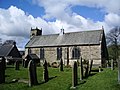
Grindleton

Last updated

Grindleton
Duke of York, Grindleton - geograph.org.uk - 759026.jpg
The Duke of York Pub, at the bottom of Main St
Location map United Kingdom Borough of Ribble Valley.svg
Red pog.svg
Grindleton
Location in Ribble Valley Borough
Location map United Kingdom Forest of Bowland.svg
Red pog.svg
Grindleton
Location in the Forest of Bowland
Lancashire UK location map.svg
Red pog.svg
Grindleton
Location within Lancashire
Population772  (2011 Census) [1]
OS grid reference SD758455
Civil parish
  • Grindleton
District
Shire county
Region
Country England
Sovereign state United Kingdom
Post town CLITHEROE
Postcode district BB7
Dialling code 01200
Police Lancashire
Fire Lancashire
Ambulance North West
UK Parliament
List of places
UK
England
Lancashire
53°54′22″N2°22′05″W / 53.906°N 2.368°W / 53.906; -2.368

Grindleton is a village and civil parish in the Ribble Valley district of the English county of Lancashire, traditionally in the West Riding of Yorkshire. Its 3,700 acres sit within the Forest of Bowland. The population of the civil ward taken at the 2011 census was 772. [1]

Contents

History

Craven in the Domesday Book shows that up till 1066 Earl Tostig was lord of Grindleton and the surrounding areas of West Bradford, Waddington, Bashall Eaves, Great Mitton, Hammerton, Slaidburn, Dunnow, Newton, Bogeuurde, Easington, Radholme Laund and Lees. This amounted to 36 carucates (ca5580 acres/1800ha) of ploughland. The Norman conquest of England added it to the extensive lands of Roger de Poitou. [2]

A caput manor in Domesday, Grindleton was subsumed into the Liberty of Slaidburn in the second half of the fourteenth century. Bowland underwent wholesale manorial reorganisation at that time, perhaps in response to the fall in population caused by the Black Death (1348–50) and the absorption of Bowland into the Duchy of Lancaster. [3]

Both Grindleton and Slaidburn fell under the ancient Lordship of Bowland which comprised a Royal Forest and a Liberty of ten manors spanning eight townships and four parishes and covered an area of almost 300 square miles (780 km2) on the historic borders of Lancashire and Yorkshire. [4] The manors within the Liberty were Slaidburn (Newton-in-Bowland, West Bradford, Grindleton), Knowlmere, Waddington, Easington, Bashall Eaves, Mitton, Withgill (Crook), Leagram, Hammerton and Dunnow (Battersby) . [5] Until 1938, Harrop was an enclave of the Forest before it was subsumed into Grindleton civil parish.

Grindletonians

The Grindletonians were a small nonconformist Christian dissenting sect founded at Grindleton in the early part of the 17th century. The group's leader was Roger Brearley (or Brierley, Brereley) (1586–1637), a curate who worked at Grindleton, Kildwick and Burnley. The beliefs of the sect are unclear, but seem to have included Antinomianism, anti-clericalism and the concept of an earthly Paradise.

Notable current & former residents

Governance

The civil parish of Grindleton was created from the township (in the ancient parish of Mitton) with the same name in 1866. In 1938, a geographically non-contiguous area of Bowland Forest Low was transferred to Grindleton. [6]

Along with Waddington, West Bradford and Sawley the parish forms the Waddington and West Bradford ward of Ribble Valley Borough Council. [7] [8]

See also

Related Research Articles

<span class="mw-page-title-main">Forest of Bowland</span> Upland conservation area in Lancashire, England

The Forest of Bowland, also known as the Bowland Fells and formerly the Chase of Bowland, is an area of gritstone fells, deep valleys and peat moorland, mostly in north-east Lancashire, England, with a small part in North Yorkshire. It is a western outlier of the Pennines.

<span class="mw-page-title-main">Ribble Valley</span> Borough and non-metropolitan district in England

Ribble Valley is a local government district with borough status in Lancashire, England. Its council is based in Clitheroe, the largest town. The borough also includes the town of Longridge and numerous villages and surrounding rural areas. It is named after the River Ribble. Much of the district lies within the Forest of Bowland, a designated Area of Outstanding Natural Beauty.

<span class="mw-page-title-main">Newton-in-Bowland</span> Human settlement in England

Newton or Newton-in-Bowland is a village and civil parish in the Ribble Valley district, in the county of Lancashire, England, formerly known as Newton-on-Hodder. The civil parish had a population of 237 in 2001, according to the United Kingdom Census, increasing to 315 at the 2011 Census. The township covers almost 6,000 acres of the Forest of Bowland. Historically, the village is part of the West Riding of Yorkshire, but was transferred to Lancashire for administrative purposes on 1 April 1974, under the provisions of the Local Government Act 1972.

<span class="mw-page-title-main">Bashall Eaves</span> Village and civil parish in the Ribble Valley district of Lancashire, England

Bashall Eaves is a village and civil parish in the Ribble Valley district of Lancashire, England, about four miles (6 km) west of Clitheroe. The placename element eaves is Old English and refers to Bashall's location on the borders of the Forest of Bowland. Historically, the village is part of the West Riding of Yorkshire, but was transferred to Lancashire for administrative purposes on 1 April 1974, under the provisions of the Local Government Act 1972.

<span class="mw-page-title-main">Slaidburn</span> Human settlement in England

Slaidburn is a village and civil parish within the Ribble Valley district of Lancashire, England. The parish covers just over 5,000 acres of the Forest of Bowland.

<span class="mw-page-title-main">Bolton-by-Bowland</span> Human settlement in England

Bolton-by-Bowland is a village and civil parish in the Ribble Valley district of Lancashire, England. Before 1974, the village was part of Bowland Rural District in the West Riding of Yorkshire. According to the census of 2001, the parish had a population of just 498, rising marginally to 499 at the census of 2011.

<span class="mw-page-title-main">Bowland Forest Low</span> Human settlement in England

Bowland Forest Low is a civil parish in the Ribble Valley district of Lancashire, England, covering some 5,500 acres (22 km2) of the Forest of Bowland. According to the 2001 census, the parish had a population of 168, falling to 160 at the 2011 Census. The parish includes the hamlets of Whitewell and Cow Ark. From northwards clockwise, it borders the civil parishes of Newton, Bashall Eaves, Aighton, Bailey and Chaigley, Bowland-with-Leagram and Bowland Forest High. Before 1974, it formed part of Bowland Rural District in the West Riding of Yorkshire.

<span class="mw-page-title-main">Bowland Forest High</span> Human settlement in England

Bowland Forest High is a civil parish in the Ribble Valley district of Lancashire, England, covering some 20,000 acres (80 km2) of the Forest of Bowland. It fell within the ancient boundaries of the West Riding of Yorkshire. According to the 2001 census, the parish had a population of 163, falling to 144 at the 2011 Census. The parish includes the settlements of Hareden, Sykes, and Dunsop Bridge. It covers Sykes Fell, Whins Brow, Croasdale Fell and Wolfhole Crag. Before 1974, it formed part of Bowland Rural District in the West Riding of Yorkshire.

<span class="mw-page-title-main">Bowland-with-Leagram</span> Human settlement in England

Bowland-with-Leagram is a civil parish in the Ribble Valley district of Lancashire, England, covering part of the Forest of Bowland. According to the census, the parish had a population of 181 in 1951, 128 in 2001 and 169 at the Census 2011.

<span class="mw-page-title-main">River Hodder</span> River in Lancashire, England

The River Hodder is in Lancashire, England. It is a County Biological Heritage Site.

Bowland was a rural district in the West Riding of Yorkshire from 1894 to 1974. It was named after the Forest of Bowland, which it included.

<span class="mw-page-title-main">Waddington, Lancashire</span> Human settlement in England

Waddington is a small village, 2 miles (3 km) north-west of Clitheroe in the Ribble Valley, Lancashire, England. The population of the civil parish at the 2011 census was 1,028. Before the 1974 county boundary changes, Waddington fell just within the Bowland Rural District of the West Riding of Yorkshire. It covers approximately 2000 acres of the Forest of Bowland.

<span class="mw-page-title-main">West Bradford, Lancashire</span> Human settlement in England

West Bradford is a village and civil parish in Lancashire, England, 2.5 miles (4 km) north of Clitheroe. The population at the 2011 census was 788. It covers some 2000 acres of the Forest of Bowland. In Domesday, it is recorded as Bradeford and in the thirteenth century, Braford in Bouland. It was part of the West Riding of Yorkshire until 1974. "West Bradford" was introduced in the nineteenth century at the start of postal services to distinguish the village from the city of the same name.

<span class="mw-page-title-main">Sawley, Lancashire</span> Human settlement in England

Sawley is a village and civil parish in the Borough of Ribble Valley in Lancashire, England. The population of the civil parish was 305 at the 2001 Census, rising to 345 at the 2011 census. It is situated north-east of Clitheroe, on the River Ribble. It was historically part of the West Riding of Yorkshire.

<span class="mw-page-title-main">Listed buildings in Lancashire</span>

There are a number of listed buildings in Lancashire. The term "listed building", in the United Kingdom, refers to a building or structure designated as being of special architectural, historical, or cultural significance. Details of all the listed buildings are contained in the National Heritage List for England. They are categorised in three grades: Grade I consists of buildings of outstanding architectural or historical interest, Grade II* includes significant buildings of more than local interest and Grade II consists of buildings of special architectural or historical interest. Buildings in England are listed by the Secretary of State for Culture, Media and Sport on recommendations provided by English Heritage, which also determines the grading.

The Lordship of Bowland is a feudal barony associated with the Forest of Bowland in Lancashire, England. The lordship fell into disuse between 1885 and 2008, during which time it was widely believed to have lapsed; it was revived in 2008.

<span class="mw-page-title-main">Honour of Clitheroe</span>

The Honour of Clitheroe is an ancient grouping of manors and royal forests centred on Clitheroe Castle in Lancashire, England; an honour traditionally being the grant of a large landholding complex, not all of whose parts are contiguous. In the case of Clitheroe, this complex was loosely clustered around the ancient wapentake of Blackburnshire.

<span class="mw-page-title-main">Great Mitton</span> Human settlement in England

Great Mitton is a village and a civil parish in the Ribble Valley, Lancashire, England. It is separated from the civil parish of Little Mitton by the River Ribble, both lie about three miles from the town of Clitheroe. The combined population of both civil parishes at the 2011 census was 266. In total, Great and Little Mitton cover less than 2000 acres of the Forest of Bowland, making it the smallest township in the Forest. Historically, the village is part of the West Riding of Yorkshire, but was transferred to Lancashire for administrative purposes on 1 April 1974, under the provisions of the Local Government Act 1972.

<span class="mw-page-title-main">Easington, Lancashire</span> Human settlement in England

Easington is a civil parish within the Ribble Valley district of Lancashire, England, with a population in 2001 of 52. The Census 2011 population details have been grouped with the parish of Slaidburn. Before 1974, it formed part of Bowland Rural District in the West Riding of Yorkshire. It covers just over 9000 acres.

<span class="mw-page-title-main">Gisburn Forest</span> Civil parish in Ribble Valley in Lancashire, England

Gisburn Forest is a civil parish in the Ribble Valley, in Lancashire, England. Mainly lying within the Forest of Bowland Area of Outstanding Natural Beauty, the parish includes the larger part of the village of Tosside and the hamlet of Grunsagill to the south. Historically, the parish lay within the West Riding of Yorkshire. It had a population of 151 at the 2011 Census.

References

  1. 1 2 UK Census (2011). "Local Area Report – Grindleton Parish (1170215111)". Nomis. Office for National Statistics . Retrieved 23 February 2018.
  2. Dr. Anne Williams and Prof G H Martin, ed. (1992). Domesday Book a Complete Translation. Penguin Books. ISBN   978-0-14-143994-5.
  3. C J Spencer and S W Jolly, 'Bowland: the rise and decline, abandonment and revival of a medieval lordship' The Escutcheon: Journal of the Cambridge University Heraldic & Genealogical Society 15, 2010 Download Archived 11 July 2011 at the Wayback Machine
  4. "Lord of the Fells, Guardian of History" (PDF). Rural Life. November 2014.
  5. Forest of Bowland official website
  6. "History of GRINDLETON". visionofbritain.org.uk. Retrieved 5 May 2011.
  7. "Waddington and West Bradford". MARIO. Lancashire County Council. Retrieved 25 March 2016.
  8. "Waddington and West Bradford". Ordnance Survey Linked Data Platform. Ordnance Survey. Retrieved 25 March 2016.