Newsholme, Lancashire

Last updated

Newsholme
Farmhouse at Newsholme - geograph.org.uk - 164807.jpg
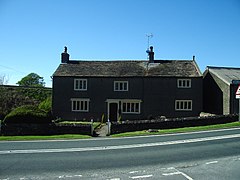
Stankas Hall Farmhouse
Location map United Kingdom Borough of Ribble Valley.svg
Red pog.svg
Newsholme
Shown within Ribble Valley
Lancashire UK location map.svg
Red pog.svg
Newsholme
Location within Lancashire
Population50 (2001 Census) [1]
OS grid reference SD839514
Civil parish
  • Newsholme
District
Shire county
Region
Country England
Sovereign state United Kingdom
Post town CLITHEROE
Postcode district BB7
Dialling code 01200
Police Lancashire
Fire Lancashire
Ambulance North West
UK Parliament
List of places
UK
England
Lancashire
53°57′32″N2°14′42″W / 53.959°N 2.245°W / 53.959; -2.245 Coordinates: 53°57′32″N2°14′42″W / 53.959°N 2.245°W / 53.959; -2.245

Newsholme is a small village and civil parish in the Ribble Valley, Lancashire, England, but lies within the historic West Riding of Yorkshire. According to the 2001 census, the parish had a population of 50, however the United Kingdom Census 2011 grouped the parish with Horton and Paythorne (2001 pop. 76 and 95), giving a total of 253. [1] [2] [3] Today it lies near the boundary with North Yorkshire on the A682, 4 miles (6 km) north of Barnoldswick and 12 miles (19 km) west of Skipton.

Contents

The parish adjoins the Ribble Valley parishes of Paythorne and Horton, and the parish of Hellifield in the Craven district of North Yorkshire.

In the west of the parish, on high ground overlooking the River Ribble, are the remains of a late Anglo-Saxon or early Norman Ringwork castle, called Castle Haugh but also known locally as Cromwell's Basin. [4] On the eastern side of the village, next to Demesne Farm is the site of a Medieval Manorial Hall called the Old Hall. [5] [6]

Between 1872 and 1957 the village had a railway station on the Ribble Valley Line. [7]

Newsholme was once a township in the ancient parish of Gisburn, in the Staincliffe Wapentake of the West Riding of Yorkshire. This became a civil parish in 1866, forming part of the Bowland Rural District from 1894 to 1974. [8] It has since become part of the Lancashire borough of Ribble Valley.

Along with Rimington, Gisburn, Middop, Gisburn Forest, Paythorne and Horton, the parish forms the Gisburn, Rimington ward of Ribble Valley Borough Council. [3] [9]

The Pennine Bridleway National Trail and Ribble Way pass through the parish, crossing the Ribble on the Paythorne Bridge. [10] [11]

See also

Related Research Articles

Craven District Local authority area of North Yorkshire, England

Craven is a local government district of North Yorkshire, England centred on the market town of Skipton. In 1974, Craven District was formed as the merger of Skipton urban district, Settle Rural District and most of Skipton Rural District, all in the West Riding of Yorkshire. The population of the Local Authority area at the 2011 Census was 55,409. It comprises the upper reaches of Airedale, Wharfedale, Ribblesdale, and includes most of the Aire Gap and Craven Basin.

Ribble Valley Borough in England

Ribble Valley is a local government district with borough status within the non-metropolitan county of Lancashire, England. The total population of the non-metropolitan district at the 2011 Census was 57,132. Its council is based in Clitheroe. Other places include Whalley, Longridge and Ribchester. The area is so called due to the River Ribble which flows in its final stages towards its estuary near Preston. The area is popular with tourists who enjoy the area's natural unspoilt beauty, much of which lies within the Forest of Bowland.

River Ribble River in North Yorkshire and Lancashire, England

The River Ribble runs through North Yorkshire and Lancashire in Northern England. It starts close to the Ribblehead Viaduct in North Yorkshire, and is one of the few that start in the Yorkshire Dales and flow westwards towards the Irish Sea.

Newton-in-Bowland Human settlement in England

Newton or Newton-in-Bowland is a village and civil parish in the Ribble Valley district, in the county of Lancashire, England, formerly known as Newton-on-Hodder. The civil parish had a population of 237 in 2001, according to the United Kingdom Census, increasing to 315 at the 2011 Census. The township covers almost 6,000 acres of the Forest of Bowland. Historically, the village is part of the West Riding of Yorkshire, but was transferred to Lancashire for administrative purposes on 1 April 1974, under the provisions of the Local Government Act 1972.

Bolton-by-Bowland Human settlement in England

Bolton-by-Bowland is a village and civil parish in the Ribble Valley district of Lancashire, England. Before 1974, the village was part of Bowland Rural District in the West Riding of Yorkshire. According to the census of 2001, the parish had a population of just 498, rising marginally to 499 at the census of 2011.

The Ribble way is a long-distance walk between the Lancashire coast and the Yorkshire Dales National Park largely following the course of the River Ribble.

Gisburn Human settlement in England

Gisburn is a village and civil parish within the Ribble Valley borough of Lancashire, England. Historically within the West Riding of Yorkshire, it lies 8 miles (13 km) northeast of Clitheroe and 11 miles (18 km) west of Skipton. The civil parish had a population of 506, recorded in the 2001 census, increasing to 521 at the 2011 Census.

Ightenhill Human settlement in England

Ightenhill is a civil parish in the Borough of Burnley in Lancashire, England, with a population of 1,975.

West Bradford, Lancashire Human settlement in England

West Bradford is a village and civil parish in Lancashire, England, 27 miles (43 km) west of the larger city of Bradford, West Yorkshire and 2.5 miles (4 km) north of Clitheroe. The population of the civil parish taken at the 2011 census was 788. It covers some 2000 acres of the Forest of Bowland. In Domesday, it is recorded as Bradeford and in the thirteenth century, Braford in Bouland. It was part of the West Riding of Yorkshire until 1974. "West Bradford" was introduced in the nineteenth century at the time of the introduction of postal services to help distinguish the village from its larger eastern neighbour of the same name.

Burnley Way Long-distance footpath in Lancashire, England

The Burnley Way is a 40-mile (64 km) long distance footpath in Lancashire, England. As a circular walk it can be walked from any point, but it is common to start and finish at the Weavers' Triangle Visitor Centre in Burnley. It covers a range of terrain from canal towpaths to open moorland.

Downham, Lancashire Human settlement in England

Downham is a village and civil parish in Lancashire, England. It is in the Ribble Valley district and at the United Kingdom 2001 census had a population of 156. The 2011 Census includes neighbouring Twiston giving a total for both parishes of 214. The village is on the north side of Pendle Hill off the A59 road about 3 miles (4.8 km) from Clitheroe. Much of the parish, including the village is part of the Forest of Bowland Area of Outstanding Natural Beauty (AONB). It adjoins the Ribble Valley parishes of Rimington, Twiston, Worston, Chatburn and Sawley, and the Pendle parish of Barley-with-Wheatley Booth.

Rimington Human settlement in England

Rimington is a rural village and civil parish in the Ribble Valley, Lancashire, England. The population of the civil parish was 382 at the 2001 Census, however at the 2011 Census Middop was included with Rimington giving a total of 480. It is east of Clitheroe and south of the A59 road. The village consists of the hamlets of Howgill, Martin Top, Newby, and Stopper Lane, and was formerly in the West Riding of Yorkshire.

Sawley, Lancashire Human settlement in England

Sawley is a village and civil parish in the Borough of Ribble Valley in Lancashire, England. The population of the civil parish was 305 at the 2001 Census, rising to 345 at the 2011 census. It is situated north-east of Clitheroe, on the River Ribble. It was historically part of the West Riding of Yorkshire.

Paythorne Village and civil parish in Lancashire, England

Paythorne is a small village and civil parish in Ribble Valley, Lancashire, England. It is situated alongside the River Ribble, north-east of Clitheroe, and on the boundary with North Yorkshire. Other parishes adjacent to Paythorne are Halton West, Nappa, Newsholme, Horton, Gisburn, Sawley, Bolton-by-Bowland and Gisburn Forest. The nearest town is Barnoldswick, situated 7 kilometres (4.3 mi) south-east of the village. Paythorne is on the edge of the Forest of Bowland Area of Outstanding Natural Beauty, although only a small area in the west of the parish is within the area's boundary. The Ribble Way long-distance walk passes through the village.

Horton, Lancashire Human settlement in England

Horton, historically known as Horton-in-Craven, is a village and a civil parish in the Ribble Valley district of the English county of Lancashire. Population details are now included in the civil parish of Newsholme. It is near the town of Barnoldswick. Horton has a place of worship, anciently called a chapelry or chapel of ease. For transport, there is the A59 nearby.

Gisburn Forest Civil parish in Ribble Valley in Lancashire, England

Gisburn Forest is a civil parish in the Ribble Valley, in Lancashire, England. Mainly lying within the Forest of Bowland Area of Outstanding Natural Beauty, the parish includes the larger part of the village of Tosside and the hamlet of Grunsagill to the south. Historically, the parish lay within the West Riding of Yorkshire. It had a population of 151 at the 2011 Census.

Middop Human settlement in England

Middop is a rural hamlet and civil parish in Lancashire, England. It is in Ribble Valley district. Middop is near the villages of Rimington and Gisburn and approximately 8 miles (13 km) north-east of its post town, Clitheroe. In the 2001 United Kingdom census, Middop had a population of 43. Owing to the limited population from the 2011 Census details are included in the parish of Rimington.

Gisburne Park Grade I listed English country house in the United Kingdom

Gisburne Park is an 18th-century country house and associated park in Gisburn, Lancashire, England, in the Ribble Valley some 6 miles (10 km) north-east of Clitheroe. The house is a Grade I listed building, and is now used as a hospital. The associated 1,000 acre park is Grade II listed, and is now an equestrian centre and holiday park.

Newsholme is a civil parish in Ribble Valley, Lancashire, England. It contains eight listed buildings that are recorded in the National Heritage List for England. All of the listed buildings are designated at Grade II, the lowest of the three grades, which is applied to "buildings of national importance and special interest". Apart from the village of Newsholme, the parish is entirely rural. The listed buildings consist of four farmhouses, a former toll house, and two milestones.

Paythorne is a civil parish in Ribble Valley, Lancashire, England. It contains twelve listed buildings that are recorded in the National Heritage List for England. Of these, one is at Grade II*, the middle grade, and the others are at Grade II, the lowest grade. The parish contains the village of Paythorne, and is otherwise rural. Most of the listed buildings are houses, farmhouses, and farm buildings. The other listed buildings include two bridges, a church, a boundary stone, and a shelter for horses.

References

  1. 1 2 "Parish headcount" (PDF). Lancashire County Council. Archived from the original (PDF) on 10 December 2006. Retrieved 27 December 2008.
  2. UK Census (2011). "Local Area Report – Newsholme Parish (1170215119)". Nomis. Office for National Statistics . Retrieved 1 March 2018.
  3. 1 2 "Wards and parishes map". MARIO. Lancashire County Council. Retrieved 1 March 2018.
  4. Historic England. "Castle Haugh Ringwork, Newsholme (1012521)". National Heritage List for England . Retrieved 26 March 2016.
  5. Historic England. "Site of the Old Hall (1005093)". National Heritage List for England. Retrieved 9 April 2016.
  6. "2009 Project selection" (PDF). Rapid surveys for Lancashire County Council . Greenlane Archaeology. pp. 22–7. Retrieved 9 April 2016.
  7. Daniels, Gerald David; Dench, Leslie Alan (February 1963) [1962]. Passengers No More 1952–1962. Closures of stations and branch lines (PDF) (2nd ed.). Brighton: GLO. p. 20. OCLC   504319235.
  8. "Newsholme CP/Tn through time". visionofbritain.org.uk. GB Historical GIS / University of Portsmouth. Retrieved 26 March 2016.
  9. "Gisburn, Rimington". Ordnance Survey Linked Data Platform. Ordnance Survey. Retrieved 22 March 2016.
  10. MKH Computer Services Ltd. "Pennine Bridleway — LDWA Long Distance Paths". Ldwa.org.uk. Retrieved 7 April 2016.
  11. MKH Computer Services Ltd. "Ribble Way — LDWA Long Distance Paths". Ldwa.org.uk. Retrieved 7 April 2016.