
The River Etherow is a river in northern England, and a tributary of the River Goyt. Although now passing through South Yorkshire, Derbyshire and Greater Manchester, it historically formed the ancient county boundary between Cheshire and Derbyshire. The upper valley is known as Longdendale. The river has a watershed of approximately 30 square miles (78 km2), and the area an annual rainfall of 52.5 inches (1,330 mm).

The River Tame is a river in the West Midlands of England, and one of the principal tributaries of the River Trent. The Tame is about 95 km (59 mi) long from the source at Oldbury to its confluence with the Trent near Alrewas, but the main river length of the entire catchment, i.e. the Tame and its main tributaries, is about 285 km (177 mi).

The River Cole is a 25 miles (40 km) river in the English Midlands. It rises on the lower slopes of Forhill, one of the south-western ramparts of the Birmingham Plateau, at Red Hill and flows south before flowing largely north-east across the plateau to enter the River Blythe below Coleshill, near Ladywalk, shortly before the Blythe meets the Tame. This then joins the Trent, whose waters reach the North Sea via the Humber Estuary. Its source is very near the main watershed of Midland England: tributaries are few and very short except in the lower reaches, so the Cole is only a small stream.

The River Lune is a river 53 miles (85 km) in length in Cumbria and Lancashire, England.

The River Taff is a river in Wales. It rises as two rivers in the Brecon Beacons; the Taf Fechan and the Taf Fawr before becoming one just north of Merthyr Tydfil. Its confluence with the River Severn estuary is in Cardiff.

The River Kent is a short river in the county of Cumbria in England. It originates in hills surrounding Kentmere, and flows for around 20 miles (32 km) into the north of Morecambe Bay. The upper reaches and the western bank of the estuary are located within the boundaries of the Lake District National Park. The river flows in a generally north to south direction, passing through Kentmere, Staveley, Burneside, Kendal and Sedgwick. Near Sedgwick, the river passes through a rock gorge which produces a number of low waterfalls. This section is popular with kayakers as it offers high quality whitewater for several days after rain. The village of Arnside is situated on the east bank of the Kent estuary, just above Morecambe Bay, and a tidal bore known as the Arnside Bore forms in the estuary at this point on high spring tides.

The Blackburn Brook is a stream in Sheffield, South Yorkshire, England which flows through the Blackburn Valley along the M1 and Ecclesfield Road and joins the River Don near the Meadowhall shopping centre. Downstream from the A61 road at Chapeltown the Blackburn Brook is defined as a main river by the Environment Agency, which requires new building development to be at least 26 feet (8 m) from the bank side as a flood defence measure and to allow access to the watercourse for maintenance.

The River Roddlesworth is a river in Lancashire, England, a tributary of the River Darwen.

The River Crouch is a small river that flows entirely through the English county of Essex.

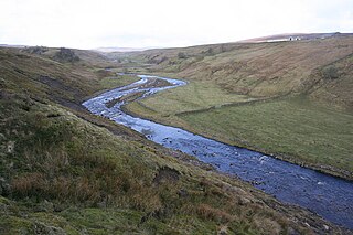
The River Winster is a river in the English county of Cumbria. The Winster was the boundary between the ancient counties of Lancashire and Westmorland. It has a relatively small catchment area; other streams flow parallel to it on either side.

Peasey Beck is a 19.6-kilometre-long (12.2 mi) beck flowing through Cumbria, England. It rises on Lambrigg Fell where it is known as the Sparishaw Beck, flows through Killington Reservoir and converges with Stainton Beck to form the River Bela at Milnthorpe. Prior to 1913, it was known as the River Beela throughout its length.

Stainton Beck is a watercourse in Cumbria, England. Its upper reaches are known as St. Sunday's Beck.

The River Doe is a river in North Yorkshire, England. The river's source is near God's Bridge close to the settlement of Chapel-le-Dale and flows through Twisleton in a south-westerly direction to Ingleton, where it meets the River Twiss to form the River Greta. The river forms part of the River Lune system that flows into the Irish Sea.
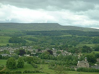
The civil parish of Caton-with-Littledale is situated in Lancashire, England, near the River Lune. The parish lies within the Forest of Bowland Area of Outstanding Natural Beauty and contains the villages of Caton, Brookhouse, Caton Green, Littledale and Townend.
The River Lune is a river in County Durham, England.

The River Gavenny or sometimes the Gavenny River is a short river in Monmouthshire in south Wales. It rises 1 mile (1.6 km) southwest of the village of Llanvihangel Crucorney from springs near Penyclawdd Court, supplemented by springs in Blaen-Gavenny Wood and tributary streams there and within the Woodland Trust-owned Great Triley Wood. It flows south for about 4 miles (6.4 km) to its confluence with the River Usk towards the eastern end of Castle Meadows at Abergavenny. The town derives its English-language name from the Gavenny's confluence with the River Usk. Of the buildings on the banks of the river, the Gothic Decorated style church of St Teilo at Llantilio Pertholey is especially notable. Parts of the church date from the thirteenth century with multiple additions since. Blaengavenny Farm, the name of which signifies the 'head of the Gavenny', is a sixteenth-century farmhouse near the river's source.

The Land Yeo is a small river which flows through North Somerset, England. It rises on Dundry Hill and supplies Barrow Gurney Reservoirs before flowing through various villages to Clevedon where it drains into the Severn Estuary. During the past 1,000 years it has powered at least ten watermills, however only one is still functional. Since 2003 initiatives have been undertaken to clean up the river, improving water quality and encouraging wildlife.

The River Worfe is a river in Shropshire, England. The name Worfe is said to derive from the Old English meaning to wander which the river is notable for in its middle section. Mapping indicates that the river begins at Cosford Bridge where the Cosford Brook and Albrighton Brook meet.
Caton-with-Littledale is a civil parish in Lancaster, Lancashire, England. It contains 53 listed buildings that are recorded in the National Heritage List for England. Of these, two are listed at Grade II*, the middle grade, and the others are at Grade II. The parish contains the villages and smaller settlements of Caton, Brookhouse, Littledale, Caton Green, and Crossgill. It is otherwise rural, with a number of isolated farms. Many of the listed buildings are houses and associated structures in the settlements and in the surrounding countryside. The other listed buildings include a church, disused chapels, a cross base, bridges, two former mills, and two milestones.

Harden Beck is a stream that flows from Hewenden Reservoir, over Goit Stock Waterfall to the River Aire in Bingley, West Yorkshire. The route starts out further up the valley as Denholme Beck, Hewenden Beck and Hallas Beck. Its waters are fed by Thornton Moor Reservoir, Stubden Reservoir, Doe Park Reservoir and Hewenden Reservoir.

