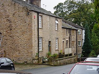
Read is a village in Lancashire 5 miles west northwest of Burnley and 2 miles east of Whalley. It is on the A671 which is the main road between Burnley and Clitheroe. The population of the civil parish as taken at the 2011 census was 1,419.
The City of Lancaster, or simply Lancaster, is a local government district with city status in Lancashire, England. It is named after its largest settlement, Lancaster, and also includes the towns of Carnforth, Heysham and Morecambe and a wider rural hinterland. The district has a population of 144,446 (2022), and an area of 219 square miles (567 km2).

A civil parish is a country subdivision, forming the lowest unit of local government in England. There are 94 civil parishes in the ceremonial county of South Yorkshire, most of the county being unparished. At the 2001 census, there were 360,191 people living in the parishes, increasing to 369,220 in 2011, accounting for 27.5 per cent of the county's population.

Quernmore is a village and civil parish in the City of Lancaster in Lancashire, England. It is located about 3 miles (5 km) east of Lancaster. The parish of Quernmore had a population of 532 recorded in the 2001 census, increasing to 567 at the 2011 Census. Apart from Quernmore itself, the parish also includes Brow Top, once a local crafts mecca, now barn conversions.

Bickerstaffe is a village and civil parish in the West Lancashire district of Lancashire, England. According to the 2001 Census the population of the civil parish was 1,196, reducing to 1,180 at the 2011 census, although the population of the electoral ward, which includes Lathom South, was slightly greater at 2,013, reducing to 1,988 at the 2011 census. The village is near junction 3 of the M58 motorway, and is about four miles west of Skelmersdale.

Woodplumpton is a village and civil parish in the City of Preston, Lancashire, England, located 5 miles (8 km) north of Preston.

Hale is a village and civil parish in the Borough of Halton, Cheshire, England with a population of 1,800. The village is north of the River Mersey, and just to the east of the boundary with Merseyside. It is 3 miles east of Speke in Liverpool, and 4 miles south-west of Widnes. The nearby village of Halebank is to the north-east.

Simonswood is a civil parish in the West Lancashire district of Lancashire, England. At the 2001 census, the population was 130, increasing to 151 by the 2011 census.

Slyne-with-Hest is a civil parish in the City of Lancaster in Lancashire, England. It had a population of 3,163 recorded in the 2001 census, decreasing to 3,126 at the 2011 Census. The parish is north of Lancaster and consists of two villages; Slyne, on the A6 road, and Hest Bank on the coast.
Scotforth is a suburb in the south of the city of Lancaster in Lancashire, England. It is home to Scotforth St Paul's Church of England Primary School and St Paul's Church. The civil parish, which does not include the suburb had a population of 239 recorded in the 2001 census, increasing to 321 at the 2011 Census.

Wheelton is a village and civil parish of the Borough of Chorley, in Lancashire, England. According to the United Kingdom Census 2001 it has a population of 1,001, reducing to 956 at the 2011 Census. The village is located on the A674 Chorley–Blackburn road.
Wiswell is a small village and civil parish in the Ribble Valley, Lancashire, England, close to Whalley and Clitheroe at the foot of Wiswell Moor.

Cabus is a village and civil parish in Lancashire, England. It lies 12 miles north of Preston, 9 miles south of Lancaster and 16 miles north east of Blackpool.

Haighton is a civil parish in the City of Preston, Lancashire, England. It is a rural area north east of the urban city of Preston, beyond Fulwood and Brookfield.

Claughton is a small village and civil parish in the City of Lancaster in Lancashire, England. The village is on the A683 road east of Lancaster and at the time of the 2001 census had a population of 132. In the 2011 census Claughton was grouped with Roeburndale to give a total of 223.

Briercliffe is a civil parish in the borough of Burnley, in Lancashire, England. It is situated 3 miles (4.8 km) north of Burnley. The parish contains suburbs of Burnley, and the rural area north east of the town. Hamlets in the parish include Cockden, Lane Bottom and in the Extwistle area, the tiny hamlet of Roggerham. According to the United Kingdom Census 2011, the parish has a population of 4,031.

Worsthorne-with-Hurstwood is a civil parish in the Borough of Burnley, in Lancashire, England. Situated on the eastern outskirts of Burnley, in 2011 it had a population of 2,963.

Thurnham is a civil parish in Lancashire, England. It is situated on the south side of the River Lune estuary in the City of Lancaster, and contains the villages of Conder Green, Glasson Dock, Lower Thurnham and Upper Thurnham. The parish has a population of 595, increasing to 651 at the 2011 census.

Nateby is a village and a civil parish in the Wyre district, in the English county of Lancashire near the town of Garstang. Nateby has a primary school, a place of worship and a post office. It once had a railway station called Nateby railway station, but the station closed on 31 March 1930. In 2001 the parish had a population of 475, increasing to 584 at the 2011 census.