Carnforth is a market town and civil parish in the City of Lancaster in Lancashire, England, situated at the north-east end of Morecambe Bay. The parish of Carnforth had a population of 5,560 in the 2011 census,[1] an increase from the 5,350 recorded in the 2001 census.[2] The town is situated around 7 miles north of Lancaster, 17 miles south of Kendal, 40 miles east (bisected by Morecambe Bay) of Barrow-in-Furness and 28 miles north-west of Settle. The town is also close to the Cumbria/Lancashire border.
Carnforth grew in the 19th century through the presence of the railway and ironworks. Due to the closeness of the coast and the hills, Carnforth is a popular base for walkers and cyclists exploring the area. The River Keer, the West Coast Main Line (WCML), the A6 and the Lancaster Canal pass through the town. The M6 motorway passes just to the east, linked to Carnforth by the A6070 (formerly the A601(M)) which was originally part of the Lancaster bypass before the M6 was extended north.
History
Christ Church
The name Carnforth is thought to derive from its old function as a ford of the River Keer on which it is situated. Over time, the descriptive name Keer-ford may have morphed into the modern Carnforth. An alternative explanation is that the name derives from 'Chreneforde' and is Anglo-Saxon in origin, as cited in the Victoria County History of Lancashire.[3] Another explanation is that it derives from the Old Englishcranford meaning 'crane ford'.[4]
Much of the history of Carnforth revolves around the railway and ironworks. Vast deposits of limestone located locally made Carnforth an ideal place for an ironworks, as limestone is a key component of the smelting process. In 1846, the Carnforth Ironworks Company established a works near to the railway station. In the same year, a recession occurred in the Earl of Dudley ironworks in Worcestershire, which meant there was a surplus of workers. A number of workers moved to the ironworks and lived in the nearby company village of Dudley (now called Millhead). In 1864, the Carnforth Haematite Company took over the works and production was vastly increased due to iron ore that was brought in by rail from the Furness Peninsula. By 1872, steel production became the main focus for the works using the new Bessemer process; this process had failed by 1879.[citation needed]
Iron production continued at the works until 1929, when it eventually closed down. The site was taken over by the War Department, as an ordnance depot and remained as such until the 1960s. From then to the present, the site is now an industrial estate housing several businesses.[5]
Market Street
In the 19th century, Carnforth grew from a small village into a railway town when it became the junction of three major railways. Carnforth Motive Power Depot was located to the west of the West Coast Main Line and, until mid-1968, was one of the last to retain an allocation of steam locomotives. The buildings are now occupied by West Coast Railways[6] who still maintain and overhaul steam locos in their premises. The concrete locomotive coaling tower is a rare survivor.
With the closure of Carnforth MPD in 1968, the station's facilities were reduced. The main line platforms were closed in May 1970 and subsequently removed when the line was electrified two years later, although services still run on the Furness line and the Bentham Line.
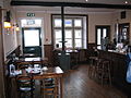
The Royal Station Hotel
From the 1920s to the 1980s, Morphy's Mill, in Oxford Street, was a major employer of women in Carnforth. Contrary to its name, it was not a mill but a factory making blouses and other garments.[7][8]
Brief Encounter
In 1945, Carnforth railway station was used as a location for the David Lean film Brief Encounter, starring Celia Johnson and Trevor Howard. Fans of this film were one of the major factors in the recent refurbishment of the railway station, including construction of a refreshment room to match the studio set used in the film. This reopened in 2021 as the Brief Encounter Refreshment Room Bistro and Bar.[9] There are also exhibitions and a heritage centre, which is now run by the Carnforth Station Trust.[10] The 2018 novel Past Encounters by local writer Deborah Swift is set, in part, in Carnforth during the filming of Brief Encounter.[11]
Gallery of film locations
Carnforth railway station refreshment room - scene for much of the film
Carnforth railway station clock and ramp from subway under platforms
Governance
An electoral ward in the same name exists. This ward is smaller than the parish with a total population of 4,439.[12]
The River Keer runs through the north-north-west of the town with the mouth of the river flowing into Morecambe Bay. It forms the parish boundary between Carnforth and Warton. A bridge between Carnforth and Millhead is the lowest road crossing of the river, although there is a footbridge a little further downstream.[14]
The Office for National Statistics recognises an area described as Carnforth Built-up area,[15] defined algorithmically, which includes Carnforth and Warton. It is divided into two parts: Carnforth subdivision,[16] which includes the Millhead area within Warton parish, and Warton subdivision.[17] The ONS definition of a built-up area includes built-up land separated by 200m from another settlement.[18]
Bus services in the town are provided by Stagecoach Cumbria and North Lancashire and Kirkby Lonsdale Coaches. Routes connect the town with Lancaster and Morecambe to the south, and to Milnthorpe, Kendal and Keswick in the north.[24] The 555 bus, which connects Lancaster with Keswick, is described as one of the longest and most scenic bus routes in England.[25]
Carnforth is on the A6 road7 miles (11km) north of Lancaster.[14] The M6 motorway passes to the east of the town; the A601(M) motorway and the B6254 road connect the town centre to junction 35.
The Lancaster Canal passes through the town; there is a marina for pleasure boats. Historically, the canal connected Lancaster to Kendal, but it is now closed beyond Tewitfield, north of Carnforth.
Both the Lancashire Coastal Way and the Bay Cycle Way skirt the western side of Carnforth, crossing the River Keer by the footbridge north-west of the town.
Media
Local TV coverage is provided by BBC North West and ITV Granada. Television signals are received from the Lancaster relay TV transmitter.[26]
This page is based on this Wikipedia article Text is available under the CC BY-SA 4.0 license; additional terms may apply. Images, videos and audio are available under their respective licenses.