The district was created on 1 April 1974 under the Local Government Act 1972, covering the area of three former districts, which were all abolished at the same time:[4]
The district was named Fylde after the coastal plan.[5] It was awarded borough status from its creation, allowing the chair of the council to take the title of mayor.[6]
The coat of arms of the borough bear the motto of the former Fylde Rural District Council, "Gaudeat Ager" from Psalm 96: 'Let the field (Fylde) be joyful' - "Let Fylde Prosper". The armorial bearings comprise a complete Achievement of Arms, that is - shield, crest and helm and mantling, supporters, badge and motto. They reflect the union of the three local authorities in the area: Lytham St Annes Borough Council, Kirkham Urban District Council and Fylde Rural District Council.[7]
The council has been under Conservative majority control since 2003.
The first election to the council was held in 1973, initially operating as a shadow authority alongside the outgoing authorities before coming into its powers on 1 April 1974. Political control of the council since 1974 has been as follows:[11][12]
The role of mayor is largely ceremonial in Fylde. Political leadership is instead provided by the leader of the council. The leaders since 2010 have been:
Of the independent councillors, nine sit together as a group, and the other three are not aligned to any group.[19] The next election is due in 2027.[18]
Since the last boundary changes in 2023 the council has comprised 37 councillors, representing 17 wards, with each ward electing one, two or three councillors. Elections are held every four years.[20]
Premises
The council is based at Lytham St Annes Town Hall on South Promenade in St Annes. The building was originally a hotel called Southdown Hydro, but was bought in 1925 to serve as a town hall following the merger of the districts of St Annes and Lytham in 1922 to become Lytham St Annes.[21]
Some council departments, including the planning department and an office of the Registrar, were previously located at the former Fylde Rural District Council offices on Derby Road in Wesham,[22] but in 2007 the council vacated this office. It was then used by the NHS North Lancashire Primary Care Trust until around 2013. The building has since been demolished and replaced by a new housing development.[23]
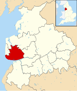
Towns and villages in the Borough of Fylde (inset: in Lancashire)
Civil parishes
Parishes in Fylde Borough
There are 15 civil parishes in Fylde. The parish councils of Kirkham, Medlar-with-Wesham and St Annes-on-the-Sea have declared their parishes to be towns, allowing them to take the style "town council".[24]
This page is based on this Wikipedia article Text is available under the CC BY-SA 4.0 license; additional terms may apply. Images, videos and audio are available under their respective licenses.