Metropolitan Borough of Oldham

Last updated

Borough of Oldham
Oldham town centre closeup from Hartshead Pike.jpg
Oldham skyline with Oldham Civic Centre in the distance and Oldham Parish Church
Motto(s): 
Latin: Sapere Aude, lit. 'Dare to be wise'
Oldham UK locator map.svg
Oldham shown within Greater Manchester
Coordinates: 53°32′N2°07′W / 53.533°N 2.117°W / 53.533; -2.117
Sovereign state United Kingdom
Country England
Region North West
City region and ceremonial county Greater Manchester
Historic counties
Incorporated1 April 1974
Named for Oldham
Administrative HQ Oldham Civic Centre
Government
[1]
  Type Metropolitan borough with leader and cabinet
  Body Oldham Council
   Control Labour
   Leader Arooj Shah (L)
   Mayor Zahid Chauhan
   Chief Executive Harry Catherall
   House of Commons
Area
[2]
  Total54.9 sq mi (142.3 km2)
  Rank 167th
Population
 (2021) [3]
  Total242,072
  Rank 77th
  Density4,410/sq mi (1,701/km2)
Demonym Oldhamer
Ethnicity (2021)
[4]
   Ethnic groups
List
Religion (2021)
[4]
   Religion
List
Time zone UTC+0 (GMT)
  Summer (DST) UTC+1 (BST)
Postcode area
Dialling codes
  • 01457
  • 0161
  • 01706
ISO 3166 code GB-OLD
GSS code E08000004
ITL code TLD37
GVA 2021 estimate [5]
 Total £4.0 billion
 Per capita£16,652
GDP (nominal)2021 estimate [5]
 Total£4.7 billion
 Per capita£19,578
Website oldham.gov.uk

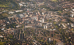
The Metropolitan Borough of Oldham is a metropolitan borough of Greater Manchester in England. It is named after its largest town, Oldham. The borough had a population of 242,072 in 2021, making it the sixth-largest district by population in Greater Manchester. [3] The borough spans 142.3 square kilometres (54.9 sq mi). [2]

Contents

Geography

Part of Oldham is rural and semi-rural, with a quarter of the borough lying within the Peak District National Park.

The Metropolitan Borough of Rochdale lies to the north-west, the Metropolitan Borough of Kirklees (of West Yorkshire) to the east, and the Metropolitan Borough of Tameside to the south. The City of Manchester lies directly to the south west and the Derbyshire Borough of High Peak lies directly to the south east, but Derbyshire is only bordered by high moorland near Black Hill and is not accessible by road.[ citation needed ]

History

Skyline of Chadderton, looking towards Manchester in the distance Oldham above Chadderton (2).jpg
Skyline of Chadderton, looking towards Manchester in the distance

Following both the Local Government Act 1888 and Local Government Act 1894, local government in England had been administered via a national framework of rural districts, urban districts, municipal boroughs and county boroughs, which (apart from the latter which were independent) shared power with strategic county councils of the administrative counties. [6] The areas that were incorporated into the Metropolitan Borough of Oldham in 1974 had formed part of Chadderton Urban District, Crompton Urban District, Failsworth Urban District, Lees Urban District and Royton Urban District from the administrative county of Lancashire, Saddleworth Urban District from the West Riding of Yorkshire, and the politically independent County Borough of Oldham. [7] By the early 1970s, nationally, this system of demarcation was described as "archaic" and "grossly inadequate to keep pace both with the impact of motor travel, and with the huge increases in local government responsibilities". [8] After the exploration of reform, such as the proposals made by the Redcliffe-Maud Report in the late 1960s, the Local Government Act 1972 restructured local government in England by creating a system of two-tier metropolitan and non-metropolitan counties and districts throughout the country. [9] The act formally established the Metropolitan Borough of Oldham as a local government district of the new metropolitan county of Greater Manchester on 1 April 1974. The district was granted honorific borough status on 23 November 1973 by Queen Elizabeth II of the United Kingdom, which allowed the council to have a mayor. [10] The new dual local authorities of Oldham Metropolitan Borough Council and Greater Manchester County Council had been running since elections in 1973 however. [11] The leading article in The Times on the day the Local Government Act came into effect noted that the "new arrangement is a compromise which seeks to reconcile familiar geography which commands a certain amount of affection and loyalty, with the scale of operations on which modern planning methods can work effectively". [12]

Ombc logo.png
Oldham Council's corporate logo, designed in 1974 by David McRae for the new authority. This logo was replaced in 2008 as part of a rebranding exercise. [13]
Oneoldham.png
The new "One Oldham" branding for the borough, used from 2008

The borough is noted as one of the more unpopular amalgamations of territory created by local government reform in the 1970s. [14] [15] [13] This being especially true of residents of the parish of Saddleworth who viewed the new arrangement as a "retrograde step". [14] It had been proposed in a government White paper that the Metropolitan Borough of Oldham include the former mill town of Middleton. However this was given to the Metropolitan Borough of Rochdale once it was decided that Rochdale and Bury would not be merged. [16] Before its creation, it was suggested that the metropolitan borough be named New Oldham, but that was rejected. [17] For its first 12 years the borough had a two-tier system of local government; Oldham Council shared power with the Greater Manchester County Council. Since the Local Government Act 1985 Oldham Council has effectively been a unitary authority, serving as the sole executive, deliberative and legislative body responsible for local policy, setting council tax, and allocating budget in the district. The Metropolitan Borough of Oldham has two civil parishes and 20 electoral wards. Noted as one of the more unpopular amalgamations of territory created by local government reform in the 1970s, [14] [15] [13] the Oldham borough underwent a £100,000 rebranding exercise in early 2008. The town has no listed buildings with a Grade I rating, [18] and the borough's architecture has been described as "mediocre". [19] There have been calls for the borough to be renamed, [13] [20] but that possibility was dismissed during the rebranding of 2008. [19]

Saddleworth Viaduct Saddleworth viaduct - geograph.org.uk - 2394598.jpg
Saddleworth Viaduct

In the early 20th century, following some exchanges of land, there were attempts to amalgamate Chadderton Urban District with the County Borough of Oldham. [21] However, this was resisted by councillors from Chadderton Urban District Council. [21]

The Oldham borough underwent a rebranding exercise in 2008 with a view to improving cross-community unity. [13] [20] Officials believed the borough's image was outdated and that "often negative" national media coverage held and continues to hold back businesses and hampers attempts to attract new investors, visitors and external funding. [20] There had been calls for the borough to be renamed to a "settlement-neutral" name (such as those of neighbouring districts of Calderdale, Kirklees and Tameside) as part of the rebranding. [20] However, consultants cited that this idea came from a "vocal minority" wishing to distance themselves from Oldham. The borough name was unchanged. [19]

Oldham Town Centre aerial view from the north Oldham town centre, aerial view from north.JPG
Oldham Town Centre aerial view from the north

Council

For the first 12 years after the county was created in 1974, the borough had a two-tier system of local government, and so Oldham Council shared power with the Greater Manchester County Council. [22] The Greater Manchester County Council, a strategic authority running regional services such as transport, strategic planning, emergency services and waste disposal, comprised 106 members drawn from the ten metropolitan boroughs of Greater Manchester. [23] However, in 1986, along with the five other metropolitan county councils and the Greater London Council, the Greater Manchester County Council was abolished, and most of its powers were devolved to the boroughs. [22] Since 1986, Oldham Council has effectively been a unitary authority that serves as the sole executive, deliberative and legislative body responsible for setting local policy, and allocating budget. Its duties also include setting levels of council tax, monitoring the health service in the borough, providing social care, and providing funding for schools.[ citation needed ] The borough's centre of administration is Oldham Civic Centre. [24]

Civil parishes form the bottom tier of statutory local government; the parish councils are involved in planning, management of town and parish centres, and promoting tourism. [25] In 2001, 46,072 people lived in Oldham's two civil parishes—Saddleworth and Shaw and Crompton—20.9% of the borough's population. [26] [27] The rest of the borough is unparished.

In 2008 a critical Audit Commission inspection found that Oldham Council's rate of improvement was ‘adequate’ and gave it a two-star rating. It said the rate of improvement had increased but had been "inconsistent". [28]

Since 2011 Oldham is one of the ten member authorities of the Greater Manchester Combined Authority (GMCA) which is a top tier local authority with responsibility for Transport, Health, Housing and Economic matters.[ citation needed ] The membership of the Combined Authority is drawn from the Leaders or Executive Mayors of each of the ten councils.[ citation needed ] In December 2012, Oldham was named ‘Most Improved Council’ at the Local Government Chronicle awards. [29] A team of six experienced politicians and officers from the Local Government Association carried out another independent ‘peer review’ of Oldham Council in December 2013. Their report said: "There has been a remarkable transformation in Oldham in recent years, both in terms of the place and in having established an ambitious and effective council. The authority can be proud of what has been achieved." [30]

In February 2014 ex-Council Leader Jim McMahon was named ‘Council Leader of the Year’ by the LGiU thinktank who said his "strong leadership has helped lead to a dramatic improvement in service delivery and correlating significant improvement in resident satisfaction rates." [31]

Oldham Civic Centre, the headquarters of Oldham Borough Council Oldham Civic Centre (3).JPG
Oldham Civic Centre, the headquarters of Oldham Borough Council

Decision making

The council operates a "strong leader" cabinet model, under which the person elected to be the leader of the council personally holds all the executive decision making powers. [32] It a matter of discretion for the leader whether he/she exercises those powers personally or delegates them. Generally decisions are delegated to individual cabinet members or to the council's cabinet.

The cabinet is made up of leader, a deputy leader and up to nine councillors appointed by the leader. [33] The cabinet is responsible for strategic decisions and recommends proposals for approval by full council on the budget, Council tax levels and the council's policy framework. [33]

Some decisions are delegated by council to district executives. There are six districts containing between two and five wards; Chadderton, Failsworth & Hollinwood, Oldham, Royton, Saddleworth & Lees and Shaw & Crompton. [34] Membership of each district executive is drawn from the elected councillors within each district.[ citation needed ]

Political composition

Since the council's formation it has generally been under the control of the Labour Party. Since 2011, the Labour Party has had overall control and now holds 32 of the 60 seats on the council. [35]

Party political make-up of Oldham Borough Council
PartySeatsCurrent Council (2018–23)
2018
2019
2021
2022
2023
Lib Dems 888910                                             
Labour 4745403532                                      
Conservative 448911                                             
Other13377                                             

Outlying towns, villages and suburbs

Aside from Oldham, the borough covers other towns and villages including:

Electoral wards

The Metropolitan Borough of Oldham is divided into 20 electoral wards, each which elects three councillors who generally sit for a four-year term on the Oldham Metropolitan Borough Council. The twenty wards are:

Electoral WardDistrictPopulationCouncillors
AlexandraOldham11,830 [36] 3
Chadderton CentralChadderton10,454 [37] 3
Chadderton NorthChadderton11,031 [38] 3
Chadderton SouthChadderton11,019 [39] 3
Coldhurst Oldham13,233 [40] 3
CromptonShaw & Crompton10,581 [41] 3
Failsworth EastFailsworth & Hollinwood10,352 [42] 3
Failsworth WestFailsworth & Hollinwood10,397 [43] 3
Hollinwood Failsworth & Hollinwood11,297 [44] 3
Medlock ValeOldham12,414 [45] 3
Royton NorthRoyton10,283 [46] 3
Royton SouthRoyton11,001 [47] 3
Saddleworth NorthSaddleworth & Lees9,672 [48] 3
Saddleworth SouthSaddleworth & Lees10,043 [49] 3
Saddleworth West & LeesSaddleworth & Lees11,196 [50] 3
St JamesOldham11,473 [51] 3
St MarysOldham13,994 [52] 3
ShawShaw & Crompton10,501 [53] 3
Waterhead Oldham12,027 [54] 3
Werneth Oldham12,149 [55] 3

Coat of arms

Oldham council's coat of arms, seen here at the Civic Centre Coat of arms of Oldham Metropolitan Borough Council.jpg
Oldham council's coat of arms, seen here at the Civic Centre

Following the 1974 reorganisation, a new coat of arms was granted to Oldham Metropolitan Borough Council, based closely on that of the predecessor Oldham County Borough Council. Like the county borough's arms, which dated from 1894, the new coat is derived from the arms of the Oldham family. The most famous member of the family was Hugh Oldham, Bishop of Exeter and founder of the Manchester Grammar School. The Oldham family arms were:

Sable a chevron Or between three owls argent on a chief of the second as many roses gules. [56]

The owls were a "canting" reference, or heraldic pun, on the original pronunciation of the name. This is still reflected in the local pronunciation of "Ow'dom". In the Metropolitan Borough's arms the gold chief (upper third of the shield) and chevron have "invected" or fluted edges. The arms are further differenced by the replacement of the three red roses by three red annulets or circles, representing the initial "O" of the authority's name. [57]

The crest, an owl upon a rock, is placed on a helm above the shield. In order to distinguish the crest from that of the county borough, it rises from a gold circlet bearing six red annulets. The crest wreath and decorative mantling repeat the black and gold colouring of the arms.[ citation needed ]

Oldham Metropolitan Borough Council was granted supporters and a heraldic badge. The supporters recall the local authorities merged in 1974, and are made up of portions of the arms of the ancient manorial lords. The red griffins come from the arms of the Chadderton and Chetham families. Each griffin wears a collar with an "engrailed" edge recalling the arms of the Radcliffe family. Each collar bears red bendlets from the arms of the Byrons. From the collars hang heptagons, the seven sides representing the union of seven councils. One heptagon bears a black spur-rowel from the Assheton family arms, the other a black saddle, recalling the derivation of the name "Saddleworth".[ citation needed ]

The badge is a black heptagon bearing a silver owl, the whole contained within a red annulet.

The Latin motto of the county borough continues in use: Sapere Aude or "dare to be wise" refers to the owls in the arms, while "Aude", pronounced "Owd" continues the pun. The motto is also used by Manchester Grammar School. [57] [58]

The blazon is as follows:

Sable a chevron invected or between three owls argent on a chief engrailed or as many annulets gules; and for a Crest: On a wreath of the colours issuant from a circlet or charged with six annulets gules a rock proper thereon an owl argent.

Supporters: On either side a griffin gules each gorged with a collar engrailed argent charged with six bendlets gules pendant therefrom a heptagon argent that on the dexter charged with a pierced mullet that on the sinister with a saddle both sable.

Badge or Device: On a heptagon sable environed by an annulet gules an owl argent. [57] [58]

Parishes

Showing status at 31 March 1974 (prior to the Local Government Act 1972 taking effect).[ citation needed ]

  1. Saddleworth (Saddleworth Urban District)
  2. Shaw and Crompton (Crompton Urban District)

Unparished areas

Showing former status.[ citation needed ]

  1. Chadderton (Chadderton Urban District)
  2. Failsworth (Failsworth Urban District)
  3. Lees (Lees Urban District)
  4. Oldham (County Borough of Oldham)
  5. Royton (Royton Urban District)

Demography

Ethnic groups

Ethnic GroupYear
2021 [59]
Number%
White: Total164,89768.2
White: British 157,91465.2
White: Irish 1,2790.5
White: Roma 5490.2
White: Gypsy or Irish Traveller 1770.1
White: Other 4,9782.1
Asian or Asian British: Total59,56524.5
Asian or Asian British: Indian 1,6760.7
Asian or Asian British: Pakistani 32,80213.5
Asian or Asian British: Bangladeshi 21,7549.0
Asian or Asian British: Chinese 8190.3
Asian or Asian British: Other Asian2,5141.0
Black or Black British: Total8,2093.4
Black or Black British: African6,0652.5
Black or Black British: Caribbean 8760.4
Other Black1,2680.5
Mixed or British Mixed: Total6,1252.6
Mixed: White and Black Caribbean2,3531.0
Mixed: White and Black African1,0430.4
Mixed: White and Asian1,8290.8
Mixed: Other Mixed9000.4
Other: Total3,2911.3
Other: Arab 5210.2
Other: Any other ethnic group2,7701.1
Total242,088100%

Religion

The following table shows the religious affiliation of residents in Oldham.

Religion2011 [60] 2021 [61]
Number%Number%
Christian 134,16759.7108,72044.9
Muslim 39,87917.759,03124.4
Jewish 108<0.11460.1
Hindu 1,2330.51,2220.5
Sikh 70<0.11320.1
Buddhism 3710.24680.2
Other religion4060.25890.2
No religion 36,16916.160,50725.0
Religion not stated12,4945.611,2734.7
Total224,897100.00%242,088100.00%

Other demographic statistics

As of the 2011 UK census, the borough of Oldham had a population of 224,897. [62]

Of the 89,703 households in Oldham, 56.6% of those aged 16 and over either live as a couple, are married, in a civil partnership or co-habiting, in line with the national average. A relatively high proportion of 9.3% of people are separated or divorced compared with England (8.6%) but in line with Greater Manchester (9.2%). [62]

The population density is higher in Oldham (15.8 people per hectare) than in England (4.1) although it is lower than that for Greater Manchester (21). [62]

Females continue to make up over half (51%) of Oldham's population, which is comparable to Greater Manchester, North West and national figures (50.6%, 50.9%, 50.8% respectively). Oldham has a younger age structure than England, with under 16s making up 22.4% of the population in Oldham compared with 18.9% nationally. People aged 75 and over make up 6.5% of Oldham's population compared with 7.8% of England's population. [62]

Despite improvements in school and college outcomes, the proportion of residents with degree-level qualifications (18.6%) has fallen further behind national rates (27.4%). The proportion of residents with no qualifications has dropped and the gap between Oldham and England has narrowed to 29.6% with no academic qualifications in 2011 compared to 37.7% ten years earlier. [62]


The rise of the middle classes in Oldham has reflected the wider national trend, roughly steady from 1841 until 1921 and then increasing almost exponentially until 2001. However, the proportion of middle-class people was always 5–10% below the national average. [63] Over the same period, the proportion of working class people in Oldham decreased steadily from 60% in 1841 to 23% 1991; since then there has been an increase in the percentage of working-class people to 34%. This was roughly the same pattern as the national averages, however Oldham has a greater proportion of working-class people than the whole of England. [64] [65] In the 2007/2008 financial year, the crime rates in Oldham were broadly similar to the national averages. However, the number of theft from a vehicle offences and theft of a vehicle per 1,000 of the population was 10.6 and 4.5 compared to the English national average of 6.9 and 2.7 respectively. [66]

Population change

The table below details the population change since 1801, including the percentage change since the last available census data. Although the Metropolitan Borough of Oldham has only existed 1974, figures have been generated by combining data from the towns, villages, and civil parishes that would later be constituent parts of the borough.

Population change in Oldham since 1801
Year1801181118211831184118511861187118811891
Population41,47152,95559,61584,49066,87377,350117,797158,244198,691233,445
 % change+27.8+12.5+41.7−20.9+15.7+52.3+34.3+25.6+17.5
Source: Vision of Britain [67]
Population change in Oldham since 1901
Year19011911192119311941195119611971198119912001
Population244,138255,322250,794246,353234,901223,982224,005224,071219,462219,613217,393
 % change+4.6+4.6−1.8−1.8−4.6−4.6+0.01+0.03−2.1+0.1−1.0
Source: Vision of Britain [68]

Economy

Oldham compared
2001 UK Census Oldham [69] Greater Manchester [70] England
Population of working age152,6021,805,31535,532,091
Full-time employment40.7%40.3%40.8%
Part-time employment11.6%11.3%11.8%
Self employed6.8%6.7%8.3%
Unemployed3.7%3.5%3.3%
Retired13.0%13.0%13.5%

The average gross weekly income in the borough of Oldham is £297; not only is this below the national average but it is the lowest of Greater Manchester's ten boroughs. Environmental technologies and life science industries have been identified as growth industries in Greater Manchester and are concentrated in Oldham as well as Bolton, Manchester, and Tameside. [71] Out of the ten metropolitan boroughs in Greater Manchester, the average house prices in Oldham are seventh highest, 15% below the average for the county. [72]

At the 2001 census, Oldham had 152,602 residents aged 16 to 74. Of these people, 2.1% were students with jobs, 3.9% students without jobs, 6.7% looking after home or family, 7.7% permanently sick or disabled and 3.8% economically inactive for other reasons. [69]

In 2001, of 92,777 residents of Oldham in employment, the industry of employment was 20.4% retail and wholesale, 20.3% manufacturing, 10.7% health and social work, 9.2% property and business services, 7.5% education, 7.1% construction, 6.7% transport and communications, 5.0% public administration and defence, 4.6% hotels and restaurants, 3.6% finance, 0.8% energy and water supply, 0.5% agriculture, and 3.7% other. This was roughly in line with national figures, although the proportion of jobs in agriculture was below the national average of 1.5% and the rates of people working in the areas of finance and property were below the national averages of 4.8% and 13.2 respectively; the proportion of people working in retail and wholesale was above the national average of 16.7%, and much higher than the national average of 14.8% for people working in manufacturing. [73]

Education

There are a total of 107 schools in Oldham. [74] This includes 86 primary schools, 15 secondary schools, 5 special schools and 1 independent grammar school. In 2007, the Oldham LEA was ranked 122nd out of 148 in the country—and 8th in Greater Manchester—based on the percentage of pupils attaining at least 5 A*-C grades at GCSE including maths and English (35.4% compared with the national average of 45.8%). [75]

In June 2014 the Oldham Education and Skills Commission was launched, chaired by former Education Secretary Estelle Morris. This 12-month inquiry is to review Oldham's classrooms from 0 to 19 years and aims at raising standards and aspirations so that every child can achieve their full potential. It will report findings in June 2015. [76] [77]

Landmarks

There were 11 Grade II* listed buildings, and 524 Grade II in the Metropolitan Borough of Oldham, [78] and thirty-six Conservation Areas. [79] Although the borough has no Grade I listed buildings, it does have the second highest number of Grade II buildings in Greater Manchester after Manchester. [80] The listed buildings range from former weavers' cottages in Saddleworth to some of the large former cotton mills in the West of the borough through to fine civic buildings such as the Old Town Hall in Oldham town centre.[ citation needed ]

Oldham has two of Greater Manchester's 38 Scheduled Monuments. Castleshaw Roman fort was built in 79 AD and was one of a chain of forts built along the route connecting the fortresses at Chester ( Deva Victrix ) and York ( Eboracum ). [81] It is one of only two known Roman forts in Greater Manchester, the other is at Manchester ( Mamucium ). Oldham's other Scheduled Monuments is a Bronze Age bowl barrow in Saddleworth. [82] Also in the borough are five of Greater Manchester's Sites of Special Scientific Interest, they are a section of Dark Peak, [83] the Ladcastle and Den Quarries, [84] the Lowside Brickworks, [85] the Rochdale Canal, [86] and part of the South Pennine Moors. [87]

Alexandra Park status on the Register of Historic Parks and Gardens of special historic interest in England was upgraded in 2013 from Grade II to Grade II* due to the large number of listed statues and buildings in the park. It is one of only 30 parks and gardens to receive the award in the North West and the only open space in Oldham to receive the distinction. Alexandra Park has also been a Green Flag Award winner. [88] It was reported in March 2014 that within the year the Grade II-listed Old Town Hall would be transformed into an entertainment complex with a cinema and restaurants in Oldham town centre. [89] A 360-degree virtual tour of the building was put online before restoration work began as part of a wider project to bring some of Oldham's civic buildings to life on Google Streetview. [90]

Transport

There are two railway lines that serve places in the Oldham borough; one is the main line service running between Huddersfield and Manchester, with Greenfield railway station the only station served by this line in the borough, and the only railway station within the borough. The other line is the main line service running between Manchester and Leeds via Halifax and Rochdale, with Mills Hill railway station (in the borough of Rochdale, and the most used station of the 3 mentioned) serving North Chadderton and Mills Hill, and Moston railway station (in the borough of Manchester) serving South Chadderton and Hollinwood.

A former railway line, the Oldham Loop Line has been converted to be part of the Manchester Metrolink light rail network. Oldham & Rochdale Line services serve Derker, Shaw & Crompton, Oldham Mumps, Freehold, South Chadderton, Hollinwood and Failsworth. [91]

There are many bus services running in the Oldham borough. The main bus operator is First Greater Manchester, whose headquarters is based in Oldham at Wallshaw Street, which is located at Oldham Mumps Bridge. [92]

The Metrolink extension, which was completed in 2014, was seen as crucial to regeneration plans for Oldham town centre and to change the nature of what it offers to residents, investors, and visitors. [93] It offers good connectivity to Manchester city centre and beyond. Trams run directly to Manchester Victoria in under 30 minutes and onwards to national networks, and also to Rochdale railway station and town centre. [94]

Oldham bus station provides a transport hub at the heart of the town centre. Combined with a network of bus corridors the services include express bus services every town minutes into Manchester city centre. The Metrolink network also extends to Manchester Airport which has direct flights to more than 200 destinations and is also only a 30-minute drive from Oldham. [95]

Twin towns

The Metropolitan Borough of Oldham has formal twinning arrangements with three European places: [96] Each was originally twinned with a place within the Metropolitan Borough boundaries prior to its creation in 1974.

CountryArmsPlaceCounty / District / Region / StateOriginally twinned withDate
Flag of Germany.svg Germany Wappen Landsberg.svg Landsberg am Lech Flag of Bavaria (lozengy).svg Bayern Failsworth Urban District 1974
Flag of Germany.svg Germany Geesthacht-Wappen.png Geesthacht Flag of Schleswig-Holstein.svg Schleswig-Holstein Chadderton Urban District 1966
Flag of Slovenia.svg Slovenia Coat of arms of Kranj.svg Kranj Upper Carniola County Borough of Oldham 1961

Freedom of the Borough

The following people and military units have received the Freedom of the Borough of Oldham.

Individuals

Military Units

[101]

See also

Related Research Articles

<span class="mw-page-title-main">Metropolitan Borough of Rochdale</span> Borough of Greater Manchester, England

The Metropolitan Borough of Rochdale is a metropolitan borough of Greater Manchester in England. Its largest town is Rochdale and the wider borough covers other outlying towns and villages, including Middleton, Heywood, Milnrow and Littleborough. It is the ninth-largest district by population in Greater Manchester with a population of 224,087 in 2021.

<span class="mw-page-title-main">Chadderton</span> Town in Greater Manchester

Chadderton is a town in the Metropolitan Borough of Oldham, Greater Manchester, England, on the River Irk and Rochdale Canal. It is located in the foothills of the Pennines, 1 mile (1.6 km) west of Oldham, 5 miles (8.0 km) south of Rochdale and 6 miles (9.7 km) north-east of Manchester.

<span class="mw-page-title-main">Failsworth</span> Town in Greater Manchester, England

Failsworth is a town in the Metropolitan Borough of Oldham in Greater Manchester, England, 4 miles (6.4 km) north-east of Manchester and 3 miles (4.8 km) south-west of Oldham. The orbital M60 motorway skirts it to the east. The population at the 2011 census was 20,680. Historically in Lancashire, Failsworth until the 19th century was a farming township linked ecclesiastically with Manchester. Inhabitants supplemented their farming income with domestic hand-loom weaving. The humid climate and abundant labour and coal led to weaving of textiles as a Lancashire Mill Town with redbrick cotton mills. A current landmark is the Failsworth Pole. Daisy Nook is a country park on the southern edge.

<span class="mw-page-title-main">Saddleworth</span> Human settlement in England

Saddleworth is a civil parish of the Metropolitan Borough of Oldham in Greater Manchester, England. It comprises several villages and hamlets as well as suburbs of Oldham on the west side of the Pennine hills.

<span class="mw-page-title-main">Royton</span> Town in Greater Manchester

Royton is a town in the Metropolitan Borough of Oldham, Greater Manchester, England, with a population of 21,284 in 2011. Close to the source of the River Irk, near undulating land at the foothills of the South Pennines, it is 1.7 miles (2.7 km) northwest of Oldham, 3.2 miles (5.1 km) southeast of Rochdale and 7.6 miles (12.2 km) northeast of Manchester.

<span class="mw-page-title-main">Oldham East and Saddleworth (UK Parliament constituency)</span> Parliamentary constituency in the United Kingdom, 1997 onwards

Oldham East and Saddleworth is a constituency in outer Greater Manchester represented in the House of Commons of the UK Parliament since January 2011 by Debbie Abrahams of the Labour Party.

<span class="mw-page-title-main">Oldham West and Royton (UK Parliament constituency)</span> Parliamentary constituency in the United Kingdom, 1997 onwards

Oldham West and Royton is a constituency represented in the House of Commons of the UK Parliament. It has been represented by Jim McMahon of the Labour Co-op party since 4 December 2015, after winning a by-election following the death of Michael Meacher on 21 October 2015.

<span class="mw-page-title-main">Hollinwood, Greater Manchester</span> Human settlement in England

Hollinwood is an area and electoral ward of the Metropolitan Borough of Oldham, Greater Manchester, England. The population at the 2011 census was 10,920.

<span class="mw-page-title-main">Shaw and Crompton</span> Civil parish in Greater Manchester, England

Shaw and Crompton is a civil parish in the Metropolitan Borough of Oldham, Greater Manchester, England, and lies on the River Beal at the foothills of the South Pennines. It is located 2.3 miles (3.7 km) north of Oldham, 3.6 miles (5.8 km) south-east of Rochdale and 8.7 miles (14 km) north-east of Manchester. Its largest settlement is Shaw.

Crompton Urban District was, from 1894 to 1974, a local government district in the administrative county of Lancashire, England. The area was coterminate with Shaw and Crompton.

<span class="mw-page-title-main">Hollinwood tram stop</span> Manchester Metrolink tram stop

Hollinwood tram stop is a tram stop and park & ride site on the Manchester Metrolink Oldham and Rochdale Line in Hollinwood, Greater Manchester, England. It was formerly a railway station before its conversion to a tram stop between 2009 and 2012.

Oldham Metropolitan Borough Council elections are generally held three years out of every four, with a third of the council being elected each time. Oldham Metropolitan Borough Council, generally known as Oldham Council, is the local authority for the metropolitan borough of Oldham in Greater Manchester, England. Since the last boundary changes in 2004, 60 councillors have been elected from 20 wards. New ward boundaries are due to come into effect from the 2023 election.

<span class="mw-page-title-main">Trent Mill</span> Cotton mill in Greater Manchester, England

Trent Mill was a cotton spinning mill on Duchess Street in Shaw and Crompton, Greater Manchester, England. It was built by F.W. Dixon & Son in 1908. It closed and was taken over by the Lancashire Cotton Corporation in 1929 reopened in 1938 and closed again in 1962, and was demolished in 1967.

<span class="mw-page-title-main">Dawn Mill, Shaw</span> Cotton mill in Greater Manchester, England

Dawn Mill, Shaw was a cotton spinning mill in Shaw and Crompton, Oldham, Greater Manchester. It was built on the site of Shaw Mill at the "dawn" of the 20th century. Dawn Mill was equipped with mule weft spindles in 1950. It was powered by Engines named Venus and Mars, 1800 hp twin tandem compound engine by George Saxon of Manchester. It was taken over by the Lancashire Cotton Corporation in the 1930s and passed to Courtaulds in 1964. It was sold again and used by distribution company DTS Logistics for storing and distributing clothing. It was demolished in 2006 to make way for an Asda supermarket.

<span class="mw-page-title-main">Newton Heath and Moston tram stop</span> Manchester Metrolink tram stop

Newton Heath and Moston is a Manchester Metrolink tram stop on the Oldham and Rochdale Line (ORL), in the Newton Heath area of Manchester, England.

<span class="mw-page-title-main">Greater Manchester Passenger Transport Executive</span> Public body responsible for public transport in Greater Manchester (1974–2011)

Greater Manchester Passenger Transport Executive was the public body responsible for public transport in Greater Manchester between 1974 and 2011, when it became part of Transport for Greater Manchester.

<span class="mw-page-title-main">Oldham Council</span>

Oldham Metropolitan Borough Council, branded and commonly referred to as Oldham Council, is the local authority of the Metropolitan Borough of Oldham in Greater Manchester, England. It is a metropolitan district council, one of ten in Greater Manchester and one of 36 in the metropolitan counties of England, and provides the majority of local government services in Oldham. It is composed of 60 councillors, three for each of the 20 electoral wards of the borough.

References

Notes

  1. "Councillors and leadership". Oldham Council. Retrieved 7 January 2024.
  2. 1 2 "Mid-Year Population Estimates, UK, June 2021". Office for National Statistics. 21 December 2022. Retrieved 18 October 2023.
  3. 1 2 "Mid-Year Population Estimates, UK, June 2021". Office for National Statistics. 21 December 2022. Retrieved 18 October 2023.
  4. 1 2 UK Census (2021). "2021 Census Area Profile – Oldham Local Authority (E08000004)". Nomis. Office for National Statistics . Retrieved 5 January 2024.
  5. 1 2 Fenton, Trevor (25 April 2023). "Regional gross domestic product: city regions". Office for National Statistics. Retrieved 2 September 2023.
  6. "Vision of Britain - Administrative Units Typology - Status definition: Urban District". visionofbritain.org.uk. Retrieved 19 March 2015.
  7. "Greater Manchester Gazetteer". Greater Manchester County Record Office. Places names - O to R. Archived from the original on 18 July 2011. Retrieved 20 September 2008.{{cite journal}}: Cite journal requires |journal= (help)
  8. Clark 1973 , p. 1.
  9. HMSO. Local Government Act 1972. 1972 c.70
  10. Oldham Metropolitan Borough Council (n.d.). "The Council and The Mayor". oldham.gov.uk. Archived from the original on 7 August 2007. Retrieved 3 December 2007.
  11. "British Local Election Database, 1889-2003". AHDS – Arts and Humanities data service. 28 June 2006. retrieved on 5 March 2008.
  12. "All change in local affairs". The Times . 1 April 1974.
  13. 1 2 3 4 5 "Seven Squares of controversy". Oldham Evening Chronicle . 28 February 2008. p. 8.
  14. 1 2 3 Daly, J.D. Oldham From the XX Legion to the 20th Century. ISBN   978-5-00-091284-3.
  15. 1 2 Millett, Freda (1996). Images of England; Oldham. Nonsuch. ISBN   978-1-84588-164-1.
  16. Philosophy on councils has yet to emerge. The Times. 8 July 1972
  17. Clark 1973 , p. 101.
  18. "Statistics by County". imagesofengland.org.uk. Archived from the original on 26 December 2007. Retrieved 22 December 2007.
  19. 1 2 3 Hemisphere Design and Marketing Consultants (February 2008). "Rebranding Oldham" (PDF). oldham.gov.uk. Archived from the original (PDF) on 13 March 2008. Retrieved 2 March 2008.
  20. 1 2 3 4 Marsden, Carl (26 September 2007). "Anyone for a Name Change?". Oldham Advertiser . Retrieved 3 December 2007.
  21. 1 2 Bateson, Hartley (1949). A Centenary History of Oldham. Oldham County Borough Council. ISBN   978-5-00-095162-0.
  22. 1 2 Barlow, Max (May 1995). "Greater Manchester: conurbation complexity and local government structure". Political Geography . 14 (4): 379–400. doi:10.1016/0962-6298(95)95720-I.
  23. Rochdale Metropolitan Borough Council (N.D.), p. 65.
  24. "Oldham Civic Centre nuclear bunker revealed after almost 50 years of secrets". Manchester Evening News. 23 May 2015. Retrieved 6 July 2020.
  25. National Association of Local Councils. "What is a town, parish or community council?". nalc.gov.uk. Archived from the original on 28 July 2008. Retrieved on 26 January 2008.
  26. United Kingdom Census 2001. "Saddleworth CP (Parish)". neighbourhood.statistics.gov.uk. Archived from the original on 12 June 2011. Retrieved 5 April 2007.{{cite web}}: CS1 maint: numeric names: authors list (link)
  27. United Kingdom Census 2001. "Shaw and Crompton CP (Parish)". neighbourhood.statistics.gov.uk. Archived from the original on 5 March 2008. Retrieved 18 March 2007.{{cite web}}: CS1 maint: numeric names: authors list (link)
  28. "Annual audit and inspection letter 2009-10".
  29. "Oldham Council is 'most improved'".
  30. "Oldham council truly remarkable - report".
  31. "2014 LGiU & CCLA C'llr Achievement Awards: Winners Announced!". 25 February 2014.
  32. Oldham Council. "Leader of the Council". oldham.gov.uk. Archived from the original on 16 March 2015. Retrieved 19 March 2015.
  33. 1 2 Oldham Council. "Cabinet". oldham.gov.uk. Archived from the original on 14 March 2015. Retrieved 19 March 2015.
  34. Oldham Council. "Neighbourhoods". oldham.gov.uk. Retrieved 19 March 2015.
  35. "Much to be done, McMahon". Oldham Chronicle. 2 June 2014. Retrieved 13 June 2014.
  36. Oldham Council. "Alexandra ward profile". oldham.gov.uk. Retrieved 19 March 2015.
  37. Oldham Council. "Chadderton Central ward profile". oldham.gov.uk. Retrieved 19 March 2015.
  38. Oldham Council. "Chadderton North ward profile". oldham.gov.uk. Retrieved 19 March 2015.
  39. Oldham Council. "Chadderton South ward profile". oldham.gov.uk. Retrieved 19 March 2015.
  40. http://www.oldham.gov.uk/download/downloads/id/.../coldhurst_ward_profile%5B%5D
  41. Oldham Council. "Crompton ward profile". oldham.gov.uk. Retrieved 19 March 2015.
  42. Oldham Council. "Failsworth East ward profile". oldham.gov.uk. Retrieved 19 March 2015.
  43. Oldham Council. "Failsworth West ward profile". oldham.gov.uk. Retrieved 19 March 2015.
  44. Oldham Council. "Hollinwood ward profile". oldham.gov.uk. Retrieved 19 March 2015.
  45. Oldham Council. "Medlock Vale ward profile". oldham.gov.uk. Retrieved 19 March 2015.
  46. Oldham Council. "Royton North ward profile". oldham.gov.uk. Retrieved 19 March 2015.
  47. Oldham Council. "Royton South ward profile". oldham.gov.uk. Retrieved 19 March 2015.
  48. Oldham Council. "Saddleworth North ward profile". oldham.gov.uk. Retrieved 19 March 2015.
  49. Oldham Council. "Saddleworth South ward profile". oldham.gov.uk. Retrieved 19 March 2015.
  50. Oldham Council. "Saddleworth West and Lees ward profile". oldham.gov.uk. Retrieved 19 March 2015.
  51. Oldham Council. "St James ward profile". oldham.gov.uk. Retrieved 19 March 2015.
  52. Oldham Council. "St Mary's ward profile". oldham.gov.uk. Retrieved 19 March 2015.
  53. Oldham Council. "Shaw ward profile". oldham.gov.uk. Retrieved 19 March 2015.
  54. Oldham Council. "Waterhead ward profile". oldham.gov.uk. Retrieved 19 March 2015.
  55. Oldham Council. "Werneth ward profile". oldham.gov.uk. Retrieved 19 March 2015.
  56. Bernard Burke, The General Armory of England, Scotland, Wales; Comprising A Registry of Armorial Bearings From the Earliest To the Present Time London, 1884.
  57. 1 2 3 Official Blazon and Description, Oldham Metropolitan Borough, undated
  58. 1 2 Robert Young. "Greater Manchester". Civic Heraldry of England and Wales. Retrieved 19 August 2008.
  59. "Ethnicity - Ethnicity by local authorities, ONS".
  60. "2011 census – theme tables". Archived from the original on 4 March 2016. Retrieved 8 January 2016.
  61. "Religion - Religion by local authorities, ONS".
  62. 1 2 3 4 5 "Census statistics" (PDF). Archived from the original (PDF) on 2 April 2015. Retrieved 19 March 2015.
  63. "Current rate: Percentage of Working-Age Males in Class 1 and 2". VisionofBritain.org.uk. Retrieved 27 June 2009.
  64. "Current rate: Percentage of Working-Age Males in Class 4 and 5". VisionofBritain.org.uk. Retrieved 27 June 2009.
  65. "Oldham District: Grouped Social Class". VisionofBritain.org.uk. Retrieved 27 June 2009.
  66. "Local Area Crime Figures for Oldham 2007–08". UpMyStreet.co.uk. Archived from the original on 3 May 2009. Retrieved 27 June 2009.
  67. "Oldham District: total population". Vision of Britain. Retrieved on 20 December 2008.
  68. "Oldham District: total population". Vision of Britain. Retrieved on 20 December 2008.
  69. 1 2 "Oldham Local Authority economic activity". Statistics.gov.uk. Retrieved 26 June 2009.
  70. "Greater Manchester Health Authority economic activity". Statistics.gov.uk. Archived from the original on 4 June 2011. Retrieved 26 June 2009.
  71. "Promoting a Dynamic Economy". Greater Manchester e-Government Partnership. Archived from the original on 12 January 2008. Retrieved 27 June 2009.{{cite journal}}: Cite journal requires |journal= (help)
  72. "House prices for Greater Manchester Local Authorities". BBC News Online. London. 16 March 2010. Retrieved 27 June 2009.
  73. "Oldham Local Authority industry of employment". Statistics.gov.uk. Archived from the original on 4 June 2011. Retrieved 26 June 2009.
  74. "Find a school".
  75. "How different LEAs performed". BBC Online. London. 17 January 2007. Retrieved 18 December 2007.
  76. "I'm SICK of Oldham's cycle of poverty, says council boss - it's holding our youngsters back". 30 June 2014.
  77. "Ex-education secretary to raise Oldham school standards". BBC News.
  78. Oldham Metropolitan Borough Council (August 2004). "Historic environment records". Oldham.gov.uk. Retrieved 24 February 2008.
  79. "The Historic Environment - Listed Buildings and Conservation Areas in Oldham". Oldham.gov.uk. Archived from the original on 25 September 2007. Retrieved 1 April 2007.
  80. "Statistics by County". Images of England. Archived from the original on 26 December 2007. Retrieved 22 December 2007.
  81. Historic England. "Rigodunum Roman fort (45891)". Research records (formerly PastScape). Retrieved 30 December 2007.
  82. Historic England. "Bowl Barrow (45895)". Research records (formerly PastScape). Retrieved 1 February 2009.
  83. "Dark Peak" (PDF). EnglishNature.org. Archived from the original (PDF) on 27 September 2007. Retrieved 27 January 2008.
  84. "Ladcaslte & Den Quarries" (PDF). EnglishNature.org. Retrieved 2 February 2008.
  85. "Lowside Brickworks" (PDF). EnglishNature.org. Archived from the original (PDF) on 13 October 2006. Retrieved 2 February 2008.
  86. "Rochdale Canal" (PDF). EnglishNature.org. Retrieved 2 February 2008.
  87. "South Pennine Moors" (PDF). EnglishNature.org. Archived from the original (PDF) on 26 September 2007. Retrieved 2 February 2008.
  88. "Oldham's Alexandra Park receives a star for historical importance". Green Flag Award. Archived from the original on 7 January 2016. Retrieved 19 March 2015.
  89. Richard Hooton (24 March 2014). "Magic of the movies". Oldham Evening Chronicle. Retrieved 19 March 2015.
  90. Oldham Council. "Old Town Hall". oldham.gov.uk.
  91. Greater Manchester tram network map Transport for Greater Manchester
  92. What does the First Manchester sale of buses and depot mean for passengers? Manchester Evening News 20 February 2019
  93. "Tramtastic".
  94. "OLDHAM METROLINK ROUTE OPENS". Archived from the original on 3 September 2014.
  95. "Location and transport".
  96. "Tourist Information in Oldham". oldham.gov.uk. Archived from the original on 6 March 2007. Retrieved 1 May 2007.
  97. "Honorary Freemen of the Borough". Oldham Borough Council. Retrieved 6 September 2021.
  98. "Local heroes to be given Freedom of the Borough by Oldham Council". The Oldham Evening Chronicle. 18 March 2021. Retrieved 6 September 2021.
  99. Mutch, James (2 September 2021). "Shaw cycling Olympic champion Matt Walls set to be given freedom of Oldham". The Oldham Times. Retrieved 6 September 2021.
  100. "Rugby star Kevin Sinfield made Freeman of Oldham". BBC News Manchester. 20 March 2023. Retrieved 20 March 2023.
  101. "Honorary Freemen of the Borough". Oldham Borough Council. Retrieved 6 September 2021.

Bibliography