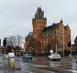
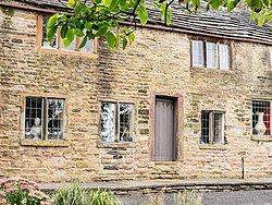
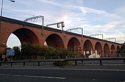
There are 236 Grade II* listed buildings in Greater Manchester , England. In the United Kingdom, the term listed building refers to a building or other structure officially designated as being of special architectural, historical or cultural significance; Grade II* structures are those considered to be "particularly significant buildings of more than local interest". [1] In England, the authority for listing under the Planning (Listed Buildings and Conservation Areas) Act 1990 [2] rests with English Heritage, a non-departmental public body sponsored by the Department for Culture, Media and Sport.
The metropolitan county of Greater Manchester is made up of 10 metropolitan boroughs: Bolton, Bury, Manchester, Oldham, Rochdale, Salford, Stockport, Tameside, Trafford and Wigan. The Grade II* buildings in each borough are listed separately. Manchester, the world's first industrialised city, [3] has 77 of Greater Manchester's 238 Grade II* listed buildings, the highest number of any borough. Bury has the least, with only eight. The River Irwell forms the boundary between Salford and Trafford, so one listed structure, Barton Swing Aqueduct, has been listed under both Salford and Trafford.
Most of Greater Manchester's listed buildings date from the Victorian and Edwardian periods. [1] According to an Association for Industrial Archaeology publication, Greater Manchester is "one of the classic areas of industrial and urban growth in Britain, the result of a combination of forces that came together in the 18th and 19th centuries: a phenomenal rise in population, the appearance of the specialist industrial town, a transport revolution, and weak local lordship". [4] Much of the region, historically a part of Lancashire, was at the forefront of textile manufacturing from the early 19th century until the early 20th century, and the county includes several former mill towns. [5] [6] Greater Manchester has a wealth of industrial heritage, represented by industrial architecture found throughout the county, [6] but many of its Grade II* listed buildings have a municipal, ecclesiastic or other cultural heritage.
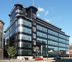
It is uncertain which Grade II* listed structure in Greater Manchester is the oldest. However, three of the 238 buildings date from the 13th century. Brandlesholme Old Hall in Bury was once an open-hall cruck-framed house, originating in the 13th century, although altered and extended in the 16th century and completely remodelled in 1849. [7] The Church of St Chad in Rochdale has a 13th-century tower (with an 1870 extension). [8] And Mab's Cross in Wigan, the stump of a boundary cross, is probably 13th century in origin. [9] The newest Grade II* listed building in Greater Manchester is the Daily Express Building, designed by Sir Owen Williams in 1939. [10] Because of the heavy impact of the Industrial Revolution on Greater Manchester, just under half of its Grade II* listed buildings (112, 47%) were completed in the 19th century.
Oldham is a town in Greater Manchester, England. It lies amongst the Pennines on elevated ground between the rivers Irk and Medlock, 5 miles (8.0 km) southeast of Rochdale, and 7 miles (11.3 km) northeast of Manchester. It is the administrative centre of the Metropolitan Borough of Oldham, which had a population of 237,110 in 2019.
Chadderton is a town in the Metropolitan Borough of Oldham, Greater Manchester, England, on the River Irk and Rochdale Canal. It is located in the foothills of the Pennines, 1 mile (1.6 km) west of Oldham, 5 miles (8.0 km) south of Rochdale and 6 miles (9.7 km) north-east of Manchester.
Leigh is a town in the Metropolitan Borough of Wigan, Greater Manchester, England, on low-lying land northwest of Chat Moss.
Failsworth is a town in the Oldham district, in Greater Manchester, England, 4 miles (6.4 km) north-east of Manchester and 3 miles (4.8 km) south-west of Oldham. The orbital M60 motorway skirts it to the east. The population at the 2011 census was 20,680. Historically in Lancashire, Failsworth until the 19th century was a farming township linked ecclesiastically with Manchester. Inhabitants supplemented their farming income with domestic hand-loom weaving. The humid climate and abundant labour and coal led to weaving of textiles as a Lancashire Mill Town with redbrick cotton mills. A current landmark is the Failsworth Pole. Daisy Nook is a country park on the southern edge.
Rochdale is a town in Greater Manchester, England, and the administrative centre of the Metropolitan Borough of Rochdale. In the 2021 census the town had a population of 111,261, compared to 223,773 for the wider borough. Rochdale is in the foothills of the South Pennines and lies in the dale (valley) of the River Roch, 5 miles (8 km) northwest of Oldham, and 10 miles (16 km) northeast of Manchester.
The Metropolitan Borough of Oldham is a metropolitan borough of Greater Manchester in England. It is named after its largest town, Oldham. The borough had a population of 243,912 in 2022, making it the sixth-largest district by population in Greater Manchester. The borough spans 142 square kilometres (55 sq mi).
Milnrow is a town within the Metropolitan Borough of Rochdale, in Greater Manchester, England. It lies on the River Beal at the foothills of the South Pennines, and forms a continuous urban area with Rochdale. It is 2 miles (3.2 km) east of Rochdale town centre, 10 miles (16.1 km) north-northeast of Manchester, and spans from Windy Hill in the east to the Rochdale Canal in the west. Milnrow is adjacent to junction 21 of the M62 motorway, and includes the village of Newhey, and hamlets at Tunshill and Ogden.
Middleton is a town in the Metropolitan Borough of Rochdale, Greater Manchester, England, on the River Irk. It is 5 miles (8.0 km) southwest of Rochdale and 5 miles (8.0 km) northeast of Manchester. Middleton had a population of 42,972 at the 2011 Census. It lies on the northern edge of Manchester, with Blackley to the south and Moston to the south east.
Orrell is a suburb of Wigan in the Metropolitan Borough of Wigan, Greater Manchester, England. The population of the ward had fallen at the 2011 Census to 11,513. The area lies 3 miles (4.8 km) to the west of Wigan town centre. The area is contiguous with Pemberton.
Atherton is a town in the Metropolitan Borough of Wigan in Greater Manchester, England and historically part of Lancashire. The town, including Hindsford, Howe Bridge and Hag Fold, is 5 miles (8.0 km) south of Bolton, 7 miles (11.3 km) east of Wigan, and 10 miles (16.1 km) northwest of Manchester. From the 17th century, for about 300 years, Atherton was known as Chowbent, which was frequently shortened to Bent, the town's old nickname. During the Industrial Revolution, the town was a key part of the Manchester Coalfield.
Standish is a town in the Metropolitan Borough of Wigan, Greater Manchester, England. Within the boundaries of the historic county of Lancashire, it is on the A49 road between Chorley and Wigan, near Junction 27 of the M6 motorway. The population of the town was 13,278 in the 2011 census.
Hollinwood is an area and electoral ward of the Metropolitan Borough of Oldham, Greater Manchester, England. The population at the 2011 census was 10,920.
Wigan is a town in Greater Manchester, England, on the River Douglas. The town is midway between the two cities of Manchester, 16 miles (25.7 km) to the south-east, and Liverpool, 17 miles (27 km) to the south-west. It is the largest settlement in the Metropolitan Borough of Wigan and is its administrative centre. The town has a population of 107,732 and the wider borough of 330,714. Wigan is part of the historic county of Lancashire.
There are 37 scheduled monuments in Greater Manchester, a metropolitan county in North West England. In the United Kingdom, a scheduled monument is a "nationally important" archaeological site or historic building that has been given protection against unauthorised change by being placed on a list by the Secretary of State for Digital Culture, Media and Sport; Historic England recommends sites for scheduling to the Secretary of State. Scheduled monuments are defined in the Ancient Monuments and Archaeological Areas Act 1979 and the National Heritage Act 1983. There are nearly 20,000 entries on the schedule, which is maintained by Historic England as part of the National Heritage List for England; more than one site can be included in a single entry. While a scheduled monument can also be recognised as a listed building, Historic England's aim is to set the most appropriate form of protection in place for the building or site. Applications to deschedule a site are administered Historic England, who will carry out an assessment and make a recommendation to the Secretary of State.
Denshaw is a village in the civil parish of Saddleworth in the Metropolitan Borough of Oldham, in Greater Manchester, England. It lies by the source of the River Tame, high amongst the Pennines above the village of Delph, 4.6 miles (7.4 km) northeast of Oldham,3.3 miles (5.3 km) north-northwest of Uppermill and Shaw and Crompton. It has a population of around 500.
The Catholic Church of St Oswald and St Edmund Arrowsmith is a Roman Catholic parish church located on Liverpool Road in Ashton-in-Makerfield, Greater Manchester, England, which is a Grade II-listed building and includes the Diocesan Shrine of St Edmund Arrowsmith.
Blackridings Mill, Oldham was a cotton waste mill lying off Block Lane in the Werneth area of Oldham, Greater Manchester. It was built before 1861 and ceased spinning between 1875 and 1880. It was then used for flock manufacture and processing cotton waste. It was taken over by the Lancashire Cotton Corporation in the 1930s and passed to Courtaulds in 1964. Production ended in 1973 and the building was demolished in 1975.
Manor Mill, Chadderton is an early twentieth century, five storey cotton spinning mill in Chadderton, Oldham, Greater Manchester. It was built in 1906. It was taken over by the Lancashire Cotton Corporation in the 1930s and passed to Courtaulds in 1964. Production finished in 1990.
Block Lane is a locality in the town of Chadderton in the Metropolitan Borough of Oldham, Greater Manchester. It is located on Chadderton's eastern border with Oldham, contiguous with the Freehold area of that town, and with Cowhill and Butler Green.
There are 48 Grade I listed buildings in Greater Manchester, England. In the United Kingdom, the term listed building refers to a building or other structure officially designated as being of special architectural, historical or cultural significance; Grade I structures are those considered to be "buildings of exceptional interest". In England, the authority for listing under the Planning Act 1990 rests with Historic England, a non-departmental public body sponsored by the Department for Culture, Media and Sport.