Grade II* listed buildings in Sedgemoor

Last updated

Sedgemoor shown within the ceremonial county of Somerset Sedgemoor UK locator map.svg
Sedgemoor shown within the ceremonial county of Somerset

Sedgemoor is a local government district in the English county of Somerset. In the United Kingdom, the term listed building refers to a building or other structure officially designated as being of special architectural, historical or cultural significance; Grade II* structures are those considered to be "particularly significant buildings of more than local interest". [1] Listing was begun by a provision in the Town and Country Planning Act 1947. Once listed, severe restrictions are imposed on the modifications allowed to a building's structure or its fittings. In England, the authority for listing under the Planning (Listed Buildings and Conservation Areas) Act 1990 rests with Historic England, a non-departmental public body sponsored by the Department for Digital, Culture, Media and Sport; local authorities have a responsibility to regulate and enforce the planning regulations. [2]

Contents

Sedgemoor is a low-lying area of land close to sea level between the Quantock and Mendip hills, historically largely marsh (or moor). It contains the bulk of the area also known as the Somerset Levels, including one of Europe's oldest known engineered roadways, the Sweet Track. [3]

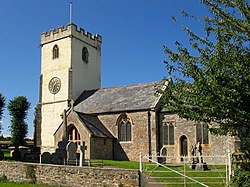
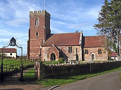
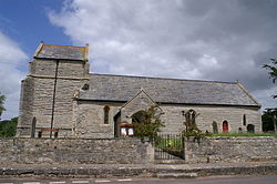
There are 90 Grade II* listed buildings in Sedgemoor. The oldest buildings in the list are Anglo-Saxon and Norman churches, with many more churches and churchyard crosses from the Middle Ages. There are also medieval country houses and the remains of castles. Urban architecture is represented by King Square in Bridgwater. Industrial buildings include Ashton Windmill which was built in the 18th century, on a site which has been the location of a windmill since the medieval period. [4] In Bridgwater the Chandos Glass Cone and Brick Kiln are parts of its industrial history. [5] [6] Related transport structures include Bridgwater railway station and the Telescopic Bridge carrying the railway over the River Parrett. [7] [8] The history of the drainage of the Somerset Levels is on display at the Westonzoyland Pumping Station Museum. [9] One of the first buildings to make extensive use of Portland cement for pre-cast concrete was Castle House in Bridgwater which was built in 1851. [10] Decorative work in Bridgwater is also represented with the inclusion of the Blake Statue and War Memorial. [11] [12]

Buildings

See also

Notes

  1. The date given is the date used by Historic England as significant for the initial building or that of an important part in the structure's description.
  2. Sometimes known as OSGB36, the grid reference is based on the British national grid reference system used by the Ordnance Survey.
  3. The "List Entry Number" is a unique number assigned to each listed building and scheduled monument by Historic England.

Related Research Articles

<span class="mw-page-title-main">Bridgwater</span> Human settlement in England

Bridgwater is a historic market town and civil parish in Somerset, England. The town had a population of 41,276 at the 2021 Census. Bridgwater is at the edge of the Somerset Levels, in level and well-wooded country. The town lies along both sides of the River Parrett; it has been a major inland port and trading centre since the industrial revolution. Most of its industrial bases still stand today. Its larger neighbour, Taunton, is linked to Bridgwater via a canal, the M5 motorway and the GWR railway line.

<span class="mw-page-title-main">River Parrett</span> River in Dorset and Somerset, England

The River Parrett flows through the counties of Dorset and Somerset in South West England, from its source in the Thorney Mills springs in the hills around Chedington in Dorset. Flowing northwest through Somerset and the Somerset Levels to its mouth at Burnham-on-Sea, into the Bridgwater Bay nature reserve on the Bristol Channel, the Parrett and its tributaries drain an area of 660 square miles (1,700 km2) – about 50 per cent of Somerset's land area, with a population of 300,000.

<span class="mw-page-title-main">Somerset Levels</span> Coastal plain and wetland area of Somerset, England

The Somerset Levels are a coastal plain and wetland area of Somerset, England, running south from the Mendips to the Blackdown Hills.

<span class="mw-page-title-main">Shapwick, Somerset</span> Human settlement in England

Shapwick is a village on the Polden Hills overlooking the Somerset Moors, in Somerset, England. It is situated to the west of Glastonbury.

<span class="mw-page-title-main">Westonzoyland</span> Human settlement in England

Westonzoyland is a village and civil parish in Somerset, England. It is situated on the Somerset Levels, 4 miles (6.4 km) south east of Bridgwater.

<span class="mw-page-title-main">Westonzoyland Pumping Station Museum</span> English industrial heritage museum

The Westonzoyland Pumping Station Museum of Steam Power and Land Drainage is a small industrial heritage museum dedicated to steam powered machinery at Westonzoyland in the English county of Somerset. It is a Grade II* listed building.

<span class="mw-page-title-main">East Huntspill</span> Human settlement in England

East Huntspill is a village and civil parish on the Huntspill Level, near Highbridge, Somerset, England. The civil parish includes Cote, Hackness and Bason Bridge.

<span class="mw-page-title-main">Moorlinch</span> Human settlement in England

Moorlinch is a village and civil parish where the Polden Hills meet the Somerset Levels in Somerset, England.

<span class="mw-page-title-main">River Parrett Trail</span> Long-distance footpath in Dorset and Somerset, England

The River Parrett Trail is a long-distance footpath that can be used for walking, jogging, or running, following the route of the River Parrett in Somerset, England. The trail, which is 50 miles (80 km) long, runs from Chedington in Dorset to the mouth of the river in Bridgwater Bay where it joins the West Somerset Coast Path.

Mendip is a local government district in the English county of Somerset. The Mendip district covers a largely rural area of 285 square miles (738 km2) ranging from the Mendip Hills through on to the Somerset Levels. It has a population of approximately 11,000. The administrative centre of the district is Shepton Mallet.

Sedgemoor is a local government district in the English county of Somerset. In the United Kingdom, the term listed building refers to a building or other structure officially designated as being of special architectural, historical or cultural significance; Grade I structures are those considered to be "buildings of exceptional interest". Listing was begun by a provision in the Town and Country Planning Act 1947. Once listed, severe restrictions are imposed on the modifications allowed to a building's structure or its fittings. In England, the authority for listing under the Planning Act 1990 rests with Historic England, a non-departmental public body sponsored by the Department for Digital, Culture, Media and Sport; local authorities have a responsibility to regulate and enforce the planning regulations.

<span class="mw-page-title-main">Grade II* listed buildings in West Somerset</span>

West Somerset is a local government district in the county of Somerset which is in South West England. In the United Kingdom, the term listed building refers to a building or other structure officially designated as being of special architectural, historical or cultural significance; Grade II* structures are those considered to be "particularly significant buildings of more than local interest". Listing was begun by a provision in the Town and Country Planning Act 1947. Once listed, severe restrictions are imposed on the modifications allowed to a building's structure or its fittings. In England, the authority for listing under the Planning Act 1990 rests with Historic England, a non-departmental public body sponsored by the Department for Digital, Culture, Media and Sport; local authorities have a responsibility to regulate and enforce the planning regulations.

<span class="mw-page-title-main">Grade II* listed buildings in Mendip</span>

Mendip is a local government district in the English county of Somerset. The Mendip district covers a largely rural area of 285 square miles (738 km2) ranging from the Mendip Hills through on to the Somerset Levels. It had a population of approximately 110,000 in 2014. The administrative centre of the district is Shepton Mallet.

<span class="mw-page-title-main">Grade II* listed buildings in South Somerset</span>

South Somerset is a local government district in the English county of Somerset. The South Somerset district occupies an area of 370 square miles (958 km2), stretching from its borders with Devon and Dorset to the edge of the Somerset Levels. The district has a population of about 158,000, and has Yeovil as its administrative centre.

<span class="mw-page-title-main">Grade II* listed buildings in Taunton Deane</span>

Taunton Deane is a local government district with borough status in the English county of Somerset. In the United Kingdom, the term listed building refers to a building or other structure officially designated as being of special architectural, historical or cultural significance; Grade II* structures are those considered to be "particularly significant buildings of more than local interest". Listing was begun by a provision in the Town and Country Planning Act 1947. Once listed, severe restrictions are imposed on the modifications allowed to a building's structure or its fittings. In England, the authority for listing under the Planning Act 1990 rests with Historic England, a non-departmental public body sponsored by the Department for Digital, Culture, Media and Sport; local authorities have a responsibility to regulate and enforce the planning regulations.

<span class="mw-page-title-main">St George's Church, Wembdon</span> Church in Somerset, England

The Anglican St George's Church was founded in the 13th century in the village of Wembdon within the English county of Somerset. The current building dates from the 14th and 15th century but was largely rebuilt in 1868 after a fire. It is a Grade II listed building.

Chorley is a market town in the borough of Chorley, Lancashire, England. The town itself is unparished, and this list contains the listed buildings in the unparished area. Outside the town are parished areas, and each of these has a separate list for its listed buildings. The unparished area contains 53 buildings that are recorded in the National Heritage List for England as designated listed buildings. Of these, one is listed at Grade I, the highest of the three grades, five are at Grade II*, the middle grade, and the others are at Grade II, the lowest grade.

St Bees is a civil parish in the Borough of Copeland, Cumbria, England. It contains 38 buildings that are recorded in the National Heritage List for England. Of these, four are listed at Grade I, the highest of the three grades, two are at Grade II*, the middle grade, and the others are at Grade II, the lowest grade. The parish includes the village of St Bees and the surrounding coastline and countryside. In the 12th century a Benedictine priory was established in the parish. Most of this disappeared after the Dissolution of the Monasteries apart from the priory church, most of which became the Church of St Mary and St Bega, the parish church of the village, while most of the chancel was modified for other uses. Also in the village is St Bees School, an independent school. The church, the school, and a number of associated structures are listed. Most of the other listed buildings are houses and associated structures, and farmhouses and farm buildings. The other listed buildings include a bridge, a signal box, and two war memorials.

Boningale is a civil parish in Shropshire, England. It contains 21 listed buildings that are recorded in the National Heritage List for England. More properties are 'curtilage listed' by virtue of their location on the grade II listed park and garden of Patshull. Of the formally listed properties, two are listed at Grade II*, the middle of the three grades, and the others are at Grade II, the lowest grade. The parish contains the village of Boningale, and is otherwise rural. The listed buildings include two former manor houses, other houses and associated structures, farmhouses and farm buildings, many of which date back to the 15th–17th centuries and which are basically timber framed. The other listed buildings include a church and items in the churchyard, and a telephone kiosk.

Hopton Wafers is a civil parish in Shropshire, England. It contains 26 listed buildings that are recorded in the National Heritage List for England. Of these, three are at Grade II*, the middle of the three grades, and the others are at Grade II, the lowest grade. The parish contains the village of Hopton Wafers, the smaller settlement of Doddington, and the surrounding countryside. The listed buildings include houses and farmhouses, some of which are timber framed, two churches, memorials and tombs in a churchyard, a country house and associated structures, two bridges, and a war memorial.

References

  1. "Listed Buildings". Historic England. Retrieved 23 August 2017.
  2. "Planning (Listed Buildings and Conservation Areas) Act 1990 (c. 9)". Ministry of Justice. Archived from the original on 18 April 2010. Retrieved 17 December 2007.
  3. "The day the Sweet Track was built". New Scientist. 16 June 1990. Archived from the original on 11 March 2010. Retrieved 26 October 2007.
  4. Historic England. "Ashton Windmill (1173522)". National Heritage List for England . Retrieved 23 August 2017.
  5. Historic England. "Chandos Glass Cone, at the junction of Northgate and Valetta Place (1019899)". National Heritage List for England. Retrieved 23 August 2017.
  6. Historic England. "Brick and tile kiln west of East Quay, 200m east of Bridgwater Dock lock (1019900)". National Heritage List for England. Retrieved 23 August 2017.
  7. Historic England. "Telescopic rail bridge over the River Parrett, 270m south east of Bridgwater Dock lock (1020624)". National Heritage List for England. Retrieved 6 April 2015.
  8. Historic England. "Rail bridge over the River Parrett (1297139)". National Heritage List for England. Retrieved 6 April 2015.
  9. Historic England. "Westonzoyland Engine Trust Old Pumping Station (1174295)". National Heritage List for England. Retrieved 6 April 2015.
  10. Historic England. "Castle House (1355168)". National Heritage List for England. Retrieved 23 August 2017.
  11. Historic England. "Blake Statue (1205747)". National Heritage List for England. Retrieved 23 August 2017.
  12. Historic England. "World War Memorial (1197395)". National Heritage List for England. Retrieved 23 August 2017.
  13. Historic England. "Ashton Windmill (1173522)". National Heritage List for England. Retrieved 3 April 2015.
  14. Historic England. "King John's Hunting Lodge (Axbridge Museum) (1059142)". National Heritage List for England. Retrieved 7 July 2015.
  15. Historic England. "Baptist Church (1298798)". National Heritage List for England. Retrieved 3 April 2015.
  16. Historic England. "Barford House And Outbuilding Wing At Rear (1058941)". National Heritage List for England. Retrieved 3 April 2015.
  17. Historic England. "Beere Manor Farmhouse And Attached Barn (1059062)". National Heritage List for England. Retrieved 3 April 2015.
  18. Historic England. "Blake Statue (1205747)". National Heritage List for England. Retrieved 3 April 2015.
  19. Historic England. "Boomer Farmhouse (1344987)". National Heritage List for England. Retrieved 3 April 2015.
  20. Historic England. "Brick Kiln (1206110)". National Heritage List for England. Retrieved 3 April 2015.
  21. Historic England. "Bridgwater Railway Station (1187364)". National Heritage List for England. Retrieved 3 April 2015.
  22. Historic England. "Castle House (1355168)". National Heritage List for England. Retrieved 3 April 2015.
  23. Historic England. "Castle House With Adjoining Wings Gate Cottage (1177302)". National Heritage List for England. Retrieved 3 April 2015.
  24. Historic England. "Castle Wall, Watergate And Undercroft (1207427)". National Heritage List for England. Retrieved 3 April 2015.
  25. Historic England. "Christ Church Unitarian Chapel (1197371)". National Heritage List for England. Retrieved 3 April 2015.
  26. Historic England. "Church Cross, In Churchyard, 10 Metres South Of Church Of St Andrew (1344903)". National Heritage List for England. Retrieved 3 April 2015.
  27. Historic England. "Church Farm House And Church Farmhouse (1344877)". National Heritage List for England. Retrieved 3 April 2015.
  28. Historic England. "Church Of All Saints (1058957)". National Heritage List for England. Retrieved 3 April 2015.
  29. Historic England. "Church Of All Saints (1344927)". National Heritage List for England. Retrieved 3 April 2015.
  30. Historic England. "Church Of All Saints (1178112)". National Heritage List for England. Retrieved 3 April 2015.
  31. Historic England. "Church Of St Bridget (1262963)". National Heritage List for England. Retrieved 3 April 2015.
  32. Historic England. "Church Of St Giles (1295089)". National Heritage List for England. Retrieved 3 April 2015.
  33. Historic England. "Church Of St John The Baptist (1059138)". National Heritage List for England. Retrieved 3 April 2015.
  34. Historic England. "Church Of St John The Baptist (1197354)". National Heritage List for England. Retrieved 3 April 2015.
  35. Historic England. "Church Of St Martin (1264213)". National Heritage List for England. Retrieved 3 April 2015.
  36. Historic England. "Church Of St Mary (1344698)". National Heritage List for England. Retrieved 3 April 2015.
  37. Historic England. "Church Of St Mary The Virgin (1344922)". National Heritage List for England. Retrieved 3 April 2015.
  38. Historic England. "Church Of St Michael (1177223)". National Heritage List for England. Retrieved 3 April 2015.
  39. Historic England. "Church Of St Michael And All Angels (1060158)". National Heritage List for England. Retrieved 3 April 2015.
  40. Historic England. "Church Of St Michael And All Angels (1296019)". National Heritage List for England. Retrieved 3 April 2015.
  41. Historic England. "Church of St Peter (1058917)". National Heritage List for England. Retrieved 3 April 2015.
  42. Historic England. "Church Of St Peter And St Paul (1060177)". National Heritage List for England. Retrieved 3 April 2015.
  43. Historic England. "Church Of The Blessed Virgin Mary (1058962)". National Heritage List for England. Retrieved 3 April 2015.
  44. Historic England. "Church Of The Holy Trinity (1264231)". National Heritage List for England. Retrieved 3 April 2015.
  45. Historic England. "Churchyard Cross In Churchyard Approximately 10 Metres South Of Nave, Church Of St Gregory (1059090)". National Heritage List for England. Retrieved 3 April 2015.
  46. Historic England. "Churchyard Cross In Churchyard, 30 Metres East Of East End, Church Of St Mary (1252634)". National Heritage List for England. Retrieved 3 April 2015.
  47. Historic England. "Churchyard Cross (1058938)". National Heritage List for England. Retrieved 3 April 2015.
  48. Historic England. "Churchyard Cross In Churchyard, Church Of St Michael (1344998)". National Heritage List for England. Retrieved 3 April 2015.
  49. Historic England. "Churchyard Cross, In The Churchyard, 5 Metres South Of South Porch, Church Of St John The Baptist (1173427)". National Heritage List for England. Retrieved 3 April 2015.
  50. Historic England. "Clerks Cottage (1344669)". National Heritage List for England. Retrieved 3 April 2015.
  51. Historic England. "Coleridge's Cottage (1344921)". National Heritage List for England. Retrieved 7 July 2015.
  52. Historic England. "Compton House And Forecourt Railings (1173405)". National Heritage List for England. Retrieved 3 April 2015.
  53. Historic England. "County Court Office (1197407)". National Heritage List for England. Retrieved 3 April 2015.
  54. Historic England. "Court House Farmhouse (1344667)". National Heritage List for England. Retrieved 3 April 2015.
  55. Historic England. "Crosse Family Monument In Churchyard About 1 Metre South Of Nave, Church Of St Mary And All Saints (1344997)". National Heritage List for England. Retrieved 3 April 2015.
  56. Historic England. "Dovecote In Grounds Of Shapwick Manor (1190558)". National Heritage List for England. Retrieved 3 April 2015.
  57. Historic England. "Durleigh Church (1177147)". National Heritage List for England. Retrieved 3 April 2015.
  58. Historic England. "Edington House (1344661)". National Heritage List for England. Retrieved 3 April 2015.
  59. Historic England. "Farm Estate Farmhouse (1237276)". National Heritage List for England. Retrieved 3 April 2015.
  60. Historic England. "Former Market Cross In Churchyard, Church Of St Mark (1252188)". National Heritage List for England. Retrieved 3 April 2015.
  61. Historic England. "Gazebo And Attached Walling Bounding Grounds Of Stowey Court (1264119)". National Heritage List for England. Retrieved 3 April 2015.
  62. Historic England. "Great House Farmhouse And Flanking Walls (1252915)". National Heritage List for England. Retrieved 3 April 2015.
  63. Historic England. "Legion House And Attached Wall To Right (1280623)". National Heritage List for England. Retrieved 3 April 2015.
  64. Historic England. "Manor House (1262680)". National Heritage List for England. Retrieved 3 April 2015.
  65. Historic England. "Market Cross (1173642)". National Heritage List for England. Retrieved 3 April 2015.
  66. Historic England. "Maunsel House (1177930)". National Heritage List for England. Retrieved 3 April 2015.
  67. Historic England. "No 10 And Attached Railings (1297163)". National Heritage List for England. Retrieved 3 April 2015.
  68. Historic England. "No 13 And Attached Railings (1297163)". National Heritage List for England. Retrieved 3 April 2015.
  69. Historic England. "No 14 And Attached Railings (1280095)". National Heritage List for England. Retrieved 3 April 2015.
  70. Historic England. "No 15 And Attached Front Railings And Rear Garden Walls (1297157)". National Heritage List for England. Retrieved 3 April 2015.
  71. Historic England. "9, High Street (1344893)". National Heritage List for England. Retrieved 3 April 2015.
  72. Historic England. "45 and 47 St Mary Street (1052245)". National Heritage List for England. Retrieved 3 April 2015.
  73. Historic England. "1 King Square (1197393)". National Heritage List for England. Retrieved 3 April 2015.
  74. Historic England. "10 And 11, West Quay (1197421)". National Heritage List for England. Retrieved 3 April 2015.
  75. Historic England. "3–9, Chandos Street (1205624)". National Heritage List for England. Retrieved 3 April 2015.
  76. Historic England. "8 And 9, King Square (1206644)". National Heritage List for England. Retrieved 3 April 2015.
  77. Historic England. "2–7, King Square (1280107)". National Heritage List for England. Retrieved 3 April 2015.
  78. Historic England. "Nos 11 And 12 And Attached Railings (1206669)". National Heritage List for England. Retrieved 3 April 2015.
  79. Historic England. "Nos 16 And 17 And Attached Railings (1297164)". National Heritage List for England. Retrieved 3 April 2015.
  80. Historic England. "Old Manor House (1059147)". National Heritage List for England. Retrieved 3 April 2015.
  81. Historic England. "Patcombe Farmhouse Including Chimney Stack Adjoining South East (1060152)". National Heritage List for England. Retrieved 3 April 2015.
  82. Historic England. "Paulet House (Formerly Known As Church Close) (1058949)". National Heritage List for England. Retrieved 3 April 2015.
  83. Historic England. "Rail Bridge Over The River Parrett (1297139)". National Heritage List for England. Retrieved 3 April 2015.
  84. Historic England. "Remains Of Churchyard Cross In Churchyard, About 23 Metres North Of North Aisle, Church Of St Mary (1344990)". National Heritage List for England. Retrieved 3 April 2015.
  85. Historic England. "Roadside Cross At Ngr St 4248 4966 (1252914)". National Heritage List for England. Retrieved 3 April 2015.
  86. Historic England. "Robin Hood's Hut (1060155)". National Heritage List for England. Retrieved 7 July 2015.
  87. Historic England. "Shapwick House Hotel The Granary (1190480)". National Heritage List for England. Retrieved 3 April 2015.
  88. Historic England. "Shapwick Manor (1190512)". National Heritage List for England. Retrieved 3 April 2015.
  89. Historic England. "St Judes (1344894)". National Heritage List for England. Retrieved 3 April 2015.
  90. Historic England. "St Michael's Cheshire Home (1425501)". National Heritage List for England. Retrieved 27 June 2017.
  91. Historic England. "Stable Block With Coach House To Shapwick Manor (1344894)". National Heritage List for England. Retrieved 3 April 2015.
  92. Historic England. "Stawell Church (1174228)". National Heritage List for England. Retrieved 3 April 2015.
  93. Historic England. "Stone Screen And Flanking Sections Of Walling Enclosing Former Parterre On Frontage Of Shapwick Manor (1293774)". National Heritage List for England. Retrieved 3 April 2015.
  94. Historic England. "Temple of Harmony (1058952)". National Heritage List for England. Retrieved 3 April 2015.
  95. Historic England. "The Admiral Blake Museum (1205363)". National Heritage List for England. Retrieved 3 April 2015.
  96. Historic England. "The Old Angel (1344883)". National Heritage List for England. Retrieved 3 April 2015.
  97. Historic England. "Tirelands Farmhouse (1177211)". National Heritage List for England. Retrieved 3 April 2015.
  98. Historic England. "West Bower Manor with barn (1058940)". National Heritage List for England. Retrieved 3 April 2015.
  99. Historic England. "West Newton Manor (1344642)". National Heritage List for England. Retrieved 3 April 2015.
  100. Historic England. "Westonzoyland Engine Trust Old Pumping Station (1174295)". National Heritage List for England. Retrieved 3 April 2015.
  101. Historic England. "Willis Family Monument (1344967)". National Heritage List for England. Retrieved 3 April 2015.
  102. Historic England. "World War Memorial (1197395)". National Heritage List for England. Retrieved 3 April 2015.