
Cheddar is a large village and civil parish in the English county of Somerset. It is situated on the southern edge of the Mendip Hills, 9 miles (14 km) north-west of Wells, 11 miles (18 km) south-east of Weston-super-Mare and 18 miles (29 km) south-west of Bristol. The civil parish includes the hamlets of Nyland and Bradley Cross. The parish had a population of 5,755 in 2011 and an acreage of 8,592 acres (3,477 ha) as of 1961.
South Cadbury is a village and former civil parish, now in the parish of South Cadbury and Sutton Montis, in the Somerset district of the ceremonial county of Somerset, England. The parish includes the village of Sutton Montis.

Chewton Mendip is a village and civil parish in Somerset, England. It is situated 4 miles (6 km) north of Wells, 16 miles (26 km) south of Bath and Bristol on the A39 very close to the A37. The village is in a valley on the Mendip Hills, is the source of the River Chew and is therefore on the edge of the Chew Valley. The parish includes the hamlets of Bathway and Green Ore.

Shipham is a village and civil parish in Somerset, England. It is on the western edge of the Mendip Hills near the A38, approximately 15 miles (24 km) south of Bristol. The parish includes the village of Rowberrow and the hamlet of Star. The parish population, according to the 2011 census, is 1,087.

Churchill is a village and civil parish in the unitary authority of North Somerset, part of the ceremonial county of Somerset. It is located on the western edge of the Mendip Hills, about 8 miles (12.9 km) east of Weston-super-Mare, and about 15 miles (24.1 km) south-west of Bristol. The parish, which includes the village of Lower Langford and the hamlet of Upper Langford, has a population of 2,250.

Worle is a village in the civil parish of Weston-Super-Mare, in the North Somerset district, in the ceremonial county of Somerset, England. It is joined to the seaside town of Weston-super-Mare on its western edge. It, however, maintains a very separate identity, and may now be bigger than its more famous neighbour. Worle pre-dates Weston and was mentioned in the Domesday Book of 1086. In the book, it is said that Worle was owned by Walter of Douai, and consisted of 750 acres (3.0 km2) and valued at 6.5 hides. "Walter of Douai holds of the King, Worle. Edgar held it in the time of King Edward, and gelded for six hides and a half." The parish church of St Martin's sits on the side of Worlebury Hill and overlooks the village.

Dinder is a small village and former civil parish, now in the parish of St Cuthbert Out, in the Somerset district, in the ceremonial county of Somerset. It is 2+1⁄2 miles west of Shepton Mallet, and 2 miles east of Wells. In 1961 the parish had a population of 198.

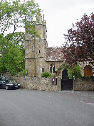
Westbury-sub-Mendip is a village and civil parish in Somerset, England. The village is on the southern slopes of the Mendip Hills, 4 miles (6.4 km) from Wells and Cheddar.

Priddy is a village in Somerset, England in the Mendip Hills, close to East Harptree and 4 miles (6 km) north-west of Wells. It is in the local government district of Mendip.

Rodney Stoke is a small village and civil parish, located at grid reference ST486501, 5 miles north-west of Wells, in the English county of Somerset. The village is on the A371 between Draycott and Westbury-sub-Mendip.
Compton Bishop is a small village and civil parish, at the western end of the Mendip Hills in the English county of Somerset. It is located close to the historic town of Axbridge. Along with the village of Cross and the hamlets of Rackley and Webbington it forms the parish of Compton Bishop and Cross.
Ston Easton is a linear village and civil parish in the English county of Somerset. It is 14 miles (23 km) southwest of Bath and 7 miles (11 km) north of Shepton Mallet. It forms part of the Mendip district and lies along the A37 road 11 miles (18 km) south of the cities of Bristol and Bath and to the west of the town of Midsomer Norton. The parish includes the hamlet of Clapton.

Charterhouse, also known as Charterhouse-on-Mendip, is a hamlet and former civil parish, now in the parish of Priddy, in the Mendip Hills Area of Outstanding Natural Beauty (AONB) in the Somerset district, in the ceremonial county of Somerset, England. The area between Charterhouse and Cheddar Gorge including Velvet Bottom and Ubley Warren is covered by the Cheddar Complex Site of Special Scientific Interest. In 1931 the parish had a population of 68.

Milton Clevedon is a village and civil parish 1 mile (1.6 km) south of Evercreech in the Mendip district of Somerset, England.
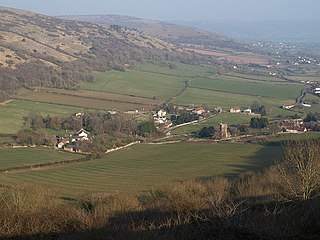
The Mendip Way is an 80-kilometre (50 mi) long-distance footpath across the Mendip Hills from Weston-super-Mare to Frome. It is divided into two sections.
Marston Bigot is a small village and former civil parish, now in the parish of Trudoxhill in the Somerset district, in the ceremonial county of Somerset, England. It is near Nunney and 3 miles (5 km) south of Frome. In 1931 the parish had a population of 117.

Babington is a small village in the civil parish of Kilmersdon, Somerset, England, which has now largely disappeared. It is between Radstock and Frome.

Stanton Prior is a small village within the civil parish of Marksbury, in the Bath and North East Somerset district, in the ceremonial county of Somerset, England. It is set in Duchy of Cornwall countryside between Newton St Loe and Marksbury, 6 miles (9.7 km) west from the UK city of Bath. In 1931 the parish had a population of 85. On 1 April 1933 the parish was abolished and merged with Marksbury.

The Hundred of Winterstoke is one of the 40 historical Hundreds in the ceremonial county of Somerset, England, dating from before the Norman conquest during the Anglo-Saxon era although exact dates are unknown. By far the most important and authoritative source for the structure, history and development of Winterstoke Hundred is a seminal paper by Dr Frank Thorn. Each hundred had a 'fyrd', which acted as the local defence force and a court which was responsible for the maintenance of the frankpledge system. They also formed a unit for the collection of taxes. The role of the hundred court was described in the Dooms (laws) of King Edgar. The name of the hundred was normally that of its meeting-place.
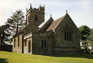
The Anglican Church of St Michael and All Angels at Rowberrow within the English county of Somerset dates from the 14th century, but parts were rebuilt in 1865. It is a Grade II* listed building.


