The Mendip Hills is a range of limestone hills to the south of Bristol and Bath in Somerset, England. Running from Weston-super-Mare and the Bristol Channel in the west to the Frome valley in the east, the hills overlook the Somerset Levels to the south and the Chew Valley and other tributaries of the Avon to the north. The hills give their name to the local government district of Mendip, which administers most of the area. The higher, western part of the hills, covering 198 km2 (76 sq mi) has been designated an Area of Outstanding Natural Beauty (AONB), which gives it a level of protection comparable to a national park.

Swildon's Hole is an extensive cave in Priddy, Somerset. At 9,144 metres (30,000 ft) in length, it is the longest cave on the Mendip Hills. It has been found to be connected to Priddy Green Sink and forms part of the Priddy Caves Site of Special Scientific Interest (SSSI).
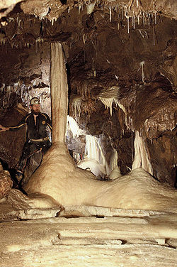
Lamb Leer is a 14.59 hectare geological Site of Special Scientific Interest between East Harptree and Priddy in the Mendip Hills, Somerset, notified in 1983. The cavern is a fragment of a very ancient major cave system which now contains one of the largest chambers in the Mendip Hills.
St. Dunstan's Well Catchment is a Site of Special Scientific Interest, covering 39.8 hectares near Stoke St Michael in the Mendip Hills, Somerset, England. The site was notified in 1967. It is of both geological and biological significance.
Thrupe Lane Swallet is a 0.5 hectares geological Site of Special Scientific Interest in Somerset, notified in 1992. It is also a Geological Conservation Review site.

Stoke St Michael is a village and civil parish on the Mendip Hills 4 miles (6.4 km) north east of Shepton Mallet, and 8 miles (12.9 km) west of Frome, in the Mendip district of Somerset, England.
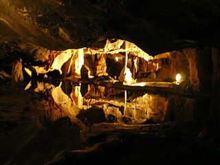
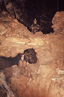
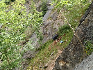
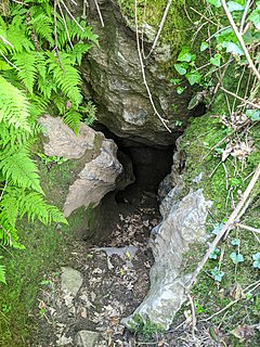
The caves of the Mendip Hills are formed by the particular geology of the Mendip Hills: large areas of limestone worn away by water makes it a national centre for caving. The hills conceal the largest underground river system in Britain.
Cox's Cave is in Cheddar Gorge on the Mendip Hills, in Somerset, England. It is open to the public as a show cave.
GB Cave is a cave between Charterhouse and Shipham in the limestone of the Mendip Hills, in Somerset, England.

St Cuthbert's Swallet is the second longest, and most complex, cave on the Mendip Hills, in Somerset, England. It forms a major part of the Priddy Caves system and water entering this swallet re-emerges at Wookey Hole. St Cuthbert's Swallet is part of, and lies underneath, the Priddy Pools Site of Special Scientific Interest.
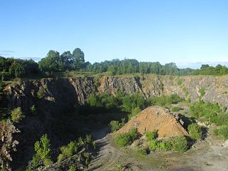
Fairy Cave Quarry is between Stoke St Michael and Oakhill in the limestone of the Mendip Hills, in Somerset, England.
Halecombe, grid reference ST697474 is a limestone quarry near Leigh-on-Mendip on the Mendip Hills, Somerset, England.

Gurney Slade quarry, grid reference ST626497 is a limestone quarry near Gurney Slade between Binegar and Holcombe, on the Mendip Hills, Somerset, England.

Stoke Lane Slocker is a cave near Stoke St Michael, in the Carboniferous Limestone of the Mendip Hills, in the English county of Somerset.
Balch Cave is a cave in Fairy Cave Quarry, near Stoke St Michael in the limestone of the Mendip Hills, in Somerset, England. The cave is part of the complex of passages feeding to St. Dunstan's Well Catchment Site of Special Scientific Interest and an abandoned Bristol Water abstraction point.
Hillier's Cave is a cave in Fairy Cave Quarry, near Stoke St Michael in the limestone of the Mendip Hills, in Somerset, England.
Rod's Pot is a limestone cave above Burrington Combe in the Mendip Hills, in Somerset, England.
Attborough Swallet is a cave in Chewton Mendip in Somerset, England.

W/L Cave is part of the Fairy Cave Quarry group of caves between Stoke St Michael and Oakhill in the limestone of the Mendip Hills, in Somerset, England.

Reservoir Hole is a cave in Cheddar Gorge in Somerset, southwest England. It contains what is believed to be the largest chamber yet found under the Mendip Hills.