Cheddar Complex

Last updated

Cheddar Complex
Site of Special Scientific Interest
Cheddargorge.jpg
Somerset UK location map.svg
Red pog.svg
Location within Somerset
Location Somerset
Grid reference ST465538
Coordinates 51°16′51″N2°46′06″W / 51.28082°N 2.76844°W / 51.28082; -2.76844 Coordinates: 51°16′51″N2°46′06″W / 51.28082°N 2.76844°W / 51.28082; -2.76844
InterestBiological and Geological
Area441.3 hectares (4.413 km2; 1.704 sq mi)
Notification 1952 (1952)
Natural England website

The Cheddar Complex is a 441.3-hectare (1,090-acre) biological Site of Special Scientific Interest near Cheddar around the Cheddar Gorge and north east to Charterhouse in the Mendip Hills, Somerset, England, notified in 1952.

Contents

The very large area includes 4 SSSIs formerly known as: Cheddar Gorge SSSI; August Hole/Longwood Swallet SSSI; GB Cavern Charterhouse SSSI; and Charterhouse on-Mendip SSSI.

It is part owned by the National Trust, commercial landowners including the Marquess of Bath's Longleat Estate; and part managed by the Somerset Wildlife Trust.

Biological

The Cheddar Complex supports a wide range of semi-natural habitats which includes unimproved grassland, calcareous dry dwarf-shrub heath, semi-natural broadleaved woodland and dense and scattered scrub. Four nationally rare plants are present, including Little Robin Geranium purpureum, Cheddar Pink Dianthus gratianopolitanus and Cheddar Bedstraw Galium fleurotii, two of which are endemic to the Cheddar area, as well as fifteen nationally scarce species. [1]

Geological

This site is important for karst, caves and vertebrate palaeontology and comprises four single interest localities. Cheddar Gorge is Britain’s largest gorge and probably the country’s best known limestone feature. It is a spectacular fluvial feature with a geomorphic history extending back 2 million years and encompassing the major environmental changes of the Pleistocene period. Cheddar Caves contain both active and fossil systems. The active cave system is one of the most heavily studied karst systems in Britain with reference to the conduit and diffuse flow characteristics of its hydrology. Charterhouse Caves include four major swallet caves that provide an indisputable record of Pleistocene landform development in the Mendips and surrounding area. Sun Hole Cave provides a varied fauna radiocarbon-dated to the end of the Late Devensian Cold Stage. [1]

Several types of limestone including Clifton Down Limestone, Cheddar Limestone and Cheddar Oolite are visible in the Gorge and surrounding areas with pale grey Burrington Oolite outcropping around Black Rock Gate. [2]

The Charterhouse area is of great importance as the finest remaining example of the unique Lead orefields of the Mendips. The surface features derived from lead working from pre-Roman times up to the nineteenth century are extremely well preserved. [1]

Somerset Wildlife Trust Reserves

The site of old mining works in Velvet Bottom Old lead mining site in the Mendips - geograph.org.uk - 1007928.jpg
The site of old mining works in Velvet Bottom

The area includes several nature reserves run by the Somerset Wildlife Trust. These include: Black Rock, Bubworth Acres, GB Gruffy, Long Wood, Mascall's Wood, Middledown, Ubley Warren and Velvet Bottom. [3]

The Black Rock reserve covers 181 acres (73 ha) of woodland, limestone grassland, conifers and an abandoned quarry. Long Wood covers 47 acres (19 ha) of ancient woodland and includes Longwood Swallet. It was historically the property of the Carthusian monks of Witham Charterhouse. In Roman times Velvet Bottom was mined for lead and the remains of circular buddle pits which were used to wash lead ore and settling beds can still be seen. Heaps of black shiny slag are the remains from re-smelting of the lead. It now consists of rough grassland, with areas of woodland and shrubs. [4] GB Gruffy includes 17 acres (6.9 ha) of neutral to acid species-rich grassland which overlies the GB Cave system. [5] The 86 acres (35 ha) of Ubley Warren are another site deeply affected by the lead mining in the area which lasted until the 19th century. [3]

See also

Related Research Articles

<span class="mw-page-title-main">Cheddar, Somerset</span> Human settlement in England

Cheddar is a large village and civil parish in the Sedgemoor district of the English county of Somerset. It is situated on the southern edge of the Mendip Hills, 9 miles (14 km) north-west of Wells, 11 miles (18 km) south-east of Weston-super-Mare and 18 miles (29 km) south-west of Bristol. The civil parish includes the hamlets of Nyland and Bradley Cross. The parish had a population of 5,755 in 2011 and an acreage of 8,592 acres (3,477 ha) as of 1961.

<span class="mw-page-title-main">Cheddar Gorge</span> Valley in Somerset, England

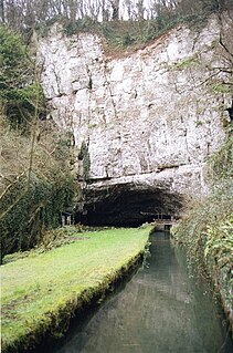
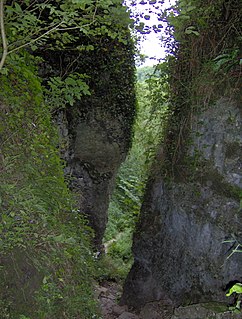
Cheddar Gorge is a limestone gorge in the Mendip Hills, near the village of Cheddar, Somerset, England. The gorge is the site of the Cheddar show caves, where Britain's oldest complete human skeleton, Cheddar Man, estimated to be 9,000 years old, was found in 1903. Older remains from the Upper Late Palaeolithic era have been found. The caves, produced by the activity of an underground river, contain stalactites and stalagmites. The gorge is part of a Site of Special Scientific Interest called Cheddar Complex.

<span class="mw-page-title-main">Mendip Hills</span> Range of limestone hills to the south of Bristol and Bath in Somerset, England

The Mendip Hills is a range of limestone hills to the south of Bristol and Bath in Somerset, England. Running from Weston-super-Mare and the Bristol Channel in the west to the Frome valley in the east, the hills overlook the Somerset Levels to the south and the Chew Valley and other tributaries of the Avon to the north. The hills give their name to the local government district of Mendip, which administers most of the area. The higher, western part of the hills, covering 198 km2 (76 sq mi) has been designated an Area of Outstanding Natural Beauty (AONB), which gives it a level of protection comparable to a national park.

<span class="mw-page-title-main">River Axe (Bristol Channel)</span> River in Somerset, England

The River Axe is a river in South West England. The river is formed by water entering swallets in the limestone and rises from the ground at Wookey Hole Caves in the Mendip Hills in Somerset, and runs through a V-shaped valley. The geology of the area is limestone and the water reaches Wookey Hole in a series of underground channels that have eroded through the soluble limestone. The river mouth is in Weston Bay on the Bristol Channel.

<span class="mw-page-title-main">Burrington Combe</span> Limestone gorge in north Somerset, England

Burrington Combe is a Carboniferous Limestone gorge near the village of Burrington, on the north side of the Mendip Hills Area of Outstanding Natural Beauty, in North Somerset, England.

<span class="mw-page-title-main">Ebbor Gorge</span> Limestone gorge in Somerset, England

Ebbor Gorge is a limestone gorge in Somerset, England, designated and notified in 1952 as a 63.5-hectare (157-acre) biological Site of Special Scientific Interest in the Mendip Hills. It was donated to the National Trust in 1967 and is now managed by Natural England as a national nature reserve.

Brimble Pit and Cross Swallet Basins is a 154.3 hectare geological Site of Special Scientific Interest between Wookey Hole and Priddy in the Mendip Hills, Somerset, notified in 1987.

<span class="mw-page-title-main">Crook Peak to Shute Shelve Hill</span> Geological and biological Site of Special Scientific Interest in Somerset, England

Crook Peak to Shute Shelve Hill is a 332.2 hectare (820.9 acre) geological and biological Site of Special Scientific Interest near the western end of the Mendip Hills, Somerset. The line of hills runs for approximately 5 kilometres (3.1 mi) from west to east and includes: Crook Peak, Compton Hill, Wavering Down, Cross Plain and Shute Shelve Hill. Most of the site is owned by the National Trust, which bought 725 acres (293 ha) in 1985, and much of it has been designated as common land. It was notified as an SSSI by Natural England in 1952.

<span class="mw-page-title-main">Priddy Mineries</span> Nature reserve in Somerset, England

Priddy Mineries is a nature reserve previously run by the Somerset Wildlife Trust. It is in the village of Priddy, on the Mendip Hills in Somerset.

<span class="mw-page-title-main">Cheddar Wood</span>

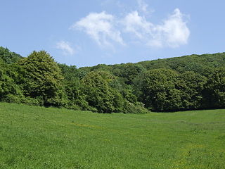
Cheddar Wood is an 86.9-hectare (215-acre) biological Site of Special Scientific Interest at Cheddar in the Mendip Hills, Somerset, England, notified in 1967.

The Perch is a 72.1 hectare biological Site of Special Scientific Interest close to Cheddar Gorge in the Mendip Hills, Somerset, England. It received SSSI notification in 1990.

<span class="mw-page-title-main">Charterhouse, Somerset</span> Human settlement in England

Charterhouse, also known as Charterhouse-on-Mendip, is a hamlet in the Mendip Hills Area of Outstanding Natural Beauty (AONB) in the English county of Somerset. The area between Charterhouse and Cheddar Gorge including Velvet Bottom and Ubley Warren is covered by the Cheddar Complex Site of Special Scientific Interest.

<span class="mw-page-title-main">Caves of the Mendip Hills</span>

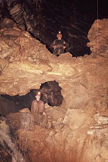
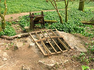
The caves of the Mendip Hills are formed by the particular geology of the Mendip Hills: large areas of limestone worn away by water makes it a national centre for caving. The hills conceal the largest underground river system in Britain.

<span class="mw-page-title-main">GB Cave</span> Limestone cave in Somerset, England

GB Cave is a cave between Charterhouse and Shipham in the limestone of the Mendip Hills, in Somerset, England.

<span class="mw-page-title-main">Longwood Swallet</span> Cave in Somerset, England

The Longwood Swallet is a cave near Charterhouse, in the Carboniferous Limestone of the Mendip Hills, in Somerset, England. The cave is part of the Cheddar Complex SSSI and is connected to August Hole.

<span class="mw-page-title-main">Upper Flood Swallet</span> Limestone cave in Somerset, England

Upper Flood Swallet which was originally known as Blackmoor Flood Swallet, is an exceptionally well-decorated cave near Charterhouse, in the carboniferous limestone of the Mendip Hills, in Somerset, England. The cave is part of the Cheddar Complex SSSI.

The Mendip Way is an 80-kilometre (50 mi) long-distance footpath across the Mendip Hills from Weston-super-Mare to Frome. It is divided into two sections.

Charterhouse Cave, on the Mendip Hills in Somerset, is the deepest cave in southern England.

<span class="mw-page-title-main">Geography of Somerset</span>

The county of Somerset is in South West England, bordered by the Bristol Channel and the counties of Bristol and Gloucestershire to the north, and Wiltshire to the east, Dorset to the south, and Devon to the west. The climate, influenced by its proximity to the Atlantic Ocean and the prevailing westerly winds, tends to be mild, damp and windy.

Tyning's Barrow Swallet is a cave between Charterhouse and Shipham in the limestone of the Mendip Hills, in Somerset, England. The cave is close to GB Cave and also to Charterhouse Cave, the deepest cave in the region.

References

  1. 1 2 3 "The Cheddar Complex" (PDF). English Nature. Retrieved 2 May 2011.
  2. "Cheddar Gorge". British Geological Survey. Retrieved 2 May 2011.
  3. 1 2 "Nature Reserves Guide" (PDF). Somerset Wildlife Trust. Retrieved 2 May 2011.
  4. "Cheddar Complex". Somerset Wildlife Trust. Retrieved 2 May 2011.
  5. "GB Gruffy". Somerset Wildlife Trust. Retrieved 2 May 2011.