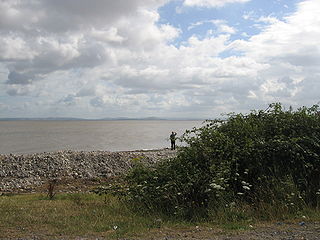
Bridgwater Bay is on the Bristol Channel, 5 kilometres (3.1 mi) north of Bridgwater in Somerset, England at the mouth of the River Parrett and the end of the River Parrett Trail. It stretches from Minehead at the southwestern end of the bay to Brean Down in the north. The area consists of large areas of mudflats, saltmarsh, sandflats and shingle ridges, some of which are vegetated. It has been designated as a Site of Special Scientific Interest (SSSI) covering an area of 3,574.1 hectares since 1989, and is designated as a wetland of international importance under the Ramsar Convention. The risks to wildlife are highlighted in the local Oil Spill Contingency Plan.

Edington is a rural village, situated on the north side of the Polden Hills in Somerset, England.

The River Brue originates in the parish of Brewham in Somerset, England, and reaches the sea some 50 kilometres (31 mi) west at Burnham-on-Sea. It originally took a different route from Glastonbury to the sea, but this was changed by Glastonbury Abbey in the twelfth century. The river provides an important drainage route for water from a low-lying area which is prone to flooding which man has tried to manage through rhynes, canals, artificial rivers and sluices for centuries.

Long Dole Wood and Meadows SSSI is a 9.8 hectares biological Site of Special Scientific Interest (SSSI) between the villages of Farrington Gurney and Hinton Blewitt in Bath and North East Somerset, notified in 1987.

Barle Valley is a 1,540 acres (620 ha) Site of Special Scientific Interest within Exmoor National Park, situated in the counties of Devon and Somerset through which the River Barle flows. It was notified in its current form under the Wildlife and Countryside Act in 1988. The site includes the Somerset Wildlife Trust's Mounsey Wood Nature Reserve and the Knaplock and North Barton SSSI which has been notified since 1954.
Shapwick Heath is a 394.0-hectare biological Site of Special Scientific Interest and national nature reserve between Shapwick and Westhay in Somerset, notified in 1967. It is part of the Brue Valley Living Landscape conservation project. The project commenced in January 2009 and aims to restore, recreate and reconnect habitat. It aims to ensure that wildlife is enhanced and capable of sustaining itself in the face of climate change while guaranteeing farmers and other landowners can continue to use their land profitably. It is one of an increasing number of landscape scale conservation projects in the UK.

Tealham and Tadham Moors is a 917.6 hectare biological Site of Special Scientific Interest south of Wedmore in Somerset, notified in 1985.

Westhay Moor is a 513.7-hectare (1,269-acre) biological Site of Special Scientific Interest 2.5 kilometres (1.6 mi) north-east of Westhay village and 4 kilometres (2.5 mi) from Wedmore in Somerset, England, notified in 1971. Westhay Moor is also notified as part of the Somerset Levels and Moors Special Protection Area under the EU Birds Directive and as a Ramsar site, and a National Nature Reserve.

Catcott is a rural village and civil parish, situated close to Edington 7 miles (11.3 km) to the east of Bridgwater on the Somerset Levels to the north of the Polden Hills in Somerset, England.

Chilton Polden is a rural village and civil parish, situated close to Edington on the Somerset Levels to the north of the Polden Hills in Somerset, England.

Purple moor grass and rush pastures is a type of Biodiversity Action Plan habitat in the UK. It occurs on poorly drained neutral and acidic soils of the lowlands and upland fringe. It is found in the South West of England, especially in Devon.

Possil Marsh is a nature reserve and Site of Special Scientific Interest, of both flora and fauna, within the city of Glasgow, Scotland. The reserve was once part of an extensive system of lochs and marshes which extended throughout much of lowland West Central Scotland. However, centuries of drainage and reclamation have resulted in the elimination of much of this system. Due to its geographic position, the marsh is particularly vulnerable from industrial and residential development. The reserve contains a monument for the High Possil meteorite, which fell there in 1804.

Ham Wall is an English wetland National Nature Reserve (NNR) 4 kilometres (2.5 mi) west of Glastonbury on the Somerset Levels. It is managed by the Royal Society for the Protection of Birds (RSPB). Since the last Ice Age, decomposing plants in the marshes of the Brue valley in Somerset have accumulated as deep layers of peat that were commercially exploited on a large scale in the twentieth century. Consumer demand eventually declined, and in 1994 the landowners, Fisons, gave their old workings to what is now Natural England, who passed the management of the 260 hectares Ham Wall section to the RSPB.

Portbury Ashlands which is now known as Portbury Wharf Nature Reserve is a nature reserve between Portishead and the Royal Portbury Dock in Somerset, England. It was formed from the redevelopment of the area of Portishead formerly occupied by two power stations. To the east of the harbour, an area known as "the Ashlands" was used for over 50 years to get rid of power station waste which was dumped into lagoons on the site.

Gowy Meadows Nature Reserve is a 165.8-hectare (410-acre) nature reserve near Ellesmere Port, Cheshire, England. It consists of low-lying meadows immediately to the east of the River Gowy near its confluence with the River Mersey, south of Stanlow Oil Refinery and west of the village of Thornton-le-Moors. It is managed by the Cheshire Wildlife Trust on behalf of the landowner, Shell UK, and was founded in 2002. The M56 motorway runs along the southern edge of the reserve.

Rosenannon Downs is a nature reserve in mid Cornwall, England, UK, being designated Rosenannon Bog and Downs Site of Special Scientific Interest (SSSI), noted for its biological characteristics. The site supports a wide variety of flora and fauna and includes Bronze Age barrows. Conservation work is carried out on the site by the owners, the Cornwall Wildlife Trust.

Brassey is a 2.1-hectare (5.2-acre) biological Site of Special Scientific Interest in Gloucestershire, notified in 1954 and renotified in 1983. It is situated on the north side of the Windrush Valley, midway between Naunton and Upper Slaughter. The reserve comprises sloping, unimproved limestone pasture. There is a fast-flowing stream. This site is one of the few freshwater marshes in Gloucestershire. The stream joins the River Windrush.
The Avalon Marshes Partnership is a group of conservation organisations working together in the Somerset Levels. The members are Natural England, the Royal Society for the Protection of Birds (RSPB), the Somerset Wildlife Trust, the Hawk and Owl Trust, Historic England, South West Heritage Trust and the Environment Agency. Between 2012 and 2016 the scheme was supported by a Heritage Lottery Fund grant of £1,772,500 with additional investment of £920,080 from other sources. The Avalon Marshes Centre, run by Natural England, is near the Shapwick Heath reserve. The network of reserves and private land managed for conservation in the Avalon marshes means that wetland management can be carried out on a landscape scale.

Bishop Monkton Ings is a Site of Special Scientific Interest, or SSSI, situated east of Bishop Monkton village in North Yorkshire, England. It consists mostly of marshy, calcareous grassland, with some broadleaved woodland, and some fen alongside the two watercourses which run through the site. This varied wetland forms a habitat for a variety of plants, including the semi-parasitic marsh lousewort (Pedicularis palustris).

