
Salisbury Plain is a chalk plateau in southern England covering 300 square miles (780 km2). It is part of a system of chalk downlands throughout eastern and southern England formed by the rocks of the Chalk Group and largely lies within the county of Wiltshire, but stretches into Hampshire.
Syon Park is the garden of Syon House, the London home of the Duke of Northumberland in Brentford in the London Borough of Hounslow. It was landscaped by Capability Brown in the 18th century, and it is Grade I listed by English Heritage under the Historic Buildings and Ancient Monuments Act 1953 for its special historic interest. The 56.6-hectare (140-acre) main gardens are a Site of Borough Importance for Nature Conservation, Grade I, and the flood meadows next to the River Thames are a biological Site of Special Scientific Interest (SSSI) and a Site of Metropolitan Importance for Nature Conservation.

Coombe Hill Canal lies in the Vale of Gloucester, south west England, north of Leigh and runs west 2.75 miles (4.43 km) from Coombe Hill Basin to the River Severn near Wainlode Hill. It opened in 1796 and closed 80 years later in 1876, after the only lock was damaged by flooding. The Gloucestershire Wildlife Trust purchased the Coombe Hill Canal nature reserve in 1985 and the area is managed by the trust. Adjacent to the Coombe Hill Canal is a large area of wet meadowland situated midway between Gloucester and Tewkesbury to the west of the A38, which was purchased by the trust in 1999. There is a north and a south meadow. This land and the Canal itself often flood in winter, which attracts hundreds of wildfowl.

The Great Fen is a habitat restoration project being undertaken on The Fens in the county of Cambridgeshire in England. It is one of the largest restoration projects in the country, and aims to create a 3,700 hectare wetland and aims to connect Woodwalton Fen National Nature Reserve (NNR), Holme Fen NNR and other nature reserves to create a larger site with conservation benefits for wildlife and socio-economic benefits for people.
Yanal Bog is a 1.6 hectare biological Site of Special Scientific Interest on the southern edge of the North Somerset Levels, just north of the village of Sandford, North Somerset. It was notified as an SSSI in 1988.

Plaster's Green Meadows is a 4.3 hectare biological Site of Special Scientific Interest near the village of Nempnett Thrubwell, Bath and North East Somerset, notified in 1989.

Purn Hill is a 6.1 hectare biological Site of Special Scientific Interest near the village of Bleadon, Somerset, notified in 1990. The site is a small promontory of Carboniferous Limestone projecting southward from the main Mendip ridge.

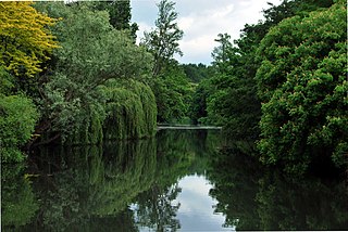
Edford Woods and Meadows is a 54.3 hectare biological Site of Special Scientific Interest, between Nettlebridge, Holcombe and Stoke St Michael, Somerset, notified in 1957.
St. Dunstan's Well Catchment is a Site of Special Scientific Interest, covering 39.8 hectares near Stoke St Michael in the Mendip Hills, Somerset, England. The site was notified in 1967. It is of both geological and biological significance.
Briarcroft Pasture is a 1.76 hectare biological Site of Special Scientific Interest in County Durham, England notified in 2004.
Whitton Bridge Pasture is a Site of Special Scientific Interest (SSSI) in the unitary authority of Stockton-on-Tees, England. At 3.18 hectares (7.9 acres) it lies to the south of Whitton village and north west of Stockton-on-Tees. SSSIs are chosen by Natural England, and Whitton Bridge Pasture was designated in 2004 because of its biological interest. It is one of 18 SSSIs in the Cleveland area of search.

Catcott, Edington and Chilton Moors SSSI is a 1083 hectare biological Site of Special Scientific Interest in Somerset, England notified in 1967. It is close to the villages of Edington and Catcott.

Hardington Moor is an 8.7 hectare biological Site of Special Scientific Interest between Hardington Mandeville and West Coker in Somerset, notified in 1994.

Gallows Hill SSSI is a Site of Special Scientific Interest on the north side of the Ebble Valley in south Wiltshire, England. Its chalk grassland and scrub contain a number of animal and plant species that are nationally rare. The 27.8 hectares site was notified in 1965.
Long Lye is an 11.7 hectare biological Site of Special Scientific Interest at Buckland St Mary in the Blackdown Hills, Somerset, notified in 1988.

Whitevine Meadows is a 13.0 hectare biological Site of Special Scientific Interest east of North and South Perrott in Somerset, notified in 1979.

Stoke St Michael is a village and civil parish on the Mendip Hills 4 miles (6.4 km) north east of Shepton Mallet, and 8 miles (12.9 km) west of Frome, in the Mendip district of Somerset, England.

Barnack Hills & Holes is a 23.3-hectare (58-acre) biological Site of Special Scientific Interest in Barnack in Cambridgeshire. It is also a national nature reserve. It is a Nature Conservation Review site, Grade I. In 2002 it was designated as a Special Area of Conservation, to protect the orchid-rich grassland as part of the Natura 2000 network of sites throughout the European Union.

Laurel Farm Meadow is a 1.6-hectare (4.0-acre) biological Site of Special Scientific Interest north-west of Halesworth in Suffolk.

Thetford Heaths is a 270.6-hectare (669-acre) biological and geological Site of Special Scientific Interest in Suffolk. It is a Nature Conservation Review site, Grade I, and parts of it are a national nature reserve, and a Geological Conservation Review, It is part of the Breckland Special Area of Conservation, and Special Protection Area A large part of this dry heathland site is calcareous grassland, and some areas are grazed by sheep or rabbits. There are several nationally rare plants and an uncommon heathland bird, and many lichens and mosses.

