Long Dole Wood and Meadows SSSI is a 9.8 hectares biological Site of Special Scientific Interest (SSSI) between the villages of Farrington Gurney and Hinton Blewitt in Bath and North East Somerset, notified in 1987.

Lower Woods is a 280.1-hectare (692-acre) biological and geological Site of Special Scientific Interest near the village of Wickwar, South Gloucestershire, notified in 1966 and renotified in 1985. The site area has increased at last revision in 1974 to a 284.1-hectare (702-acre) site. The site is a nature reserve managed by the Gloucestershire Wildlife Trust.

Midger is a 65.7-hectare (162-acre) biological Site of Special Scientific Interest straddling the border of Gloucestershire and South Gloucestershire, notified in 1966 and renotified in 1984. Since the last revision in 1974, the size has been reduced to a 56-hectare (140-acre) site. It lies east of Hillesley, Gloucestershire and north of Hawkesbury Upton, South Gloucestershire. It is at the head of the Kilcott Valley.

Bowdown and Chamberhouse Woods is a 67.9-hectare (168-acre) biological Site of Special Scientific Interest south of Thatcham in Berkshire. An area of 55 hectares is a nature reserve managed by the Berkshire, Buckinghamshire and Oxfordshire Wildlife Trust.
Hayley Wood is a 51.7-hectare (128-acre) biological Site of Special Scientific Interest south-east of Great Gransden in Cambridgeshire. It is a Nature Conservation Review site, Grade 1, and it is managed by the Wildlife Trust for Bedfordshire, Cambridgeshire and Northamptonshire. It was the subject of a book by the academic and woodland expert Oliver Rackham, listed below, who regularly visited and recorded his observations of the woodland in his notebooks.

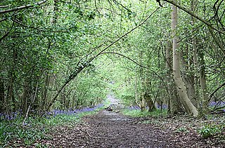
Grass Wood is an ancient woodland of 88 hectares in Wharfedale, North Yorkshire, England, that has an exceptional ground flora of woodland wildflowers.

Backstone Bank and Baal Hill Woods is a Site of Special Scientific Interest in the County Durham district of Durham, England. It occupies the steep eastern slopes of the valley of Waskerley Beck, alongside and downstream of Tunstall Reservoir, some 3 km north of Wolsingham and is one of the largest expanses of semi-natural woodland in west Durham.
Croes Robert Wood is a nature reserve and Site of Special Scientific Interest (SSSI), noted for its biological characteristics, in Monmouthshire, south east Wales. Gwent Wildlife Trust, the owners of the site, manage the woodland through methods of coppicing and charcoal burning to encourage its notable flora and fauna.

Wotton Hill is a hill on the edge of the Cotswold Hills in Gloucestershire, England, 0.5 miles (0.80 km) north of Wotton-under-Edge. The Cotswold Way passes over the hill.
Lower Wye Gorge is a 65-hectare (160-acre) biological and geological Site of Special Scientific Interest in Gloucestershire, notified in 1954 and renotified 1987. The site includes two Gloucestershire Wildlife Trust nature reserves being Ban-y-gor Wood and Lancaut. The Natural England citation states a revision for Lancaut inclusion.

Dymock Woods is a 53-hectare (130-acre) biological Site of Special Scientific Interest in Gloucestershire, notified in 1990. The site is listed in the 'Forest of Dean Local Plan Review' as a Key Wildlife Site (KWS).

Foxley Wood is a nature reserve in Foxley, Norfolk, England, the largest ancient woodland and coppice in Norfolk. The Norfolk Wildlife Trust, which manages this reserve, bought it in 1998. It is 123 hectares in size. It is a Site of Special Scientific Interest, a Nature Conservation Review site, Grade 2, and a National Nature Reserve.

Hobbs Quarry, Longhope is a 1-hectare (2.5-acre) geological and biological Site of Special Scientific Interest in Gloucestershire, England, notified in 1966. It is situated midway between Longhope and Dursley Cross in the Forest of Dean. Adjacent woods are Kiln Wood and Coleman's Wood. The site was managed by the Gloucestershire Wildlife Trust. Ownership changed to an independent Charitable Trust - Hobbs Nature Reserve Trust - on 1 August 2023. The Management Plan is similar to the one GWT had agreed with Natural England, combining conservation and research work on the geological exposures and preservation of the valuable natural environment. An explanatory website is under development to aid any groups planning educational visits. Local specialists are available to assist with these if required.

Collinpark Wood is a 66.69-hectare (164.8-acre) biological Site of Special Scientific Interest in Gloucestershire, notified in 1966, revised in 1974 and renotified in 1983. There was a boundary change in 1983. There are seven units of assessment. Unit 1 is a 15-hectare (37-acre) area owned and managed by the Gloucestershire Wildlife Trust. The trust purchased this part of the wood in 1979 with grant aid from WWF. The site is listed in the 'Forest of Dean Local Plan Review' as a Key Wildlife Site (KWS).

Bull Cross, The Frith and Juniper Hill is a 42.33-hectare (104.6-acre) biological and geological Site of Special Scientific Interest in Gloucestershire, notified in 1954. The site is listed in the ‘Stroud District’ Local Plan, adopted November 2005, Appendix 6 as an SSSI and Regionally Important Geological Site (RIGS).
Shorn Cliff And Caswell Woods is a 69.2-hectare (171-acre) biological Site of Special Scientific Interest in Gloucestershire, notified in 1986. The site is listed in the 'Forest of Dean Local Plan Review' as a Key Wildlife Site (KWS).
Siccaridge Wood is a 26.6-hectare (66-acre) nature reserve in Gloucestershire. The site is listed in the ‘Stroud District’ Local Plan, adopted November 2005, Appendix 6 as a Key Wildlife Site (KWS).

Short Wood and Southwick Wood is a 54.7-hectare (135-acre) nature reserve north-west of Oundle in Northamptonshire. It is managed by the Wildlife Trust for Bedfordshire, Cambridgeshire and Northamptonshire. Short Wood is a 25.3-hectare (63-acre) biological Site of Special Scientific Interest.
Tiddesley Wood – the Harry Green Reserve is a nature reserve of the Worcestershire Wildlife Trust. It is situated about 1 mile west of Pershore and 7 miles south-east of Worcester, in Worcestershire, England. The reserve is an ancient woodland, and is designated a Site of Special Scientific Interest.