Roebuck Meadows

Last updated
Roebuck Meadows
Site of Special Scientific Interest
Meadow near Roebuck Farm (geograph 1900630).jpg
Somerset UK location map.svg
Red pog.svg
Location within Somerset
Area of Search Somerset
Grid reference ST132354
Coordinates 51°06′41″N3°14′29″W / 51.11130°N 3.24133°W / 51.11130; -3.24133 Coordinates: 51°06′41″N3°14′29″W / 51.11130°N 3.24133°W / 51.11130; -3.24133
Interest Biological
Area 3.6 hectares (0.036 km2; 0.014 sq mi)
Notification 1988 (1988)
Natural England website

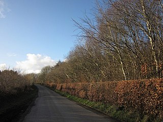
Roebuck Meadows (grid reference ST132354 ) is a 3.6 hectare (8.9 acre) biological Site of Special Scientific Interest south of Crowcombe in Somerset, notified in 1988.

Ordnance Survey National Grid System of geographic grid references used in Great Britain

The Ordnance Survey National Grid reference system is a system of geographic grid references used in Great Britain, distinct from latitude and longitude. It is often called British National Grid (BNG).

Hectare metric unit of area

The hectare is an SI accepted metric system unit of area equal to a square with 100-metre sides, or 10,000 m2, and is primarily used in the measurement of land. There are 100 hectares in one square kilometre. An acre is about 0.405 hectare and one hectare contains about 2.47 acres.

Crowcombe

Crowcombe is a village and civil parish under the Quantock Hills in Somerset, England, 5.5 miles (9 km) south east of Watchet, and 8 miles (13 km) from Taunton. The village has a population of 489.

Roebuck Meadows have a very varied and herb-rich vegetation composed of mire and grassland communities together comprising an important example of lowland mire, which is a nationally scarce habitat. The meadows contain Cornish moneywort ( Sibthorpia europaea ), a nationally scarce plant restricted to south-west Britain. [1]

<i>Sibthorpia europaea</i> species of plant

Sibthorpia europaea is a species of flowering plant known by the common name Cornish moneywort. It can be found as a disjunct distribution in western Europe from the Azores, Portugal and Spain to south-western Ireland and south-western United Kingdom. It also occurs in Crete, Pelion, Greece and tropical Africa. One possible explanation could be that the species had a more widespread distribution, possibly during the Tertiary.

Related Research Articles

Clonskeagh Suburb of Dublin in Leinster, Ireland

Clonskeagh or Clonskea, is a small southern suburb of Dublin, Ireland. The district straddles the River Dodder.

Aire Point to Carrick Du SSSI

Aire Point to Carrick Du SSSI is a Site of Special Scientific Interest on the Penwith Peninsula, Cornwall, England. It is 5.98 square kilometres in extent, stretching from grid reference SW360279 to grid reference SW513410. The site is designated both for its biological and its geological interest.

This article gives an overview of the mire communities in the British National Vegetation Classification system.

Goss Moor

Goss Moor is a National Nature Reserve in Cornwall, England, located 12 kilometres (7.5 mi) south-west of Bodmin in the parishes of St Dennis, St Columb Major, Roche and St Enoder. It is the largest continuous mire complex in south-west Britain and consists of mainly peatland and lowland heath. Together with the neighbouring moor to the east, it forms the Goss And Tregoss Moors Site of Special Scientific Interest (SSSI), as well as the Breney Common and Goss and Tregoss Moors Special Area of Conservation (SAC).

Yanal Bog

Yanal Bog is a 1.6 hectare biological Site of Special Scientific Interest on the southern edge of the North Somerset Levels, just north of the village of Sandford, North Somerset. It was notified as an SSSI in 1988.

Briggins Moor

Briggins Moor is a 15.3 hectare biological Site of Special Scientific Interest in Somerset, notified in 1994. The site is south of Dulverton and close to the border with Devon.

Barle Valley

Barle Valley is a 1,540 acres (620 ha) Site of Special Scientific Interest within Exmoor National Park, situated in the counties of Devon and Somerset through which the River Barle flows. It was notified in its current form under the Wildlife and Countryside Act in 1988. The site includes the Somerset Wildlife Trust's Mounsey Wood Nature Reserve and the Knaplock and North Barton SSSI which has been notified since 1954.

North Curry Meadow

North Curry Meadow is a 1.3 hectare biological Site of Special Scientific Interest in North Curry, Somerset, England, notified in 1989.

Ruttersleigh

Ruttersleigh is a 97 hectares biological Site of Special Scientific Interest between Buckland St Mary and Staple Fitzpaine on the north-facing slope of the Blackdown Hills. in Somerset, notified in 1991.

Southey and Gotleigh Moors

Southey and Gotleigh Moors is an 81.3 hectare biological Site of Special Scientific Interest on the Blackdown Hills in Somerset, notified in 1988.

Woolhayes Farm

Woolhayes Farm is a 13.2 hectare biological Site of Special Scientific Interest east of Combe St Nicholas in Somerset, notified in 1992.

Popeswood village in United Kingdom

Popeswood is a village in Berkshire, England, near Bracknell. The village is within the civil parish of Binfield approximately 1.5 miles (2.4 km) west of Bracknell. The main part of Popeswood lies north of the B3408 west of Temple Park and south of Binfield village, with a smaller section south of the B3408 between Amen Corner and Farley Wood.

Mere Beck Meadows

Mere Beck Meadows, formerly known as Willoughby Hall Meadows, is a Site of Special Scientific Interest in the Teesdale district of County Durham, England. It consists of three hay meadows, situated on the south side of Hury Reservoir, immediately below the Blackton Reservoir dam.

Pow Hill Bog

Pow Hill Bog is a Site of Special Scientific Interest in the Wear Valley district of County Durham, England. It lies alongside Derwent Reservoir, approximately 2 km north-west of the village of Edmundbyers and adjacent to the Edmundbyers Common portion of the Muggleswick, Stanhope and Edmundbyers Commons and Blanchland Moor SSSI.

Lymsworthy Meadows is a Site of Special Scientific Interest (SSSI) in north Cornwall, England, UK, noted for its biological characteristics.

Down Bank

Down Bank is a 5.9-hectare (15-acre) biological Site of Special Scientific Interest south-west of Canterbury in Kent.

References

  1. "Roebuck Meadows" (PDF). English Nature. Retrieved 2006-08-19.