
A grassland is an area where the vegetation is dominated by grasses (Poaceae). However, sedge (Cyperaceae) and rush (Juncaceae) can also be found along with variable proportions of legumes, such as clover, and other herbs. Grasslands occur naturally on all continents except Antarctica and are found in most ecoregions of the Earth. Furthermore, grasslands are one of the largest biomes on Earth and dominate the landscape worldwide. There are different types of grasslands: natural grasslands, semi-natural grasslands, and agricultural grasslands. They cover 31–69% of the Earth's land area.

A meadow is an open habitat or field, vegetated by grasses, herbs, and other non-woody plants. Trees or shrubs may sparsely populate meadows, as long as these areas maintain an open character. Meadows can occur naturally under favourable conditions, but are often artificially created from cleared shrub or woodland for the production of hay, fodder, or livestock. Meadow habitats, as a group, are characterized as "semi-natural grasslands", meaning that they are largely composed of species native to the region, with only limited human intervention.
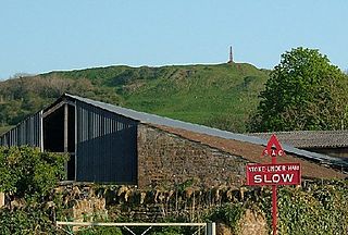
Ham Hill is a geological Site of Special Scientific Interest (SSSI), Scheduled Ancient Monument, Iron Age hill fort, Roman site, Local Nature Reserve and country park, to the west of Yeovil in Somerset, England.

Brewham is a civil parish in Somerset, England, consisting of the villages of North Brewham and South Brewham, on either side of the river in the Brue Valley 3 miles (4.8 km) east of Bruton and 9 miles (14.5 km) south-west of Frome. The parish has a population of 441.

Plantlife is a wild plant conservation charity. As of 2023, it manages 24 nature reserves around the United Kingdom. HM King Charles III is patron of the charity.

Burledge Hill is on the southern edge of the village of Bishop Sutton, Somerset, England. It is the site of a Site of Special Scientific Interest and an univallate Iron Age hillfort.
Yanal Bog is a 1.6 hectare biological Site of Special Scientific Interest on the southern edge of the North Somerset Levels, just north of the village of Sandford, North Somerset. It was notified as an SSSI in 1988.

Draycott Sleights is a 61.95 hectares biological Site of Special Scientific Interest at Draycott in the Mendip Hills, Somerset, England, notified in 1987. The name is pronounced locally as "Slates", presumably a variation on the Saxon word Slade meaning amongst other things hillside, rather than in the same manner as the Yorkshire place of the same spelling.
The Perch is a 72.1 hectare biological Site of Special Scientific Interest close to Cheddar Gorge in the Mendip Hills, Somerset, England. It received SSSI notification in 1990.

Catcott, Edington and Chilton Moors SSSI is a 1083 hectare biological Site of Special Scientific Interest in Somerset, England notified in 1967. It is close to the villages of Edington and Catcott.

Hardington Moor is an 8.7 hectare biological Site of Special Scientific Interest between Hardington Mandeville and West Coker in Somerset, notified in 1994.

Babcary Meadows is a 13.6 hectares biological Site of Special Scientific Interest north of Babcary in Somerset, notified in 1988.

Barle Valley is a 1,540 acres (620 ha) Site of Special Scientific Interest within Exmoor National Park, situated in the counties of Devon and Somerset through which the River Barle flows. It was notified in its current form under the Wildlife and Countryside Act in 1988. The site includes the Somerset Wildlife Trust's Mounsey Wood Nature Reserve and the Knaplock and North Barton SSSI which has been notified since 1954.
Barrington Hill Meadows is a 16.1 hectare biological Site of Special Scientific Interest in Somerset, England, notified in 1987.

Roebuck Meadows is a 3.6 hectare biological Site of Special Scientific Interest south of Crowcombe in Somerset, notified in 1988.

Twinhills Woods and Meadows is a 21.2 hectare biological Site of Special Scientific Interest on the Monarch's Way south of Dulcote in Somerset, notified in 1990.

A wet meadow is a type of wetland with soils that are saturated for part or all of the growing season which prevents the growth of trees and brush. Debate exists whether a wet meadow is a type of marsh or a completely separate type of wetland. Wet prairies and wet savannas are hydrologically similar.

Oenanthe pimpinelloides is a species of flowering plant in the family Apiaceae known by the common name corky-fruited water-dropwort. It is a plant of tall, lightly grazed or infrequently mown grassland and coastal meadows in Europe and neighbouring parts of Asia and North Africa.

Whelford Meadow is a 1.86-hectare (4.6-acre) biological Site of Special Scientific Interest in Gloucestershire, England, notified in 1985.
Dunsdon National Nature Reserve is a nature reserve of the Devon Wildlife Trust, near Dunsdon and about 3.5 miles (5.6 km) north-west of Holsworthy, in Devon, England. The habitat is culm grassland.
