Street Heath

Last updated
Street Heath
Site of Special Scientific Interest
The Glastonbury Canal (geograph 2438616).jpg
Somerset UK location map.svg
Red pog.svg
Location within Somerset
Area of Search Somerset
Grid reference ST464394
Coordinates 51°09′05″N2°46′04″W / 51.15134°N 2.76772°W / 51.15134; -2.76772 Coordinates: 51°09′05″N2°46′04″W / 51.15134°N 2.76772°W / 51.15134; -2.76772
Interest Biological
Area 12.5 hectares (0.125 km2; 0.048 sq mi)
Notification 1966 (1966)
Natural England website

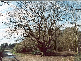
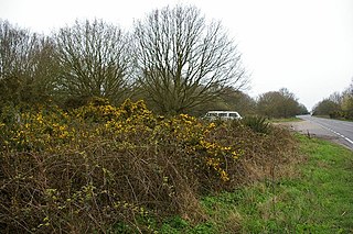
Street Heath (grid reference ST464394 ) is a 12.5 hectare (31.0 acre) biological Site of Special Scientific Interest 4 km west of Glastonbury in Somerset, notified in 1966. [1] [2] It next to the Glastonbury Canal and Ham Wall nature reserve. Street Heath has itself been designated as a Local Nature Reserve. [3] [4]

Ordnance Survey National Grid System of geographic grid references used in Great Britain

The Ordnance Survey National Grid reference system is a system of geographic grid references used in Great Britain, distinct from latitude and longitude. It is often called British National Grid (BNG).

Hectare metric unit of area

The hectare is an SI accepted metric system unit of area equal to a square with 100-metre sides, or 10,000 m2, and is primarily used in the measurement of land. There are 100 hectares in one square kilometre. An acre is about 0.405 hectare and one hectare contains about 2.47 acres.

Glastonbury town in Somerset, England

Glastonbury is a town and civil parish in Somerset, England, situated at a dry point on the low-lying Somerset Levels, 23 miles (37 km) south of Bristol. The town, which is in the Mendip district, had a population of 8,932 in the 2011 census. Glastonbury is less than 1 mile (2 km) across the River Brue from Street, which is now larger than Glastonbury.

Street Heath is a nature reserve, managed by Somerset Wildlife Trust, which has outstanding examples of communities that were once common on the Somerset Levels. It possesses a vegetation consisting of wet and dry heath, species-rich bog and carr woodland, with transitions between all these habitats. Rare ferns present include marsh fern (Thelypteris palustris) and royal fern ( Osmunda regalis ). Old peat workings and rhynes have a wetland community which includes bulrush (Typha latifolia), yellow flag iris (pseudacorus), cyperus-like sedge (Carex pseudocyperus) and lesser bur-reed (Sparganium minimum). Insects recorded include 33 species of butterflies, 200 moths and 12 grasshoppers and crickets, with several notable rarities. Birds breeding in the carr woodland include the local willow tit [1]

Nature reserve protected area for flora, fauna or features of geological interest

A nature reserve is a protected area of importance for flora, fauna or features of geological or other special interest, which is reserved and managed for conservation and to provide special opportunities for study or research. Nature reserves may be designated by government institutions in some countries, or by private landowners, such as charities and research institutions, regardless of nationality. Nature reserves fall into different IUCN categories depending on the level of protection afforded by local laws. Normally it is more strictly protected than a nature park.

Somerset Wildlife Trust organization

Somerset Wildlife Trust is a wildlife trust covering the county of Somerset, England.

Somerset Levels coastal plain and wetland area of Somerset, South West England

The Somerset Levels are a coastal plain and wetland area of Somerset, England, running south from the Mendips to the Blackdown Hills.

Related Research Articles

Etherow Country Park

Etherow Country Park is situated at Compstall, England, between Marple Bridge and Romiley, in the Metropolitan Borough of Stockport, Greater Manchester. It is a Local Nature Reserve and the starting point of the Goyt Way.

Therfield Heath mountain in United Kingdom

Therfield Heath is a biological Site of Special Scientific Interest and Local Nature Reserve on the chalk escarpment just north of Therfield, Hertfordshire; since it lies south-west of the town of Royston it is also known locally as Royston Heath. The Heath is a common on which sheep are still regularly grazed. The site offers views towards the north, over the valley of the Cam as far as Cambridge.

Esher Commons

Esher Commons is a 360.1-hectare (890-acre) biological Site of Special Scientific Interest south-west of Esher in Surrey. It includes Esher Common, Fairmile Common, West End Common and Oxshott Heath. Esher Common and West End Common are Local Nature Reserves.

Ockham and Wisley Commons

Ockham and Wisley Commons is a 266-hectare (660-acre) biological Site of Special Scientific Interest east of Woking in Surrey. It is also a Local Nature Reserve and part of the Thames Basin Heaths Special Protection Area. It is part of the slightly larger area of 297-hectare (730-acre) Wisley & Ockham Commons & Chatley Heath nature reserve, which is owned by Surrey County Council and managed by the Surrey Wildlife Trust.

Whitmoor Common

Whitmoor Common is a 166-hectare (410-acre) biological Site of Special Scientific Interest on the northern outskirts of Guildford in Surrey. It is part of the Thames Basin Heaths Special Protection Area and the 184.9-hectare (457-acre) Whitmoor and Rickford Commons Local Nature Reserve, which is owned by Surrey County Council and managed by the Surrey Wildlife Trust.

Kings and Bakers Woods and Heaths nature reserve in the United Kingdom

Kings and Bakers Woods and Heaths is a 212.8 hectare Site of Special Scientific Interest (SSSI) between Heath and Reach in Bedfordshire and Great Brickhill in Buckinghamshire. The site is mainly in Bedfordshire but includes Rammamere Heath in Buckinghamshire. It was notified in 1984 under Section 28 of the Wildlife and Countryside Act 1981, and the local planning authorities are Central Bedfordshire Council and Aylesbury Vale Council. Part of it is a National Nature Reserve, and part of it is a nature reserve managed by the Wildlife Trust for Bedfordshire, Cambridgeshire and Northamptonshire. it is also a Nature Conservation Review site.

Stanmore Common

Stanmore Common is a 49.2-hectare public park, Local Nature Reserve and Site of Metropolitan Importance for Nature Conservation in Stanmore in the London Borough of Harrow in England. It is owned by Harrow Council and managed by the council with a local group. It was a biological Site of Special Scientific Interest, but was de-notified in the early 1990s.

Wangford Warren and Carr Suffolk Wildlife Trust nature reserve

Wangford Warren and Carr is a 67.8 hectare biological Site of Special Scientific Interest between Brandon and Lakenheath in Suffolk. It is a Nature Conservation Review site, Grade I, and part of the Breckland Special Area of Conservation, and Special Protection Area An area of 15 hectares is managed as a nature reserve by the Suffolk Wildlife Trust

Barnby Broad and Marshes human settlement in United Kingdom

Barnby Broad and Marshes is a Site of Special Scientific Interest (SSSI) in the Waveney district of the English county of Suffolk. The site is 189.6 hectares in size. It is in the parishes of North Cove and Barnby, located between Beccles and Lowestoft in the north of the county. The site is bordered on its southern edge by the East Suffolk railway line and to the north by the River Waveney. It is a Special Area of Conservation, a Special Protection Area under the EC Birds Directive, and a Ramsar internationally important wetland site. There are two Suffolk Wildlife Trust nature reserves in the site, Castle Marshes and North Cove.

Astridge Wood

Astridge Wood is a 19.42-hectare (48.0-acre) biological Site of Special Scientific Interest in Gloucestershire, England, notified in 1985. The site is listed in the 'Forest of Dean Local Plan Review' as a Key Wildlife Site (KWS).

Bixley Heath

Bixley Heath is a 5.1 hectare biological Site of Special Scientific Interest on the eastern outskirts of Ipswich in Suffolk. It is also a Local Nature Reserve owned and managed by Ipswich Borough Council.

Hertford Heath nature reserve

Hertford Heath nature reserve is a 28 hectare biological Site of Special Scientific Interest in Hertford Heath in Hertfordshire. It is managed by the Herts and Middlesex Wildlife Trust and the local planning authority is East Hertfordshire District Council.

Tiptree Heath Nature Reserve Essex Wildlife Trust Nature reserve

Tiptree Heath Nature Reserve is a 25 hectare biological Site of Special Scientific Interest south-west of Tiptree in Essex. It is managed by the Essex Wildlife Trust together with the Friends of Tiptree Heath.

Barton Mills Valley

Barton Mills Valley is a 10.7 hectare Local Nature Reserve in Mildenhall in Suffolk. It is owned and managed by Forest Heath District Council. The site is in Breckland Forest biological Site of Special Scientific Interest.

References

  1. 1 2 "Street Heath citation" (PDF). Sites of Special Scientific Interest. Natural England. Retrieved 26 July 2013.
  2. "Map of Street Heath". Sites of Special Scientific Interest. Natural England. Retrieved 26 July 2013.
  3. "Street Heath". Local Nature Reserves. Natural England. Retrieved 26 July 2013.
  4. "Map of Street Heath". Local Nature Reserves. Natural England. Retrieved 26 July 2013.