
Kingweston is a village and civil parish in Somerset, England, situated on Combe Hill, 3 miles (4.8 km) north east of Somerton in the South Somerset district. The village has a population of 128.

The Flying Dust First Nation is a Cree First Nation band government located adjacent to the city of Meadow Lake in Saskatchewan, Canada. Highway 55 goes through the band's reserve community.
East Harnham Meadows is a 17.29 hectare biological Site of Special Scientific Interest in Wiltshire, England, in the Harnham suburb to the south-east of the city of Salisbury. The water-meadows are in the flood-plain of the River Avon.
Stoke Common Meadows is a biological Site of Special Scientific Interest in north Wiltshire, England. The 10.2 hectare site is in Purton parish, 1.6 miles (2.6 km) west of Purton Common hamlet and 3 miles (5 km) south-west of the town of Cricklade.
Lower Coombe and Ferne Brook Meadows is an 11.34 hectare biological Site of Special Scientific Interest in Wiltshire, England which sits on the Upper Greensand and Gault Clay. The site is home to rare fen meadow and neutral grassland communities in an unimproved grassland. Species such as Triglochin palustris, Caltha palustris and Oenanthe pimpinelloides can be found at the location. Three streams, which form headwaters of the River Nadder flow through the site. It was notified in 2002.

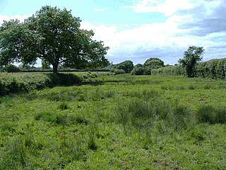
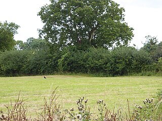
Roebuck Meadows is a 3.6 hectare biological Site of Special Scientific Interest south of Crowcombe in Somerset, notified in 1988.

Brampton Meadow is a one hectare biological Site of Special Scientific Interest north-west of Brampton in Cambridgeshire, England.
Mere Beck Meadows, formerly known as Willoughby Hall Meadows, is a Site of Special Scientific Interest in the Teesdale district of County Durham, England. It consists of three hay meadows, situated on the south side of Hury Reservoir, immediately below the Blackton Reservoir dam.

Hucclecote Meadows is a 5.74-hectare (14.2-acre) biological Site of Special Scientific Interest divided into two areas on each side of the M5 road in the Severn Vale, Gloucestershire. It was notified in 1984. The western area is also a Local Nature Reserve.

Mill Meadows, Billericay is a 6.7-hectare (17-acre) biological Site of Special Scientific Interest (SSSI) in Billericay in Essex, England. It is part of the 36.8 hectare Mill Meadows Local Nature Reserve (LNR), which is owned and managed by Basildon District Council.

Hemingford Grey Meadow is a 0.7-hectare (1.7-acre) biological Site of Special Scientific Interest south of Hemingford Grey in Cambridgeshire. It is managed by the Wildlife Trust for Bedfordshire, Cambridgeshire and Northamptonshire as Arthur's Meadow.

Wilde Street Meadow is an 11.6-hectare (29-acre) biological Site of Special Scientific Interest between Lakenheath and Mildenhall in Suffolk, England.
Moat Farm Meadows is a 3.3-hectare (8.2-acre) biological Site of Special Scientific Interest north-east of Otley in Suffolk.
The Anglican Church of All Saints in Kingweston, Somerset, England was rebuilt between 1852 and 1855 by Charles Edmund Giles. It is a Grade II* listed building.
