
Cheddar is a large village and civil parish in the Sedgemoor district of the English county of Somerset. It is situated on the southern edge of the Mendip Hills, 9 miles (14 km) north-west of Wells, 11 miles (18 km) south-east of Weston-super-Mare and 18 miles (29 km) south-west of Bristol. The civil parish includes the hamlets of Nyland and Bradley Cross. The parish had a population of 5,755 in 2011 and an acreage of 8,592 acres (3,477 ha) as of 1961.

Axbridge Hill and Fry's Hill is a 64.8-hectare (160-acre) biological Site of Special Scientific Interest in the Mendip Hills, Somerset, notified in 1990. The hills are above the town of Axbridge, immediately to the east of Shute Shelve Hill.

Crook Peak to Shute Shelve Hill is a 332.2 hectare (820.9 acre) geological and biological Site of Special Scientific Interest near the western end of the Mendip Hills, Somerset. The line of hills runs for approximately 5 kilometres (3.1 mi) from west to east and includes: Crook Peak, Compton Hill, Wavering Down, Cross Plain and Shute Shelve Hill. Most of the site is owned by the National Trust who bought 725 acres (293 ha) in 1985, and much of it has been designated as common land. It was notified as an SSSI by Natural England in 1952.

Rodney Stoke is a 69.6 hectare biological Site of Special Scientific Interest, just north of the village of Rodney Stoke in the Mendip Hills, Somerset, notified in 1957.
The Perch is a 72.1 hectare biological Site of Special Scientific Interest close to Cheddar Gorge in the Mendip Hills, Somerset, England. It received SSSI notification in 1990.

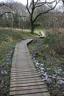
The Cheddar Complex is a 441.3 hectare biological Site of Special Scientific Interest near Cheddar around the Cheddar Gorge and north east to Charterhouse in the Mendip Hills, Somerset, England, notified in 1952.

Cogley Wood is a 60.7 hectare biological Site of Special Scientific Interest east of Bruton in Somerset, notified in 1987.

Barle Valley is a 1,540 acres (620 ha) Site of Special Scientific Interest within Exmoor National Park, situated in the counties of Devon and Somerset through which the River Barle flows. It was notified in its current form under the Wildlife and Countryside Act in 1988. The site includes the Somerset Wildlife Trust's Mounsey Wood Nature Reserve and the Knaplock and North Barton SSSI which has been notified since 1954.

Exmoor Coastal Heaths is a 1758.3 hectare biological Site of Special Scientific Interest in Devon and Somerset, notified in 1994.
Langford Heathfield is a 95.4 hectare biological Site of Special Scientific Interest at Langford Budville, 3 km (1.9 mi) north west of Wellington in Somerset, notified in 1966.
Long Lye is an 11.7 hectare biological Site of Special Scientific Interest at Buckland St Mary in the Blackdown Hills, Somerset, notified in 1988.

Longleat Woods is a 249.9 hectare biological Site of Special Scientific Interest south of Frome in Somerset, notified in 1972.

Ruttersleigh is a 97 hectares biological Site of Special Scientific Interest between Buckland St Mary and Staple Fitzpaine on the north-facing slope of the Blackdown Hills. in Somerset, notified in 1991.

Twinhills Woods and Meadows is a 21.2 hectare biological Site of Special Scientific Interest on the Monarch's Way south of Dulcote in Somerset, notified in 1990.

Whitevine Meadows is a 13.0 hectare biological Site of Special Scientific Interest east of North and South Perrott in Somerset, notified in 1979.

Strawberry Banks is a 5.06-hectare (12.5-acre) biological Site of Special Scientific Interest in Gloucestershire, notified in 1993.
Rowridge Valley is a 39.8-hectare (98-acre) Site of Special Scientific Interest (SSSI) that is 2 km (1.2 mi) east of the village of Calbourne and just east of the Rowridge Transmitter mast in the Isle of Wight. The site was notified in 1987 under the Wildlife and Countryside Act 1981 for its biological features. The site is an example of semi-natural woodland on chalk soil and is of special botanical importance as the only site in Britain where the wood calamint is to be found.

Daneway Banks is a 17-hectare (42-acre) biological Site of Special Scientific Interest in Gloucestershire, notified in 1954 and renotified in 1983. It lies half a mile west of Sapperton and is part of a group of wildlife sites in the Frome Valley that includes Siccaridge Wood and Sapperton Canal reserves. The site is in the Cotswold Area of Outstanding Natural Beauty.

Wotton Hill is a hill on the edge of the Cotswold Hills in Gloucestershire, England, 0.5 miles (0.80 km) north of Wotton-under-Edge. The Cotswold Way passes over the hill.
Shorn Cliff And Caswell Woods is a 69.2-hectare (171-acre) biological Site of Special Scientific Interest in Gloucestershire, notified in 1986. The site is listed in the 'Forest of Dean Local Plan Review' as a Key Wildlife Site (KWS).

